Chicago’s Cloudy Conundrum: A Peek into Tomorrow’s Weather
By
Amy Freeze
Explore the nuances of Chicago’s weather as clouds linger and the Midwest braces for scattered thunderstorms. Get your full regional weather update here.
Clouds will linger in Chicago leading to an overcast morning. Meanwhile, moderate to heavy rain sweeps the Midwest with lighter rains touching Chicago.
Tomorrow’s forecast in Chicago starts with cloud cover but promises a pleasant midday with partly sunny skies and a comfortable 68 to 72°F range. Regional weather across the Midwest shows variability with cities like Kansas City enjoying up to 85°F. A cold front approaching will bring potentially severe storms and localized flooding, particularly from St. Louis to Columbus. This comprehensive analysis provides everything you need to plan ahead and stay prepared.
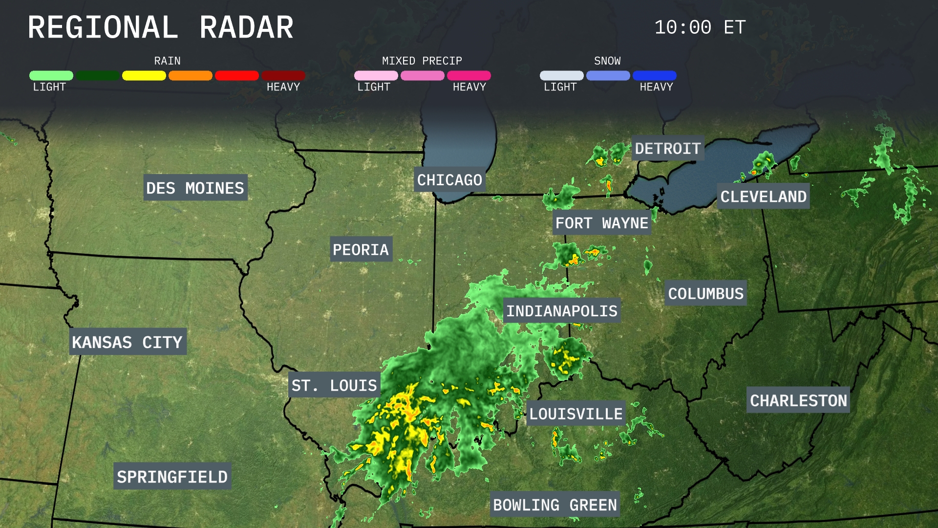
Rain is sweeping across the Midwest, primarily affecting areas from St. Louis to Indianapolis with moderate to heavy precipitation. Louisville and Bowling Green are experiencing rain, moving northeast toward Fort Wayne and Columbus. Lighter rain can be seen touching the outskirts of Chicago and Springfield. Meanwhile, clear skies prevail around Des Moines and Kansas City, providing a break from the wet conditions.
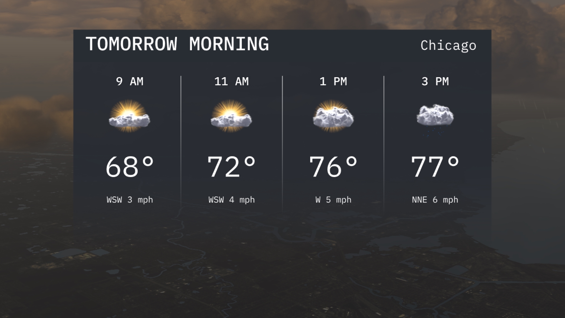
Tomorrow morning in Chicago will see comfortable temperatures starting at 68 degrees by 9 AM, warming up to 72 degrees by 11 AM. Winds will be light, generally from the west-southwest at 3 to 4 miles per hour. Skies will be partly sunny through the morning, making it a pleasant start to the day.
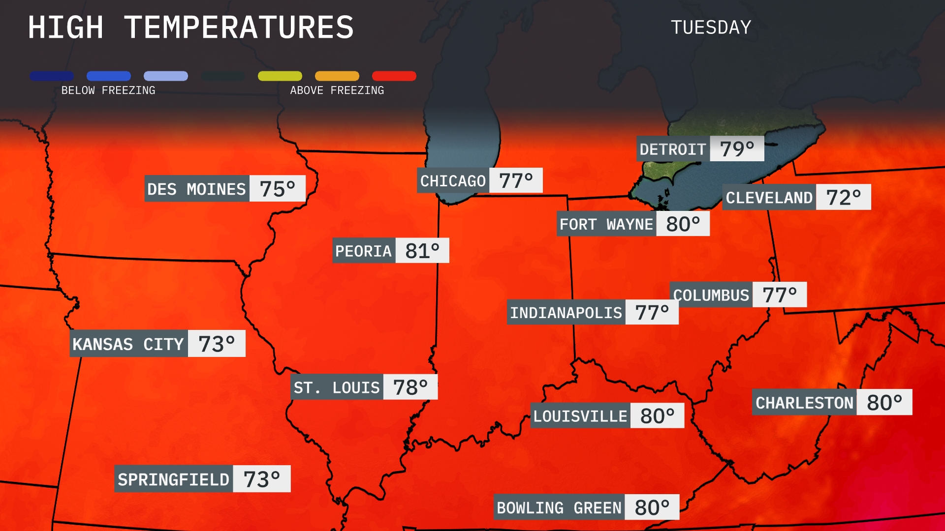
Tomorrow in the Midwest, highs are looking warm for this time of year. Chicago will see a pleasant 77 degrees, while Peoria tops out at a notable 81 degrees. Indianapolis and Columbus both reach 77 degrees, with Louisville slightly warmer at 80 degrees. Cleveland will be a bit cooler, with a high of 72 degrees, reflecting below-average temperatures for late September.
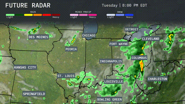
A cold front moves through the Midwest region, bringing scattered thunderstorms from St. Louis to Indianapolis into Fort Wayne, presenting a risk of heavy rain and possible localized flooding from Tuesday evening into Wednesday morning. Temperatures will dip slightly post-front, offering cooler, drier conditions. Strong storms are expected near Columbus, potentially leading to severe weather, including damaging winds. Pay attention to evening commute impacts as showers continue from Springfield to Charleston. By Wednesday afternoon, skies begin to clear from Kansas City to Chicago, preparing for a sunnier end to the week.
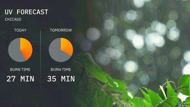
The UV index in Chicago is moderate today with a value sufficient to cause a burn in about 27 minutes of direct sunlight. Tomorrow, the UV index remains moderate, increasing the burn time to approximately 35 minutes.
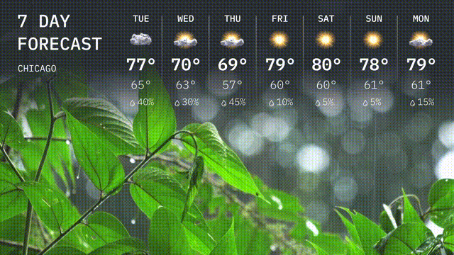
Tuesday: Expect a high of 77 degrees with a low of 65 degrees.
Wednesday: See a high of 70 degrees and a low of 63 degrees.
Thursday: Temperatures will reach 69 degrees during the day, cooling to 57 degrees at night. Chance of rain is 45%.
Friday: A high of 79 degrees is expected, cooling down to 60 degrees.
Saturday: It’ll be warmer with a high of 80 degrees and a low of 62 degrees.
Sunday: Clear skies are expected with a high of 78 degrees and a low of 61 degrees.
Monday: Mostly sunny with temperatures reaching 79 degrees during the day and 61 degrees at night.