Miami Mornings to Moonlit Storms: Your Southeast Weather Spectrum
By
Amy Freeze
Explore the contrast of sunny mornings and stormy evenings across the Southeast. From Miami's warmth to the thunderous echoes in Nashville, stay ahead with our detailed forecast.
Gearing up for another weather rollercoaster in Miami and the Southeast! From warm sun to cool showers, know what to expect with our full breakdown.
Welcome to our extensive weather coverage for Miami and the surrounding Southeast region. As you plan your week, consider the fluctuating temperatures and impending storms that could impact your everyday routine. Our detailed guide not only forecasts the weather but also provides insights on how to prepare for each day, from UV index warnings to anticipated storm tracks.
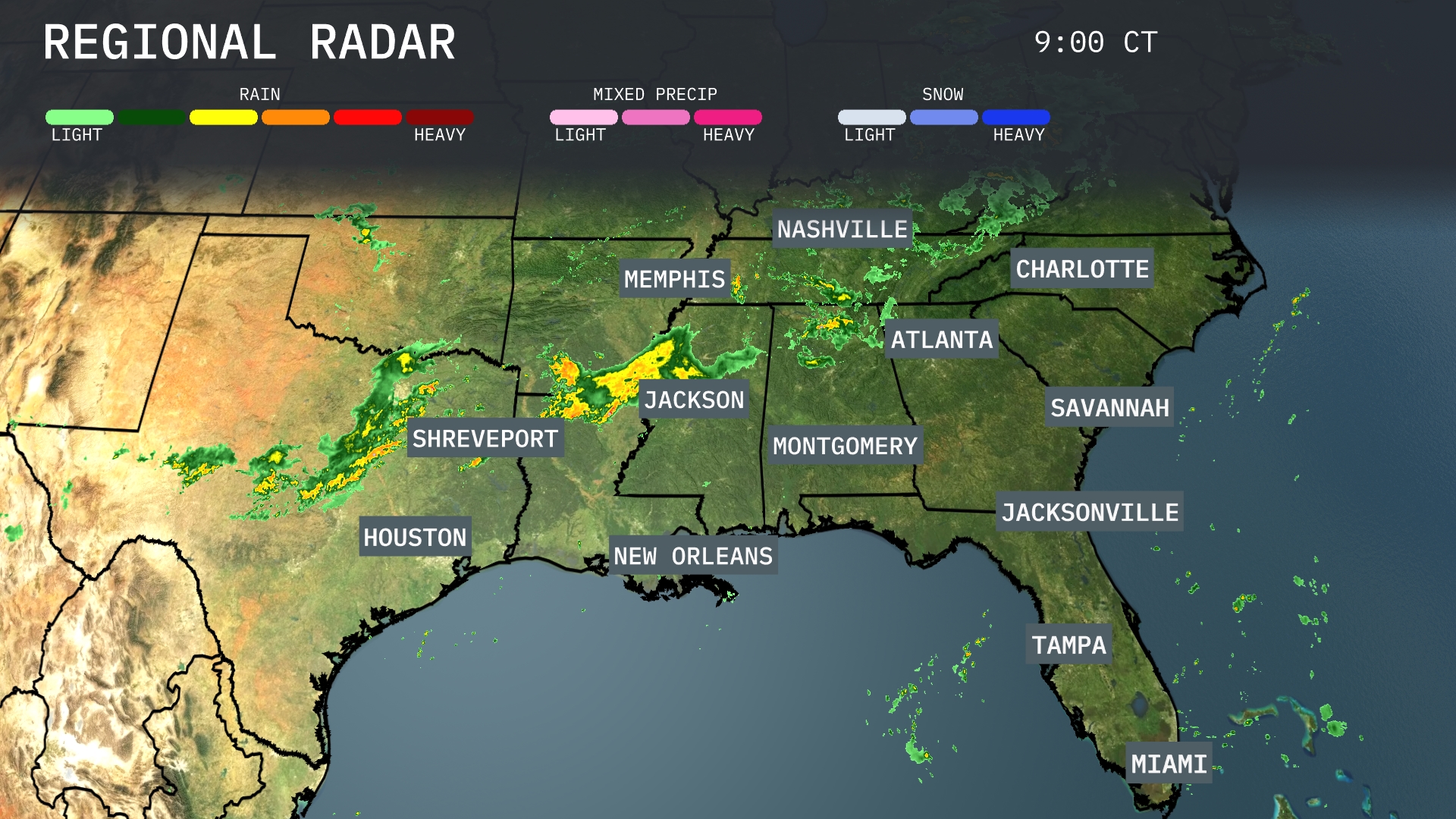
On the Regional Radar, a line of storms is moving west to east, currently impacting areas from Houston to Jackson. Heavy rainfall and thunderstorms are primarily concentrated over southern Mississippi, extending towards Alabama. Light to moderate showers are also seen sweeping across northern Louisiana towards Shreveport. Nashville and Charlotte are experiencing cloud cover with scattered light rain expected to develop as the system progresses eastward.
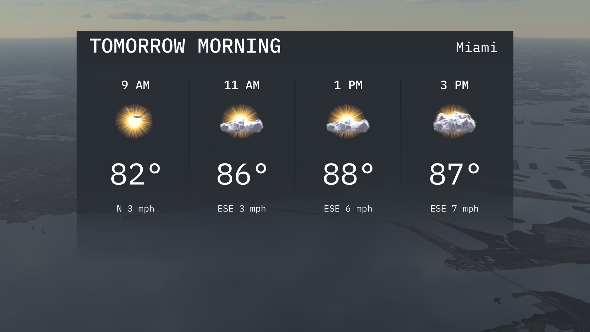
Tomorrow morning in Miami starts with clear skies at 9 AM, warming rapidly to 82 degrees with a light north wind. By 11 AM, bright sunshine continues, with temperatures climbing to 86 degrees and winds shifting slightly to the east-southeast.
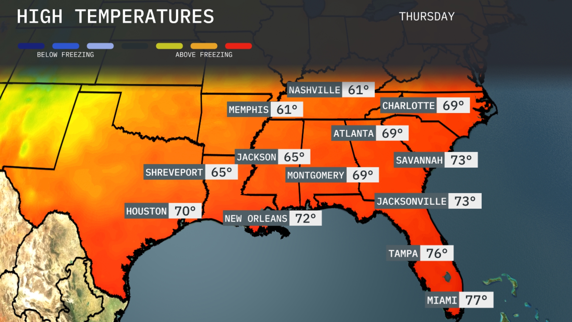
Tomorrow, temperatures in the Southeast will see a warm trend, with highs in Atlanta reaching 69 degrees. Montgomery will experience a slightly warmer day, hitting 69 as well, while Jackson stands at 65 degrees. Over in New Orleans, the high will be a comfortable 72 degrees, and Tampa will see a peak of 76 degrees. Miami rounds it out with a balmy high of 77 degrees, indicative of above-average warmth for this time of year.
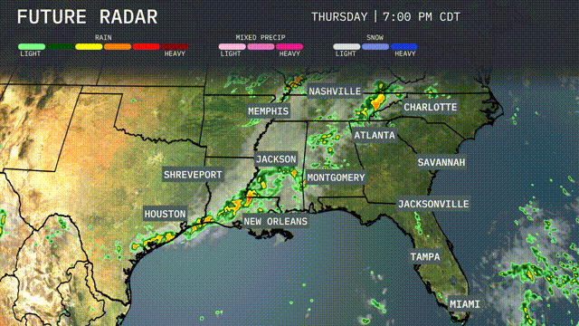
A cold front is set to move through the Southeast, bringing a line of storms impacting the region from Houston to New Orleans and up through Jackson. Anticipate these storms to reach areas such as Memphis and Nashville by tomorrow afternoon, with potential for heavy downpours. The front is expected to pass through Atlanta early in the morning, possibly affecting the morning commute with thunderstorms. There is the potential for isolated severe weather, with damaging winds being the primary threat. By late Thursday, coastal areas from Jacksonville to Miami can expect scattered showers as the system continues eastward.
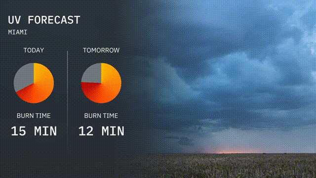
The UV index in Miami is high today, with a burn time of about 15 minutes under direct sunlight. Tomorrow, expect the UV index to remain elevated with a quicker burn time of 12 minutes.
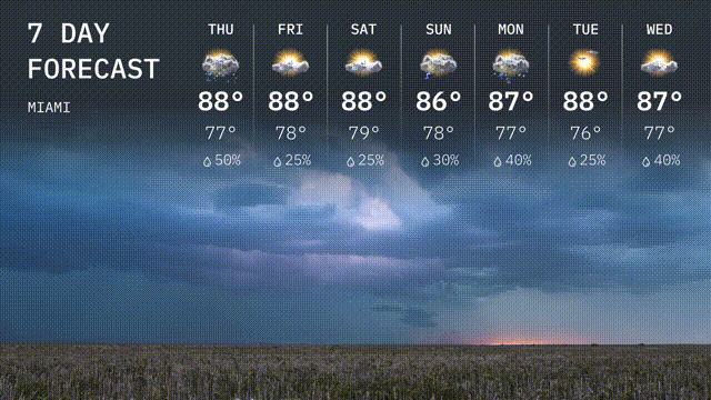
For the 7 day forecast in Miami:
Thursday: Pack an umbrella with thunderstorms likely, a high of 88 degrees and a low of 77.
Friday: a bit of rain remains with a high of 88 degrees, dipping to 78 at night.
Saturday: It’s a repeat of rain during the day, continuing with a high near 88 degrees and a low of 79.
Sunday: A few more clouds bring temperatures down a touch to a high of 86 degrees and a low of 76.
Monday: Watch for scattered showers, with a high squeezing up to 87 degrees.
Tuesday: Enjoy the sunshine! There will be a daytime high of 88 degrees and a low of 76.
Wednesday: The sun continues with a high around 87 degrees and lows near 76.