Navigating New York Mornings: Your Complete Weather Guide for 09/24/2025
By
Amy Freeze
Discover what New York City's weather has in store for you tomorrow morning and the following days, from light breezes to potential showers. Stay prepared and informed with our detailed forecast!
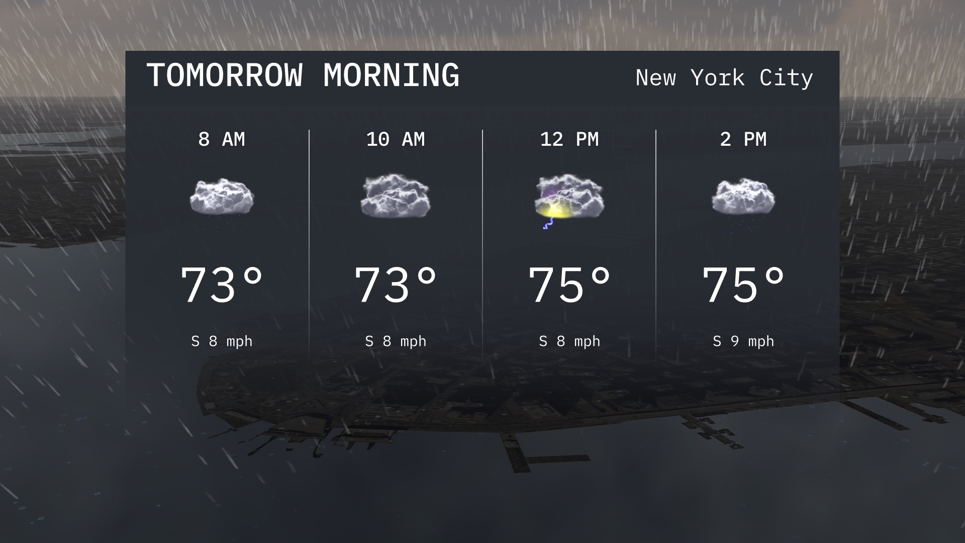
A glimpse into your NYC morning: 73°F, south winds at 8 mph, and partly cloudy skies. What else does the week hold for New York City’s weather? Read on for full details!
This post digs deep into the weather forecast for New York City starting the morning of September 24th, 2025, with a look at temperatures, wind directions, and sky conditions. It extends into a comprehensive weekly forecast highlighting potential showers, varying temperatures, and tips to handle unexpected weather changes across the Northeast. From daytime highs to nightly lows, each detail is designed to help you navigate the week smoothly and comfortably.
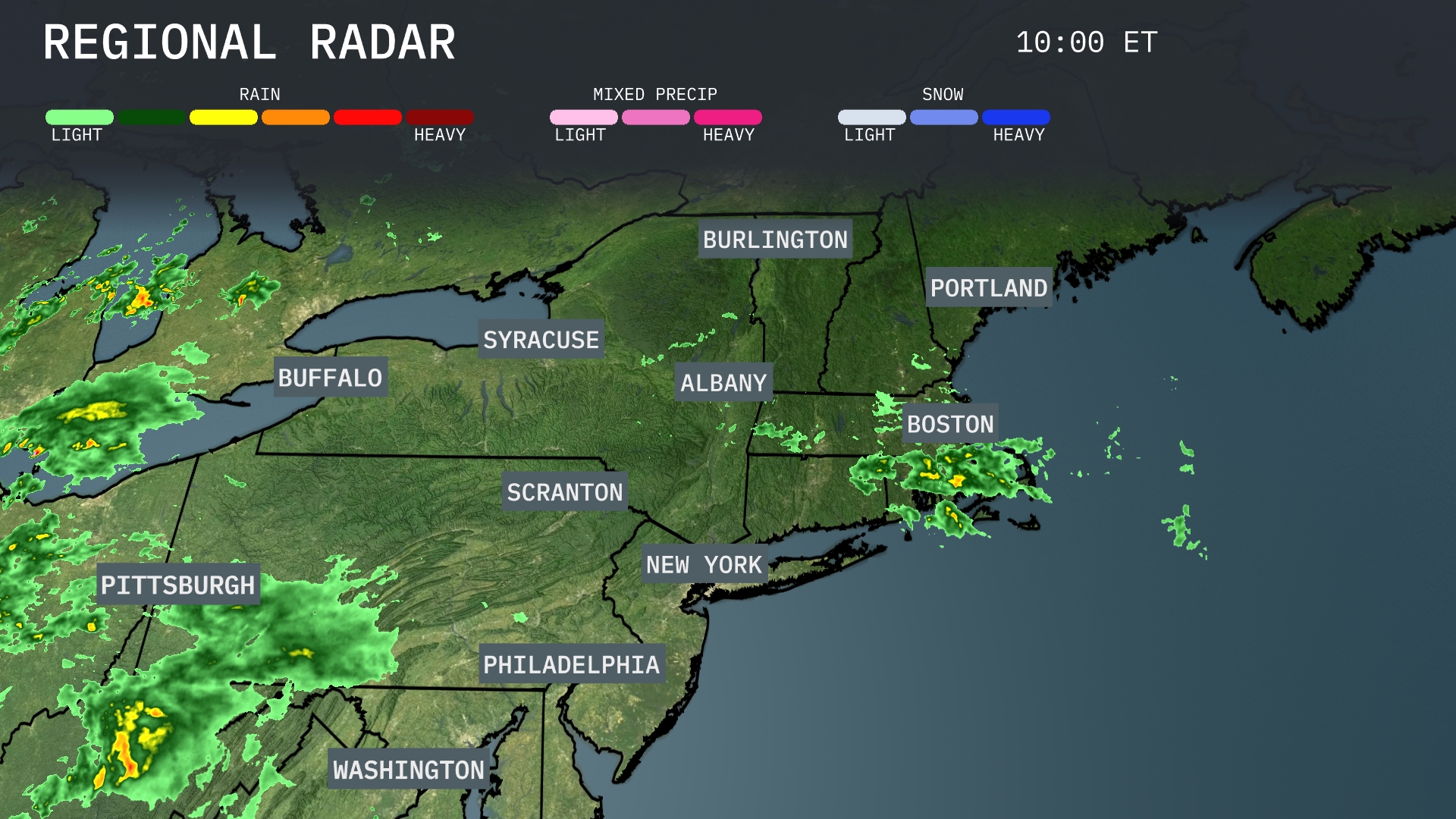
The Northeast is currently experiencing a weather mix, with light to moderate rain observed around Boston, moving offshore. Showers are extending from the Pittsburgh area into parts of upstate New York, affecting cities like Syracuse and Buffalo. Light rain is also moving into areas like Burlington. In New York City and Philadelphia, conditions are mostly clear, providing a respite from the wet weather.
Starting tomorrow morning in New York City, expect temperatures around 73 degrees, with mostly cloudy skies prevailing. Winds will be from the south at 8 mph, providing a gentle breeze to start the day. As you approach noon, temperatures are expected to rise slightly to 75 degrees with partly sunny conditions emerging.
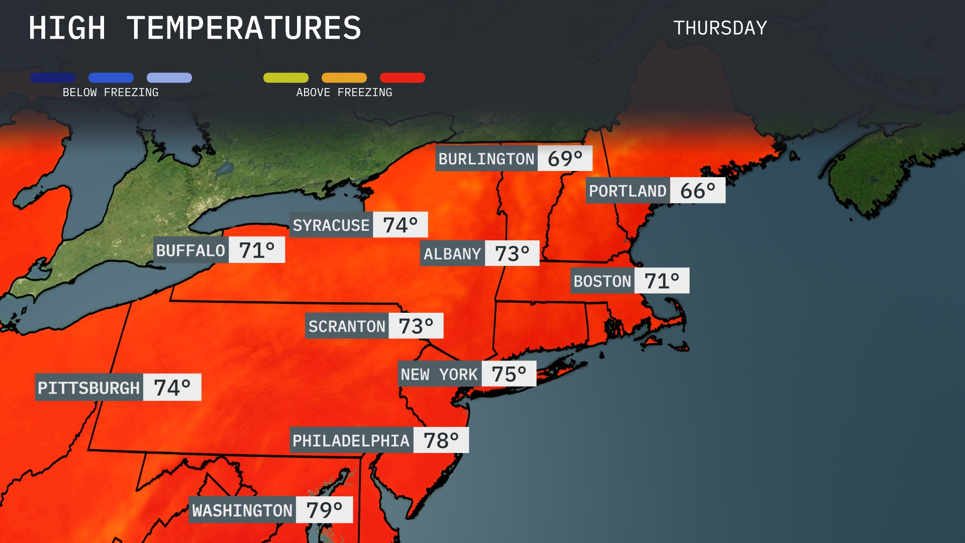
Tomorrow in the Northeast, temperatures will see some pleasantly warm highs. Washington, D.C. is forecasted to reach 79 degrees, while Philadelphia will be a touch cooler at 78. New York City can expect a high of 75 degrees, with Albany following closely at 73. Further north, Syracuse will see a high of 74 degrees, and Buffalo is expected to hit 71. These temperatures are generally above average for this time of year, driven by a warm air mass moving into the region.
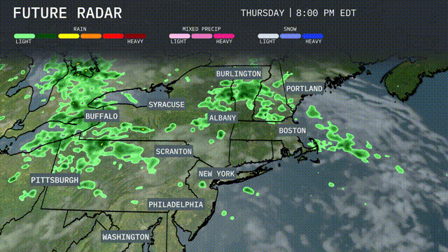
A series of showers and thunderstorms will sweep across the Northeast tomorrow, starting from Buffalo to Boston. Expect heavy rain with potential for localized flooding, particularly from Syracuse to Albany, as these storms move through. In the evening, rainfall will impact Burlington and Portland, with cooler temperatures settling in post-storm. New York and Philadelphia could see gusty winds accompanying the front. As the weather clears into Thursday night, temperatures will drop slightly, bringing a cooler end to the week.
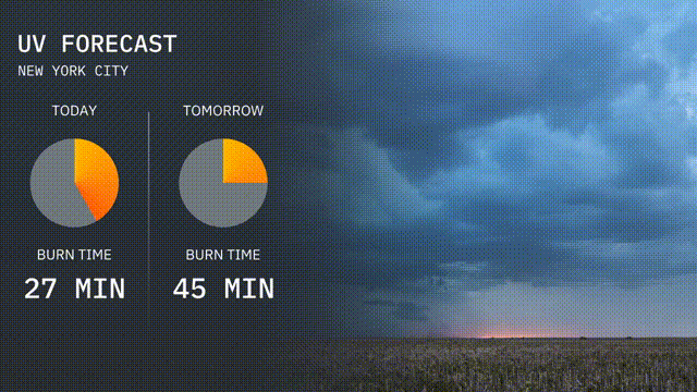
Today’s UV index in New York City is at a moderate 5, with a burn time of about 27 minutes under direct sun. For tomorrow, the UV level rises to 6, with a burn time of approximately 45 minutes.
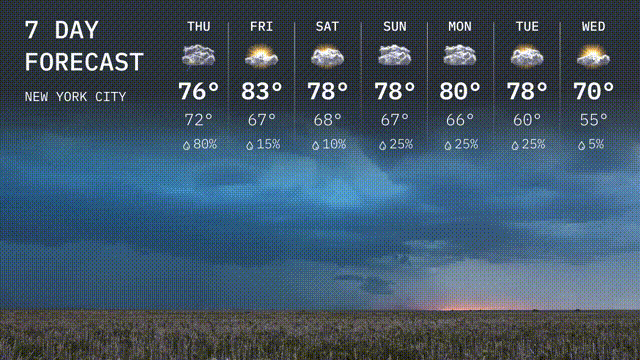
For the 7-day forecast in New York City:
Thursday: Look for a high near 76 degrees and a mild low of 72 with partly cloudy skies.
Friday: It’s warming up to 83 degrees during the day with a low of 67 and potential for clouds.
Saturday: Expect mostly sunny skies with a high around 78 degrees cooling to 68 degrees at night.
Sunday: Partly sunny and comfortable with highs reaching 78 degrees and lows at 67.
Monday: Partly cloudy conditions persist with highs of 80 degrees and lows down to 66.
Tuesday: The clouds remain with a high of 78 degrees and a low around 60, with a slight chance of rain.
Wednesday: Look for partly cloudy skies with temperatures peaking at 70 degrees and a cooler low of 55.