From Mild Mornings to Stormy Skies: Atlanta’s Weather Forecast Breakdown
By
Amy Freeze
Explore the shifting skies of Atlanta with our detailed weather breakdown for tomorrow and the upcoming week, featuring a mix of sun, clouds, and potential storms.
Atlanta welcomes a mixed bag of weather this week—from partly sunny skies to cool temperatures and potential thunderstorms. Find out what the weather holds in store for you!
Tomorrow morning in Atlanta, expect partly cloudy skies with mild temperatures rising throughout the morning. The city will see a high of 67 degrees influenced by a cooler air mass moving through the Southeast. A cold front advancing could bring active weather, including possible thunderstorms sweeping from New Orleans to Atlanta. The 7-day forecast promises a dynamic weather pattern with varying temperatures and conditions. Stay updated and prepared with our comprehensive local weather insights.
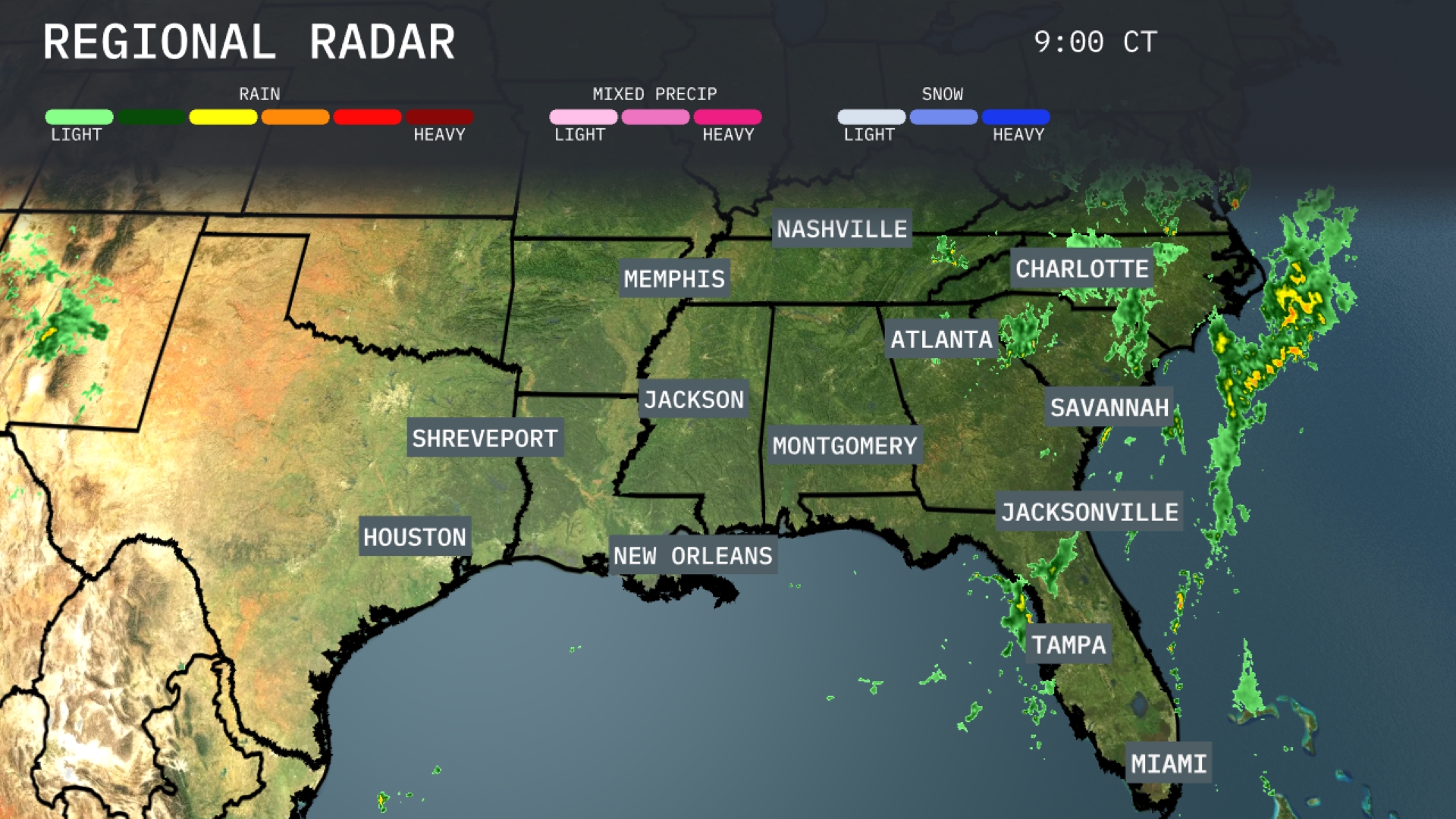
The Southeast is currently experiencing widespread rain primarily affecting areas from Jacksonville to Savannah, with heavy showers moving northeast off the coast of the Carolinas. Scattered rain is pushing through areas including Tampa and Miami, with cloud cover extending into Georgia. Meanwhile, Shreveport, Houston, and New Orleans are observing relatively clear conditions as the wet weather remains mostly to the east. In Nashville, skies are overcast with potential for light rain later today.
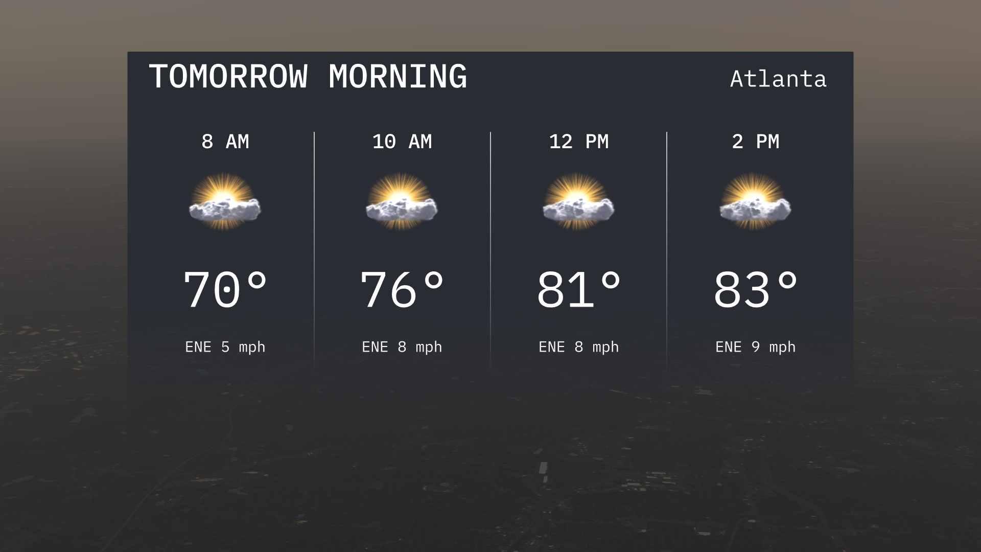
For tomorrow morning in Atlanta, expect temperatures to start at a mild 70 degrees at 8 AM, gradually warming to 76 degrees by 10 AM. Winds will be coming from the east-northeast at speeds ranging from 5 to 8 miles per hour. Skies will be partly cloudy throughout the morning, offering a pleasant balance of sun and clouds. By 12 PM, temperatures continue to rise to 81 degrees, with steady winds and a bright outlook.
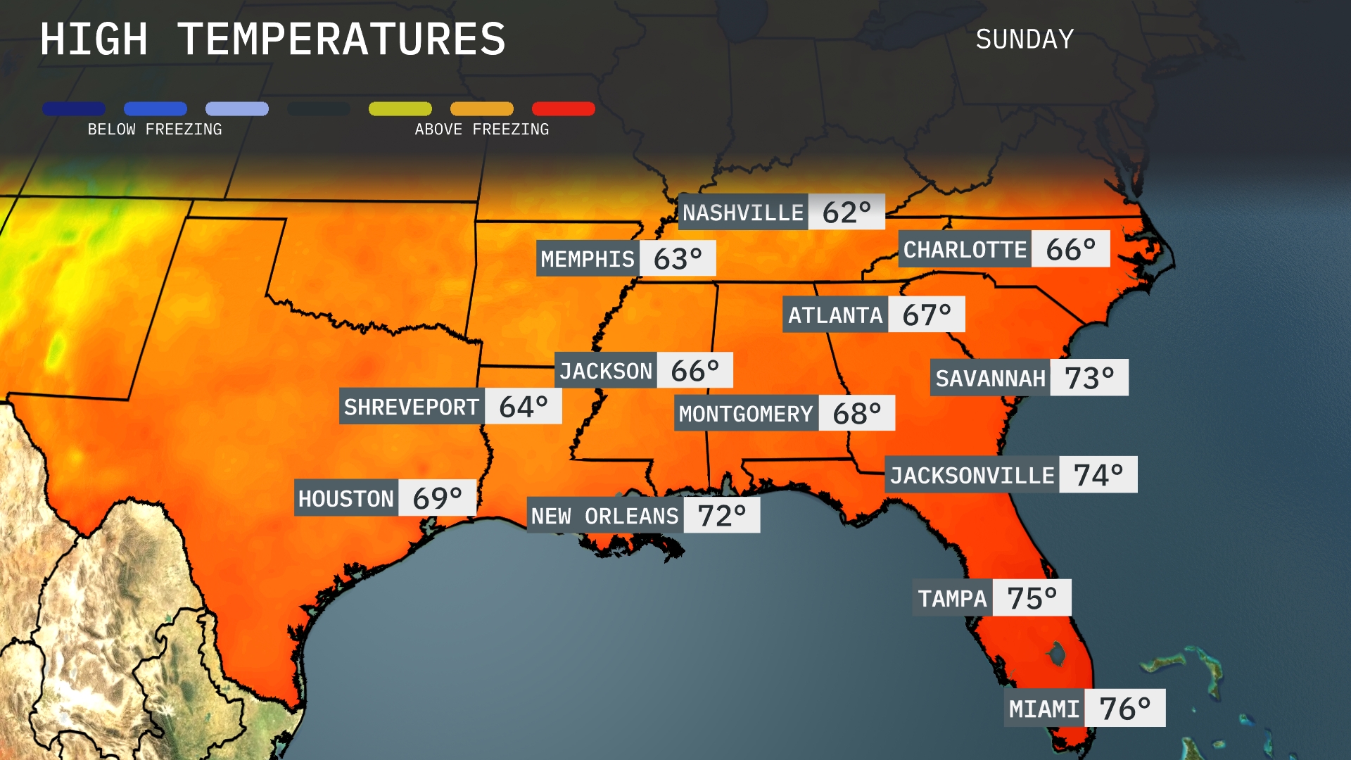
Tomorrow in Atlanta, expect a high of 67 degrees, while Charlotte will reach 66 degrees. Montgomery is looking at a slightly warmer 68 degrees, and temperatures in Jacksonville will hit 74 degrees. In the Deep South, New Orleans will see a high of 72 degrees, and Miami is set for a warm 76 degrees. Overall, these temperatures are somewhat below average for this time of year, influenced by a cooler air mass moving through the region.
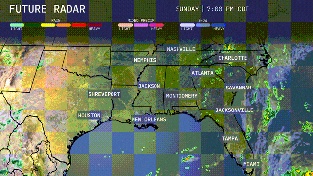
A cold front is advancing through the Southeast tomorrow, bringing a wave of active weather. Expect thunderstorms sweeping from New Orleans to Atlanta throughout the day. Heavy downpours and gusty winds are possible, with the potential for isolated severe storms, particularly across Louisiana and Mississippi. Rainfall amounts may exceed an inch in some areas, raising concerns for localized flooding. Following the front, cooler temperatures will settle in, offering a refreshing change by the evening hours.
Today, the UV index in Atlanta is high with a value of 8, meaning sunburn can occur in about 20 minutes if you’re outdoors without protection. It remains high tomorrow, so remember to reapply sunscreen regularly and seek shade when possible.
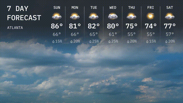
For the 7-day forecast in Atlanta:
Sunday: Expect partly sunny skies with a high of 86 degrees and a low of 66 degrees.
Monday: Mostly cloudy with a high of 81 degrees and a low of 66 degrees.
Tuesday: The temperature climbs to 82 degrees with some sun, and the night cools to 65 degrees.
Wednesday: Thunderstorms likely in the area with a high of 80 degrees and an overnight low of 61 degrees.
Thursday: A bit cooler, with the day topping out at 75 degrees under partly cloudy skies and a low of 55 degrees.
Friday: Highs reach 74 degrees with partly sunny conditions and cooling to 57 degrees at night.
Saturday: Ending the week with plenty of sunshine, a daytime high of 77 degrees, and a low of 57 degrees.
Have a great week ahead! Stay safe!