Chicago Weather Forecast: From Sunshine to Rainstorms
By
Amy Freeze
Explore a week of varying weather in Chicago, highlighting sunny mornings and potential stormy nights with a brisk drop in temperatures mid-week.
This week in Chicago, enjoy the warm sunny days before preparing for stormy nights. Catch all the details on what to expect from the weather in your city!
Starting the week with bright, sunny days, Chicago offers perfect outdoor weather with temperatures soaring up to 87°F. As the week progresses, a strong cold front will bring thunderstorms and a noticeable drop in temperatures. Prepare for potential severe weather conditions mid-week and plan your outdoor activities accordingly. Read more about this week’s detailed weather forecast on our blog at https://amyfreeze.ai/.
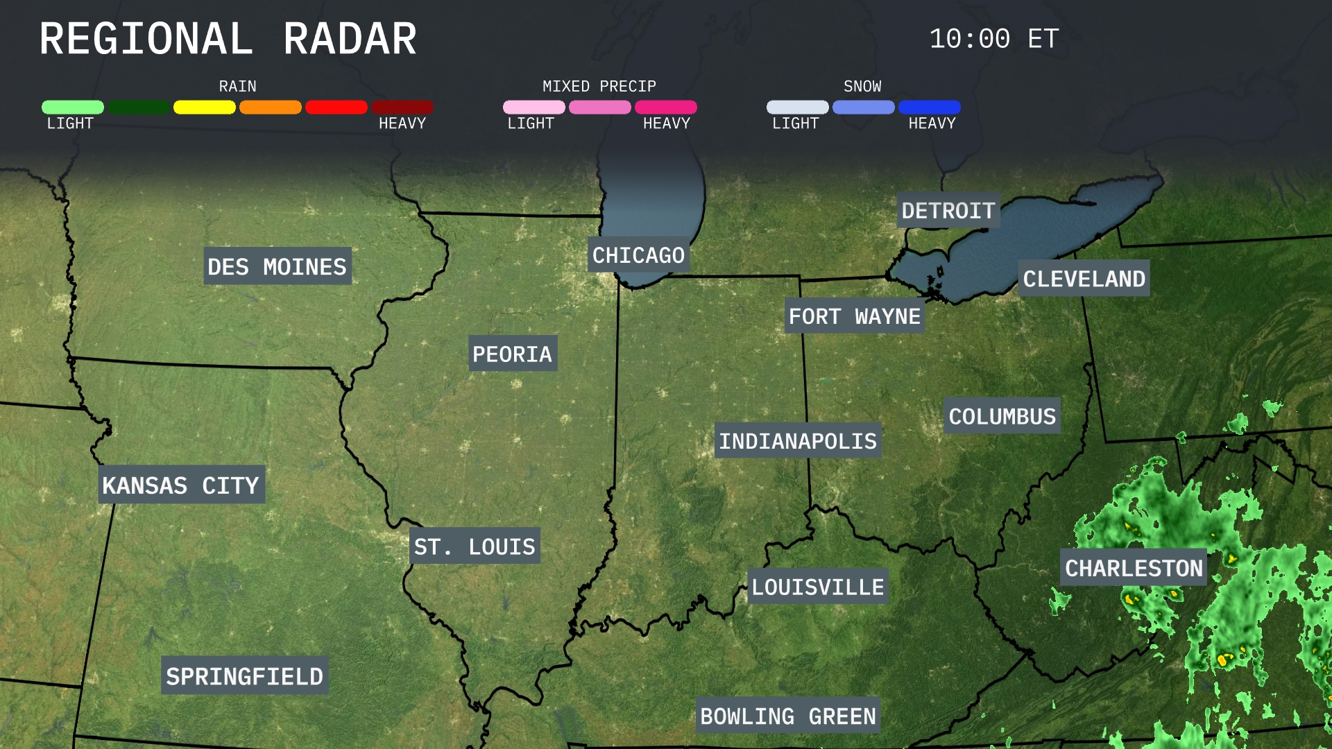
A clear start across the Midwest this morning, with high-pressure system keeping skies mostly sunny from Des Moines through Kansas City to St. Louis. However, areas near Charleston are experiencing heavy rain, as a system pushes moisture from the southeast. Detroit and Cleveland may see some cloud cover but remain dry for now. Keep an eye on Fort Wayne as cloud cover might thicken later today, with rain spreading towards the Ohio Valley overnight.
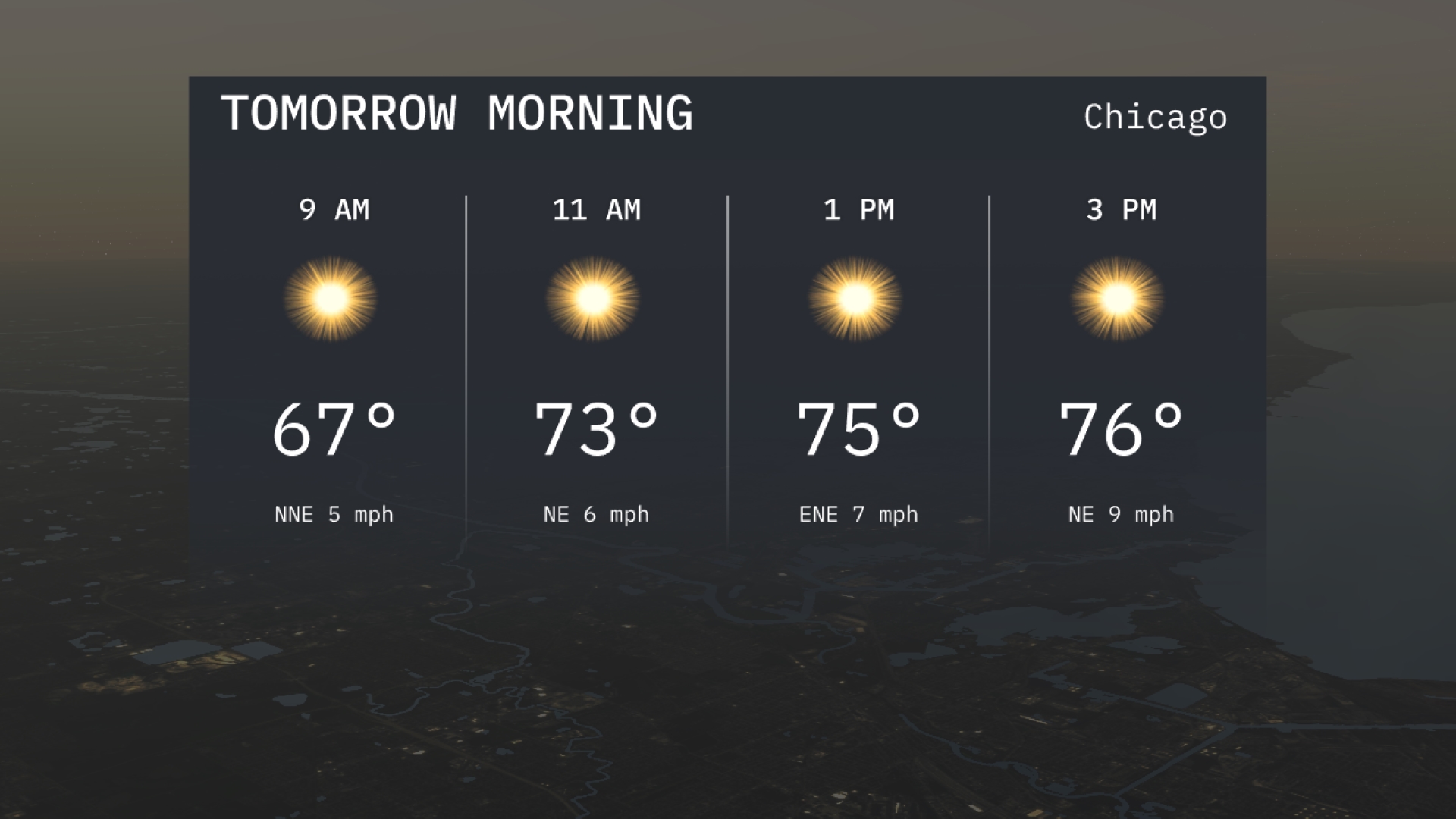
Expect a bright start to your morning in Chicago with temperatures at 67 degrees by 9 AM and warming up to 73 degrees by 11 AM. Sunny skies will dominate the day, making it a great time to enjoy the outdoors. Winds will be gentle, coming from the north-northeast. Perfect weather for any morning activities you have planned!
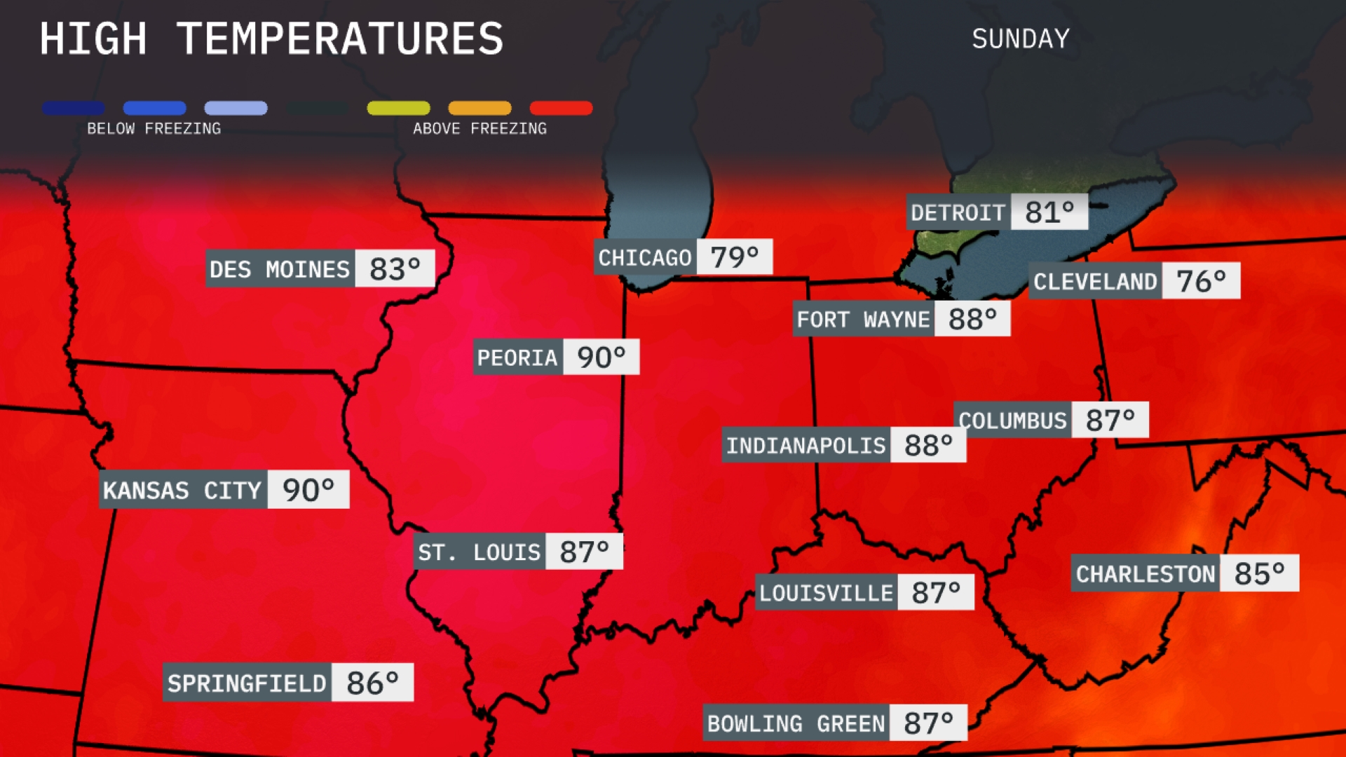
Tomorrow, Kansas City sizzles with a high of 90 degrees, while Peoria also reaches 90, indicating notably above-average temperatures for this time of year. St. Louis isn’t far behind, expected to hit 87 degrees. Indianapolis and Columbus will see highs of 88, showcasing the widespread warmth across the Midwest. Cooler temperatures linger in Cleveland at 76 and Detroit at 81, but the overall trend remains decidedly warm as high pressure influences the region.
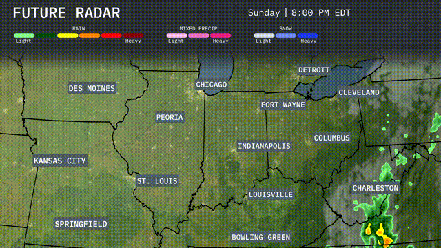
A strong cold front moves into the Midwest overnight, bringing scattered thunderstorms and periods of heavy rain from Kansas City to Indianapolis. Expect gusty winds and potential for severe storms, especially around St. Louis and Springfield, with isolated tornado threats possible. Rainfall could exceed an inch in some areas, increasing flood risks along rivers. By midday tomorrow, cooler, drier air settles in from the north, sweeping across Chicago to Cleveland with temperatures dropping about 10 to 15 degrees. This system clears skies by Wednesday, leaving behind pleasant conditions for the latter part of the week.
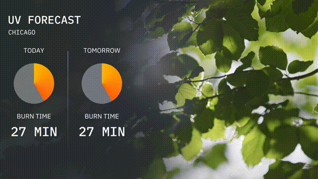
The UV index in Chicago for today is at 3, with a burn time of about 27 minutes under direct sunlight. Tomorrow maintains the same UV index level, so continue applying sunscreen if you’re heading outdoors. Remember, with an index of 3, the sun’s rays are moderate, but caution is still advised.
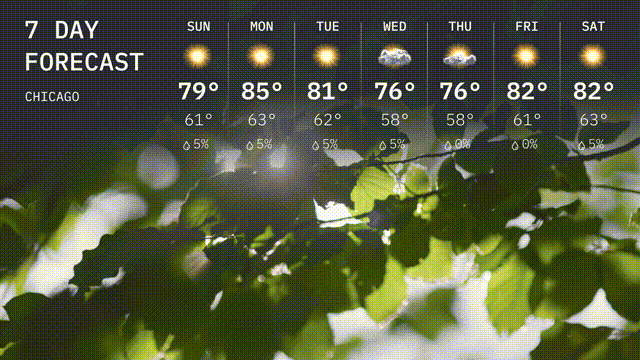
Sunday: A pleasant day with partly sunny skies, expect a high of 79 degrees and a low of 61 degrees.
Monday: Warmer conditions with a high reaching 85 degrees and dropping to a low of 63 degrees at night.
Tuesday: Clouds roll in, and temperatures will peak at 81 degrees, with overnight lows around 62 degrees.
Wednesday: Anticipate some showers with a high of 76 degrees, cooling to 58 degrees.
Thursday: Lingering showers, with temperatures reaching up to 76 degrees and a low of 61 degrees.
Friday: Sunny and warm, with a high of 82 degrees and a nighttime low of 61 degrees.
Saturday: Another sunny day in store, with highs around 82 degrees and lows of 63 degrees.