Salt Lake City Week in Weather: From Clear Skies to Chilly Showers
By
Amy Freeze
Explore the dynamic changes in weather from sunny heights to rainy nights in Salt Lake City. Get the scoop on this week’s forecast including the nearby cities.
This week in Salt Lake City, expect a mix of sun and showers. Starting with a sunny Friday and gearing up for a sharp temperature drop and potential rains heading into the weekend. Full insights on our blog at https://amyfreeze.ai/!
As Salt Lake City welcomes another week, residents can look forward to a variety of weather conditions. Enjoy sunny days with highs reaching up to 72 degrees, perfect for your outdoor activities. However, keep your umbrellas close by as we anticipate showers and possibly a cold front affecting travel especially near mountain passes. For those planning ahead, check out our complete 7-day weather breakdown and stay prepared for anything the sky throws your way, only on https://amyfreeze.ai/!
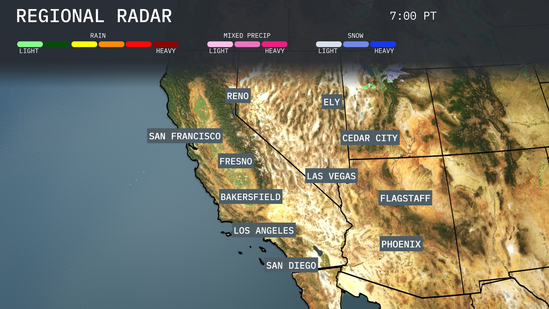
San Francisco and Fresno are experiencing some light rain moving southeastward, providing a touch of relief after dry conditions. Bakersfield is also seeing showers that could lead to slick roads. Reno remains dry, but expect cloud cover moving over the city. To the east, light showers are moving through Ely, which could impact travel.
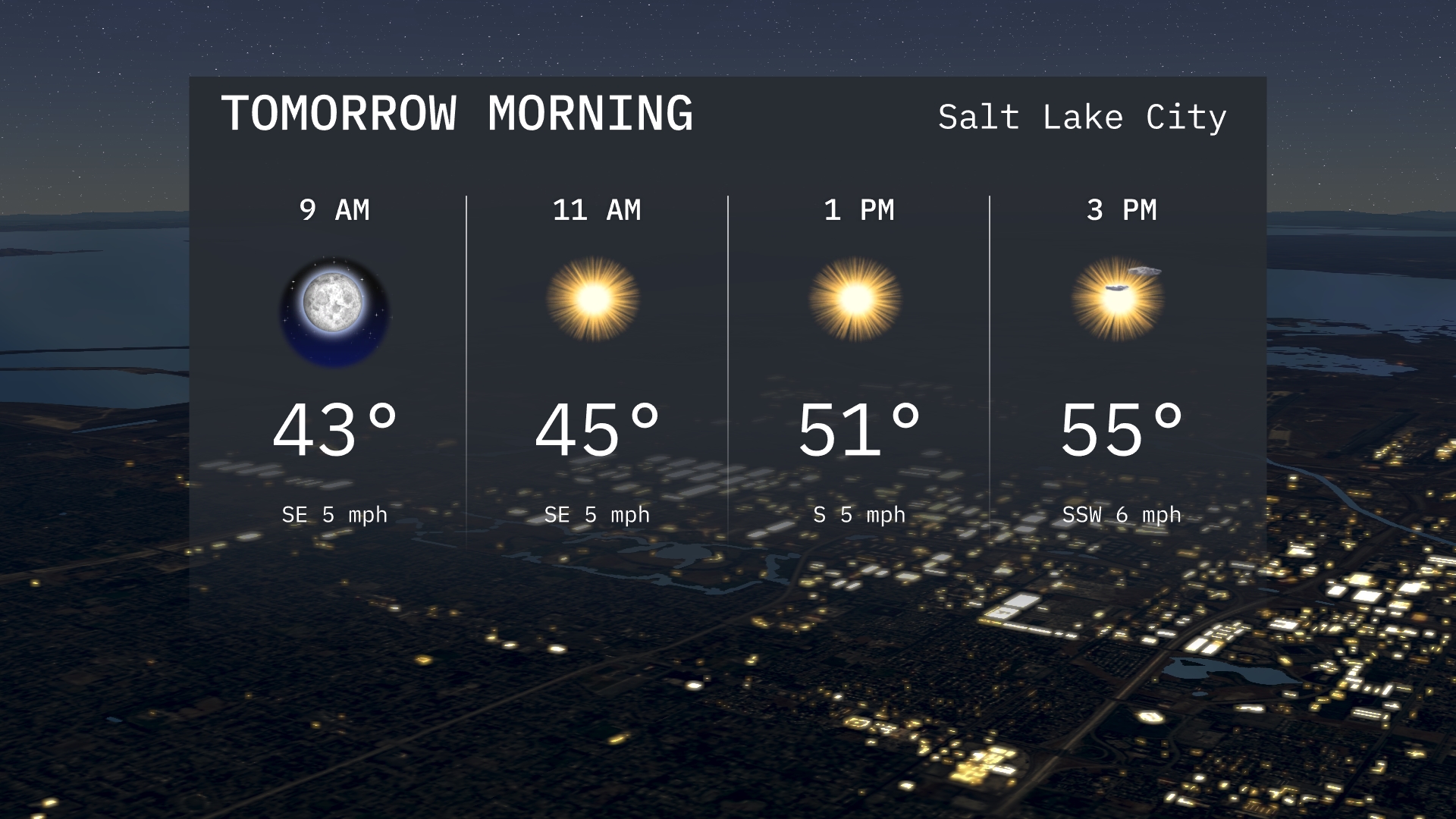
Salt Lake City tomorrow morning will start off clear, with temperatures around 43 degrees at 9 AM. By 11 AM, expect sunny skies with a slight southeast breeze at 5 mph as temperatures rise to 45 degrees. The morning conditions are calm, setting the stage for a bright and pleasant day ahead.
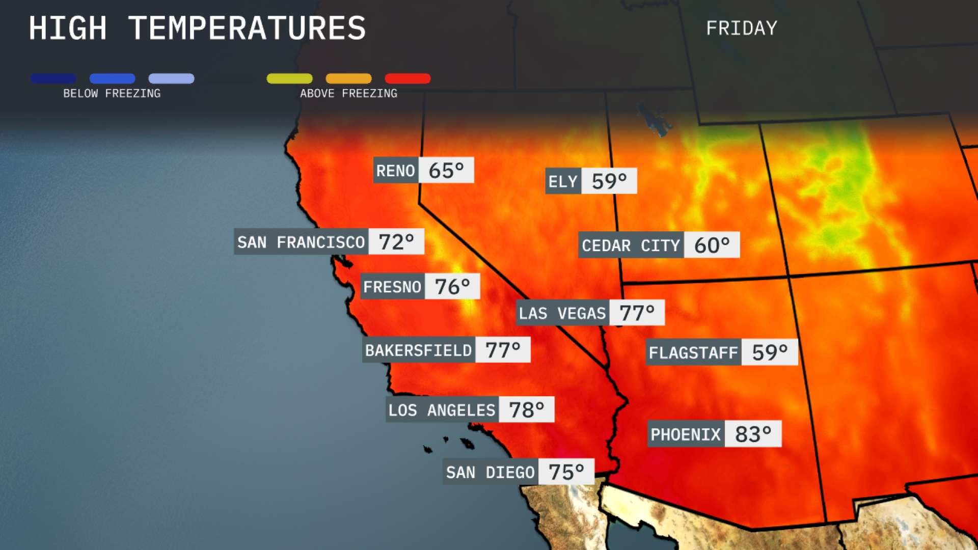
Tomorrow in Phoenix, expect a high of 83 degrees, well above average for this time of year. Las Vegas will see a warm day with temperatures peaking at 77 degrees. Over in Los Angeles, temperatures are forecasted to reach 78 degrees, while San Diego enjoys a pleasant high of 75 degrees. Further inland, Bakersfield and Fresno are both set for highs of 77 and 76 degrees, respectively. This warmth is driven by a prevailing high-pressure system in the region, keeping conditions clear and sunny across the Southwest.
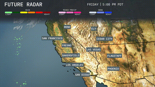
A brisk cold front is sweeping through the Southwest, bringing a sharp drop in temperatures by tomorrow evening, particularly over Las Vegas and Phoenix. Expect scattered showers and isolated thunderstorms, primarily along the coast from Los Angeles to San Francisco, with the heaviest rainfall hitting the Bay Area. The high deserts, including Ely and Cedar City, will stay dry but cooler than usual. Gusty winds accompany the front, posing a risk for tricky travel conditions, especially around mountain passes in northern California. The weather calms down by mid-week as the system pushes eastward, leaving behind clearer skies and cooler air.
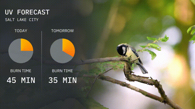
The UV index in Salt Lake City is moderate today with a value suggesting a burn time of about 45 minutes in direct sunlight. Tomorrow, the UV index remains moderate, with a slightly reduced burn time of 35 minutes. Remember to protect your skin by using sunscreen and wearing a hat if you plan to be outdoors!
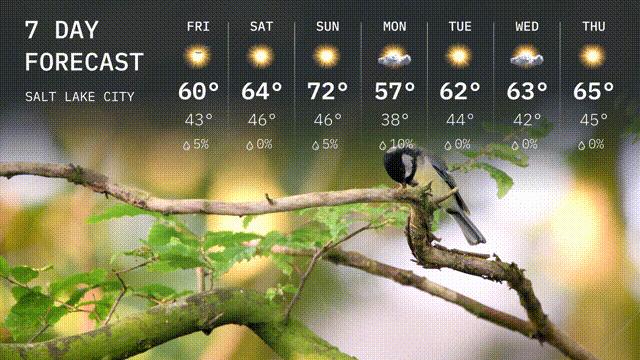
Here’s the 7-day outlook for Salt Lake City:
Friday: Enjoy sunny skies with a high of 60 degrees and a low of 43 degrees.
Saturday: More sunshine on the way, warming up to 64 degrees with the nighttime low of 46 degrees.
Sunday: Bright and sunny, perfect for outdoor plans, with a high reaching 72 degrees and a low at 47 degrees.
Monday: A cooler day is expected, partly sunny with highs around 57 degrees, cooling to 38 degrees at night.
Tuesday: Sunshine and clouds mix, warming to 62 degrees, with a chillier overnight low of 44 degrees.
Wednesday: Another sunny day with temperatures climbing to 63 degrees and a low of 42 degrees.
Thursday: The week rounds off with partly sunny conditions, reaching a high of 65 degrees and a low around 45 degrees.