Atlanta’s Weather Outlook: Balancing Sunshine and Showers
By
Amy Freeze
Discover what’s in store for Atlanta's weather this week. From sunny mornings to evening showers, stay updated with our comprehensive guide.
This week in Atlanta, expect everything from pleasant sunny days to potential stormy afternoons. Stay prepared with our accurate and detailed weather forecasts!
As the Southeast braces for a variety of weather conditions, Atlanta will experience a mix of partly cloudy skies, rising temperatures, and potential showers moving in. Our comprehensive blog post covers the daily forecasts, weather warnings, and advice on how to handle the fluctuating conditions. For the detailed 7-day forecast and savvy weather insights from Meteorologist Amy Freeze, click here: https://amyfreeze.ai/atlanta-weekly-weather-sun-and-showers.
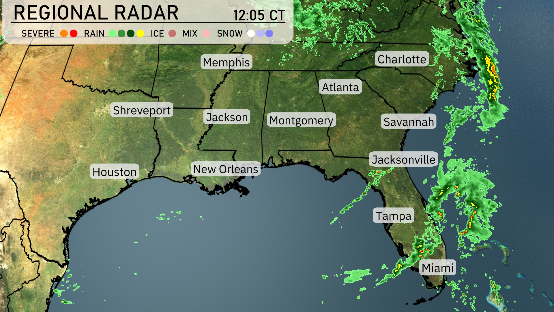
The Southeast is experiencing scattered showers from the western Gulf moving eastward. Miami and Tampa are dealing with steady rain, which could intensify, while Jacksonville sees lighter showers. Farther north, rain is making its way toward Savannah and possibly reaching Charleston later today. The areas around Montgomery and Atlanta remain dry for now, but clouds may increase as the system progresses. The Tennessee Valley, including Memphis, remains calm under clear conditions.
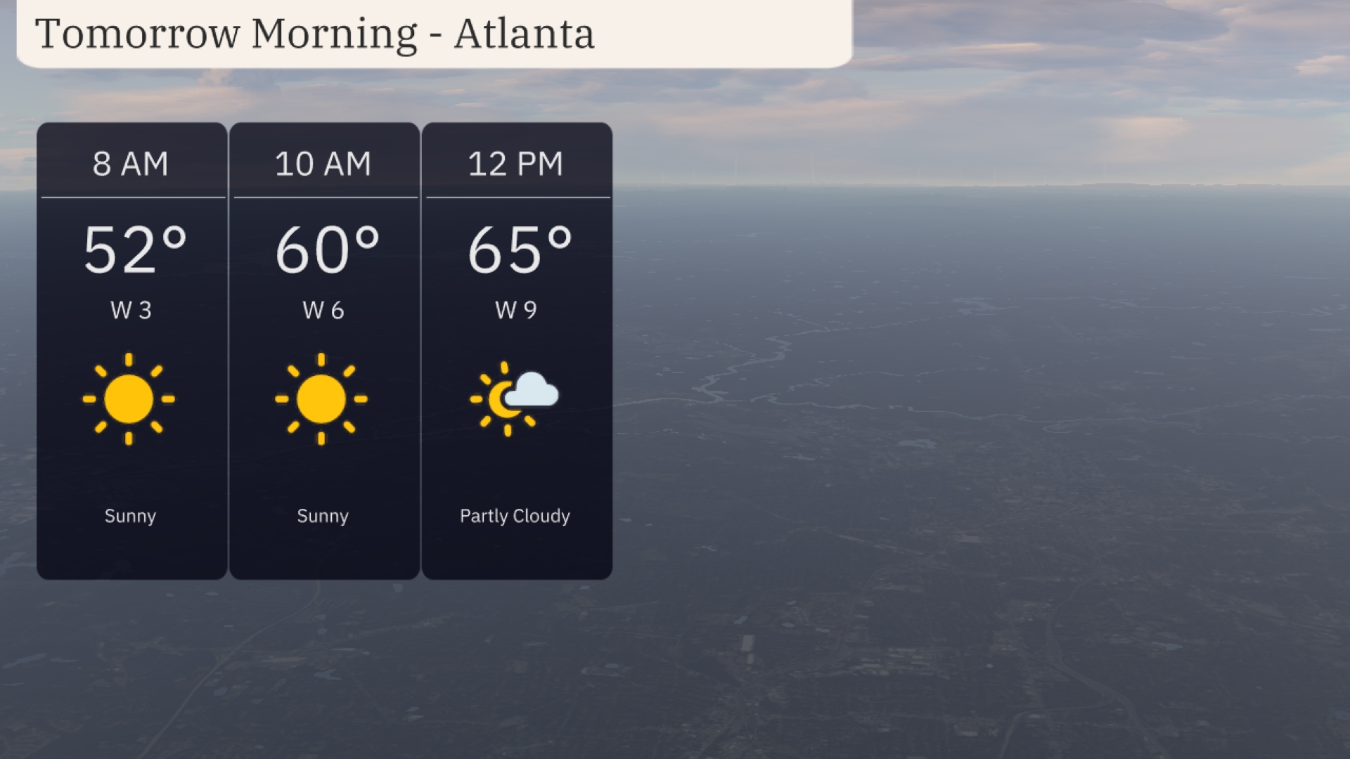
Atlanta will wake up to sunny conditions with temperatures starting at 52 degrees at 8 AM. By 10 AM, the temperature will rise to 60 degrees, with a light west wind at 6 miles per hour. As the morning progresses to noon, expect partly cloudy skies and a temperature of 65 degrees, accompanied by a slightly stronger west wind at 9 miles per hour.
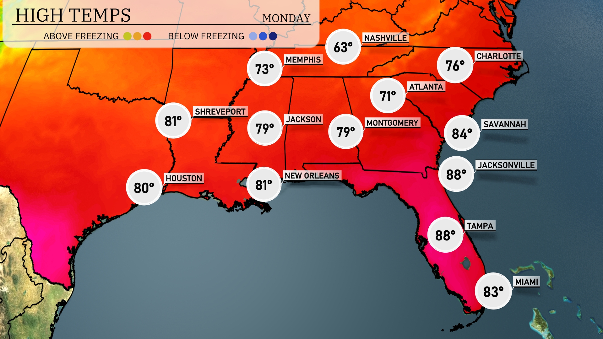
High temperatures tomorrow across the Southeast are expected to be notably warm, with many areas experiencing above-average readings. Jacksonville leads the pack at 88 degrees, while Tampa also reaches 88. Montgomery and New Orleans will see highs around 79 and 81 degrees, respectively. Atlanta will be slightly cooler at 71 degrees, influenced by cloud cover in the region.
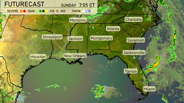
A dynamic weather scenario unfolds in the Southeast, as a cold front pushes through the region. From Jackson to Montgomery, scattered thunderstorms are likely to develop by tomorrow afternoon, with a risk of heavy rain and strong winds. Areas along the Gulf Coast, including New Orleans and Mobile, should prepare for bouts of intense rainfall and localized flooding. By evening, the frontal boundary will extend towards Atlanta and Charlotte, introducing cooler air and calmer conditions through Wednesday. Stay weather-aware and look out for any severe weather alerts that might be issued during this active weather pattern.
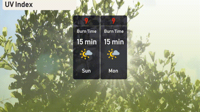
The UV index in Atlanta will be very high on both Sunday and Monday, with a level of 9 each day. Expect a burn time of just 15 minutes in direct sunlight, so it’s crucial to take precautions. Apply sunscreen, wear hats, and seek shade during midday hours to protect your skin from the intense sun exposure.
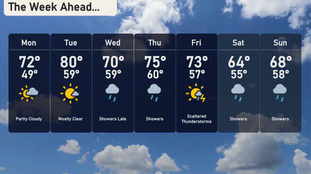
For the 7 Day Forecast in Atlanta:
Monday: Partly cloudy skies with a daytime high of 72 degrees, cooling to 49 degrees at night.
Tuesday: Mostly clear with temperatures rising to 80 degrees, and a low of 59 degrees.
Wednesday: Showers expected later in the day. Highs around 70 degrees and lows at 59 degrees.
Thursday: Continued showers with a high of 75 degrees and a low of 60 degrees.
Friday: Scattered thunderstorms are likely. Look for a high of 73 degrees and a night low of 57.
Saturday: Showers will persist, with daytime temperatures reaching 64 degrees and dropping to 55 at night.
Sunday: More showers on the horizon with a high of 68 degrees and a low of 58 degrees.