Storms Sweep Southeast: Tracking the Turbulence and Tropical Temperatures
By
Amy Freeze
Severe storms march through the Southeast, coupled with record-high temperatures. From detailed city forecasts to safety tips, stay prepared with our exclusive weather insights.
A wave of severe weather and intense heat envelops the Southeast. Follow along as Meteorologist Amy Freeze highlights the major weather events and temperature swings in the region.
Welcome to your detailed Southeast weather forecast. This week, expect severe storms from Memphis to Montgomery and experience temperatures that scream summer, especially in hot spots like Jacksonville. Your guide, Meteorologist Amy Freeze, covers everything from nightly lows to the fierce afternoon sun. With potential severe weather threats and dramatic temperature ranges, it’s crucial to stay informed and prepared. For a city-by-city breakdown and expert insights, follow the full forecast.
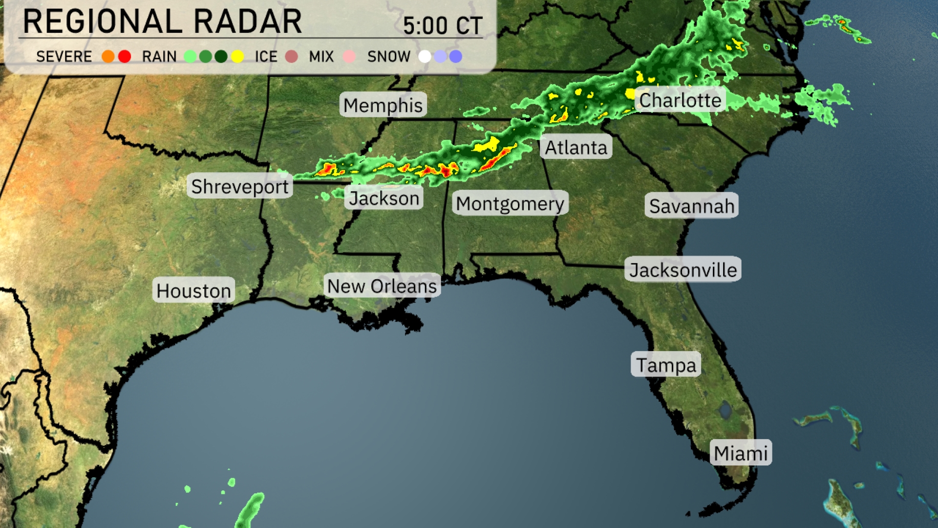
A line of severe storms extends from Memphis to Charlotte, moving eastward, with significant rainfall over Jackson continuing towards Atlanta. In the vicinity of Shreveport, occasional light showers are occurring, while New Orleans remains dry and clear for now. Montgomery and surrounding areas are witnessing increased cloud cover ahead of the approaching weather system. Coastal cities such as Savannah, Jacksonville, and Tampa are currently enjoying clear skies.
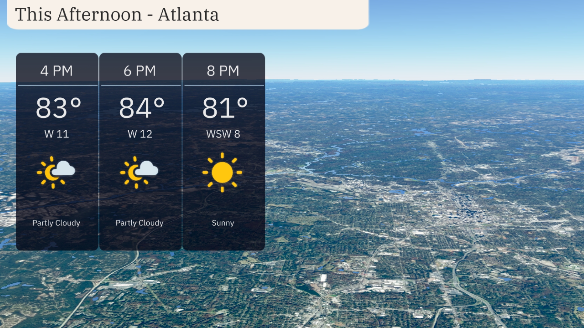
Temperatures in Atlanta this afternoon are in the low 80s, reaching 84 degrees by 6 PM. Winds are from the west at 11 to 12 miles per hour, offering a light breeze. Expect partly cloudy skies throughout, clearing up to sunny conditions by 8 PM.
Today in New Orleans, expect a high of 90 degrees, while Shreveport will also see a toasty 90. Jackson’s forecast is slightly cooler at 86 degrees. Over in Florida, Jacksonville will feel the heat with a sizzling high of 97, making it one of the hottest spots in the region. Tampa is warmer too, with a high reaching 91 degrees, while Miami will top out at a more mild 88 degrees. As we look at these temps, it’s clear that summer has settled in for much of the Southeast today.
Tonight, the Southeast will see mild overnight temperatures. Expect a low of 72 degrees in Jackson and 75 in Shreveport, while Memphis dips to 72. Atlanta will cool down to around 66 degrees, and Nashville will settle at 64. Warmer readings will prevail in Florida, with Tampa at 73 and Miami at 77.
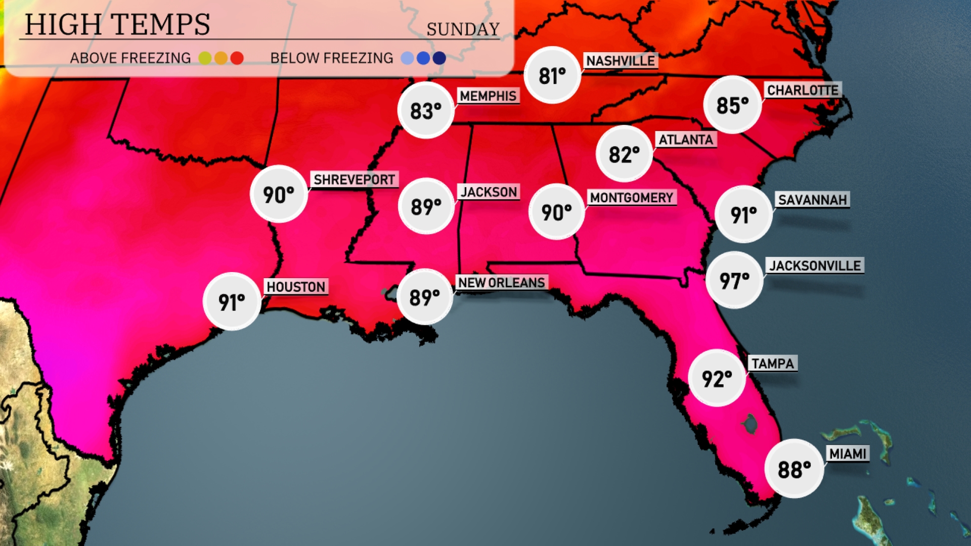
High temperatures tomorrow in the Southeast are soaring above average as warm air influences the region. Atlanta will reach a high of 82 degrees, while Montgomery tops out at 90 degrees. Savannah is expected to see a sizzling 91 degrees, and Jacksonville could hit a remarkable 97 degrees. Houston will also feel the heat with a high of 91 degrees, while New Orleans matches that at 89 degrees.
A line of storms is setting up to move through the Southeast tomorrow, impacting areas from Shreveport to Montgomery. Look out for severe thunderstorms likely late afternoon with potential for damaging winds and heavy rainfall, particularly over Mississippi. By evening, showers could spread eastward, reaching locations like Atlanta. In the wake of this front, expect temperatures to dip slightly, bringing cooler, more pleasant weather by Sunday.
The UV index for Atlanta on Saturday is 7, with a burn time of approximately 20 minutes in direct sunlight. On Sunday, the UV index is even higher at 8, which presents a quicker burn time of just 17 minutes, so consider wearing hats and UV-blocking sunglasses.