Atlanta’s Weather Lens: Partly Cloudy Today, Storms on the Horizon
By
Amy Freeze
Dive into Atlanta’s weather details as Meteorologist Amy Freeze guides you through what to expect this week—from serene partly cloudy skies to looming thunderstorms.
Explore Atlanta’s weather journey as we bring you a detailed analysis from Meteorologist Amy Freeze. From today’s partly cloudy skies to possible thunderstorms, stay prepared!
Meteorologist Amy Freeze here to bring you the most comprehensive overview of Atlanta’s weather for the upcoming week. Expect a variety of conditions, from partly cloudy mornings with gentle northwest winds to potential severe thunderstorms due to a cold front sweeping in from Houston to Jacksonville. With temperatures fluctuating and the UV index hitting extreme levels, our detailed 7-day forecast will help you stay safe and make the most out of your week. For further in-depth analysis, visit https://amyfreeze.ai/
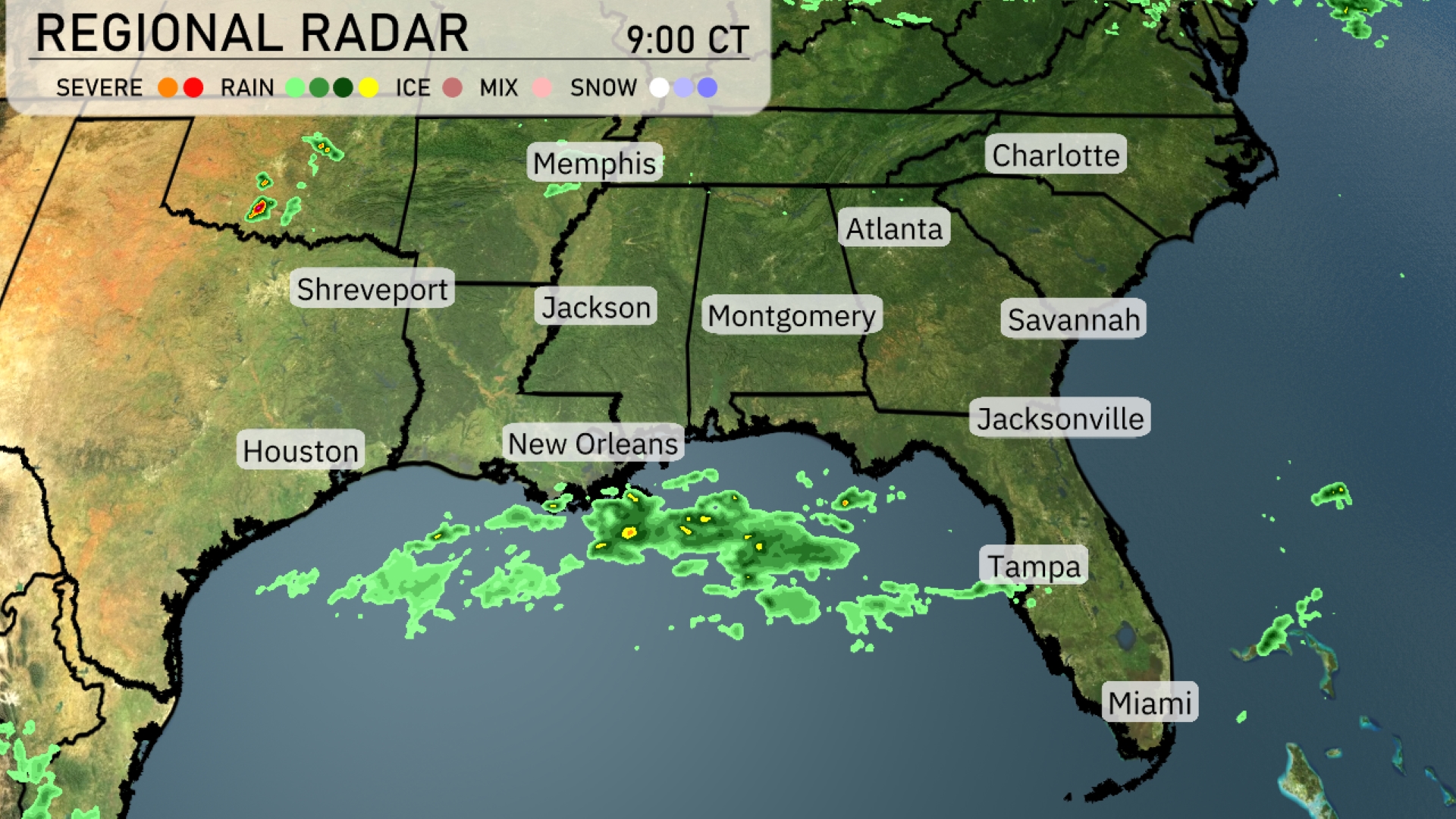
Currently, on the radar, a band of showers is sweeping across the Gulf Coast, stretching from Houston to New Orleans, bringing much-needed rain to these areas. New Orleans is experiencing moderate rainfall, while Houston manages to stay mostly dry. The showers continue their journey eastwards towards Tampa, getting ready to bring some wet weather to the Sunshine State. Inland, conditions remain relatively calm, with clear skies over regions such as Atlanta and Montgomery. Eastern areas like Savannah and Charlotte are enjoying sunny conditions.
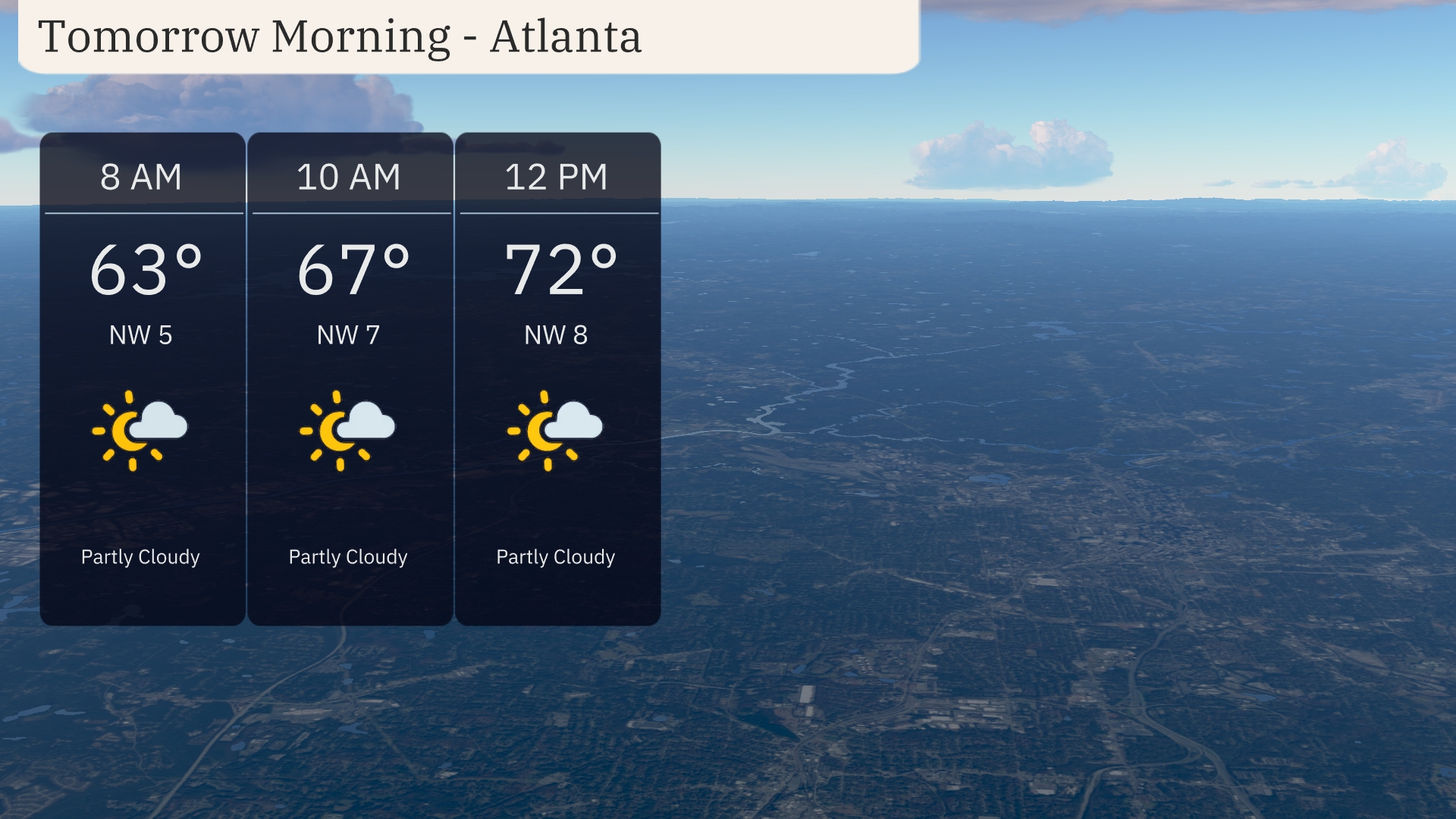
For tomorrow morning in Atlanta, expect partly cloudy conditions to start your day. Temperatures will rise from 63 degrees at 8 AM to 72 degrees by midday. Winds will be from the northwest, starting at 5 mph and gradually increasing to 8 mph by noon.
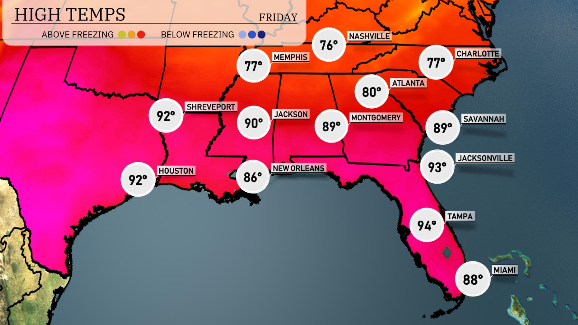
Tomorrow’s temperatures in the Southeast are expected to be significantly above average. Atlanta will see a high of 80 degrees, while Jackson is forecasted to reach 90 degrees. In New Orleans, expect warmer conditions with a high around 86 degrees. Miami will be sizzling at 88 degrees, and Tampa could hit 94 degrees, making it one of the hottest spots in the region.
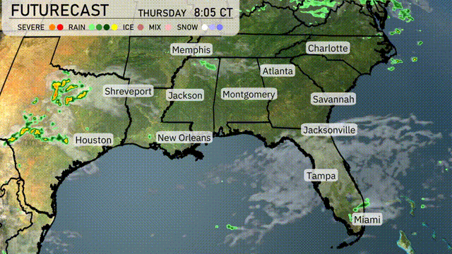
A cold front is set to impact the Southeast, particularly from Houston to Jacksonville, with showers and thunderstorms overnight into Thursday. Look out for the possibility of heavy rainfall and strong winds, especially in New Orleans and Montgomery by early morning. Temperatures will dip slightly post-front, offering a brief relief from the recent warmth. Coastal areas like Miami and Tampa remain mostly dry with warm conditions. Remember, the risk of scattered storms will linger as the front clears by the end of Thursday, moving towards the Carolinas.
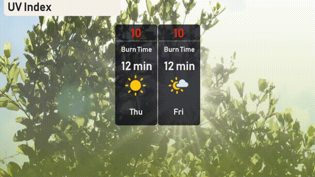
The UV index in Atlanta will be at an extreme level of 10 on both Thursday and Friday, with a very short burn time of just 12 minutes in direct sunlight!
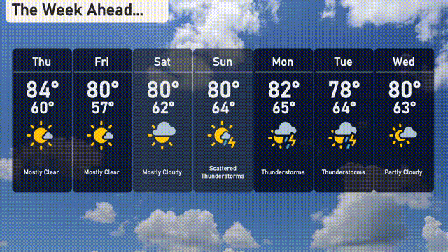
For the 7-day forecast in Atlanta:
Thursday: Mostly clear skies with a high of 84 degrees and a low of 60.
Friday: Another clear day, enjoy the sunshine with temperatures reaching 80 degrees and dropping to 57 at night.
Saturday: Partly cloudy with a high of 80 degrees, cooling down to 62 by evening.
Sunday: Scattered thunderstorms expected with a high of 80 degrees and a low of 64 degrees.
Monday: Thunderstorms continue with highs around 82 degrees and lows near 65.
Tuesday: More thunderstorms on the horizon, hitting a high of 78 degrees and 64 for the low.
Wednesday: Partly cloudy skies to wrap up the week, a high of 80 degrees and a low of 63.