Chicago’s Weather Tapestry: Sunshine and Storms Unfold with Amy Freeze
By
Amy Freeze
Dive into the heart of the Midwest’s weather patterns with Amy Freeze as we explore a week of shifting skies, from serene sun to storm fronts.
Meteorologist Amy Freeze delivers an engaging glimpse into Chicago’s ever-changing weather landscape, highlighting everything from mild afternoons to storm-laden evenings.
Explore a detailed analysis of the shifting weather in the Midwest, led by Amy Freeze. From the intricate dance of rising temperatures across the region to the preparations needed for approaching storm systems, this post delivers actionable insights combined with expert commentary. Witness the balance of sunny days interspersed with crucial weather alerts as we navigate the week ahead.
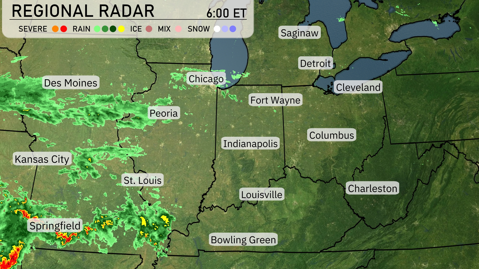
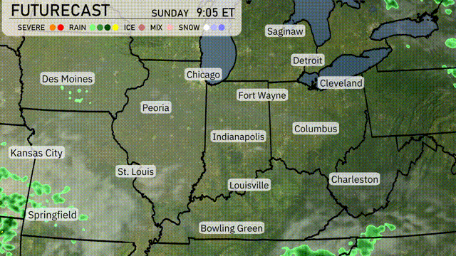
A line of storms is currently moving northeast across Missouri, with Springfield experiencing severe weather. Rain is stretching from St. Louis to Kansas City, intensifying as it moves northeast. In Illinois, Peoria is seeing the initial bands of rain approaching from the southwest. The Great Lakes region, including Chicago and Detroit, remains dry and clear for the moment. Indiana and Ohio are under mostly clear skies, with clouds beginning to increase from the west.
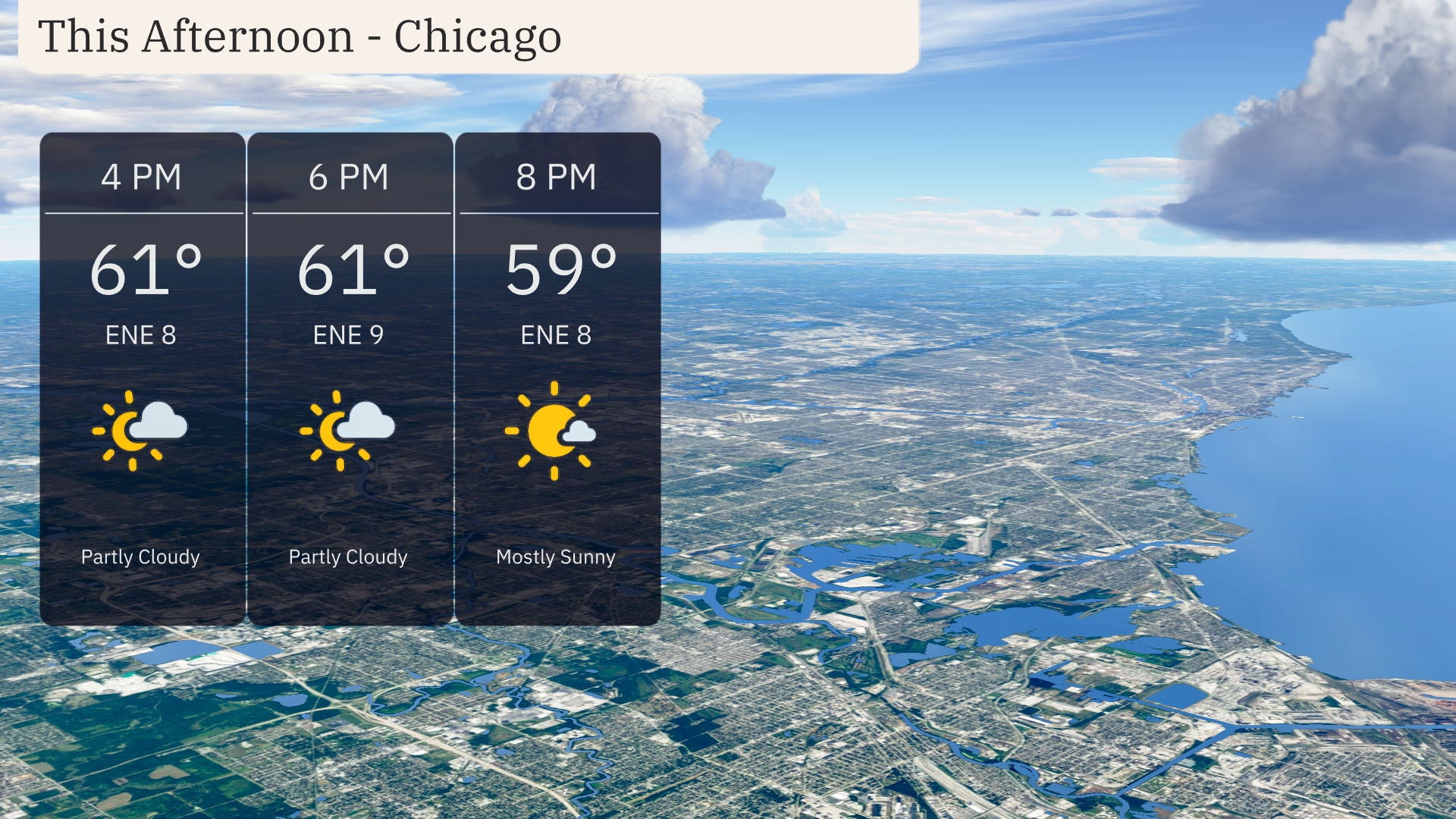
This afternoon in Chicago, temperatures will hold steady around 61 degrees. Expect partly cloudy skies with an east-northeast wind at 8 to 9 miles per hour. By 8 PM, skies will clear to mostly sunny, and temperatures will cool slightly to 59 degrees.
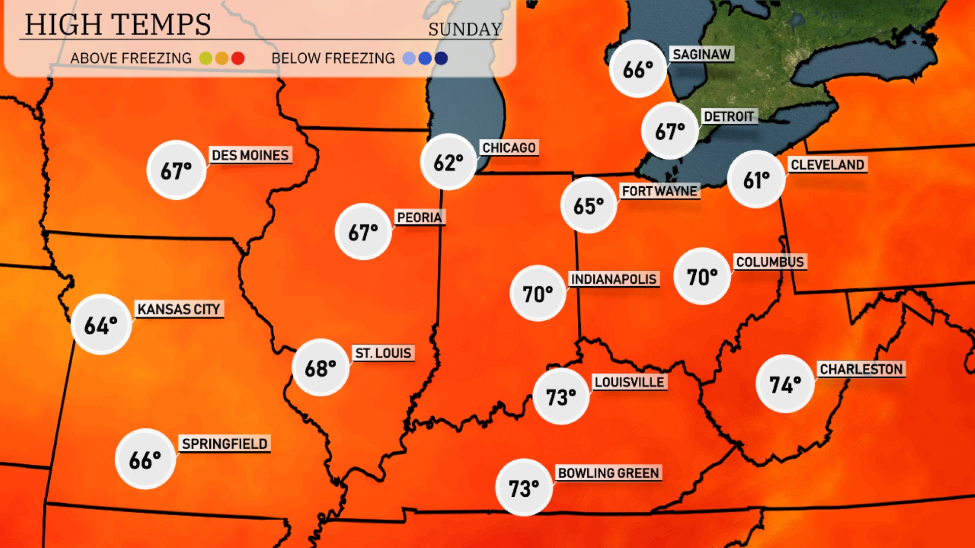
This afternoon, the Midwest is experiencing a range of temperatures that reflect a warm trend across the region. Chicago will see a high of 62 degrees, while just a bit warmer, Fort Wayne registers at 65. Indianapolis is enjoying a pleasant day with a high of 70. To the south, Louisville reaches 73 degrees, and Bowling Green also matches that temperature. Interestingly, Kansas City is slightly cooler at 64, while St. Louis feels a bit warmer at 68.
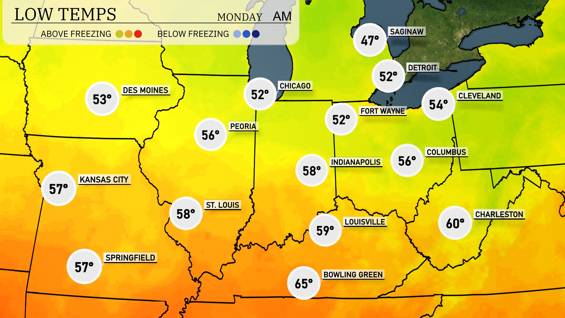
Tonight in the Midwest, expect cooler temperatures across the region. Chicago will see a low of 52 degrees, while temperatures dip to 47 in Saginaw, marking a significant drop. Indianapolis is forecasted for a low of 58 degrees, with Cleveland close behind at 54. Expect lows of 56 degrees in both Columbus and Peoria. St. Louis will remain slightly warmer at 58 degrees.
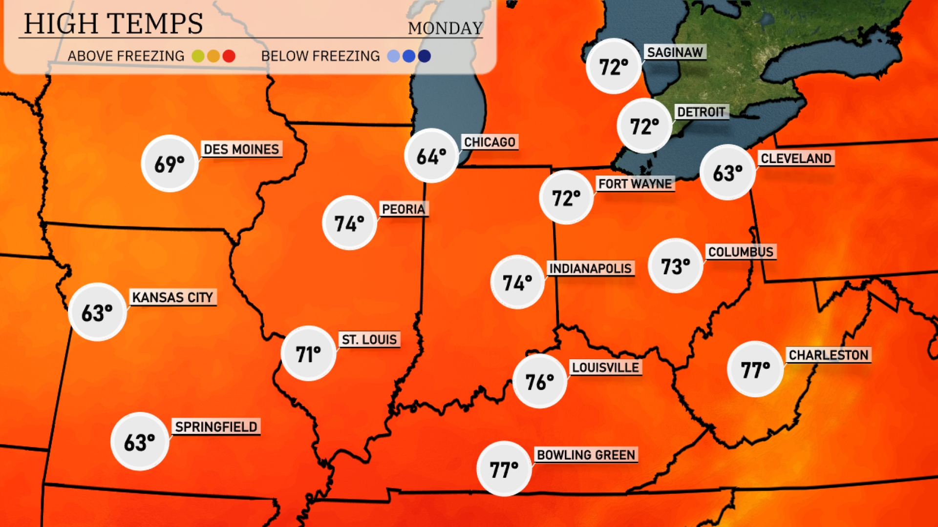
Tomorrow Chicago will reach 64 degrees, while Indianapolis enjoys a pleasant 74 degrees. Louisville is anticipating a warm 76 degrees, and Bowling Green could see temperatures rise to an impressive 77 degrees. However, Kansas City will cool down at just 63 degrees, which is below average for this time of year.
A potent cold front will sweep across the Midwest, triggering potential severe weather from Peoria to Indianapolis, particularly on Sunday night. Expect strong thunderstorms with damaging winds and the chance for isolated tornadoes, especially in the path of the front. As the system moves eastward, areas from Louisville to Columbus should prepare for heavy rain and gusty conditions. By Monday, temperatures will drop significantly behind the front, bringing cooler, drier air and a brief respite from precipitation. Ppersistent showers could linger near Cleveland and along the Ohio River Valley into Monday evening, posing localized flooding risks.
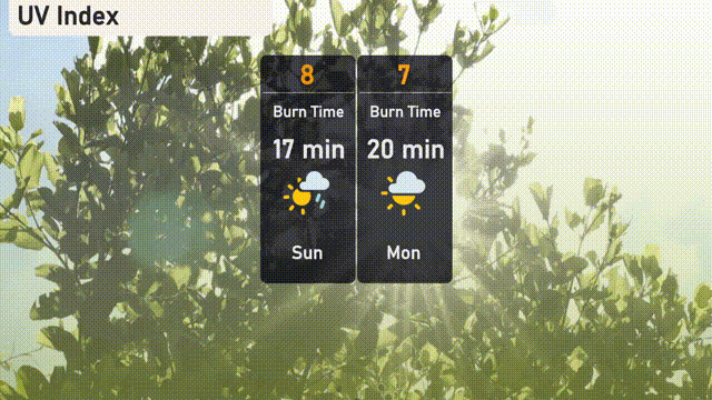
The UV index in Chicago will be high today at 8, with a burn time of approximately 17 minutes, so apply sunscreen frequently and seek shade when needed. On Monday, expect a slightly lower index of 7, with a burn time around 20 minutes.