Dive into a detailed analysis of Chicago’s changing weather patterns from clear skies to incoming storms, directly from your trusted meteorologist, Amy Freeze.
This week in Chicago, enjoy crisp mornings and stay prepared for unexpected downpours and cool nights. Get the full scoop in our detailed weather report!
Meteorologist Amy Freeze here with your extended forecast for Chicago. This week we’re seeing a dynamic weather pattern, ranging from clear, sunny mornings to potentially severe thunderstorms by the weekend. Temperatures vary, peaking at 87°F with cooler nights around 50°F. Don’t miss out on our daily updates for real-time weather changes and tips to stay safe during unexpected weather events.
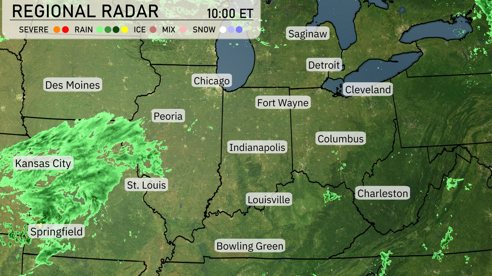
On the regional radar, widespread rain is sweeping across eastern Kansas, extending into Missouri with heavier precipitation centered near Kansas City and moving northeastward. Springfield is also experiencing consistent rain as this system progresses further into the Midwest. Light showers are reaching areas like St. Louis and Peoria, while Chicago remains dry under cloudy conditions. Rain is spotted near Detroit and Cleveland, with showers approaching from the west. Bowling Green and Indianapolis are seeing scattered showers, while areas like Fort Wayne and Columbus are currently enjoying clearer skies.
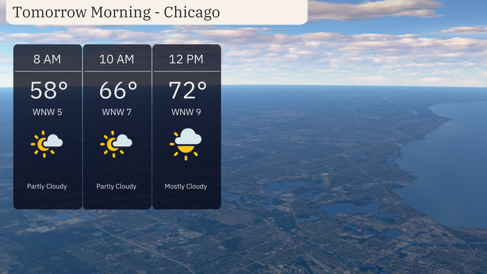
Temperatures in Chicago for tomorrow morning will start at a cool 58 degrees at 8 AM, with partly cloudy skies. By 10 AM, expect temperatures to rise to 66 degrees, accompanied by a light northwest wind at 7 miles per hour. Heading into the midday, temperatures will climb to 72 degrees by noon as cloud coverage increases to mostly cloudy, with the wind continuing from the northwest at 9 miles per hour.
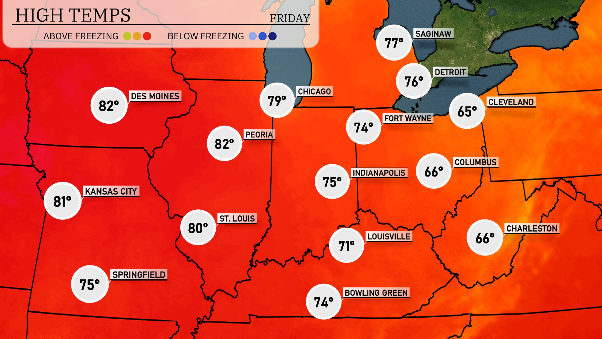
Expect warm temperatures across the Midwest tomorrow, with several cities experiencing above-average highs. St. Louis will see a high of 80 degrees, while Peoria reaches 82. Kansas City is forecasted at 81 degrees, and Chicago will hit 79. The trend indicates warmer readings as high-pressure systems settle in over the region. Cleveland will experience cooler conditions, with a high of just 65 degrees.
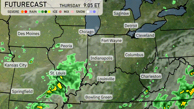
A powerful low-pressure system is set to impact the Midwest, delivering widespread rain from Springfield to Indianapolis. Expect early morning storms in St. Louis with a risk of heavy downpours and gusty winds moving eastward. The cold front’s passage will usher in cooler temperatures, dropping highs by about 10 degrees across much of the region by Friday. Weather conditions will improve after this system passes, but be prepared for localized flooding where rainfall totals exceed an inch. Stay weather aware for any severe thunderstorm warnings particularly in areas like Peoria and Fort Wayne.
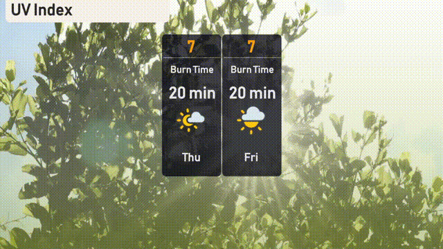
The UV index in Chicago is high with a level of 7, meaning a burn time of around 20 minutes in direct sunlight.
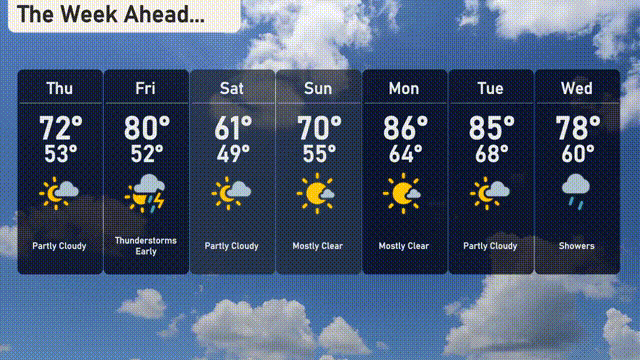
Thursday: Partly cloudy with a high of 72 degrees and a low of 53.
Friday: Thunderstorms likely early, warming up to 80 degrees and a low of 52.
Saturday: Partly cloudy skies, cooler temperatures with a high of 62 degrees and a low of 50.
Sunday: Mostly clear with a slight warm-up, reaching 69 degrees during the day and a low of 54.
Monday: Mostly clear once more, hitting a warm 85 degrees and a low around 64.
Tuesday: Partly cloudy as temperatures rise to a high of 87 degrees, dipping to 69 overnight.
Wednesday: Showers return, cooler with temperatures peaking at 76 degrees and a low of 60.