Rising Temps & Rumbling Storms: Your Southeast Weather Watch
By
Amy Freeze
Experience a spectrum of weather changes from Miami's partly cloudy mornings to severe storms tearing through the Southeast. Stay updated and prepared with expert insights from Meteorologist Amy Freeze.
Catch all the weather action from sunny Miami to storm-hit Southeast with none other than Meteorologist Amy Freeze as she brings you the latest updates.
Starting your day in Miami or bracing for storms in the Southeast? Get your detailed forecast here, from partly cloudy skies and mild temps in Miami to severe weather warnings across the region! Plus, safety tips for extreme sun exposure and updates on storm movements.
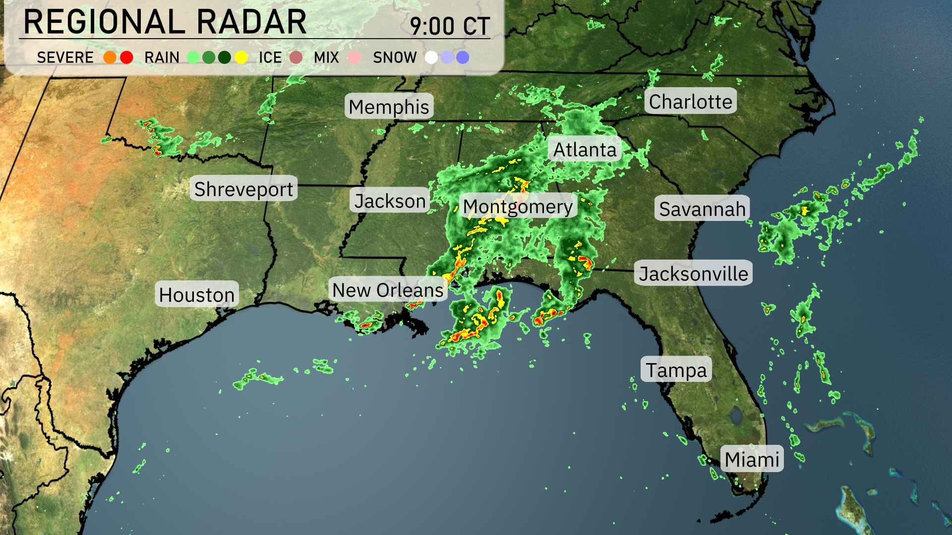
A stormy scene unfolds in the Southeast today as the radar reveals an active weather pattern. Severe weather is advancing through southern Mississippi into Alabama, with intense storms near Montgomery producing heavy rain and potentially strong winds. A broader area of rain stretches from New Orleans across central Alabama, heading towards Atlanta. Showers are moving east, impacting areas such as Jacksonville. Savannah and the coastline to Charleston remain relatively clear for the time being, offering a reprieve from the showers inland.
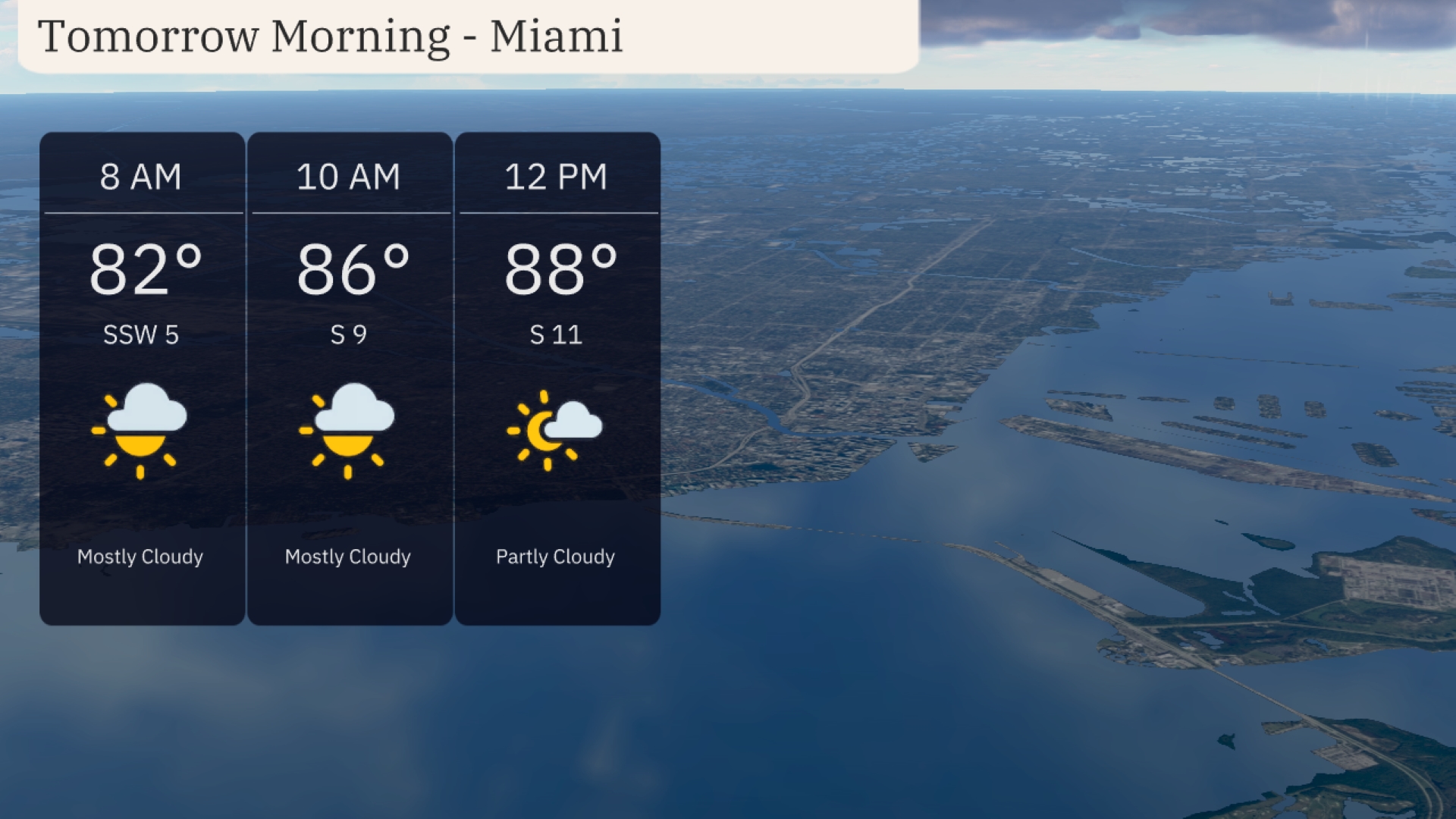
In Miami tomorrow morning, temperatures will start at 82 degrees by 8 AM, rising to 86 degrees by 10 AM. Expect mostly cloudy skies with a south-southwest wind at 5 mph early on, shifting to 9 mph by mid-morning. By noon, temperatures will reach 88 degrees, with a partly cloudy sky and winds increasing to 11 mph from the south.
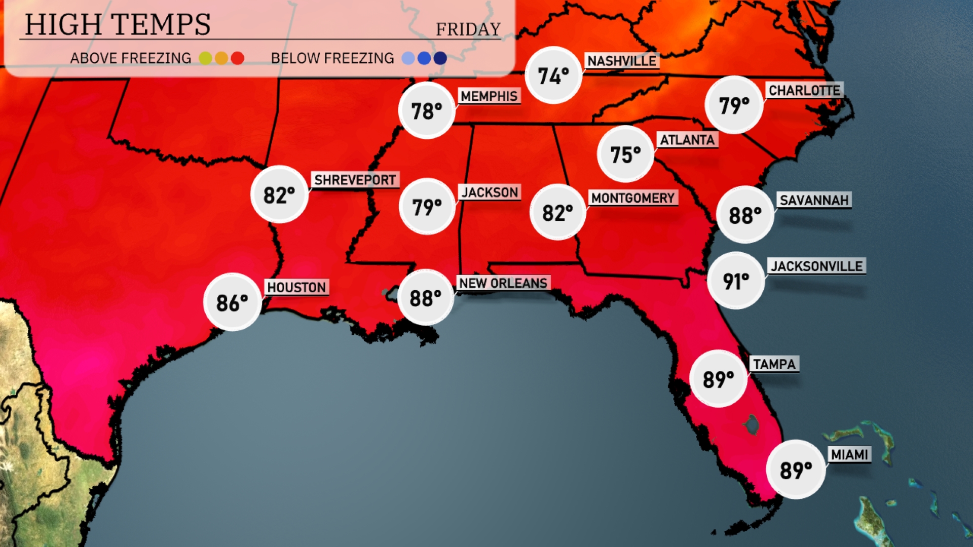
Tomorrow Atlanta will reach 75 degrees, while Memphis sees a slightly cooler high of 74. Further south, New Orleans will be warm at 88 degrees, and Jacksonville is expected to soar to a sweltering 91 degrees. Montgomery, Alabama, will enjoy 82 degrees, and Tampa will hit 89 degrees.
A cold front is pushing through the Southeast, bringing widespread showers and thunderstorms from New Orleans to Jacksonville. Expect particularly heavy rain and potential flooding in areas around Jackson and Montgomery into tomorrow morning. Charlotte and Atlanta could experience scattered storms with gusty winds, while Savannah might see localized flooding. Temperatures will drop slightly after the passage of the front, offering cooler relief by tomorrow night.
The UV index in Miami is expected to be very high at 11 on both Thursday and Friday, indicating sun exposure risks are extreme. Burn time in direct sunlight is approximately 11 minutes. It’s crucial to apply sunscreen frequently, wear protective clothing, and seek shade during peak sunlight hours, particularly between 10 a.m. and 4 p.m. Stay safe in the sun, Miami!
Thursday: Look forward to partly cloudy skies with a high of 88 degrees and a low of 80.
Friday: Partly cloudy with temperatures reaching up to 89 degrees, dropping to 78 overnight.
Saturday: Continuing the trend with partly cloudy skies and a high of 89 degrees, a low of 78.
Sunday: Watch for isolated thunderstorms with highs of 86 degrees and lows around 77.
Monday: Thunderstorms early in the day, cooling to a high of 84 degrees, with a low of 77.
Tuesday: Partly cloudy conditions resume, with temperatures peaking at 85 degrees, a low of 79.
Wednesday: Another partly cloudy day with a high of 85 degrees and a low of 79.