Dive into tomorrow’s weather details with Amy Freeze! From scattered showers in Scranton to a sunny forecast in NYC, see what’s brewing in the Northeast.
Discover what weather awaits New Yorkers tomorrow morning – from cloudy skies to gentle breezes, and how the Northeast braces for a mixed bag of conditions.
Meteorologist Amy Freeze here with your detailed Northeast Forecast update. Expect varying conditions as you step out tomorrow: from scattered showers in southeastern New York to brisk winds across the city, coupled with rising temperatures through noon. Read more on how these changes could influence your day and prepare accordingly. With comprehensive insights and timely updates, never miss a beat of Mother Nature’s plans!
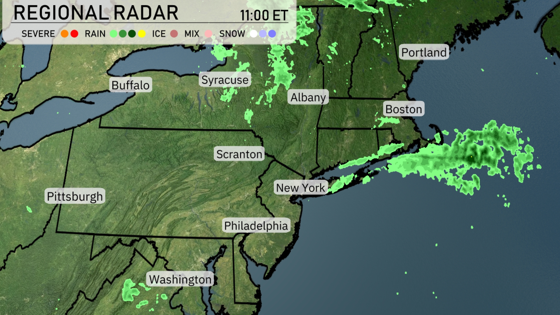
Rain showers are concentrated over southeastern New York, heading towards the Boston area, where they are expected to intensify. Albany is experiencing light precipitation, with showers moving northeast. The radar shows some rain west of Portland and approaching the coast. Washington and surrounding areas are starting to see scattered rainfall, likely moving towards Philadelphia. Syracuse and Buffalo currently remain clear, while Scranton experiences overcast conditions.
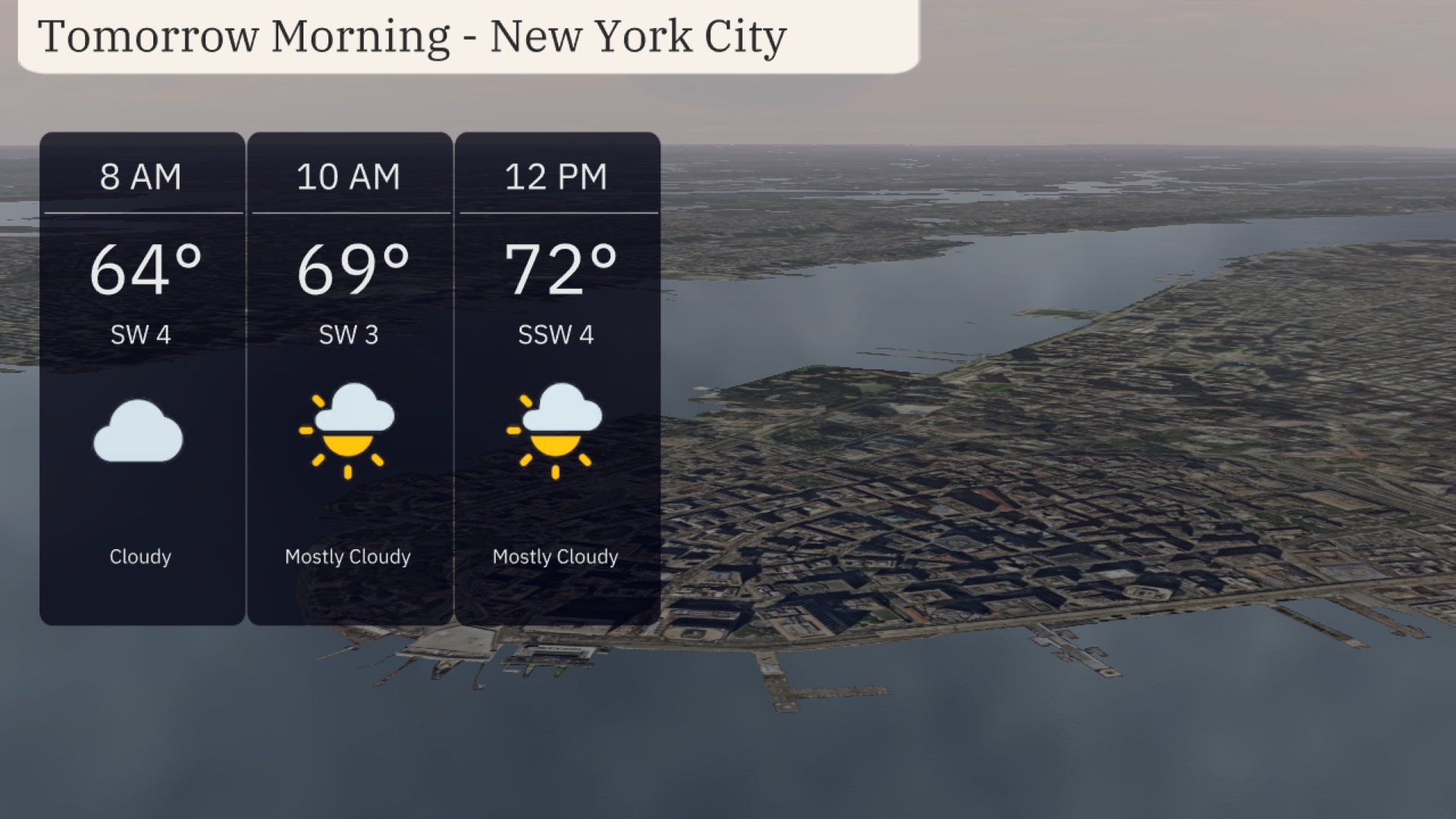
Expect a cloudy start to your morning in New York City, with temperatures at 64 degrees at 8 AM. Winds will be from the southwest around 4 mph. Moving into the late morning, temperatures rise to 69 degrees by 10 AM with partly cloudy skies and a gentle southwest breeze of about 3 mph. By midday, anticipate mostly cloudy conditions with temperatures reaching 72 degrees and winds shifting slightly to the south-southwest at 4 mph.
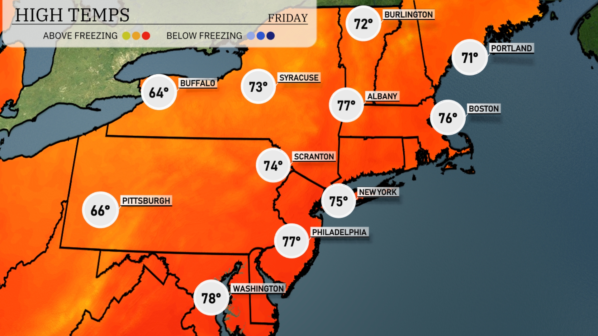
Tomorrow New York will see a high of 75 degrees, while Philadelphia tops out at 77 degrees. Boston isn’t far behind, reaching 76 degrees, and Syracuse will warm to 73 degrees. Pittsburgh will experience a milder day at 66 degrees, and Scranton has a forecast high of 74 degrees
A cold front will approach the Northeast, bringing a mix of scattered showers and thunderstorms primarily affecting areas from Scranton to Albany by tomorrow afternoon. Portland and Boston will experience increasing cloudiness, with potential for light rain showers moving in by midday. Temperatures will initially stay mild, but cooler air will filter in behind the front, leading to a noticeable drop by evening. Winds might become gusty, especially near coastal regions, which could lead to minor travel delays.
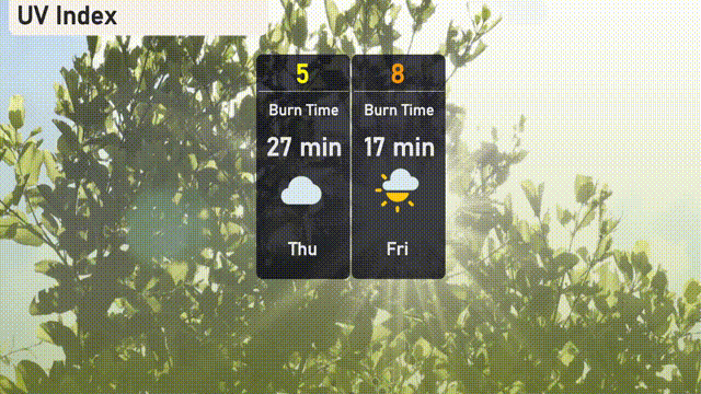
The UV index in New York City on Thursday will be moderate with a value of 5, resulting in a burn time of about 27 minutes. On Friday, the UV index climbs to 8, exposing a higher risk with a burn time of just 17 minutes.
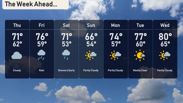
For the 7-day forecast in New York City:
Thursday: Expect a cloudy day with a high of 70 degrees and a low of 62.
Friday: Rain and possible thunderstorms with highs reaching 75 degrees and lows around 60.
Saturday: Early showers are possible. Daytime temperatures will reach 72 degrees, slipping to 53 at night.
Sunday: The afternoon clears to partly cloudy skies, hitting a high of 66 degrees with a low of 54.
Monday: Partly cloudy, warming to a pleasant 74 degrees and cooling to 57 overnight.
Tuesday: Mostly clear skies, with temperatures climbing to 77 degrees during the day and a nighttime low of 61.
Wednesday: Partly cloudy conditions, with temperatures rising to a warm 80 degrees, cooling to 64 at night.