Morning Weather Watch: Sunny Spells and Storm Alerts in Salt Lake City
By
Amy Freeze
Join Amy Freeze as she navigates through the mixed weather patterns in Salt Lake City, from sunshine to potential storms across the Southwest.
Meteorologist Amy Freeze provides the latest weather updates for Salt Lake City and the Southwest, covering everything from sunny mornings to storm warnings. Check out the full details!
// Complete version of the provided ‘Salt Lake City Tomorrow Morning News – 05/30/2025’ text here.
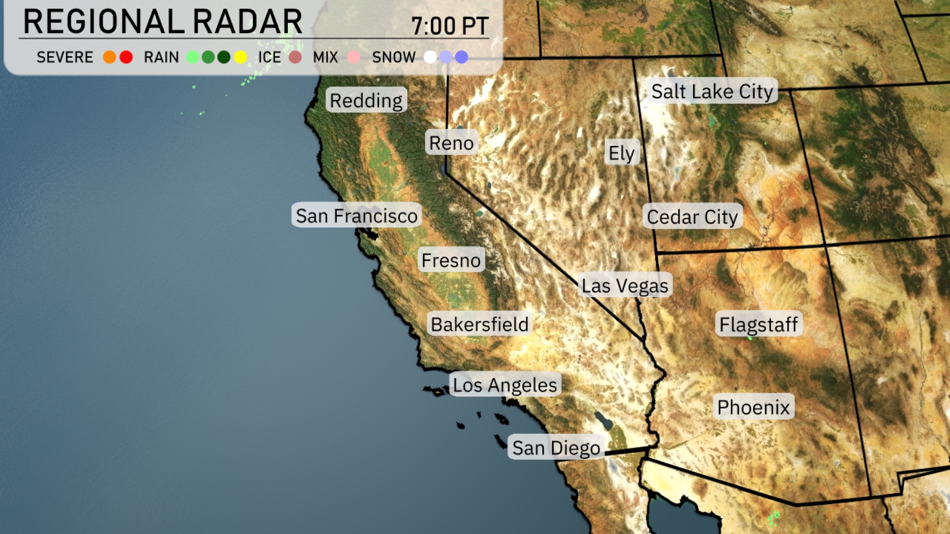
On the Regional Radar, a line of wet weather is impacting the Southwest region. Coastal areas like San Francisco are experiencing rain, which is also spreading toward Fresno and Bakersfield in the central valleys. Areas like Los Angeles and San Diego remain dry for now, but cloudy skies suggest changes could be on the way. The region should prepare for a mix of rain and snow, especially in mountainous terrains and northern parts of Nevada.
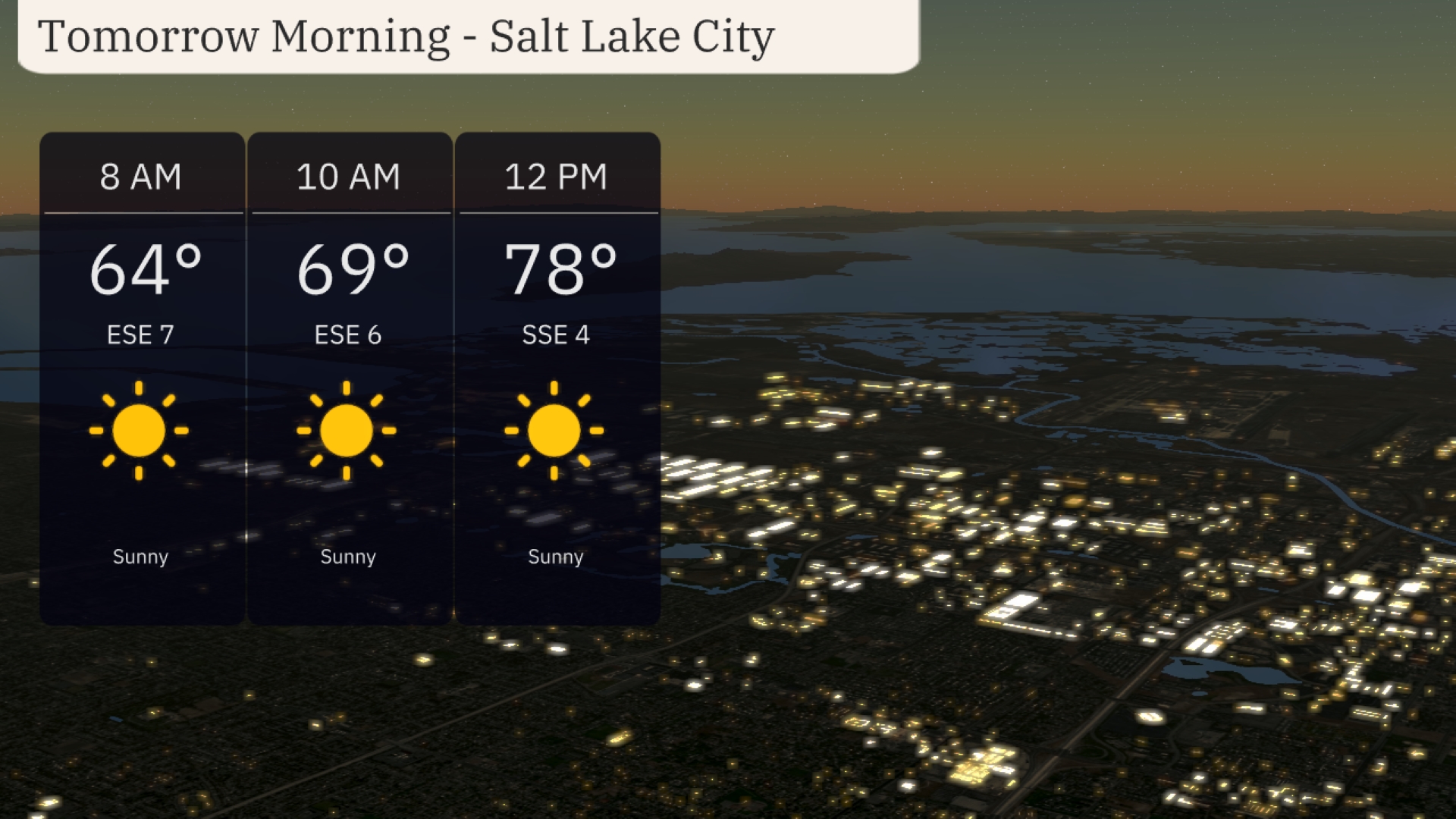
The morning in Salt Lake City kicks off sunny with temperatures starting at 64 degrees by 8 AM. By 10 AM, conditions warm to 69 degrees, maintaining clear skies. A calm southeast breeze begins at 7 mph and gradually decreases to 6 mph by mid-morning. Expect continued sunshine and a soothing start to the day, perfect for outdoor activities.
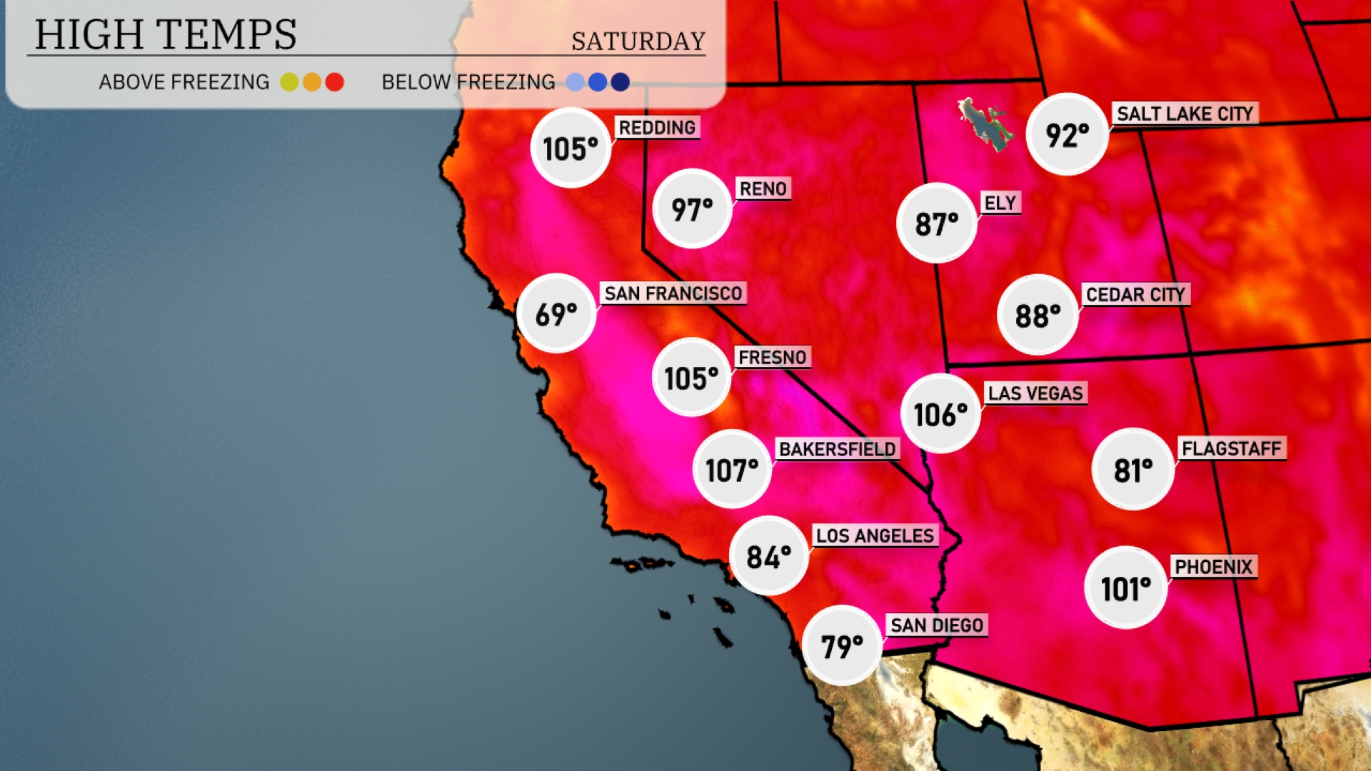
High temperatures in the Southwest tomorrow soar well above average, indicating a pattern emerging for a warm start to June. Las Vegas will blaze at 106 degrees, while Phoenix isn’t far behind at 101 degrees. Bakersfield is set to hit a sizzling 107 degrees, making it one of the hottest spots in the region. In contrast, coastal areas like San Diego will remain more moderate at 79 degrees, providing some relief from the intense heat. Meanwhile, Fresno reaches 105 degrees, highlighting that much of the region will feel the heat wave’s impact.
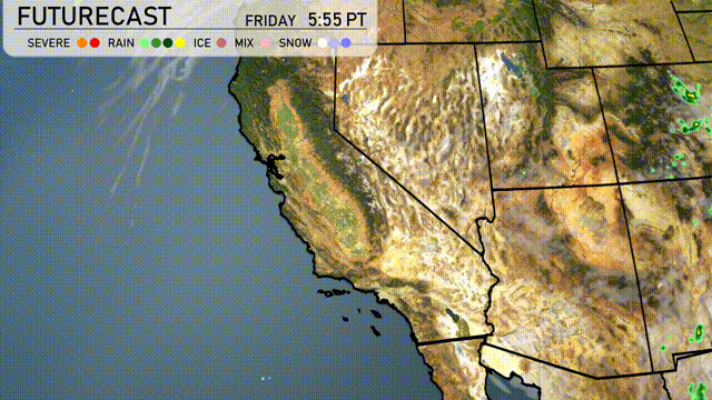
For the Southwest region tomorrow, a trough will bring increased wind activity across Arizona and New Mexico, with gusts potentially reaching up to 40 miles per hour. Expect cooler temperatures in these areas, with highs in the mid-70s. A cold front will sweep through Southern California, bringing scattered showers and possible thunderstorms, especially in the mountains and inland valleys. Northern California will see bouts of rain, enhancing the risk of localized flooding.
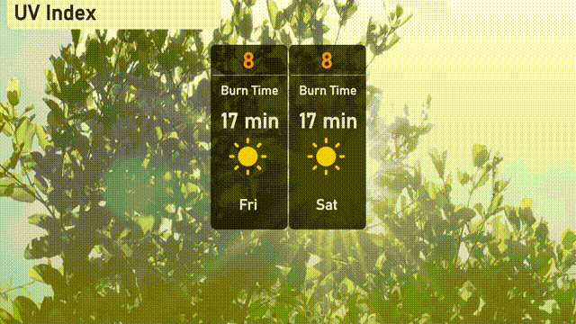
The UV index in Salt Lake City will be high on Friday and Saturday, reaching a level of 8. This indicates a potential sunburn in about 17 minutes with direct exposure.
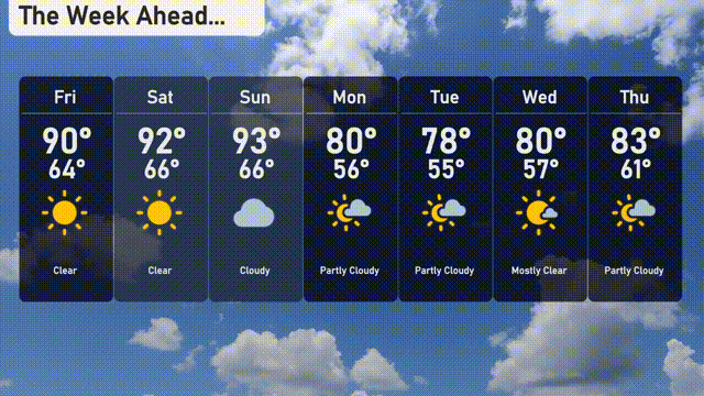
Friday: The skies are clear with a high reaching 90 degrees and a low of 64 degrees.
Saturday: Another clear day, warmer with a high of 92 degrees and a low of 66 degrees.
Sunday: Clouds move in, showing a high of 93 degrees and a low of 66 degrees.
Monday: Partly cloudy conditions, cooler with a high of 80 degrees and a low of 56 degrees.
Tuesday: Enjoying partly cloudy skies with a high of 78 degrees, low of 55 degrees.
Wednesday: Mostly clear, temperatures rebounding to a high of 80 degrees and a low of 57 degrees.
Thursday: Wrapping up the week with partly cloudy skies, a high of 83 degrees and a low of 61 degrees.