Austin Weather Watch: From Serene Evenings to Stormy Horizons
By
Amy Freeze
Explore the contrast of Austin's clear skies with the Southern Plains' brewing storms. Amy Freeze provides an expert forecast for the week.
Clear skies in Austin tonight with a regional storm update. Learn what the weather holds for the entire Southern Plains.
Meteorologist Amy Freeze breaks down today’s weather around Austin and forecasts impending storms across the Southern Plains. From clear, starlit walks in Austin to storm preparation near Oklahoma, get the details on what to expect and how to stay safe. Discussing everything from high temperatures to UV index warnings, this comprehensive guide offers valuable insights into the week’s weather dynamics.
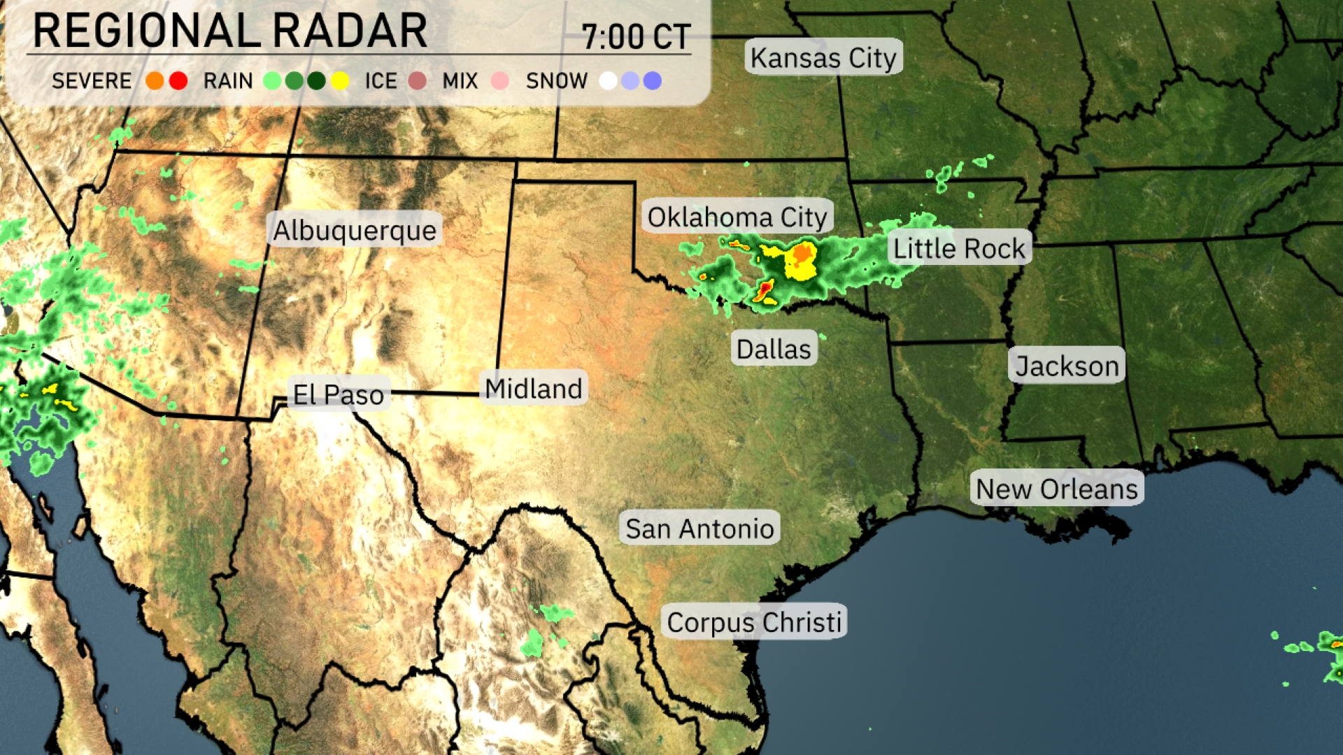
The regional radar for the Southern Plains indicates a developing storm system near Oklahoma City, with strong thunderstorms extending toward Little Rock. Dallas is under a light rain shower, which is slowly moving eastward. Albuquerque is experiencing isolated rain showers, with the potential for more to develop as the system moves east. The Texas coast from Corpus Christi to San Antonio remains dry and clear. Farther to the southeast, El Paso and the surrounding areas are enjoying calm weather with no precipitation in sight.
This evening in Austin, temperatures will start at 90 degrees at 9 PM, cooling down to 80 degrees by 1 AM. Skies remain partly cloudy throughout the evening. A gentle south-southeast breeze at 6 mph will accompany the warm temperatures.
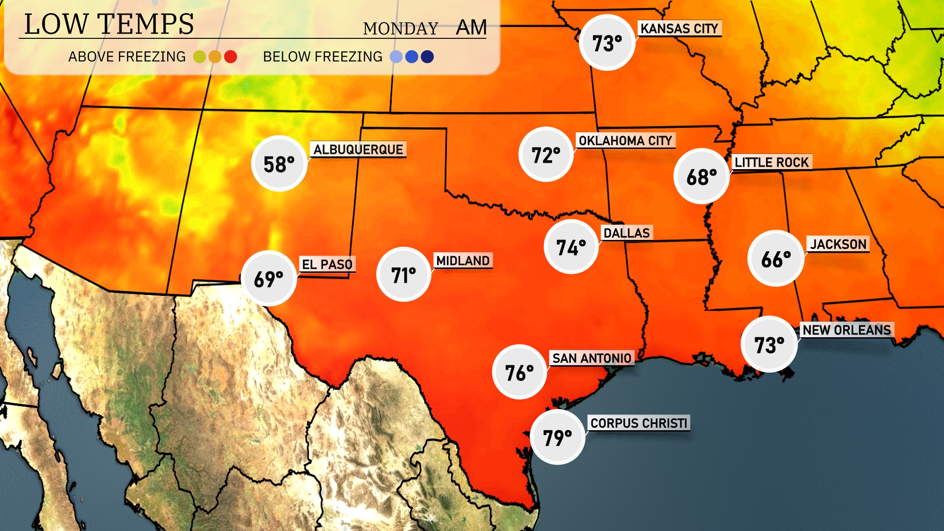
Tonight expect a chilly 66 degrees in Jackson and a slightly warmer 73 in New Orleans. Little Rock is looking at a low of 68 degrees, while Dallas will cool down to 74. In contrast, Midland is anticipated to have a low of 71 degrees, with El Paso hovering around 69.
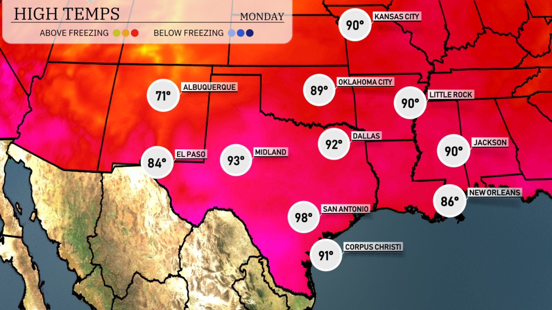
Tomorrow in San Antonio, the high will soar to 98 degrees, marking a significant spike from typical June temps. Midland will reach 93 degrees, while Dallas is forecasted to hit 92 degrees. El Paso will enjoy a warm 84 degrees, and Corpus Christi will see a high of 91 degrees.
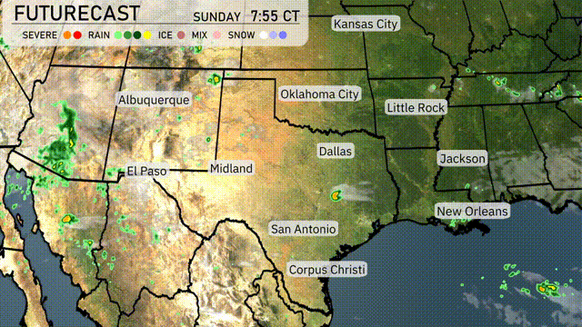
A mix of rain and thunderstorms is forecast for parts of the Southern Plains starting tomorrow, impacting areas from Oklahoma City to Dallas. As a frontal boundary moves through, watch for midday storms with a slight risk of severe weather, including strong winds and brief downpours. Temperatures will remain warm, with highs in the mid-80s°F range, but humidity levels will make it feel warmer. Rainfall could be beneficial, helping mitigate any drought concerns across the region, but localized flooding cannot be ruled out. By Thursday, expect clearing skies as the front exits to the east, bringing slightly cooler, drier conditions.
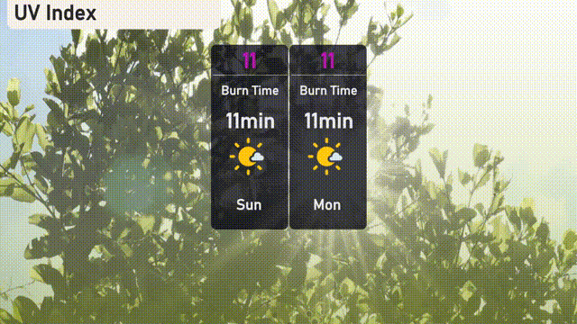
The UV index in Austin for today and tomorrow is extreme, at 11. Expect a burn time of approximately 11 minutes, making sun protection crucial.
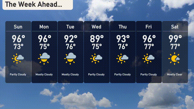
For Austin’s 7-day forecast:
Sunday: Partly cloudy skies with temperatures soaring to 96 degrees during the day and cooling to 73 at night.
Monday: Mostly cloudy, maintaining a high of 96 degrees and a low of 75.
Tuesday: Largely cloudy with a slight drop in temperatures, reaching 92 degrees for a high and 76 overnight.
Wednesday: Partly cloudy conditions with a high of 89 degrees and a low of 75.
Thursday: Mostly clear with temperatures peaking at 93 degrees and settling at 76 after sunset.
Friday: Enjoy partly cloudy weather with a high of 96 degrees and a low of 77.
Saturday: The week concludes with mostly clear skies, and temperatures reaching a high of 99 degrees, dipping to 77 in the evening.