NYC Glistens Under Partly Cloudy Skies: Amy Freeze’s Weather Wrap-Up
By
Amy Freeze
Meteorologist Amy Freeze highlights today’s weather and forecasts impending storms across the Northeast in her detailed report, ensuring a clear understanding of this week’s sunny forecasts and tomorrow’s stormy shifts.
Catch today’s glowing NYC forecast with Amy Freeze! Partly cloudy with highs of 82°F and tips for managing tomorrow’s storm. Stay educated, stay prepared.
Welcome to your in-depth weather digest with Metrologist Amy Freeze. Today, NYC basks under partly cloudy skies with a high of 82°F. As we look towards tomorrow, a low-pressure system promises showers and cooler temperatures post-rain. Read on for safety tips in impending storms and get your weekly forecast exclusively from an expert’s view here on our blog at https://amyfreeze.ai.
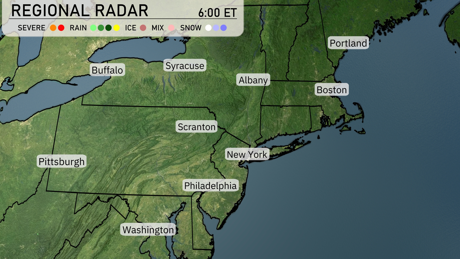
The Northeast region is predominantly under clear skies, with no significant precipitation showing up on the radar. Conditions are calm from Buffalo to Boston and down through New York City, Philadelphia, and Washington. There are no indications of rain, ice, or snow across the area, ensuring a dry and pleasant day. Cloud cover appears sparse, keeping skies largely clear from Syracuse to Albany. Residents in Portland and Scranton can enjoy the clear conditions.
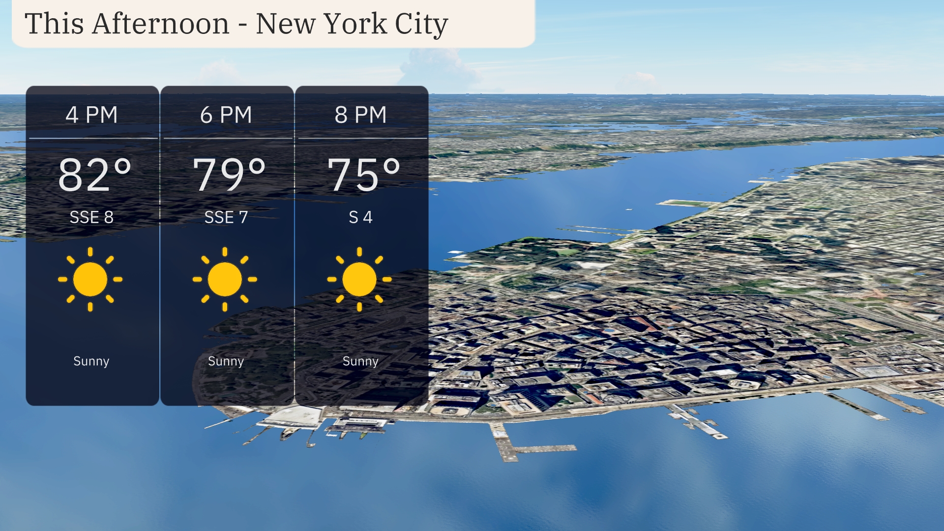
Expect a sunny afternoon in New York City with temperatures starting at 82 degrees at 4 PM. Winds will be gently blowing from the SSE around 8 mph, providing a slight breeze to accompany the warm weather. By 6 PM, temperatures will cool slightly to 79 degrees with a continued SSE breeze at 7 mph. As evening approaches, you’ll notice temperatures drop to a comfortable 75 degrees by 8 PM with winds shifting to the south at 4 mph, maintaining clear skies throughout.
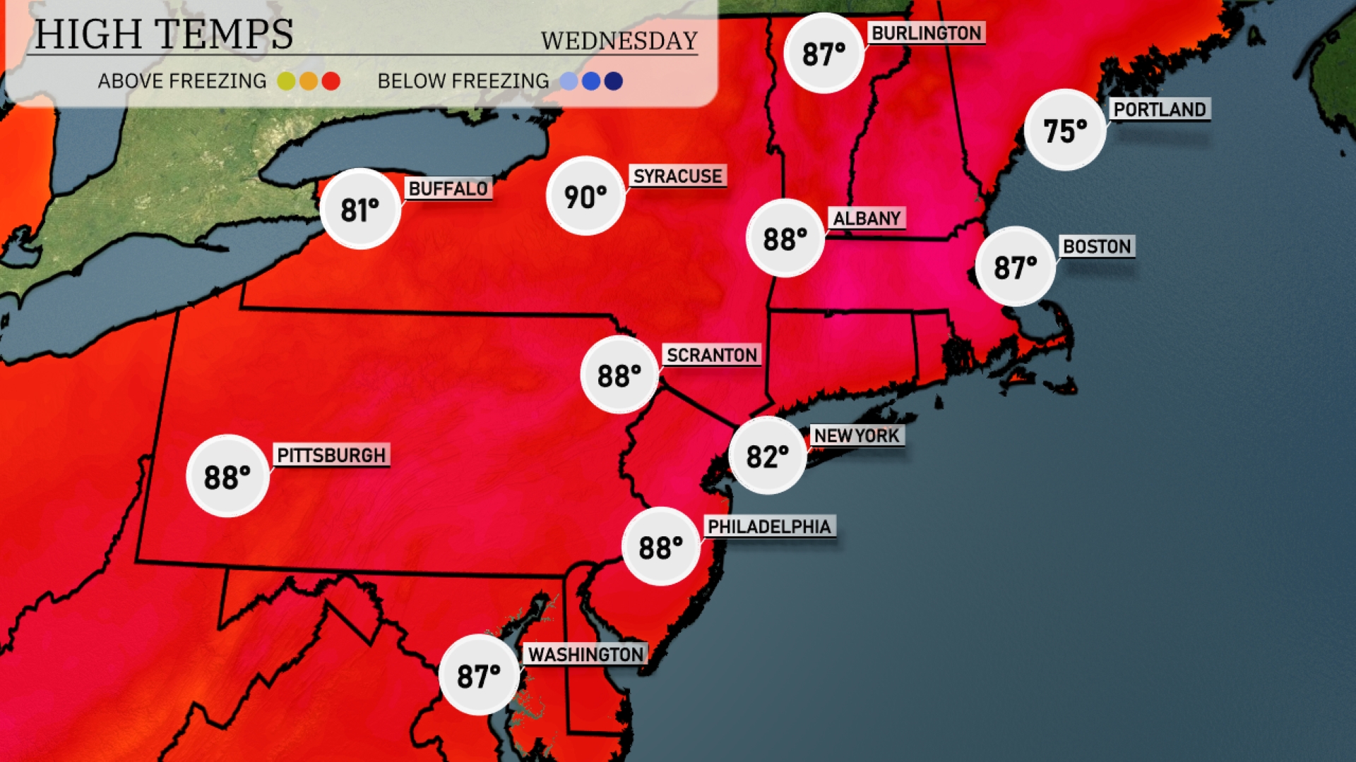
Today New York City is hitting 82 degrees, while Philadelphia reaches a steamy 88. Up in Scranton and Albany, we’re looking at similar conditions with highs of 88 degrees. Syracuse is the warmest spot today at 90 degrees. To the north, Buffalo marks a cooler 81, and Boston sees a comfortable 87 degrees. Portland rounds out the region with a cooler high of 75.
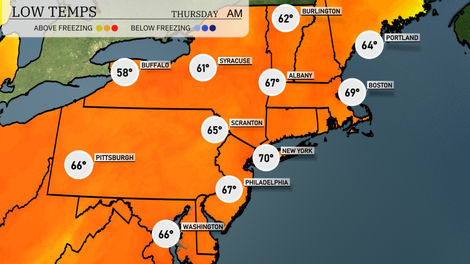
Tonight temperatures will dip to 58 degrees in Buffalo and drop to 61 in Syracuse. Expect a low of 65 in Scranton, while Philadelphia will reach 67. New York City will hold steady at 70 degrees, but areas like Albany will feel a little cooler at 67.
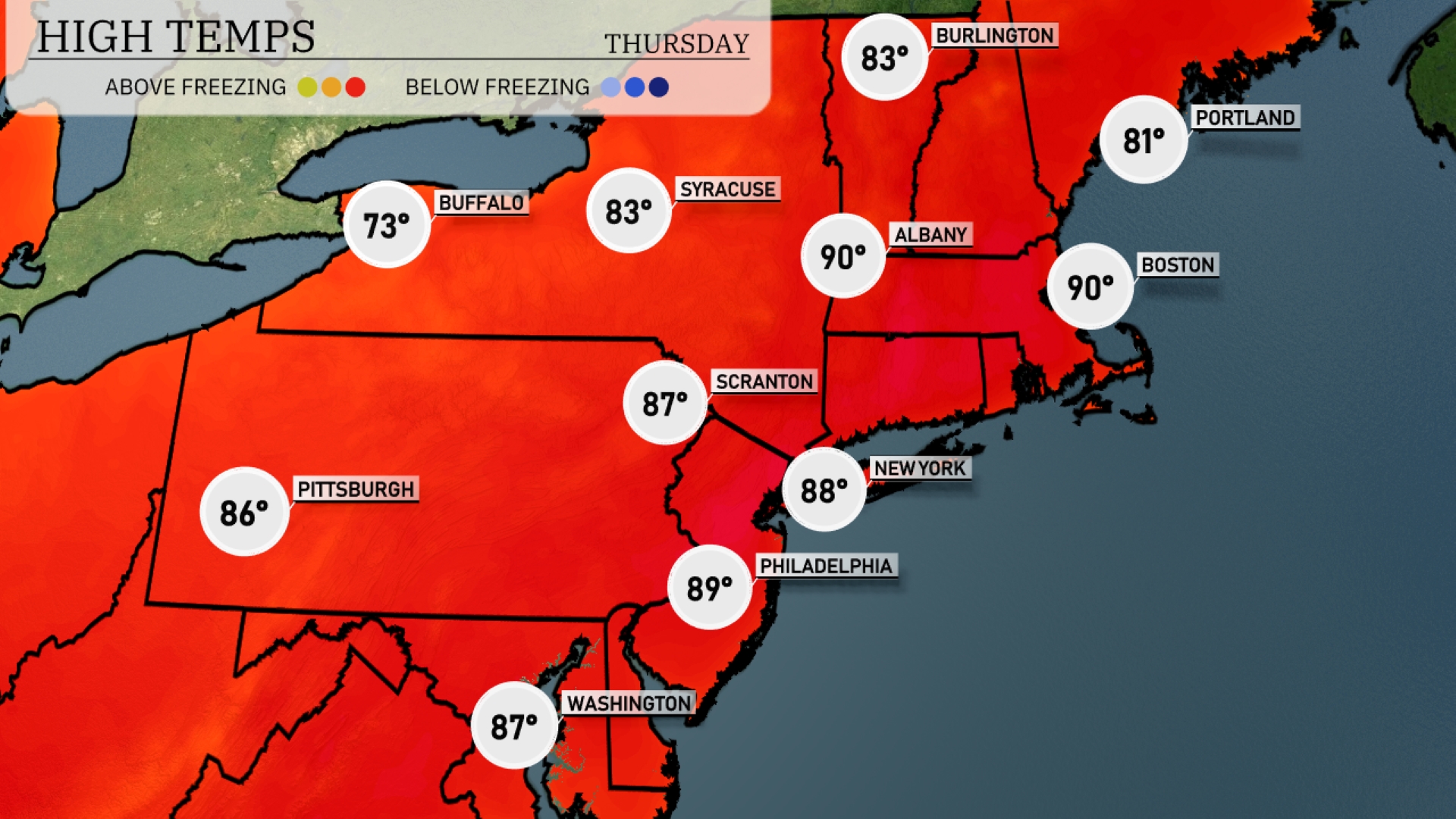
Tomorrow in the Northeast, expect a scorching day with highs reaching around 90 degrees in both New York and Boston. Philadelphia is also set to sweat it out with a high of 89 degrees. Pittsburgh will see slightly cooler temperatures at 86 degrees, while Scranton will reach 87 degrees. Syracuse and Albany are forecasted for the low 80s.
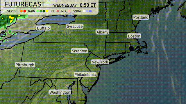
A low-pressure system will move through the Northeast tomorrow morning, bringing widespread rain from Pittsburgh to Boston. Expect heavy rainfall to hit New York City and surrounding areas by late morning, with potential gusty winds accompanying the downpour. Rain totals could exceed an inch, which may lead to localized flooding, particularly in urban areas. By evening, the rain will taper off, and cooler air will settle in, dropping temperatures by 5 to 10 degrees into Thursday.
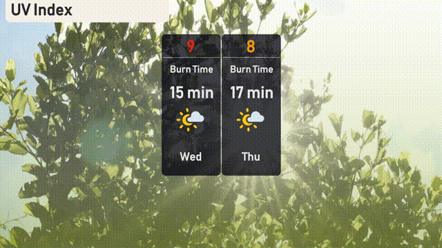
The UV index in New York City is very high today at 9, so make sure to protect your skin, as the burn time is about 15 minutes in direct sunlight. For tomorrow, the index is still high at 8, with a burn time of approximately 17 minutes.