Navigating NYC’s Skies: A Week of Weather Extremes
By
Amy Freeze
This week in NYC ranges from serene clear skies to stormy forecasts. Dive deep into our comprehensive weather analysis with Meteorologist Amy Freeze.
This week, NYC experiences everything from clear skies to potential storm alerts. Check out Meteorologist Amy Freeze’s detailed forecast.
Explore the evolution of New York City’s weather this week as Amy Freeze guides you through each day’s expectations, from warm evenings to predicted storm threats. Gain insights on how to prepare for a week of dynamic weather with detailed temperature reports and safety tips.
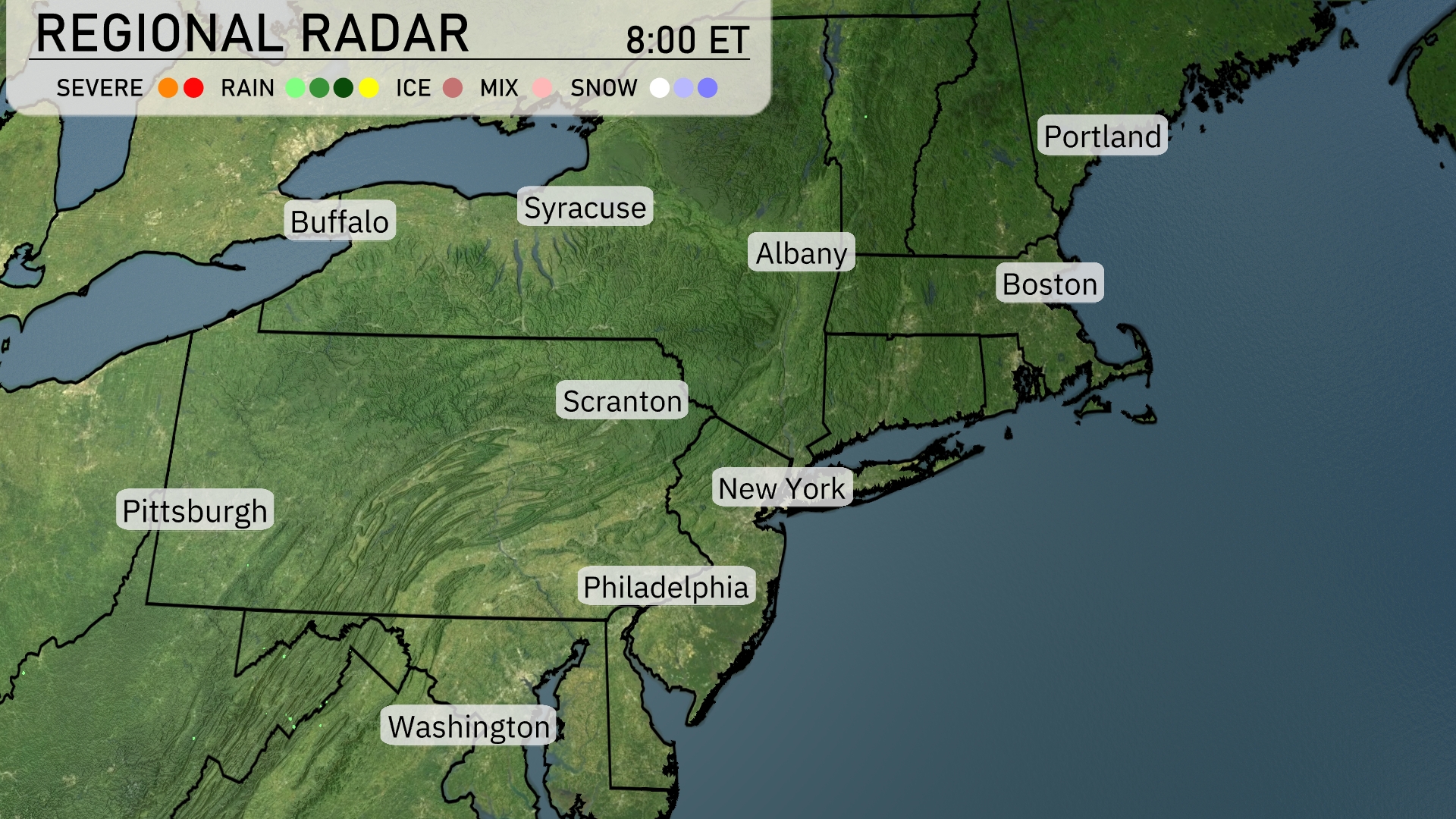
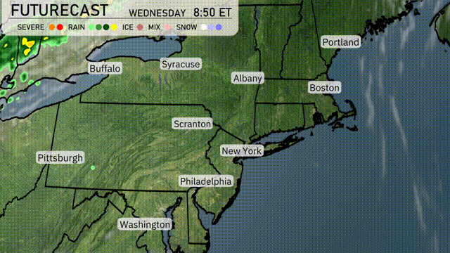
The radar shows clear and calm conditions across much of the Northeast today. Skies are generally clear from Boston to Syracuse, providing a great opportunity to enjoy some outdoor activities. There’s no precipitation affecting major cities like New York, Philadelphia, and Washington D.C. Coastal areas and inland regions alike are under blue skies, with no significant cloud cover or weather disturbances.
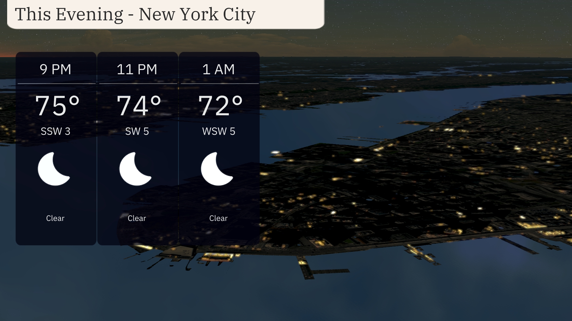
For this evening in New York City, clear skies will prevail. Temperatures will gradually decrease from 75 degrees at 9 PM to 72 degrees by 1 AM. Winds will be light, shifting slightly from south-southwest at 3 mph to west-southwest at 5 mph.
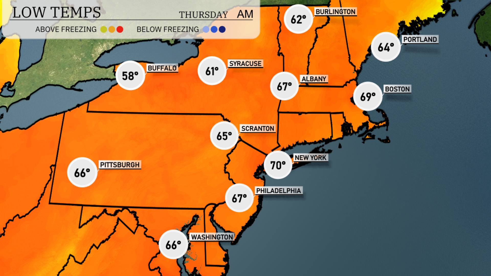
Tonight Pittsburgh reaches a low of 66 degrees. Scranton will be slightly cooler at 65 degrees, while Albany is expected to feel a bit warmer at 67 degrees. New York City will see a low of 70 degrees, providing a milder overnight vibe. Boston will hover around 69 degrees, and further north, Syracuse is projected to drop to 61 degrees.
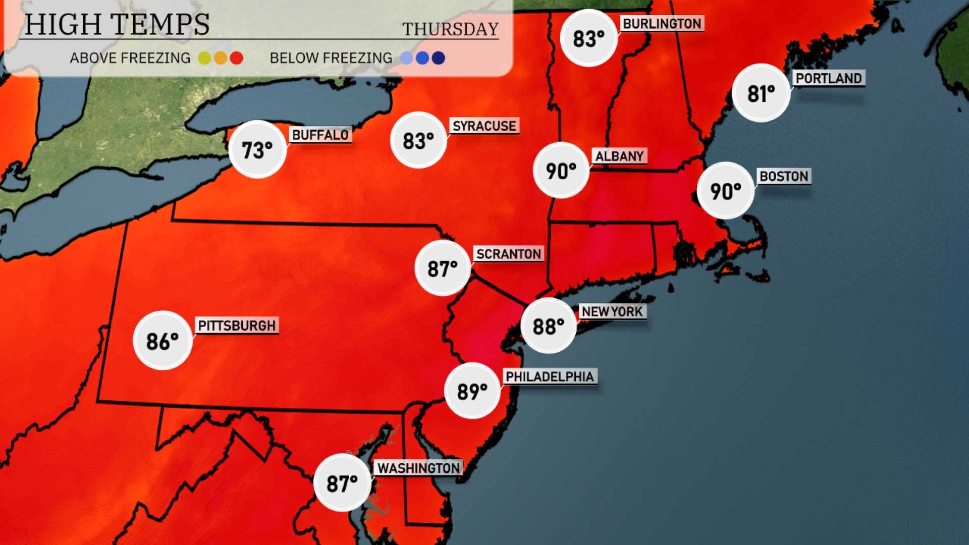
Tomorrow expect a hot day with New York reaching a high of 88 degrees and Boston hitting 90 degrees, marking a notable above-average trend for this time of year. Philadelphia is also in the spotlight with a high of 89 degrees, while Scranton will see 87. Farther north, Syracuse is forecasted to hit 83 degrees and Buffalo will remain cooler at 73 degrees.
Expect a dynamic weather day across the Northeast tomorrow as a weather system moves in from the west. Showers and isolated thunderstorms are anticipated, particularly in upstate New York and Pennsylvania, with the potential for gusty winds. Temperatures will range from the mid-60s in Boston to low 70s in Philadelphia, with a slight cooling trend following the frontal passage. Close monitoring is advised as some areas might experience brief heavy rainfall, leading to localized flooding concerns.
The UV index in New York City will be very high at 9 for both Wednesday and Thursday, with a burn time of just 15 minutes in direct sunlight.
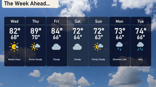
Wednesday: Mostly clear skies with a high of 82 degrees and a low of 68.
Thursday: Partly cloudy as temperatures rise to 89 degrees and drop to 70 at night.
Friday: The clouds roll in, bringing a high of 84 degrees and a low of 66.
Saturday: Cloudy conditions continue with temperatures reaching 72 degrees for a high and 64 degrees for a low.
Sunday: Expect partly cloudy skies with a high of 72 degrees and a low of 63.
Monday: Late-day showers are on the horizon with highs around 73 degrees and lows at 64.
Tuesday: Rain is expected throughout the day with temperatures peaking at 74 degrees and a low of 66.