Austin’s Morning Mixture: From Clear Skies to Sizzling Sun – Weather Forecast with Amy Freeze
By
Amy Freeze
Explore the detailed weather forecast for Austin and the Southern Plains with insights from meteorologist Amy Freeze. From scattered showers to bright sunny days, see what the week has in store for us!
This week on the Southern Plains: Austin gears up for a mix of showers and sunshine. Stay tuned as Amy Freeze breaks down the weather patterns and what to expect in your area!
Welcome to our detailed analysis of the upcoming weather conditions for Austin and the Southern Plains. Meteorologist Amy Freeze offers insights on the current weather trends including the forecast of scattered showers across Texas, Oklahoma, and Louisiana, and high temperatures across various cities. With an incoming cold front and potential severe weather warnings, stay prepared and informed with our expert guidance.
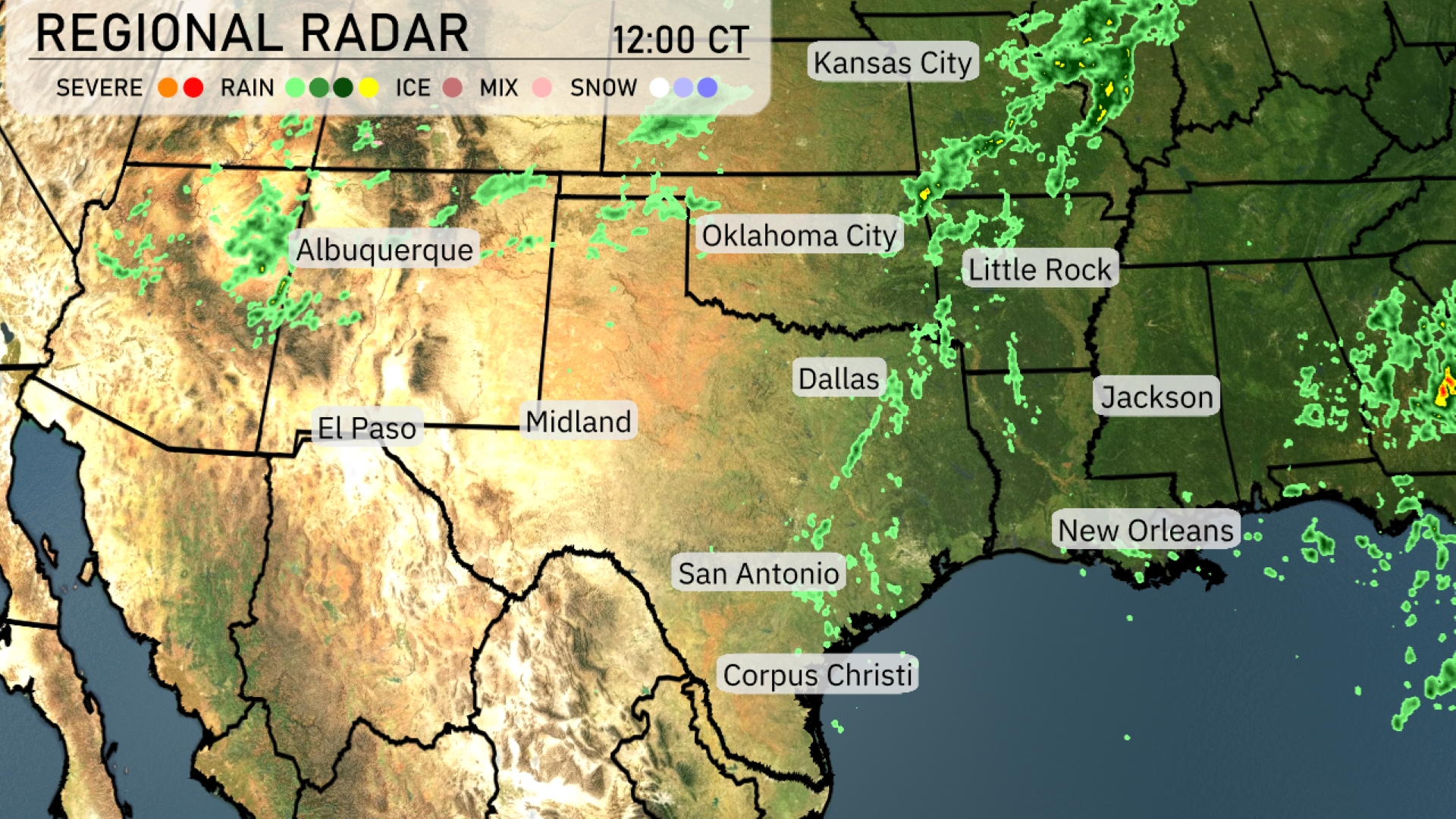
A developing line of scattered showers stretches across parts of Texas, Oklahoma, and Louisiana. Oklahoma City and Dallas are experiencing light rain, with this activity moving eastward towards Little Rock. Southeast Texas, including areas near Corpus Christi, is mostly clear with some scattered clouds. Light rain showers are moving through Jackson, while New Orleans enjoys drier conditions. Albuquerque and El Paso remain dry under a clear sky as the day progresses.
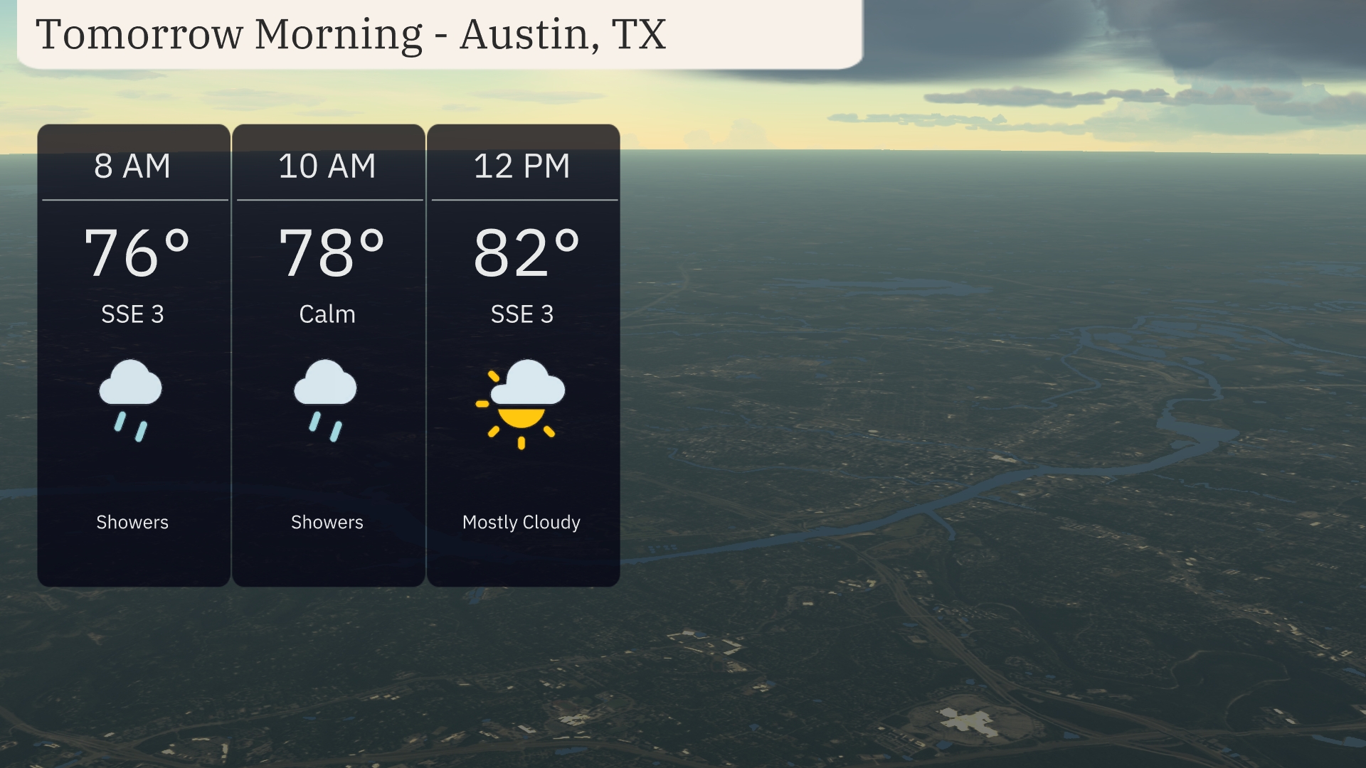
Expect a wet start to the morning with showers lingering in Austin. Temperatures will rise from 76 degrees at 8 AM to 78 degrees by 10 AM. Winds will be gentle from the southeast in the early hours, turning calm mid-morning. By noon, clouds will dominate the sky as temperatures reach 82 degrees.
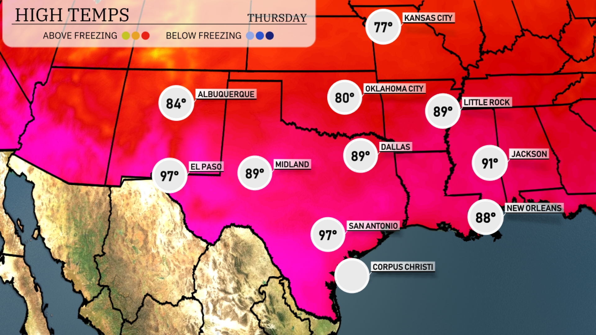
Tomorrow in San Antonio, expect a sizzling high of 97 degrees, significantly above average for this time of year. El Paso will also see warm temperatures, reaching 97, while Midland warms up nicely to 89 degrees. In Dallas, high temperatures will be more moderate at 89 degrees. Farther east, Little Rock anticipates hitting 89 degrees, and Jackson is set for a steamy 91 degrees. New Orleans rounds out the day with a high of 88 degrees as humidity remains high across the region.
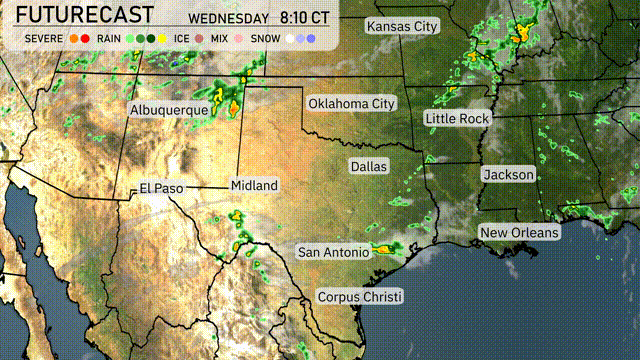
A cold front makes its way into the Southern Plains, bringing rain from Midland to Dallas by Wednesday afternoon. Oklahoma City could experience stronger storms with the potential for severe weather, including damaging winds and hail. Keep an eye out for severe weather warnings as this front progresses southeast. In San Antonio and Corpus Christi, expect beneficial rainfall, which may help alleviate dry conditions. By Thursday, the front moves toward the Gulf Coast, potentially impacting New Orleans with showers and scattered storms.
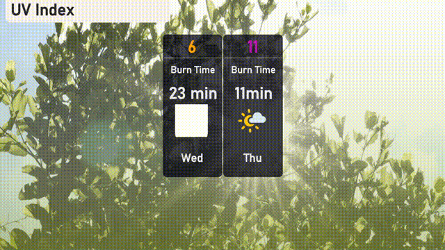
The UV index in Austin is set to reach 6 on Wednesday, presenting a moderate sun exposure risk with a burn time of about 23 minutes. Looking ahead to Thursday, the UV index climbs to 11, posing a very high exposure risk with a burn time of only 11 minutes. Take precautionary measures by applying broad-spectrum sunscreen, wearing a hat, and seeking shade during peak sun hours, especially on Thursday.
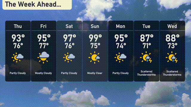
For the 7 Day Outlook in Austin:
Thursday: Partly cloudy with warm conditions, highs reaching 93 degrees and dropping to 76 degrees overnight.
Friday: Mostly cloudy skies, getting slightly warmer with a high of 95 degrees and a low of 77 degrees.
Saturday: Partly cloudy again, temperatures peaking at 97 degrees with a low of 76 degrees in the evening.
Sunday: Mostly clear skies and very warm, hitting a high of 99 degrees and a low of 75 degrees.
Monday: Partly cloudy with temperatures reaching up to 95 degrees and cooling down to 74 degrees.
Tuesday: Scattered thunderstorms are likely, with a cooler high of 87 degrees and a low of 71 degrees.
Wednesday: Continued scattered thunderstorms with similar conditions, highs around 88 degrees and a low of 73 degrees.