Austin Weather Watch: Partly Cloudy and Primed for Storms
By
Amy Freeze
Meteorologist Amy Freeze delivers an in-depth look at the shifting weather patterns over Austin and the Southern Plains, highlighting impending thunderstorms and temperature spikes.
Meteorologist Amy Freeze breaks down today’s weather conditions across Austin and the Southern Plains, covering the latest on temperatures and storm activity.
Explore detailed weather insights with Meteorologist Amy Freeze as she covers the varying climatic conditions across the Southern Plains, focusing on Austin. From partly cloudy skies to the potential for severe weather, including strong winds and hail, understand what these changes mean for your week ahead. Plus, stay informed about temperature trends and the best ways to stay safe under the sun with a UV index warning.
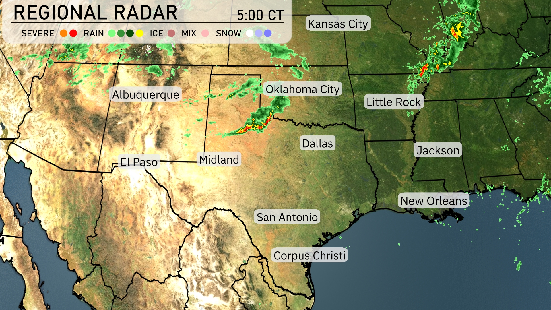
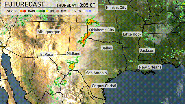
On the regional radar, storms are currently intensifying northeast of Oklahoma City, moving towards Little Rock. A band of rain stretches across the northern panhandle of Texas, touching areas near Midland and extending into southeastern New Mexico. Albuquerque is experiencing rain showers with scattered cloud cover seen throughout the state. Clear conditions prevail across much of central and southern Texas, although rain is developing south of Dallas. New Orleans and the surrounding Gulf Coast region remain dry for now but there’s cloud cover poised to move in.
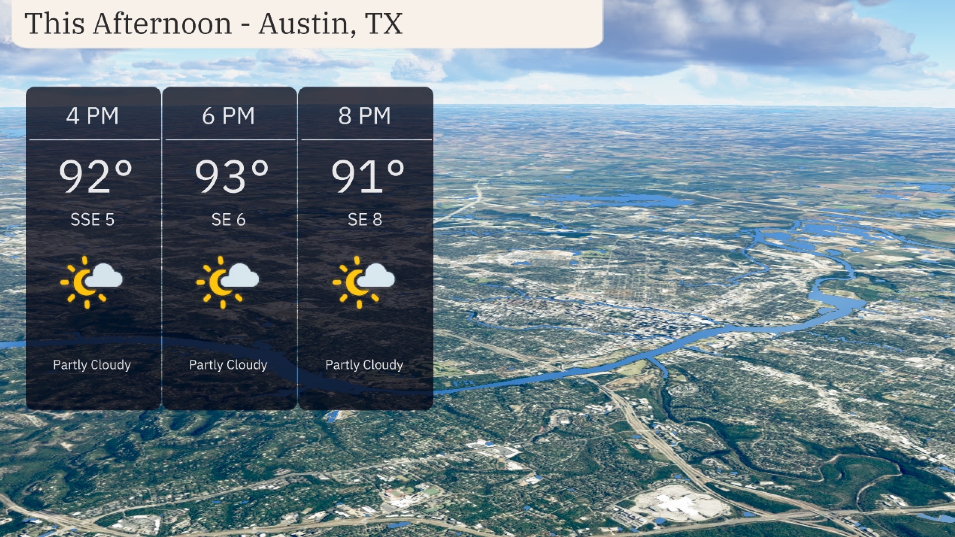
This afternoon in Austin brings partly cloudy skies with temperatures holding steady in the low 90s, reaching up to 93 degrees by 6 PM. A gentle breeze from the southeast ranges from 5 to 8 miles per hour, providing a bit of relief from the warm temperatures.
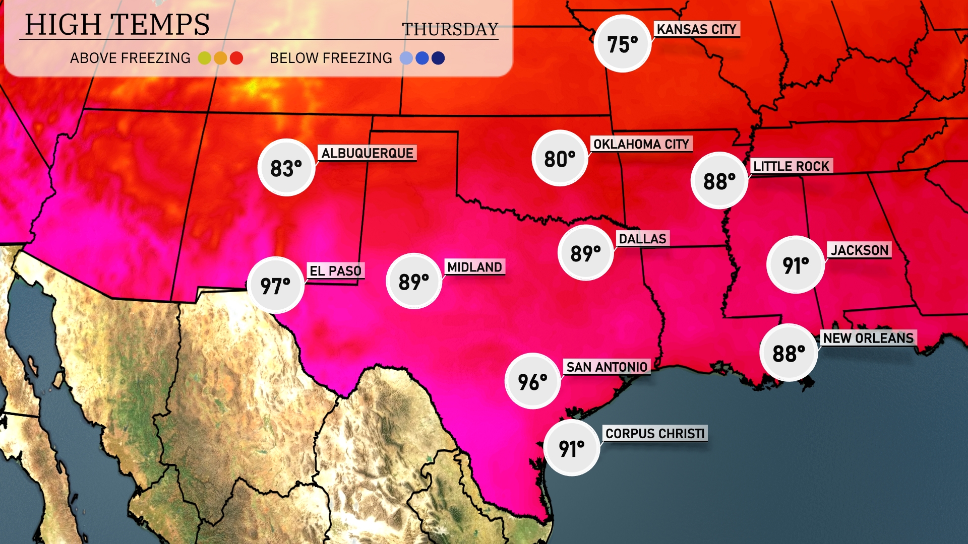
Today, temperatures in the Southern Plains are reaching sizzling highs. In Dallas, expect a high of 89 degrees, while the mercury rises to 97 in El Paso. San Antonio is feeling the heat too, with a high of 96 degrees. Midland matches Dallas at 89 degrees, while Corpus Christi is slightly cooler at 91. In other nearby cities, Jackson will see a warm high of 91 degrees, and New Orleans is looking at a pleasant 88 degrees.
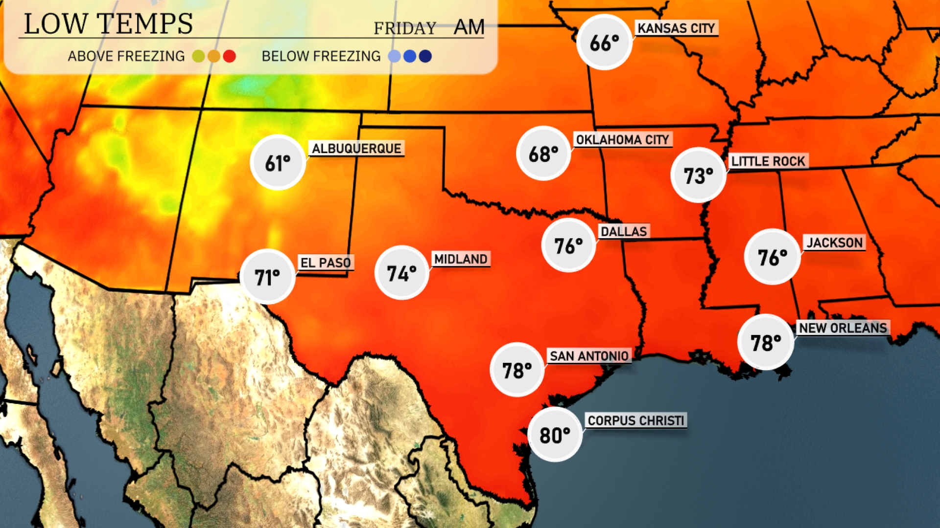
Tonight Dallas will see a low of 76 degrees, while Oklahoma City drops to 68. In contrast, Little Rock is expected to cool down to 73 degrees. El Paso will sit at 71 degrees overnight, and San Antonio will remain warm at 78 degrees.
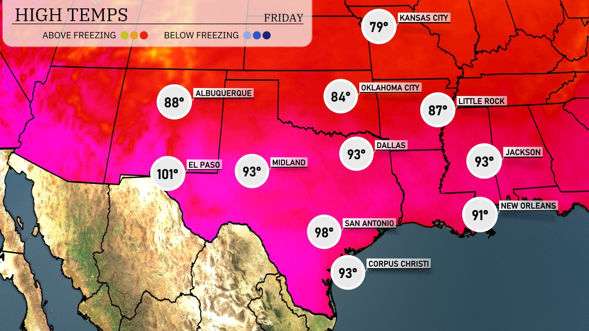
Tomorrow Midland will also see high temperatures around 93 degrees, indicating warm conditions persisting in West Texas. San Antonio is set to reach a balmy 98 degrees, while Corpus Christi will experience a high of 93 degrees. Dallas is forecasting a slightly cooler day at 93 degrees.
On the futurecast for the Southern Plains, thunderstorms are expected to develop rapidly late tonight, particularly around Oklahoma City and extending into Dallas. A cold front is sweeping across the region, which will enhance the potential for severe weather, including strong winds and hail through Thursday afternoon. Rainfall from Midland to San Antonio will provide relief from ongoing dry conditions but could lead to localized flooding due to intense downpours. By Thursday night, temperatures are set to decrease, bringing a cooler air mass into areas from El Paso to Corpus Christi.
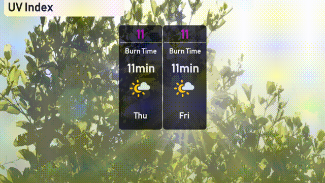
The UV index in Austin for Thursday is 11, indicating an extremely high level with a burn time of just 11 minutes. Similarly, Friday’s UV index also remains at 11.