Midwest Murmurs: A Canvas of Climates from Storms to Sunshine
By
Amy Freeze
Amy Freeze navigates through the Midwest's dynamic weather, highlighting storms, clear skies, and temperature shifts. Dive into the details with Chicago's own expert.
Meteorologist Amy Freeze provides an essential update on the evolving weather conditions across the Midwest. Chicago enjoys a rare pause from rain, while Indianapolis braces for storms.
Welcome to your weather update with Meteorologist Amy Freeze. As clouds linger over Chicago, the broader Midwest faces a vibrant line of storms. This detailed post unpacks the spectrum from moderate rains in Detroit to potential downpours in Bowling Green and peaceful skies in St. Louis. Understand the implications of a shifting high-pressure system and plan your week with Chicago’s very own weather expert. For a deeper dive into the forecasts and what your week could look like, visit our extensive coverage.
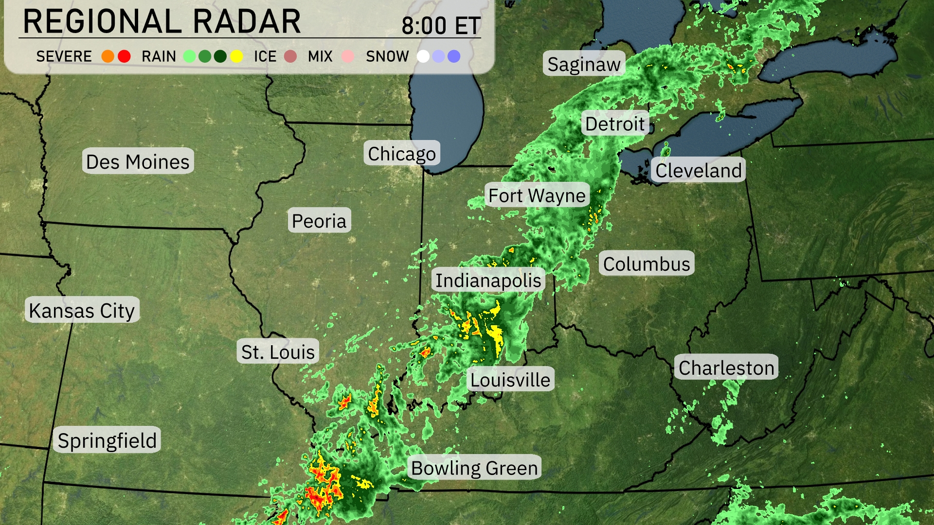
A vibrant line of storms stretches across the Midwest, extending from Indianapolis towards the southeast, affecting areas like Louisville with heavy rain and embedded thunderstorms. Moderate rainfall is making its way over Detroit and Cleveland, extending into Fort Wayne, indicating cloudy and wet conditions for those cities. Light rain showers are also present around Columbus, offering a damp start to the day. Meanwhile, Chicago and Des Moines enjoy a reprieve under mostly clear skies, away from the precipitation currently tracking eastward. Farther south, St. Louis experiences dry conditions, while Bowling Green is just on the edge of this rain shield, preparing for possible downpours.
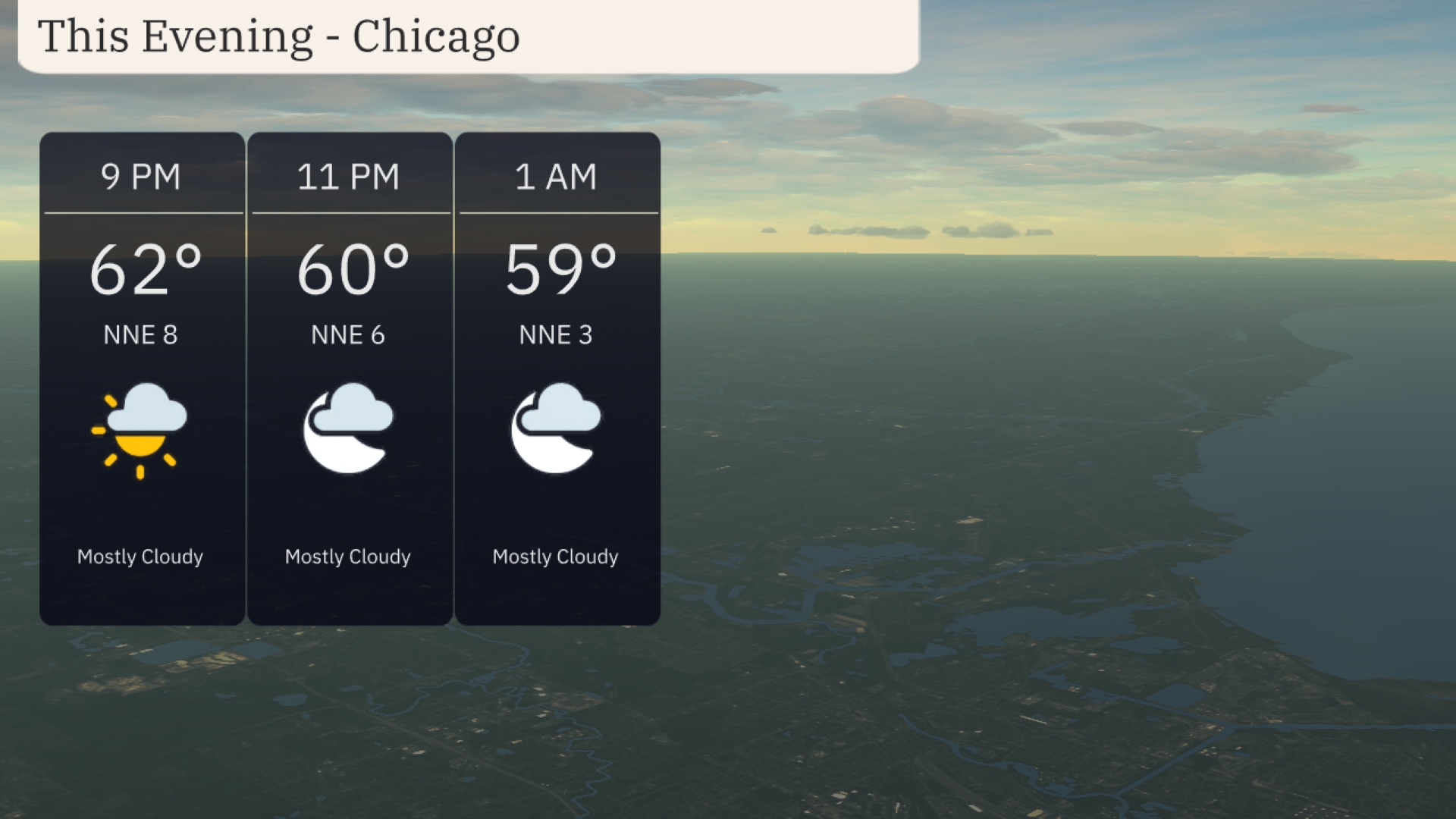
This evening in Chicago, expect mostly cloudy skies with temperatures starting at 62 degrees at 9 PM, dropping slightly to 59 degrees by 1 AM. Winds will be coming from the north-northeast, decreasing from 8 miles per hour to 3 miles per hour as the night progresses.
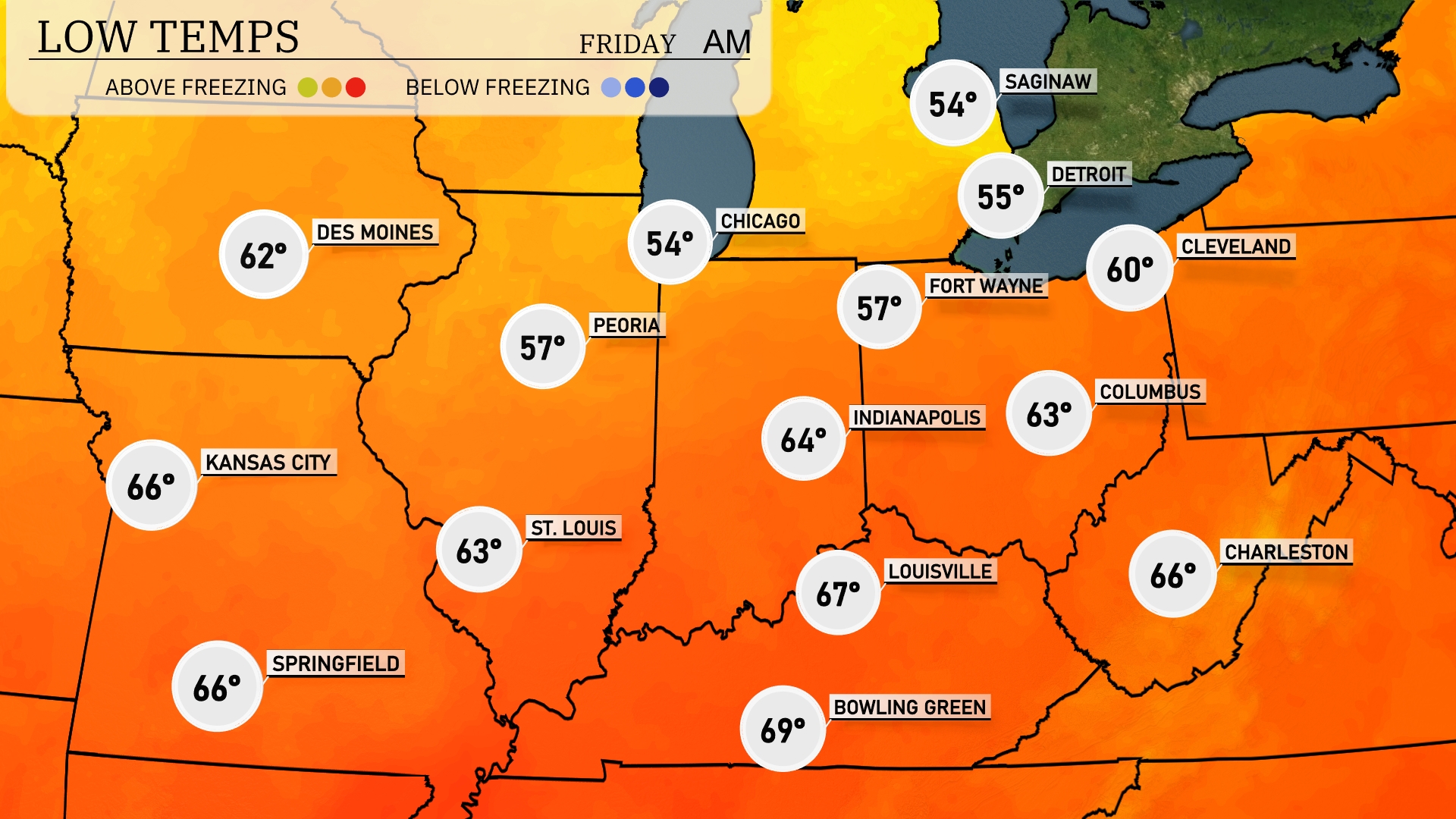
Tonight, Chicago will cool to 54 degrees, while Indianapolis registers a low of 64. Peoria drops to 57 degrees, and Fort Wayne expects a chilly 57 as well. In contrast, St. Louis will remain warmer at 63 degrees. Expect Kansas City to cool slightly to 66 degrees.
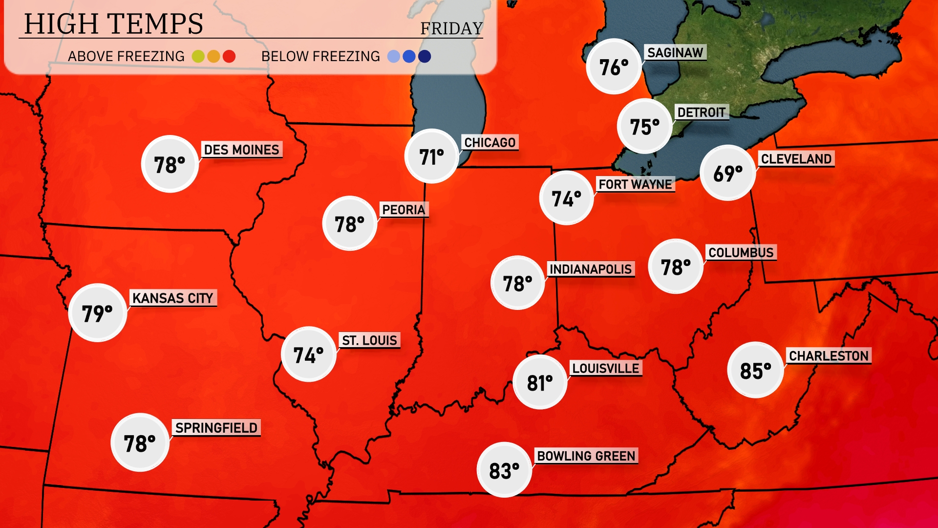
Tomorrow, Kansas City tops out at 79 degrees, while St. Louis will see a high of 74. Indianapolis and Peoria both reach 78 degrees, keeping things warm across the Midwest. Columbus will experience slightly cooler temperatures at 69 degrees, while Louisville warms up to 81. Charleston stands out with a high of 85 degrees, signaling above-average warmth for the region, influenced by a high-pressure system settling in.
A line of storms is forecast to impact the Midwest, starting with rain showers stretching from Peoria to Indianapolis by midday tomorrow. Expect potential severe weather in areas including Fort Wayne and Cleveland, where thunderstorms could bring heavy rainfall and strong winds. As the system progresses eastward, Cincinnati and Charleston might see stormy weather during the late afternoon and evening. Temperatures are likely to remain warm, with a slight dip after the front passes. Keep an eye on local updates for any severe weather alerts.
For Thursday in Chicago, the UV index is 9, posing a very high risk of harm with a burn time of just 15 minutes. On Friday, it slightly drops to 8, still very high and only slightly safer, with a 17-minute burn time.
For the 7-day forecast in Chicago:
Thursday: Enjoy mostly cloudy skies with a high of 72 degrees and a low of 57 degrees.
Friday: Expect partly cloudy conditions with a high of 72 degrees and a low of 55 degrees.
Saturday: Showers are in the forecast, with temperatures reaching 70 degrees for the high and dipping to 57 degrees overnight.
Sunday: Anticipate partly cloudy skies with a high climbing to 76 degrees and the low staying around 57 degrees.
Monday: Partly cloudy again, with a high of 75 degrees and a low of 55 degrees.
Tuesday: Mostly clear skies with a high of 74 degrees, and an evening low of 57 degrees.
Wednesday: Enjoy clear skies and a warm up to 82 degrees with a low of 62 degrees.