Navigating Chicago’s Skies: Tomorrow’s Forecast and the Midwest’s Maelstrom
By
Amy Freeze
Dive into our in-depth analysis of the complex weather patterns rocking Chicago and the Midwest. Learn what to expect directly outside your door!
Chicago gears up for a weather rollercoaster! From cloudy beginnings to stormy nights, get the full forecast and what it means for your week ahead.
Meteorologist Amy Freeze provides a detailed look at the evolving weather patterns over Chicago and the Midwest. With showers, thunderstorms, and varying temperatures across the region, understanding these changes is crucial. Learn about the expected weather for tomorrow morning in Chicago, the line of rain stretching from Missouri to Michigan, and the upcoming sunny days. Stay informed and prepared with our thorough coverage.
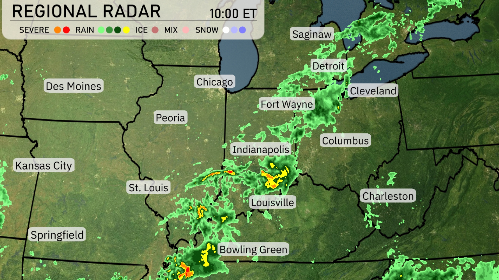
Showers and thunderstorms are sweeping across the Midwest, with a prominent line of rain stretching from Springfield, Missouri to Detroit, Michigan. St. Louis and Indianapolis are experiencing moderate to heavy rainfall, with severe thunderstorms embedded within the system. Chicago is on the cusp of this rain band, seeing increasing showers as the system moves eastward. Fort Wayne, Indiana is receiving pockets of heavier rain as the line progresses toward Cleveland, where rain showers are also present. Meanwhile, Des Moines and Kansas City remain dry under cloudy conditions, as the bulk of the precipitation is concentrated eastward.
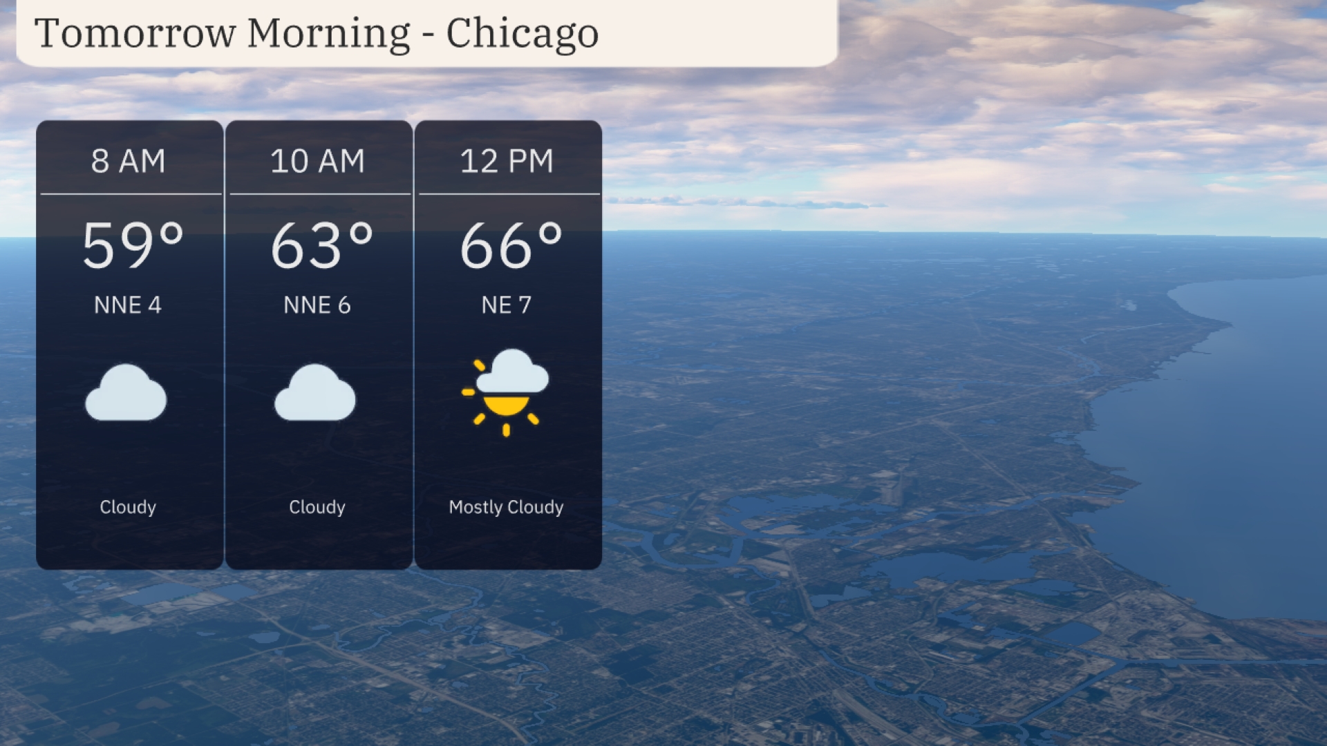
Tomorrow morning in Chicago, expect cloudy skies with temperatures starting at 59 degrees at 8 AM. Winds will be coming from the north-northeast at around 6 to 7 miles per hour. By 10 AM, temperatures will rise to 63 degrees while maintaining cloud cover. Toward noon, temperatures will reach 66 degrees with mostly cloudy conditions as a light breeze continues.
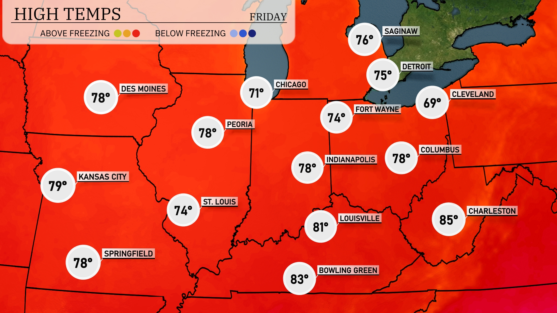
Tomorrow, Kansas City reaches a high of 79 degrees, while St. Louis will see a peak at 74. Indianapolis and Peoria are both expected to hit 78 degrees. Louisville is looking warmer at 81, with Bowling Green climbing to 83, the highest in the Midwest.
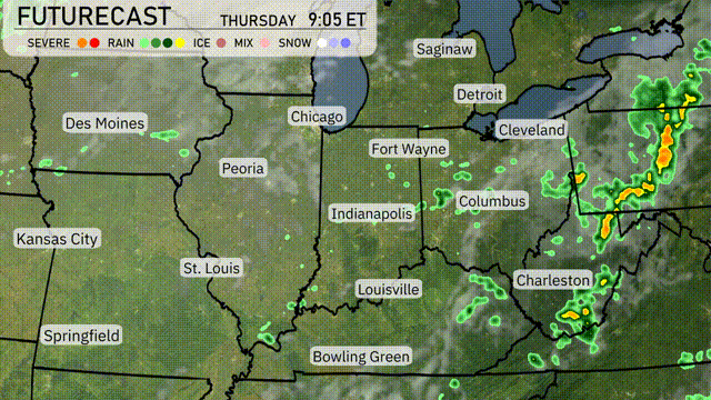
A frontal system is moving across the Midwest, bringing scattered rain and thunderstorms from Des Moines to Indianapolis. Expect heavy downpours and gusty winds, particularly from Fort Wayne to Cleveland tonight, which could lead to localized flooding. Temperatures will generally stay mild, with lows in the mid-60s and highs reaching the upper 70s. As the front passes, a high-pressure system moves in, clearing skies over Chicago and St. Louis by tomorrow afternoon.
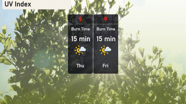
The UV index in Chicago is expected to be very high at 9 both Thursday and Friday. With these conditions, sunburn can occur in approximately 15 minutes under direct sunlight.
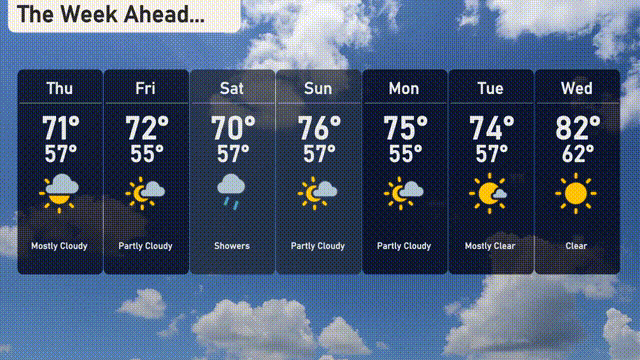
For Chicago, here’s your 7-day forecast:
Thursday: Mostly cloudy with a high of 71 degrees and a low of 57 degrees.
Friday: Enjoy partly cloudy skies as temperatures reach 72 degrees during the day and drop to 55 at night.
Saturday: Expect some showers with a daytime high of 70 degrees and a low of 57 degrees.
Sunday: Partly cloudy skies continue with a warm high of 76 degrees, cooling to 57 degrees overnight.
Monday: Partly cloudy again with temperatures peaking at 75 degrees and dipping to 55 degrees.
Tuesday: Revel in mostly clear skies, reaching up to 74 degrees during the day and falling to 57 degrees at night.
Wednesday: Clear and sunny, warming up to a delightful 82 degrees with a low of 62 degrees.