Navigating Through Clouds: Tomorrow’s Weather Across Los Angeles & Southwest
By
Amy Freeze
Explore the varying temperatures and weather conditions expected in Los Angeles and across the Southwest on June 6, 2025. From temperate mornings to a stormy horizon!
Tune into tomorrow’s weather insights with a detailed forecast for Los Angeles and the Southwest. Discover sunny spots, potential storms, and everything in between!
On June 6, 2025, Los Angeles and the Southwest will experience diverse weather from clear, sunny skies to the onset of potential storms by the evening. Los Angeles will wake up to a calm, partly cloudy morning while places like Phoenix will hit scorching highs. We’ll discuss the impacts of a cold front anticipated in the region and the high UV index warnings for Los Angeles. Join us for the full forecast breakdown on our blog and prepare for the day ahead!
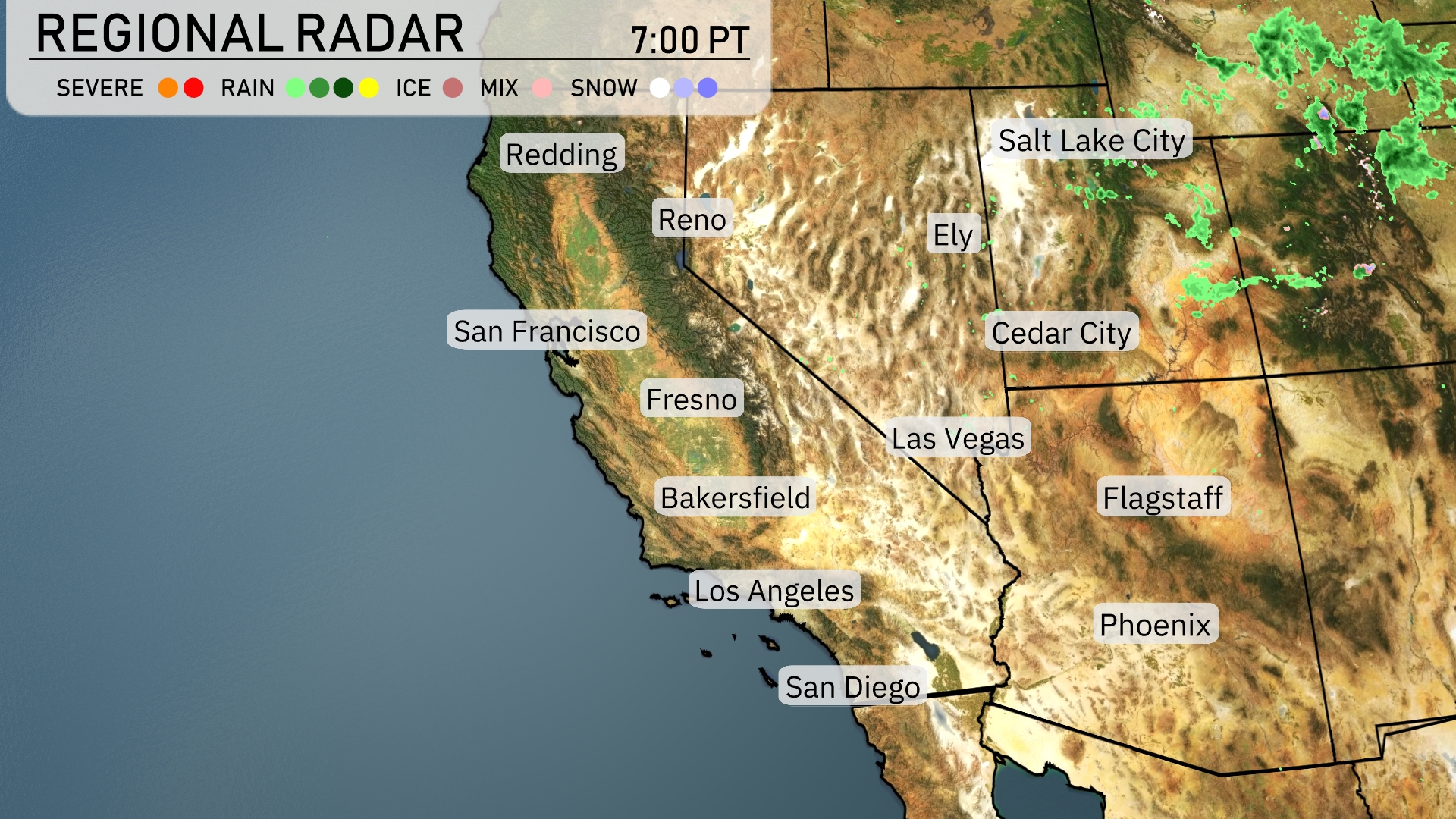
Across the Southwest region, clear skies are providing vast areas of sunshine from San Diego to Las Vegas, with no major precipitation in sight. Cloud cover is more noticeable in Salt Lake City, where rain showers are just beginning and expected to continue. In southern Utah near Cedar City, a low-pressure system is contributing to a slight uptick in cloud activity, though conditions remain dry. Moving farther south, Phoenix and Flagstaff are enjoying a dry spell with only scattered high clouds.
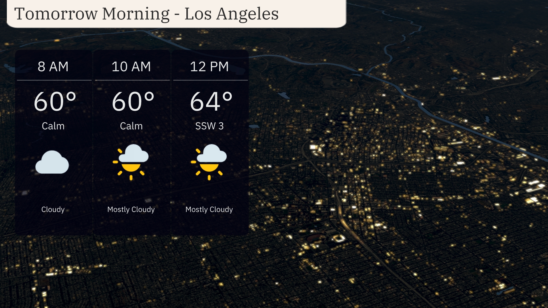
Tomorrow morning in Los Angeles, temperatures will hold steady at 60 degrees from 8 AM to 10 AM, with a calm atmosphere. By noon, the temperature edges up to 64 degrees with a south-southwest breeze at 3 miles per hour. The morning starts with cloudy skies, transitioning to mostly cloudy with occasional sun peaks by 10 AM.
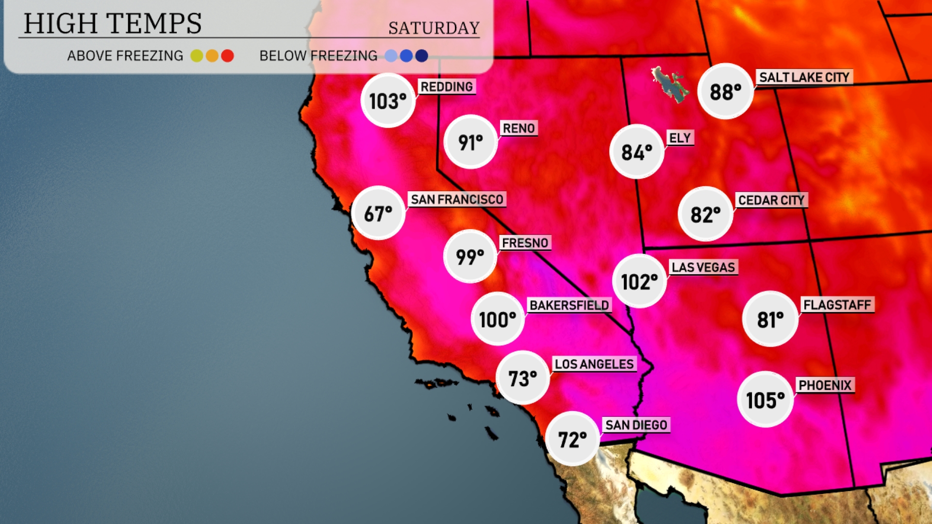
Tomorrow, Phoenix will blaze with a high of 105 degrees, a significant jump above average for early June. Las Vegas isn’t far behind, expecting to reach 102 degrees, while Bakersfield will also warm up to 100 degrees. In contrast, San Francisco will experience a much cooler day at 67 degrees. Expect mild conditions in Los Angeles with highs around 73 degrees, influenced by coastal marine layers keeping temperatures in check.
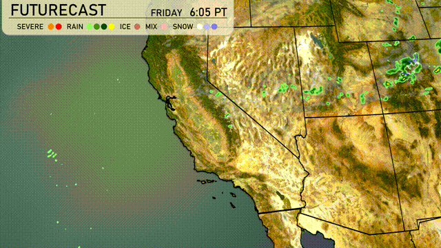
A cold front with scattered thunderstorms is set to move through the Southwest starting Friday evening. Expect periods of rain primarily along Northern Arizona and New Mexico, bringing potential for localized flooding in lower elevations by Saturday morning. Southwestern deserts, including Phoenix and Las Vegas, will see breezy conditions with temperatures dropping by about 5 to 10 degrees. Eastern New Mexico could experience isolated severe storms with gusty winds. The front exits the region Saturday afternoon, leading to clearing skies and cooler temperatures.
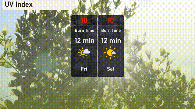
The UV index in Los Angeles is very high at 10 for both Friday and Saturday, with a burn time of just 12 minutes.
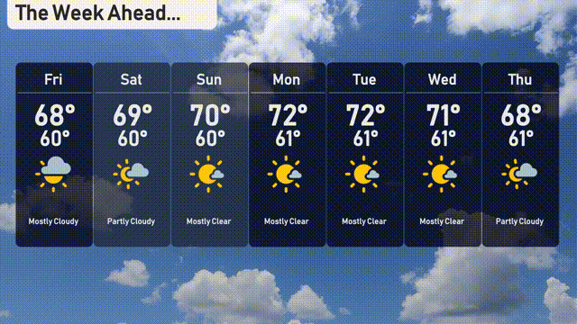
For the 7-day forecast in Los Angeles:
Friday: Mostly cloudy with a high of 68 degrees, and the low is 60 degrees.
Saturday: A bit more sunshine with a high of 69 degrees and cooling down to 60 degrees at night.
Sunday: Mostly sunny, reaching a pleasant 70 degrees for a high, with an overnight low of 60 degrees.
Monday: Clear skies continue with temperatures peaking at 72 degrees and dropping to 61 degrees.
Tuesday: Expect mostly clear conditions with a daytime high of 72 degrees and a nighttime low of 61 degrees.
Wednesday: Mostly sunny and slightly cooler, with a high of 71 degrees and a low of 61 degrees.
Thursday: Partly cloudy conditions return, with a high of 68 degrees and a low of 61 degrees.