A deep dive into Miami's dynamic weather patterns for the coming week: Understand what to expect from sun-up to sun-down, with exclusive tips on how to weather the extremes.
Partly cloudy or thunderstorm? Get the latest updates and expert insights into Miami’s unpredictable weather. Stay prepared and informed with our daily weather forecasts.
As Miami greets another week, residents and visitors can expect a mix of partly cloudy mornings transitioning into stormy evenings. With a UV index peaking at extreme levels, understanding the forecast becomes crucial for your daily planning. This comprehensive weather report covers detailed temperature shifts, storm predictions, and essential safety tips as the cold front approaches bringing potential thunderstorms.
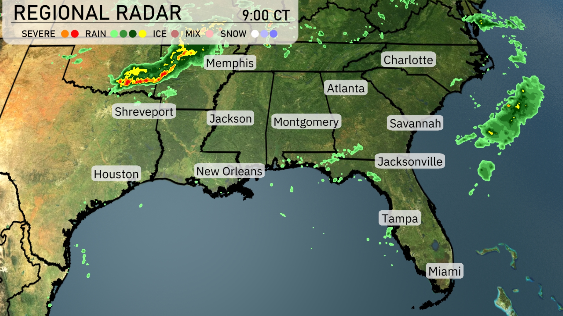
A line of severe storms is currently moving southeast from Shreveport toward Jackson, bringing heavy rain and the potential for strong thunderstorms. Showers are extending into parts of Alabama, particularly near Montgomery, with cloudy skies building over Atlanta. A band of rain is sweeping across the Nashville area, heading eastward. The southern regions, including Miami and Tampa, remain mostly clear under serene conditions.
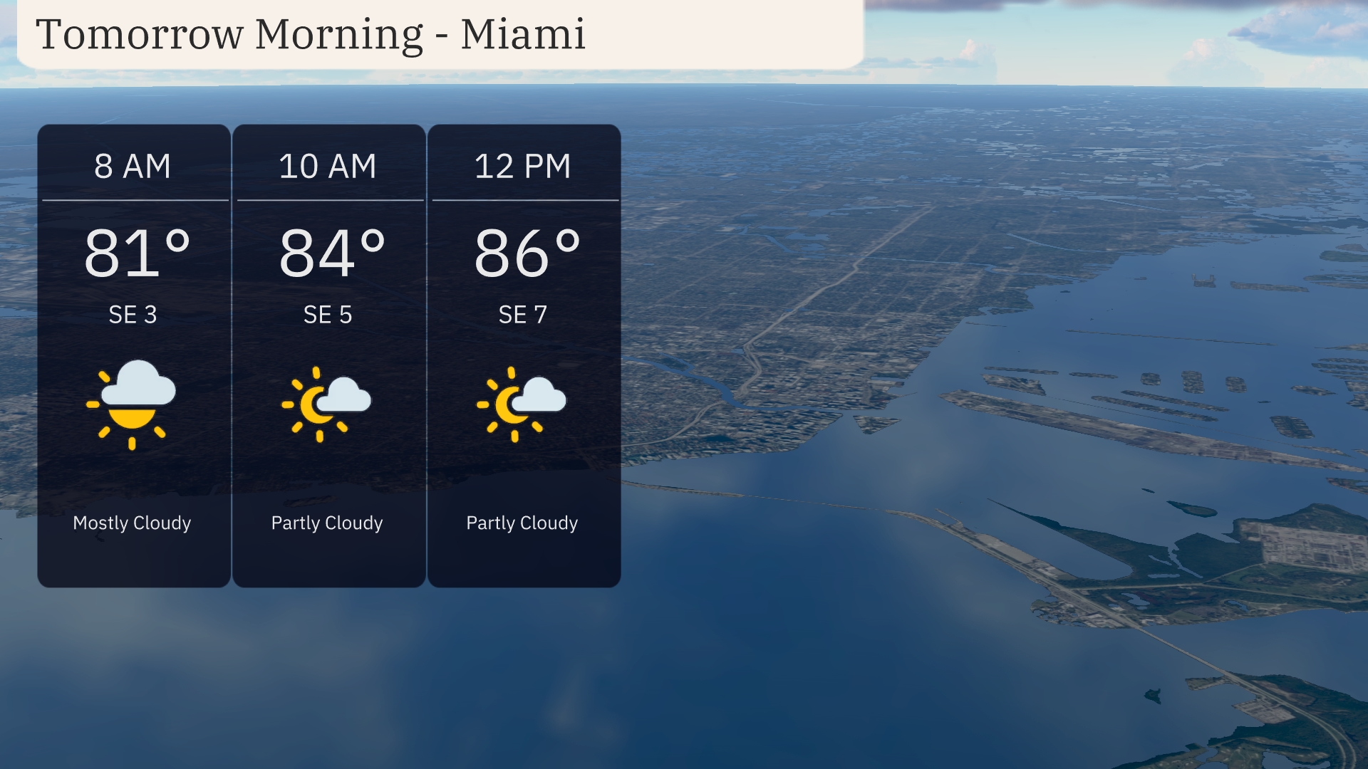
Tomorrow morning in Miami, temperatures will start at 81 degrees at 8 AM and rise to 84 degrees by 10 AM, with a south-east breeze at 5 miles per hour. Expect mostly cloudy skies turning partly cloudy as the morning progresses. By 12 PM, the temperature reaches 86 degrees with winds picking up slightly to 7 miles per hour.
Tomorrow in Shreveport, expect a sizzling high of 96 degrees. Houston is set to reach 95, while Jackson climbs to 93. Montgomery will experience a warm high of 92 degrees, and in Atlanta, temperatures will peak at 89. The heat continues in Florida, with both Jacksonville and Savannah hitting 94 degrees, while Tampa enjoys a high of 91.
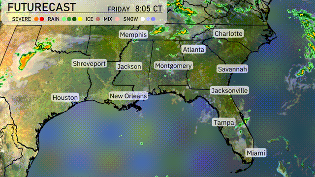
A cold front is set to move into the Southeast by Friday evening, bringing scattered thunderstorms from Jackson to Birmingham. Expect heavy rain in New Orleans and Montgomery, with localized flooding possible. The storm line reaches Atlanta by late Friday night, impacting early Saturday morning commutes with strong winds and potential gusty conditions. Rainfall totals could exceed an inch in several areas, easing drought conditions but increasing flood risks. By Saturday afternoon, expect temperatures to drop around ten degrees post-front passage, clearing up for a cooler, dry weekend ahead.
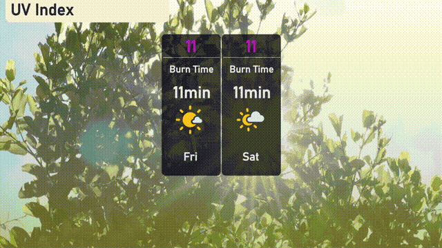
The UV index in Miami is extremely high at 11 both today and tomorrow. This means the sun’s rays are particularly potent, with a burn time of only 11 minutes in direct sunlight.
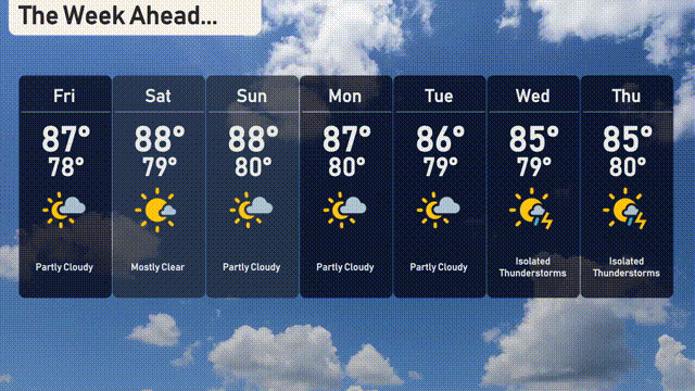
For the 7 day forecast in Miami:
Friday: Partly cloudy with a high of 87 degrees and a low of 78 degrees.
Saturday: Mostly clear skies, reaching a high of 88 degrees and a low of 79 degrees.
Sunday: Partly cloudy, high of 88 degrees with a low of 79 degrees.
Monday: Another partly cloudy day with temperatures peaking at 87 degrees and dipping to 80 degrees overnight.
Tuesday: Expect mostly clear skies with a high of 86 degrees and a low of 79 degrees.
Wednesday: Isolated thunderstorms likely; high temperatures around 85 degrees and a low of 79 degrees.
Thursday: Thunderstorms remain possible with highs near 85 degrees, cooling to 80 degrees by night.