Los Angeles Weather Update: Clear Skies and Regional Heat Waves
By
Amy Freeze
Get the latest weather outlook for Los Angeles and the Southwest, featuring sunny skies in LA and extreme heat in other parts of the region. Discover the full weekly forecast and weather patterns.
Enjoy mostly clear skies and comfortable temperatures in Los Angeles today, with an update on varying weather patterns across the Southwest. From sizzling heat to pleasant breezes, see what’s in store for the region.
Today in Los Angeles, the weather remains clear with temperatures in the low 70s, making it a perfect day for outdoor activities. This contrasts sharply with the searing heat observed in Phoenix and Las Vegas, where temperatures soar above 100 degrees. Our comprehensive analysis includes forecasts for the entire week, insights into the high UV index affecting the area, and safety tips for dealing with extreme weather conditions. Visit our blog for a detailed 7-day forecast and tips on how to stay cool and protected.
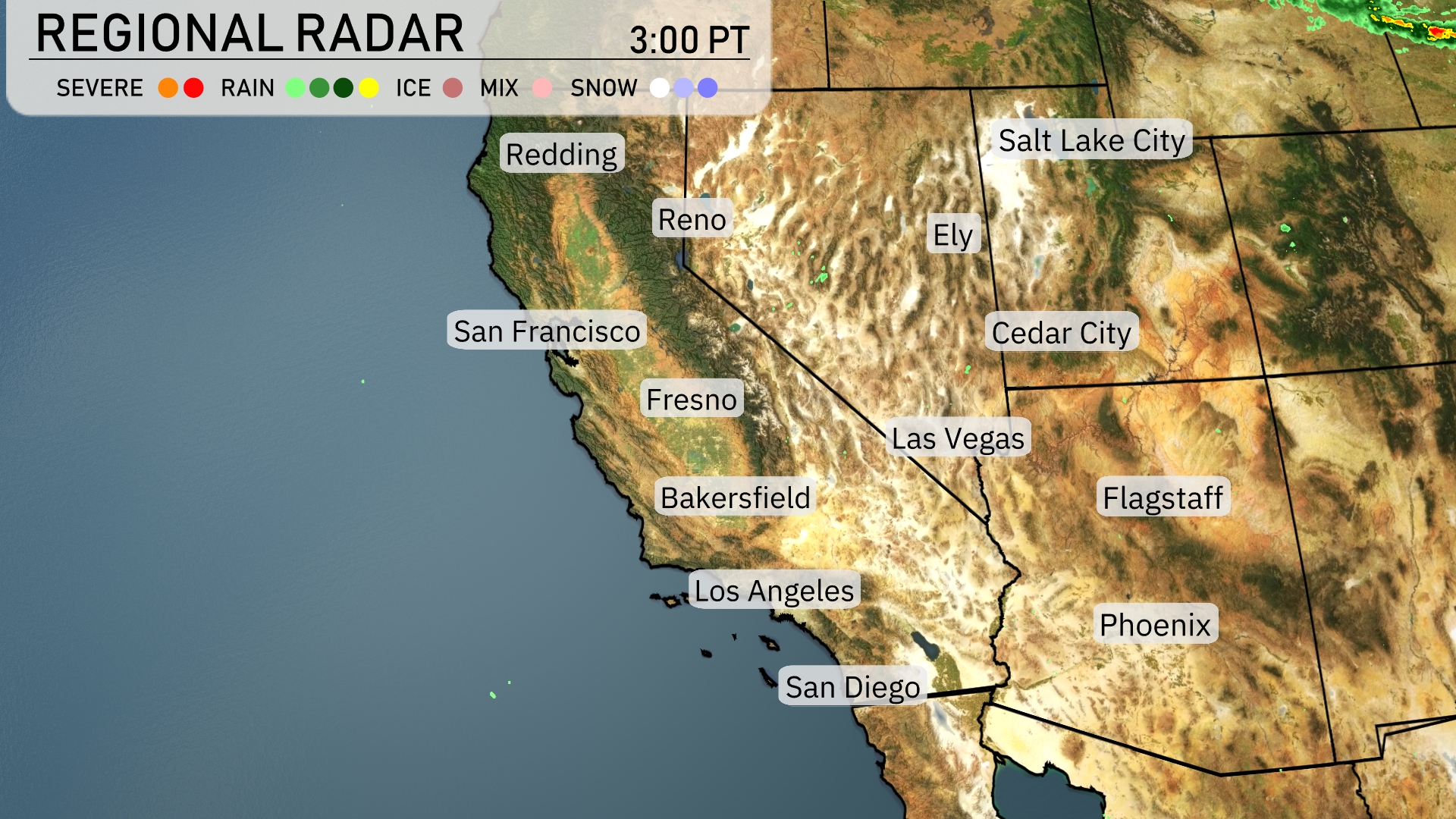
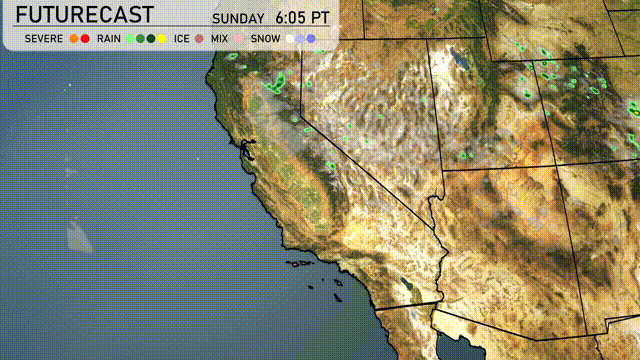
The Southwest region is seeing a range of conditions, with a mix of weather patterns in different areas. San Francisco and Fresno are experiencing rain, providing a break from dry conditions. Over in Ely, Nevada, skies are clear with no significant weather concerns at the moment. Flagstaff is preparing for cool temperatures, while Los Angeles remains dry under clear skies.
Afternoon temperatures in Los Angeles are projected to reach the low 70s, peaking at 72 degrees around 6 PM. Winds from the south-southwest will remain gentle, at 6 to 8 miles per hour throughout the afternoon. Expect Sunshine today.
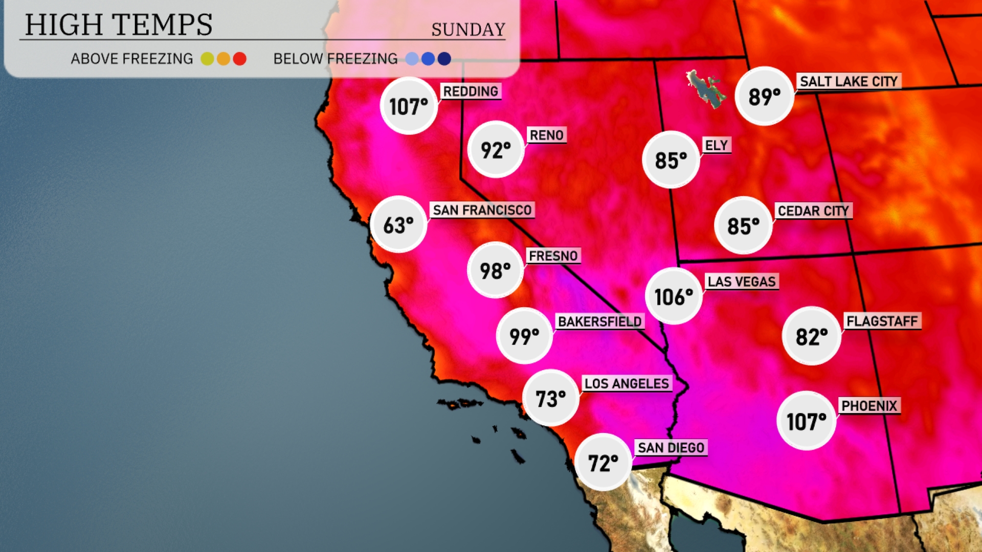
Today’s high temperatures in the Southwest are sizzling. Las Vegas reaches a hot 106 degrees, while Phoenix isn’t far behind with an equally scorching 107. Bakersfield will see a high of 99 degrees, with Fresno notching 98. In contrast, the coastal areas feel more temperate with Los Angeles at 73 degrees and San Diego slightly cooler at 72. Flagstaff is experiencing a break from the heat, hitting a comfortable 82 degrees today.
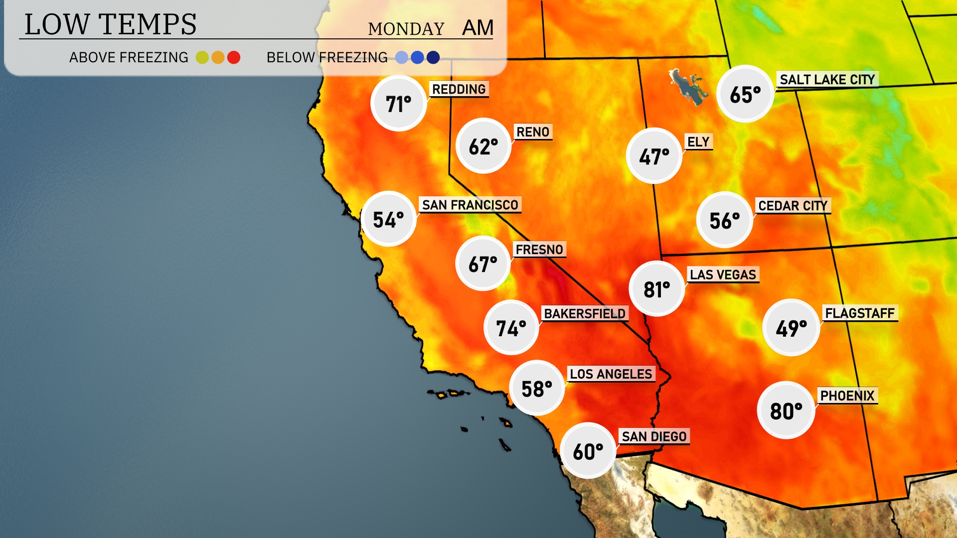
Tonight, temperatures will dip significantly across the Southwest. Flagstaff is expected to hit a low of 49 degrees, while Ely cools down to 47. In contrast, Las Vegas will remain mild at 56, with Phoenix seeing a low of 80 degrees. San Francisco will have a chilly low of 54 degrees, marking a noteworthy drop from previous nights.
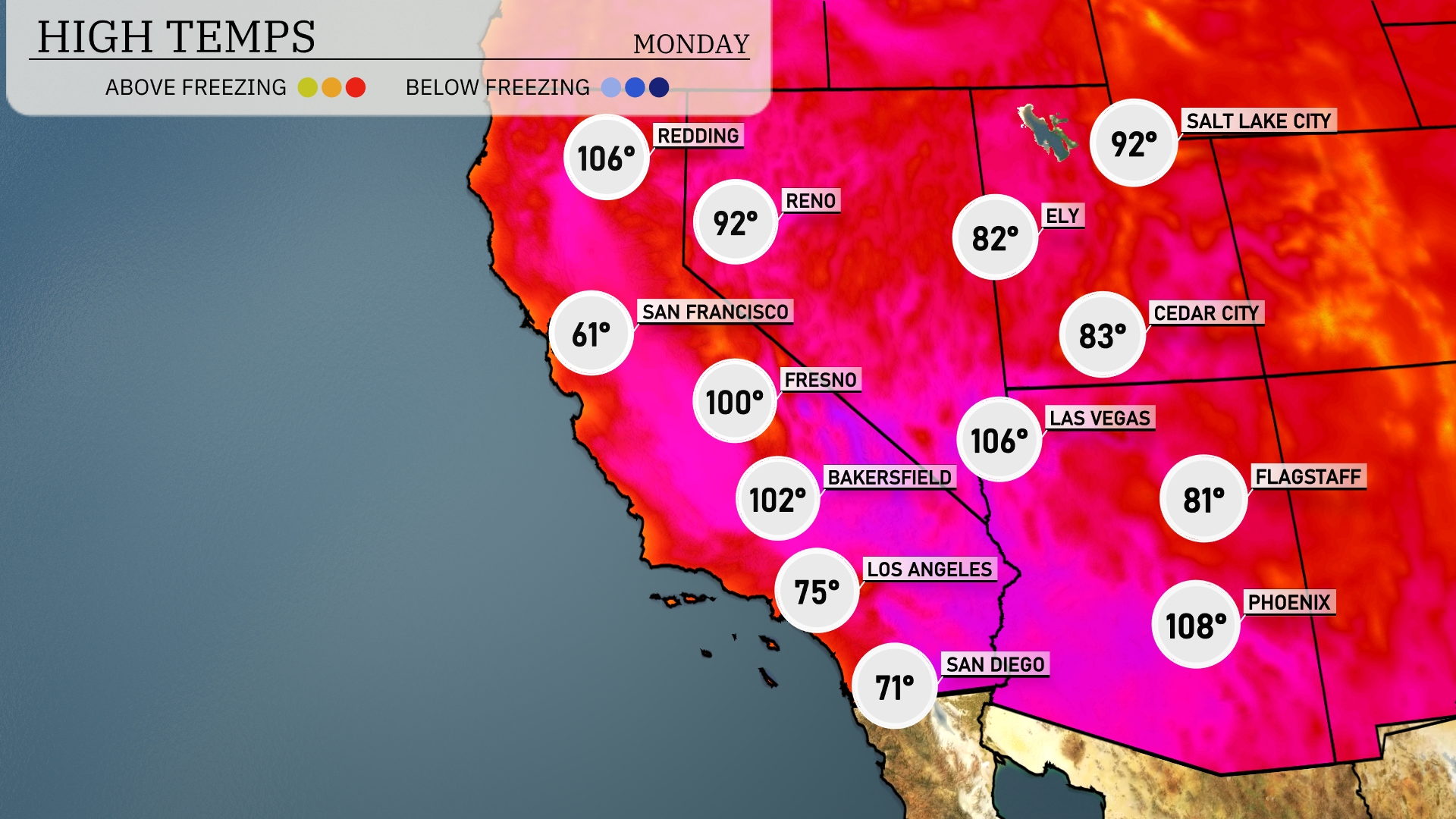
Tomorrow, Phoenix will be sizzling with a high of 108 degrees, significantly above average for this time of year. Las Vegas is also in the heat with temperatures peaking at 106 degrees, maintaining a trend of elevated warmth in the region. Bakersfield and Fresno will experience highs of 102 and 100 degrees respectively, both well above typical June readings. Los Angeles will stay relatively cooler at 75 degrees, but still warmer than usual for the coastal city. San Francisco sees a dramatic drop with a high of just 61 degrees, influenced by marine layers keeping temperatures down.
A high-pressure system establishes sunny and warm conditions across Arizona and New Mexico. However, a low-pressure trough slides along the California coast, bringing scattered showers to the central and northern regions. Gusty winds accompany these showers, particularly over mountainous terrains. Temperatures remain steady in the low to mid-90s for inland desert areas, while coastal zones experience cooler highs in the mid-70s. Extreme southwestern Arizona could see isolated thunderstorms as moisture streams north from Baja California.
For Los Angeles, the UV index on Sunday and Monday is very high at 10, with a burn time of just 12 minutes in direct sunlight.