Austin Ablaze: A Glimpse into Summer 2025’s Soaring Temperatures and Storms
By
Amy Freeze
Explore the dynamic weather patterns over Austin and the Southern Plains featuring intense heat, serene skies, and stormy forecasts. Detailed insights for effective planning!
As Austin hits near triple-digit temperatures, we unravel the upcoming weather trends with storms on the horizon across the Southern Plains. Get the scoop on what to expect right outside your door!
Join us as we break down the day-by-day weather developments in Austin and neighboring areas. This comprehensive guide covers fluctuating temperatures, storm predictions, and safety tips to keep you informed and prepared. From sunny highs to storm-laden skies, learn all about the summer 2025 weather trends in our detailed blog post.
Across the Southern Plains, the regional radar shows a line of storms stretching from southern Oklahoma through Arkansas and moving towards Mississippi. Little Rock is under moderate rain with some storm activity, while Jackson sees heavier thunderstorms developing. Meanwhile, clear skies dominate much of Texas, including Dallas and San Antonio, with no precipitation in sight. Albuquerque and El Paso remain under tranquil weather conditions with no signs of storm activity.
Through the afternoon hours in Austin, expect hot temperatures, peaking at 97 degrees by 6 PM. Sunny skies dominate the forecast, casting clear and bright conditions over the city. Winds are gentle, coming from the south, reaching up to 8 miles per hour, and shifting slightly southeast later at 10 miles per hour by 8 PM.
Today’s high temperatures across the Southern Plains are quite impressive. El Paso is sizzling at 104 degrees, while Midland and San Antonio both reach the century mark at 100 degrees. Dallas is a bit cooler with a high of 93, and Oklahoma City follows closely at 91. Further east, Little Rock hits 92 degrees, while Jackson remains more moderate at 85. Expect a mix of clouds and sun, but no significant cool relief in sight for today.
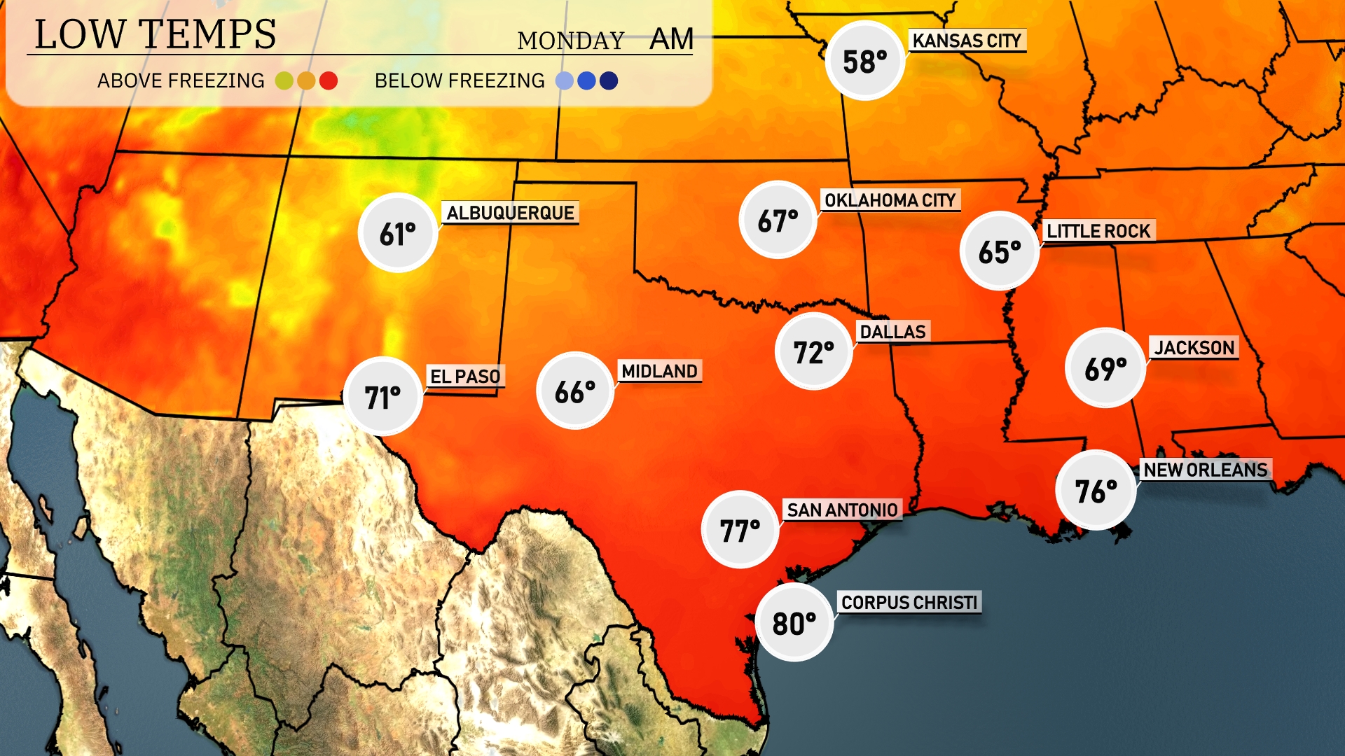
Tonight in the Southern Plains, temperatures will drop significantly. Dallas will see a low of 72 degrees, while Oklahoma City cools down to 67. Further south, San Antonio is expected to hit 77, with Corpus Christi at a warm 80 degrees. El Paso will experience a cooler night at 71 degrees.
Tomorrow in El Paso, expect a scorching high of 101 degrees, while Midland swelters at 88 degrees. San Antonio will see a warm 98, and Dallas will reach 88 degrees. Farther east, New Orleans will be toasty too, with highs hitting 91 degrees, and Jackson will experience a pleasant 85.
A cold front is sweeping through the Southern Plains tomorrow, bringing scattered storms from Dallas to Oklahoma City. Expect potential severe weather with heavy rain and possible hail in the afternoon and evening hours. As this system moves eastward, Little Rock to Jackson could experience strong thunderstorms by late evening. Over the next 24 hours, rainfall amounts could contribute to localized flooding, so remain alert for flash flood warnings. Following the front’s passage, temperatures will dip slightly, leading to cooler conditions across the region by Wednesday morning.
The UV index in Austin for Sunday and Monday is very high, peaking at 11. Expect a quick burn time of around 11 minutes in direct sunlight.