New York Weather Front: Partly Cloudy with a Chance of Drama!
By
Amy Freeze
NYC and the Northeast brace for a blend of clouds, showers, and stunning sunshine. Get the scoop on what your week looks like weather-wise!
Navigate NYC’s partly cloudy skies and prepare for potential showers. Our latest blog provides an update on what to expect in the Big Apple and surrounding areas.
This week in New York City and throughout the Northeast, the weather throws us a mixed bag. With a comfortable mix of partly cloudy skies and the chance for light showers, make sure to gear up for a week filled with weather surprises. As temperatures sway from mild to cool, get a detailed breakdown of daily weather expectations, including a special focus on a front system threatening with heavier showers and potential thunderstorms. Don’t let the weather catch you off guard! Read more about how to prepare and what to expect on our blog at https://amyfreeze.ai/
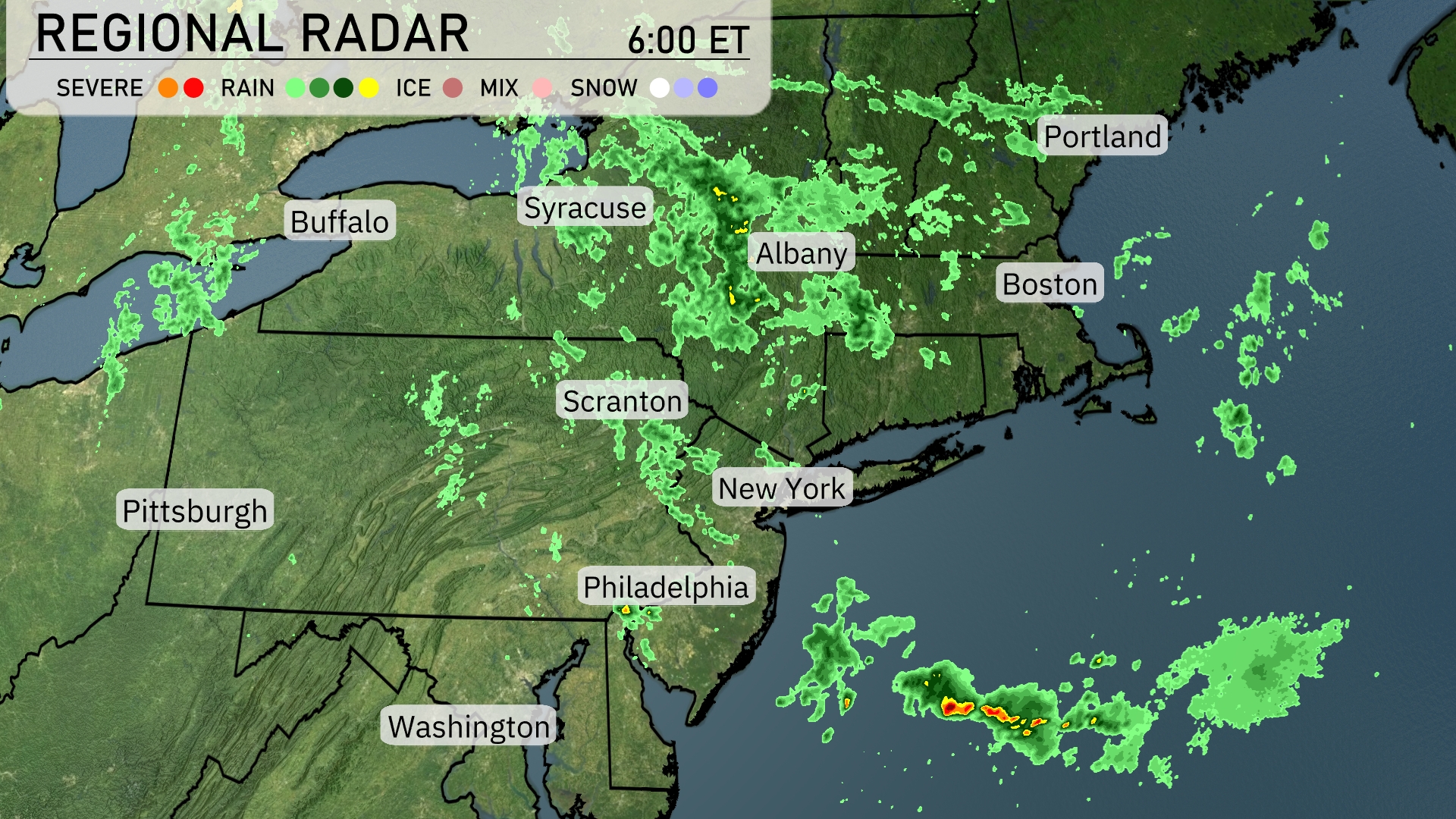
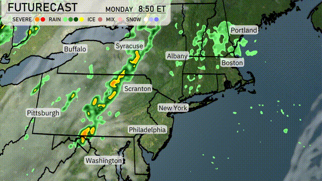
The Northeast is experiencing a variety of weather patterns this morning. Syracuse and Albany are currently under light to moderate rain, which is spreading across much of Upstate New York. Rain showers are also present north of Boston and moving into coastal regions, although the city itself remains mostly dry at this time. Philadelphia, New York City, and Buffalo are mostly clear, while Scranton sees some scattered showers to the east.
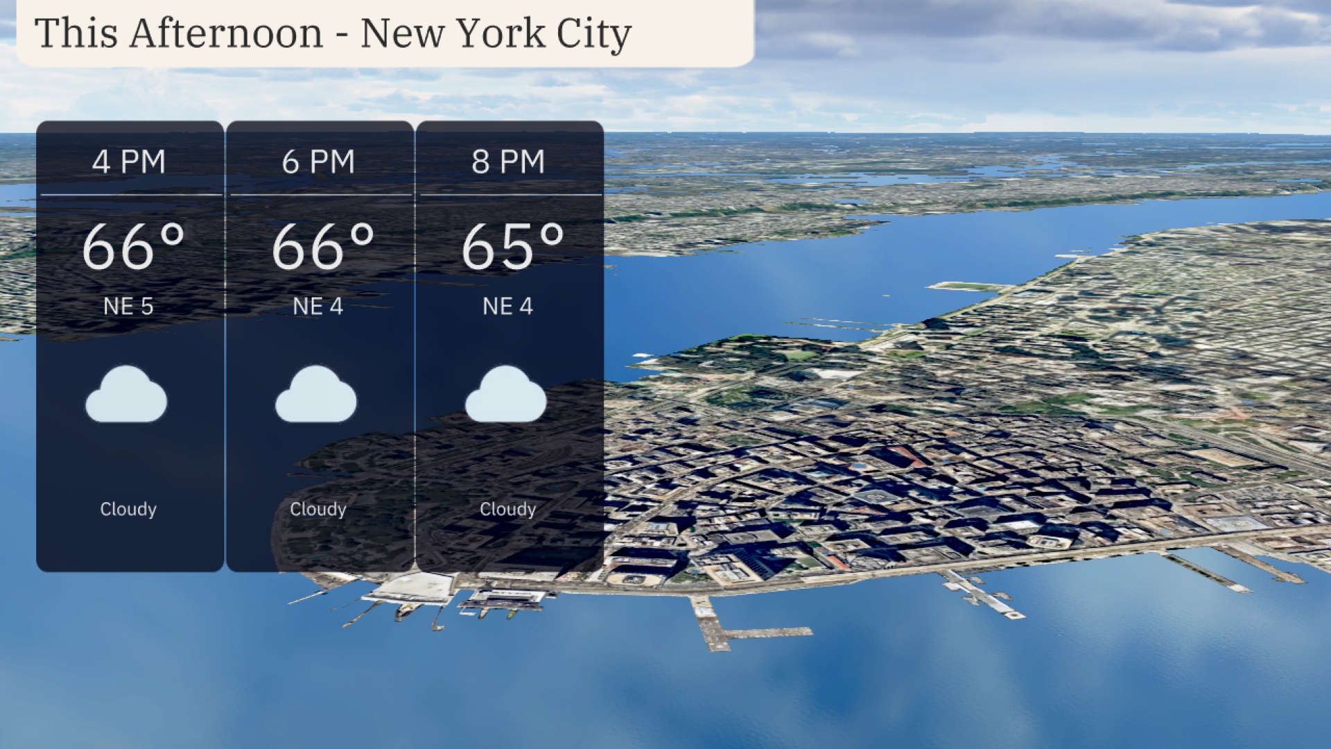
In New York City this afternoon, temperatures are steady around 66 degrees with northeast winds at 5 miles per hour decreasing to 4 miles per hour. Cloud cover persists throughout, bringing a consistent and calm weather pattern.
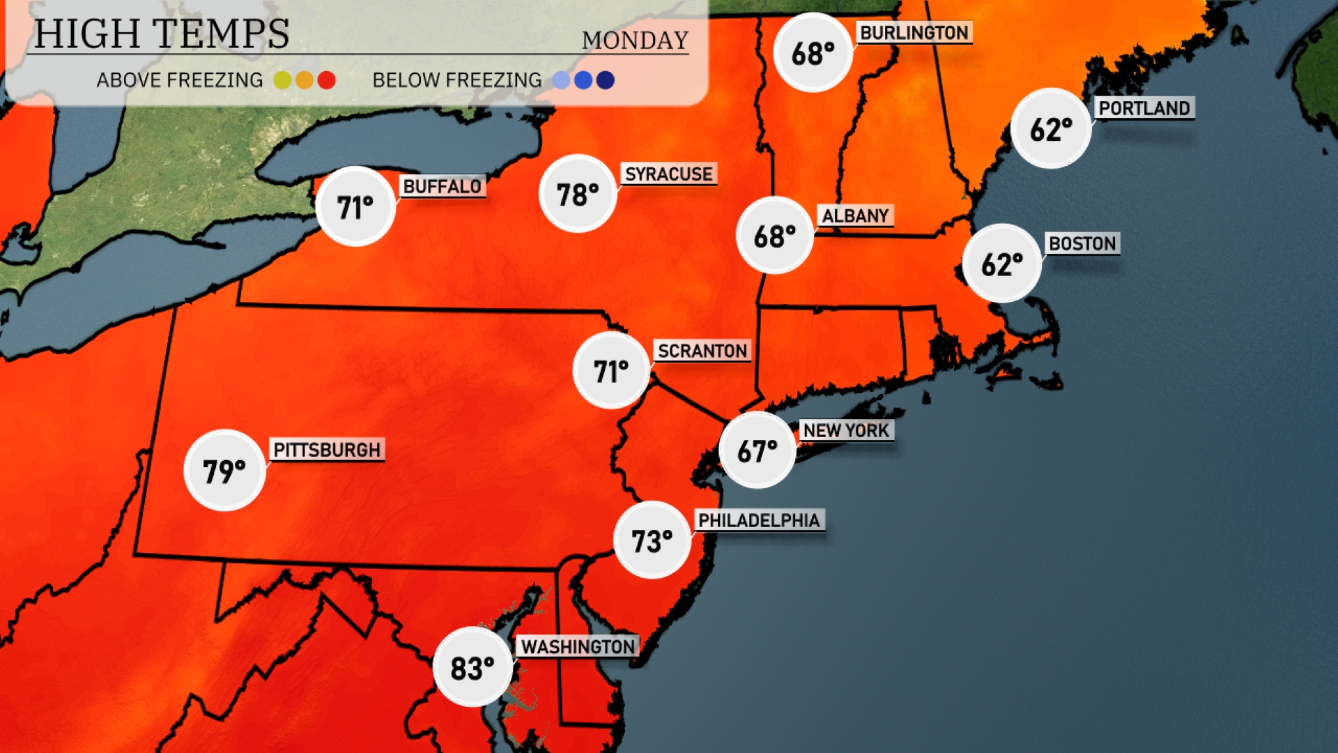
This afternoon Philadelphia sees a high of 73 degrees. Scranton reaches up to 71 degrees, and Buffalo is slightly cooler at 71 as well. Albany checks in at 68 degrees, with Portland and Boston trailing at 62 degrees each. Pittsburgh stands out with a high of 79 degrees.
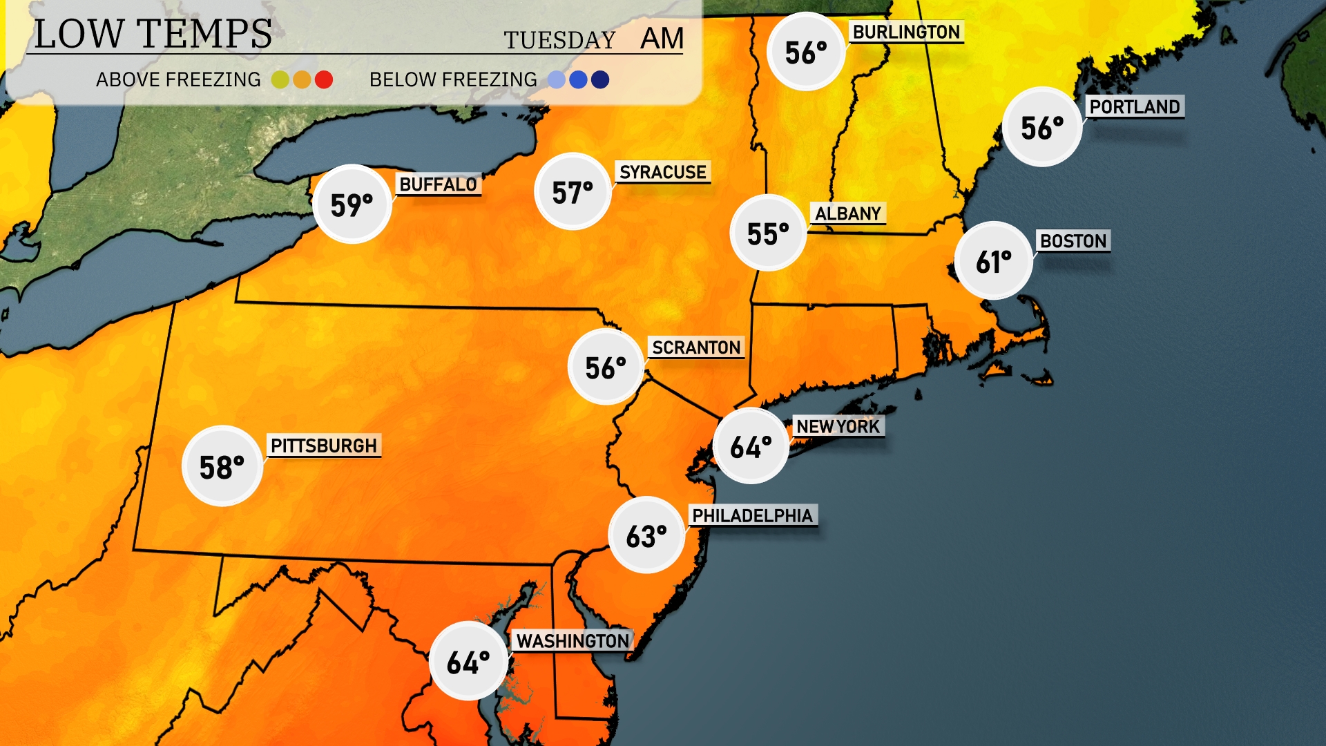
Tonight Albany is expected to see a low of 55 degrees, while Scranton will fall to 56. Buffalo will be slightly cooler at 59 degrees. In the heart of New York City, expect a mild overnight low of 64 degrees.
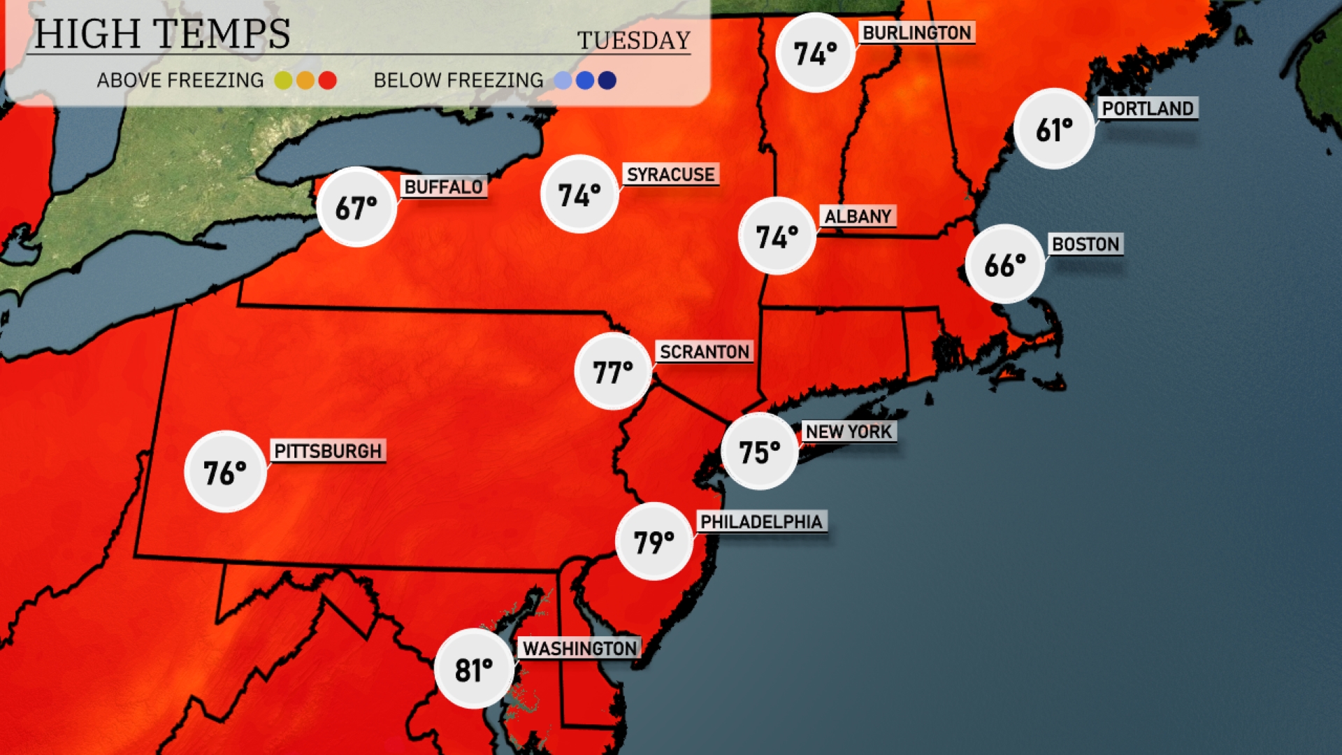
Tomorrow, Boston can expect a high of 66 degrees, while Portland will see slightly cooler temperatures at 61. New York City is looking at a comfortable 75 degrees, with Philadelphia warming up to 79. Scranton reaches 77 degrees, and Pittsburgh will also enjoy a high of 76.
A frontal system is set to move through the Northeast tomorrow, bringing a line of showers and thunderstorms from Washington, D.C., northward through New York City and into Boston. The storms could bring heavy rainfall and strong winds, particularly in the evening hours, so it’s essential to stay weather aware. There is potential for localized flooding in areas experiencing the heaviest downpours. Cooler and drier conditions will settle in by Wednesday, with temperatures dropping a few degrees across the region.
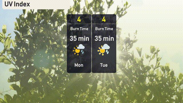
The UV index in New York City is moderate at 4 on both Monday and Tuesday, with a burn time of 35 minutes in direct sunlight. Keep in mind, a few clouds could offer brief sun breaks but not enough to eliminate sun exposure risks. Remember your sunscreen and stay sun-safe!