Weather Wonders: Atlanta’s Weekly Outlook from Sunny Spots to Stormy Patches
By
Amy Freeze
Explore the ups and downs of Atlanta's weather with our in-depth weekly forecast. From sizzling highs to stormy lows, we unravel what the skies have in store for the Southeast.
This week in Atlanta, gear up for a mix of clear skies and possible storms. We will see temperatures ranging from pleasant days to cooler nights, with a chance of showers and thunder. Read on for day-to-day insights!
Dive deeper into Atlanta’s diverse weather patterns in our extensive forecast. We’re analyzing everything from the daily temperature nuances to potential thunderstorm impacts across the Southeast. Prepare for variable conditions like gentle winds and drastic showers, and understand what these changes mean for your week.
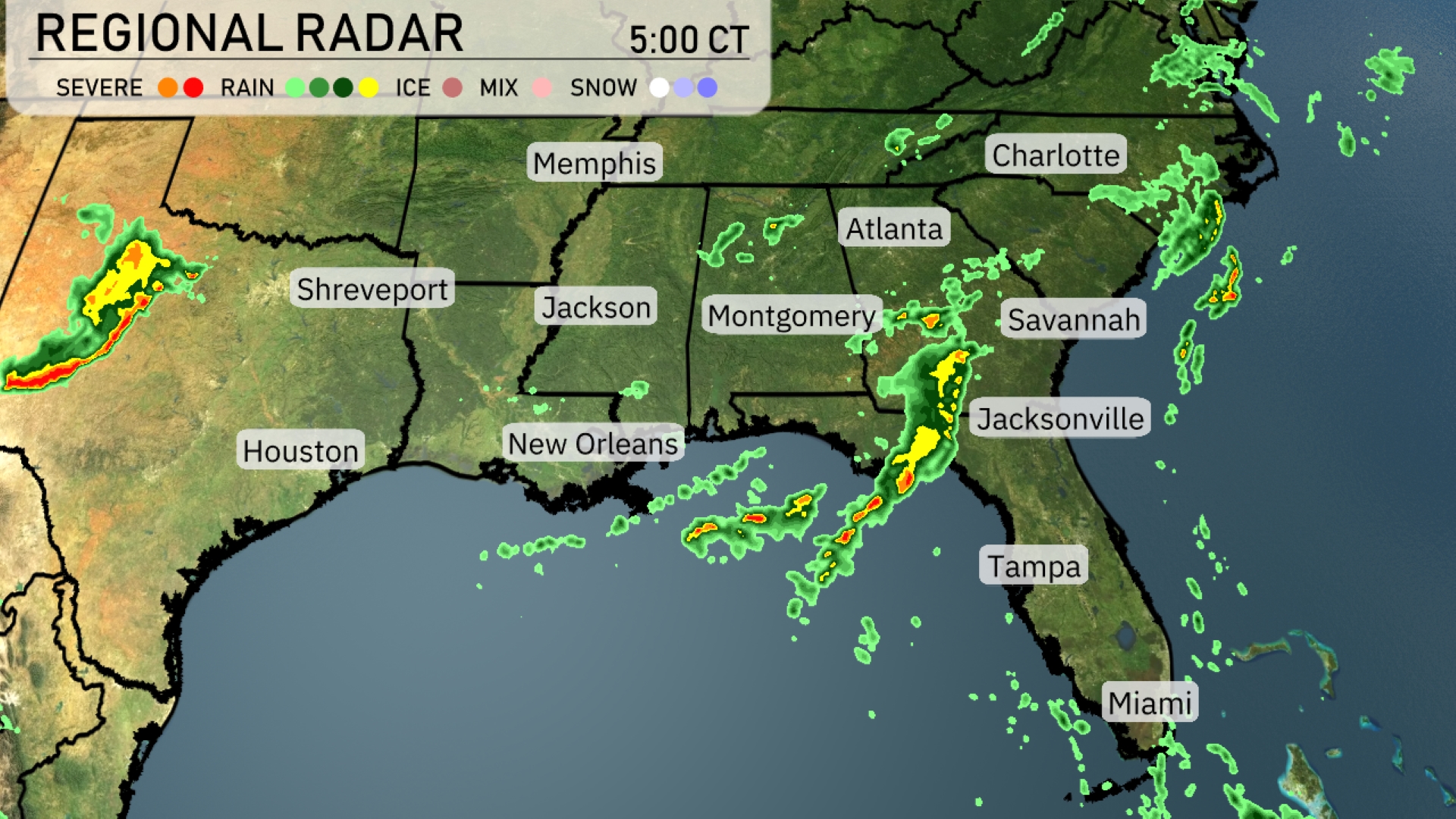
An active weather pattern is evident across the Southeast, with notable downpours advancing eastward. Florida’s panhandle and coastal Georgia are experiencing intense rainfall, with states like Alabama and Mississippi seeing scattered showers. Jacksonville is captured in a stormy grip, as these conditions spread toward Savannah. Drier air is making its presence known over Arkansas and western Tennessee, offering some relief amidst the storm activity.
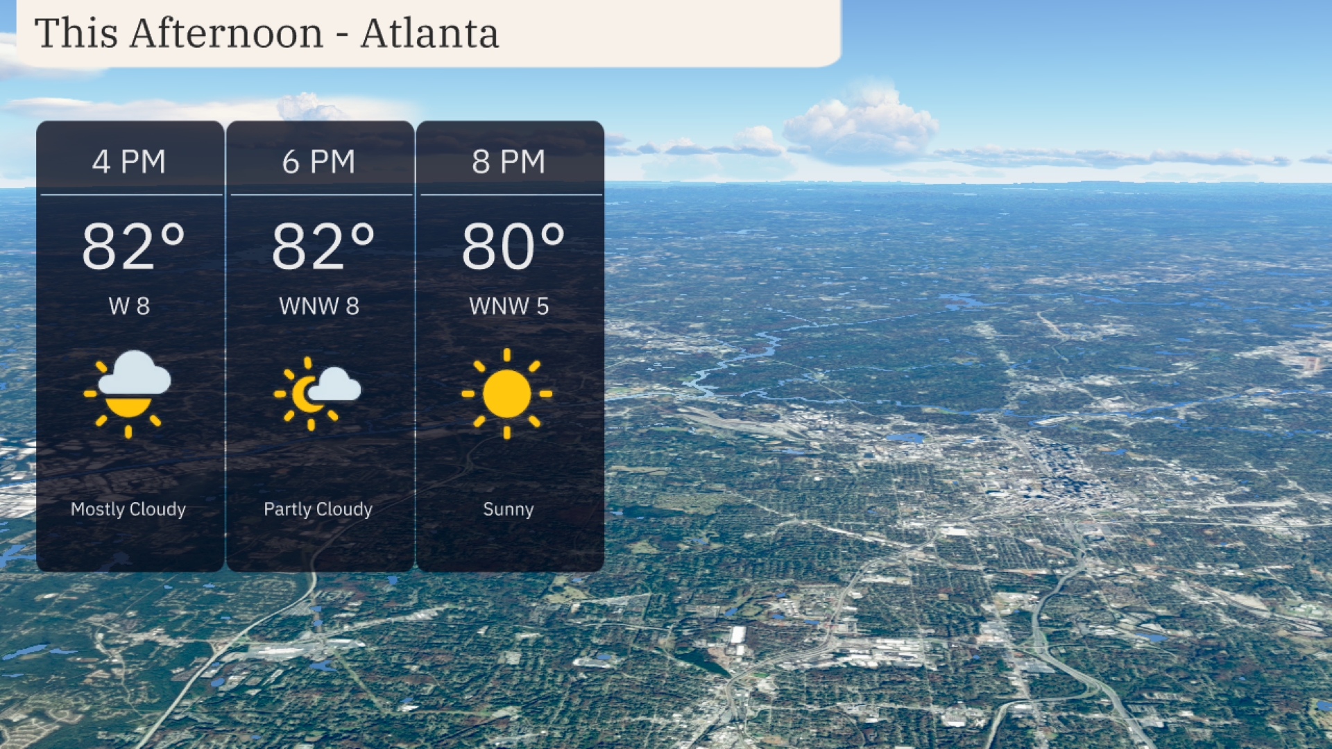
This afternoon in Atlanta, temperatures will remain in the low 80s, hovering around 82 degrees. Winds will be gentle and shift slightly from west to west-northwest at 8 miles per hour. Expect mostly cloudy skies at 4 PM, lightening to partly cloudy by 6 PM. By 8 PM, skies will clear completely, providing a pleasant end to the day.
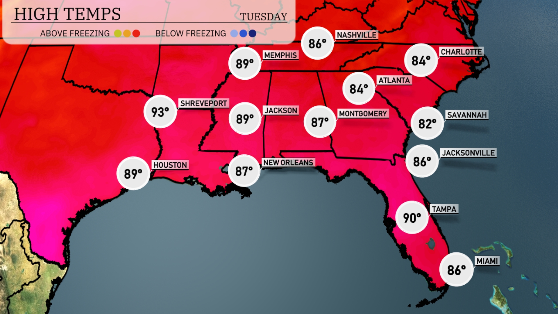
Today’s regional high temperatures in the Southeast are shaping up to be quite warm. In Shreveport, residents can expect a sizzling high of 93 degrees. Houston will register a high of 89, and Jackson will also see a warm day at 89 degrees. Down in New Orleans, the temperature reaches 87, with Florida cities basking in the heat—Tampa will hit 90 degrees while Jacksonville sits at a comfortable 86. Savannah is slightly cooler with a high of 82, making for a pleasant day along the coast.
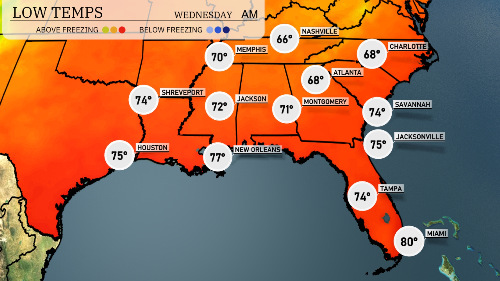
Tonight, Memphis will cool down to 66 degrees. Expect chilly temperatures of 68 in Nashville and 68 in Atlanta as well. Shreveport should experience a low of 74, while Jackson will reach 72. Meanwhile, New Orleans remains warmer with a low of 77.
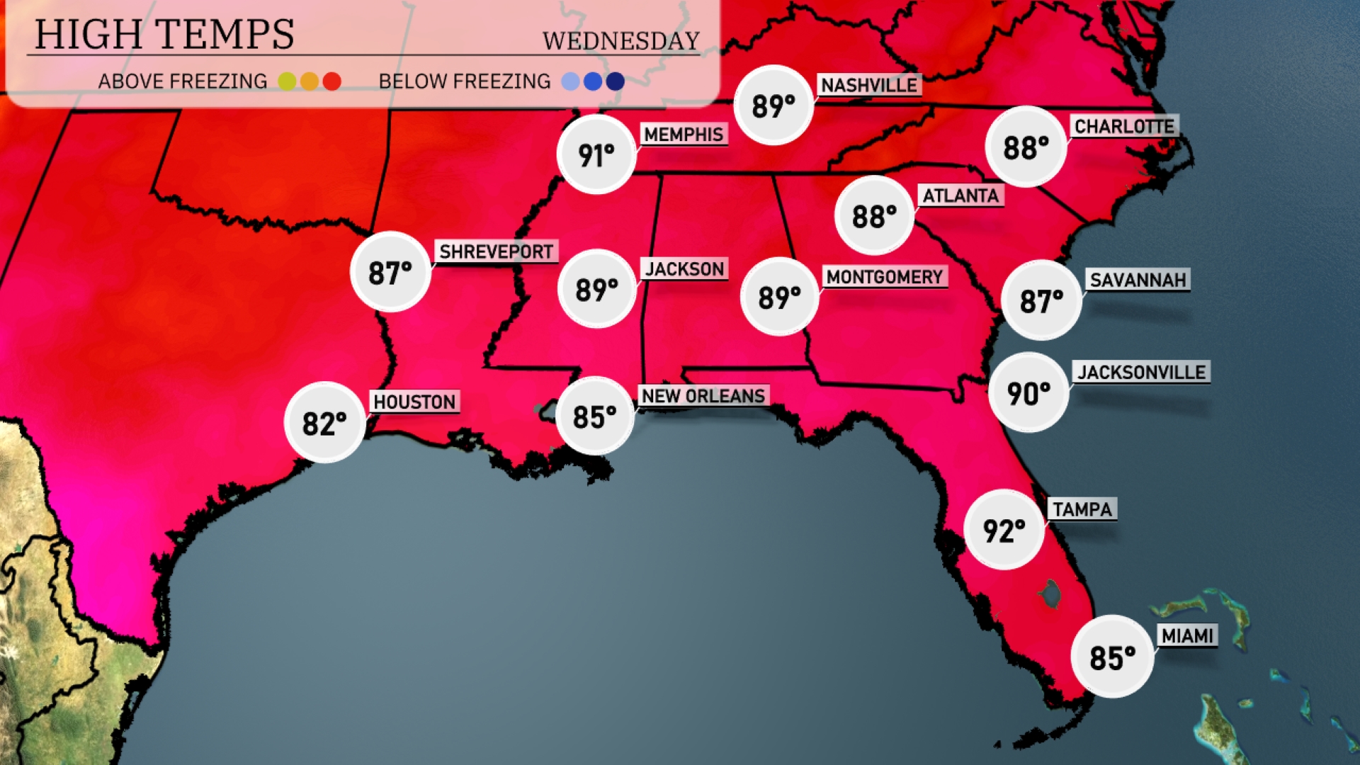
Tomorrow in the Southeast, Jacksonville will heat up to a sweltering 90 degrees. Atlanta is expected to reach a high of 88, while Montgomery also sees a warm 89. New Orleans will enjoy a pleasant 85 degrees, but further inland, Jackson and Memphis will soar to 89 and 91 degrees, respectively.
A dynamic weather pattern is unfolding across the Southeast tomorrow. A cold front moving through the region brings a heightened risk of thunderstorms, particularly from New Orleans to Montgomery, with scattered showers reaching Jacksonville to Savannah by the afternoon. Expect heavy downpours and the possibility of damaging winds during these storms. Temperature trends show a slight cooling post-front, easing by the mid-week. Stay prepared for potential severe weather during this period.
The UV index in Atlanta will be very high on Tuesday with a value of 9, indicating a burn time of about 15 minutes in direct sunlight. For Wednesday, the UV index rises to 10, with a quicker burn time of 12 minutes.