Weather Whirl: Partly Clouds and Starry Nights Across the Southwest
By
Amy Freeze
Explore the changing skies over the Southwest, with a special spotlight on Salt Lake City's evening forecast and surprising temperature variations.
This evening in Salt Lake City, anticipate partly cloudy conditions with some cooling forecasts across the Southwest. Explore the varying temperature trends from the California coastline to Nevada’s desert highs.
Tonight’s update zooms into the Southwest, highlighting the weather patterns impacting Salt Lake City. We take a broad look at regional conditions, from clear skies in some locales to unexpected evening chills in others. Stay tuned for day-to-day forecasts and tips on how to manage the fluctuating weather.
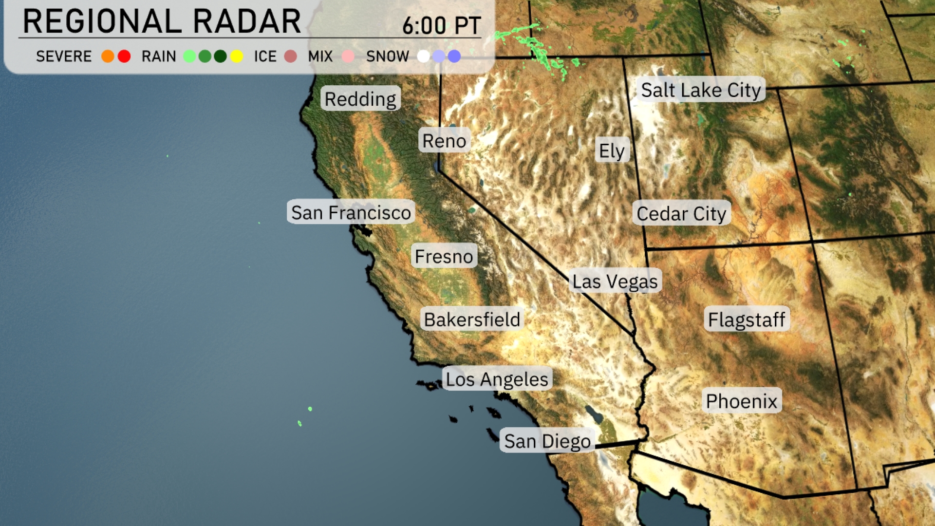
In the Southwest, clear conditions dominate much of the region, but there’s a pocket of precipitation entering the Reno and Ely areas, with rain showers expected. The California coastline from San Francisco to Los Angeles is experiencing dry weather. In Flagstaff, expect clear skies with calm conditions. Las Vegas and Phoenix continue to enjoy clear weather as high pressure maintains its sunny influence.
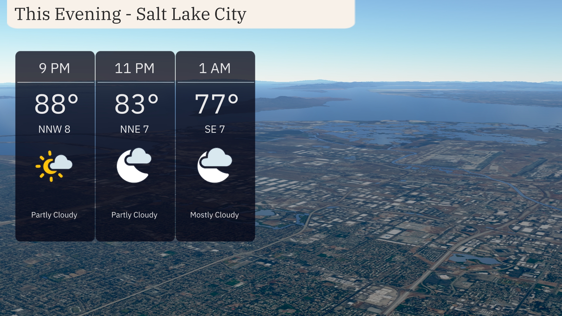
For this evening in Salt Lake City, partly cloudy skies will prevail initially, transitioning to mostly cloudy by early morning. Temperatures will dip from 88 degrees at 9 PM to 77 degrees by 1 AM. Winds will be gentle, shifting from the northwest to southeast at around 7 to 8 miles per hour.
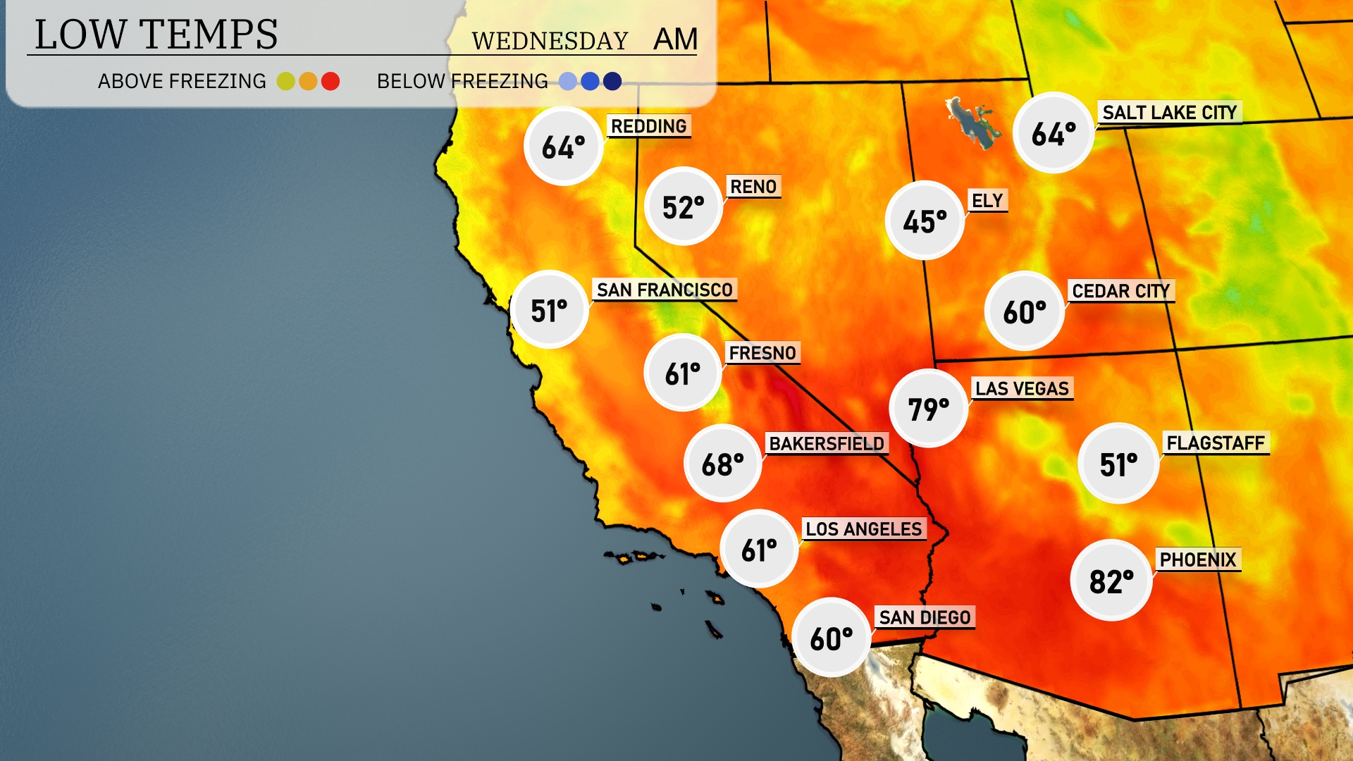
Tonight, Los Angeles will dip to 61 degrees, while San Diego cools to 60. Bakersfield is expected to see a low of 68 degrees. In contrast, Flagstaff is looking at a much chillier 51 degrees, and Ely is forecasted to drop to 45 degrees.
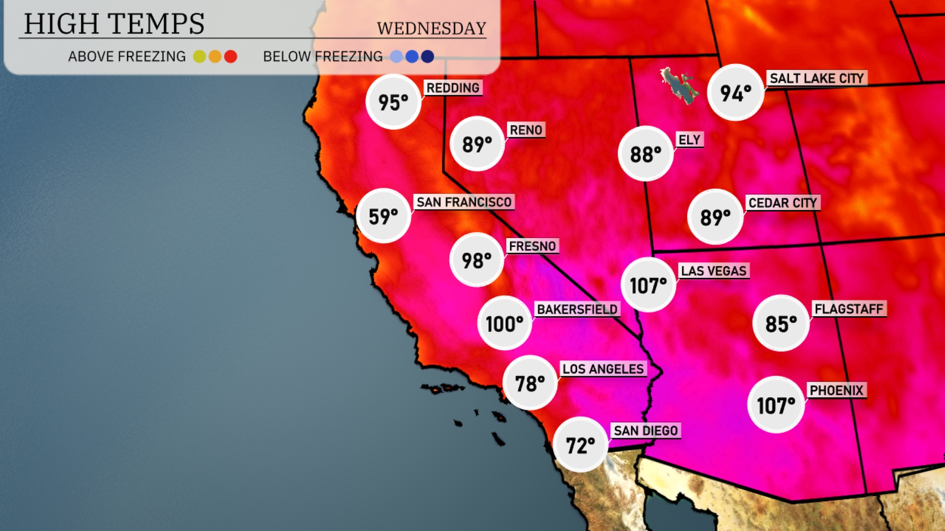
Tomorrow in the Southwest, Phoenix will experience a scorching high of 107 degrees, while Las Vegas matches that intensity with an afternoon high of 107 as well. Bakersfield is set to reach 100 degrees, signaling a notable heatwave trend across California. Further north, Fresno will see a high of 98 degrees, slightly below average for this time of year. San Francisco remains cooler at just 59 degrees due to coastal influences, contrasting sharply with the inland temps.
A warm and dry pattern persists across the Southwest tomorrow, with ample sunshine across Arizona and New Mexico maintaining highs in the upper 80s to low 90s. Watch for gusty winds in the afternoon along the mountain ranges, posing an elevated fire risk. San Diego and Los Angeles will see cooler conditions in the mid-70s with fog lingering along coastal areas through the morning.
Salt Lake City’s UV index is expected to be very high on Tuesday, reaching a peak of 9, with sunburn possible in about 15 minutes—take precautions such as sunscreen and shade. By Wednesday, it will slightly decrease to 8, offering a burn time of around 17 minutes in direct sunlight.
For the 7-day forecast in Salt Lake City:
Tuesday: Partly cloudy skies with a high of 91 degrees and a low of 66 degrees.
Wednesday: Mostly clear with a high of 92 degrees and a low of 62 degrees.
Thursday: Partly cloudy again, peaking at 90 degrees with a low of 64 degrees.
Friday: Clear skies with the temperature reaching 93 degrees during the day and 65 degrees at night.
Saturday: More sunshine, bringing the highs up to 95 degrees and lows settling around 65 degrees.
Sunday: Partly cloudy conditions with a daytime high of 94 degrees and a low of 63 degrees.
Monday: Cooling slightly with partly cloudy skies, a high of 89 degrees, and a low of 59 degrees.