Miami’s Mixed Bag: Sun, Clouds, and Incoming Storms – Your Weekly Weather Forecast
By
Amy Freeze
This week in Miami, experience a rollercoaster of weather phenomena, from soothing sun to looming storms. Get all your updates here!
As Miami greets a new week, expect fluctuating conditions from sun to showers. Stay updated on the latest changes in your local forecast at https://amyfreeze.ai/
Welcome to your detailed guide to Miami’s weather for the upcoming week. Tuesday starts with mostly cloudy skies and an extreme UV index, so don’t forget your sunscreen. As we progress through the week, a cold front will introduce thunderstorms and possible cool offs. Wrap up the week with partly cloudy skies and enjoyable temperatures. For a complete day-by-day forecast, visit our full blog at https://amyfreeze.ai/
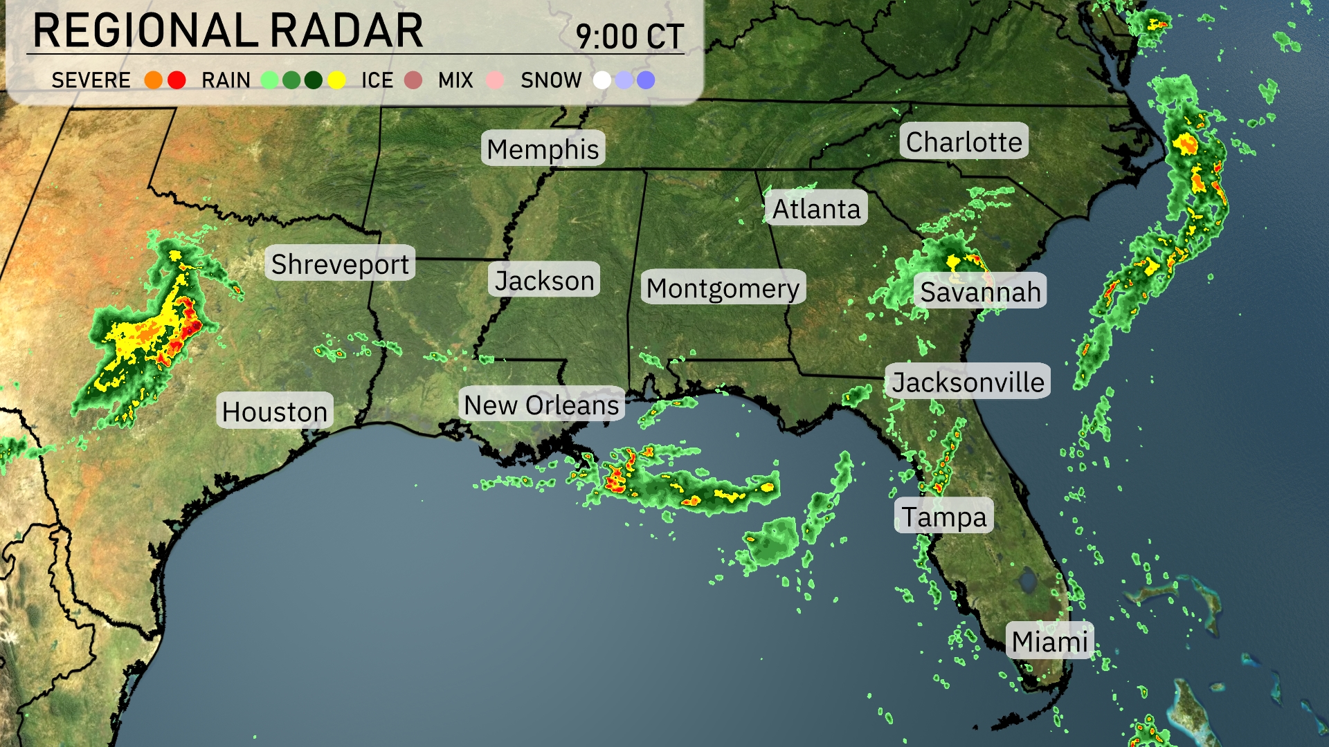
On the Regional Radar, we’re seeing a strong line of storms progressing eastward, impacting areas from New Orleans to the Florida Panhandle with heavy showers. Atlanta is experiencing increasing cloud cover ahead of approaching storms. Scattered showers are also affecting Savannah, while Charlotte is currently remaining dry with clouds building. Jacksonville is getting some rain, and areas along the East Coast are seeing showers moving offshore.
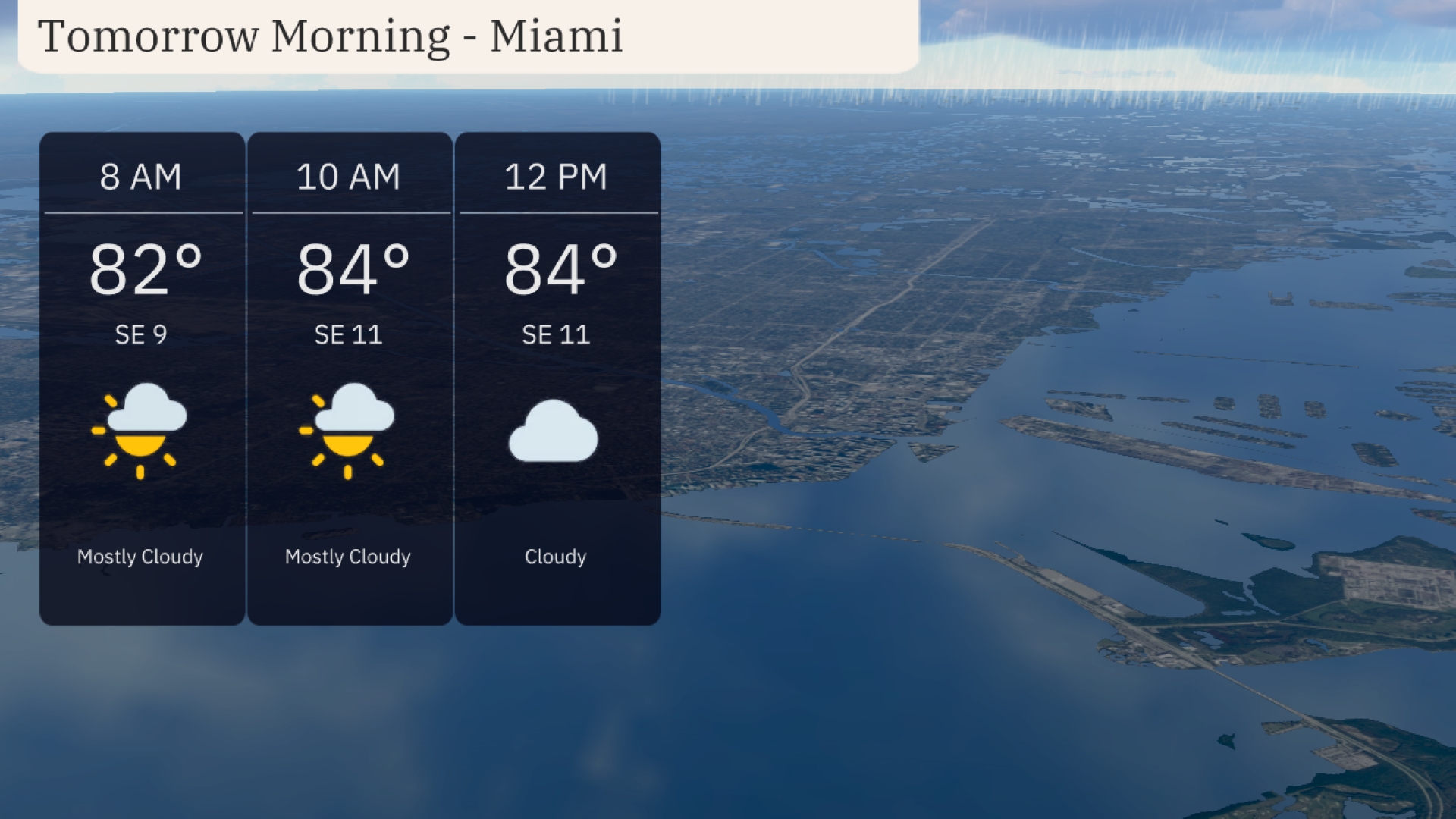
In Miami tomorrow morning, temperatures start at 82 degrees at 8 AM, climbing to 84 degrees by 10 AM and holding steady through noon. Expect a mostly cloudy sky transitioning to overcast by midday. A light southeast breeze is forecasted, with winds reaching 11 miles per hour.
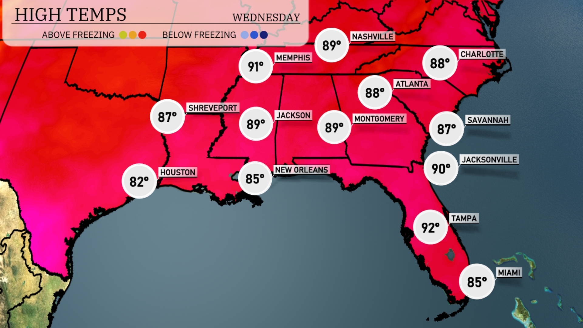
Tomorrow in Jackson, expect a high of 89 degrees, while Memphis will be slightly warmer at 91. Montgomery will also see a high of 89, as well as Nashville. The heat continues in Atlanta with temperatures reaching 88 degrees, and Jacksonville is forecasted to hit 90 degrees. The region is experiencing above-average temperatures influenced by a strong high-pressure system.
A cold front is advancing towards the Southeast, bringing a band of thunderstorms from Houston to New Orleans as early as Tuesday night. Heavy rain is expected to impact areas from Shreveport to Montgomery, with localized flooding possible. By Wednesday morning, Atlanta will experience rain showers, potentially affecting the commute. Thunderstorms extend from Jacksonville up to Savannah, with gusty winds and intense downpours in some spots. Temperatures will drop slightly after the front passes, providing cooler and more comfortable air.
Tuesday’s UV index in Miami is extreme at 11, with a burn time of just 11 minutes in direct sunlight, so make sure to have that sunscreen ready! Come Wednesday, the UV index will remain very high at 8, and burn time increases slightly to 17 minutes.
Tuesday: Mostly cloudy skies with highs of 85 degrees and lows dipping to 80 degrees.
Wednesday: Expect showers late with daytime highs reaching 85 degrees and lows around 79 degrees.
Thursday: Partly cloudy conditions with a high of 86 degrees and lows near 81 degrees.
Friday: Partly cloudy again, with temperatures peaking at 87 degrees and a low of 80 degrees overnight.
Saturday: Partly cloudy skies continue with a daytime high of 87 degrees and a low around 80 degrees.
Sunday: Enjoy mostly clear weather with highs of 87 degrees and nighttime lows at 80 degrees.
Monday: Partly cloudy to start the week, with temperatures remaining steady at a high of 87 degrees and lows of 80 degrees.