Chicago Braces for Severe Weather: Your Comprehensive Forecast
By
Amy Freeze
Severe storms, temperature swings, and rain showers: unpack the latest forecast for Chicago and the broader Midwest region with an expert analysis.
Chicago is on high alert as severe weather targets the Midwest. Discover the latest updates on temperatures, storm pathways, and safety measures in our latest blog post.
As a line of severe storms approaches, Chicago is gearing up for a mix of cloudy skies and potential severe weather conditions. This detailed post covers the forecast for the Midwest, including temperature highs and lows, storm predictions, and practical tips for staying safe during turbulent weather. From winds and rainfall to temperature fluctuations and UV indexes, get all the information you need to be prepared.
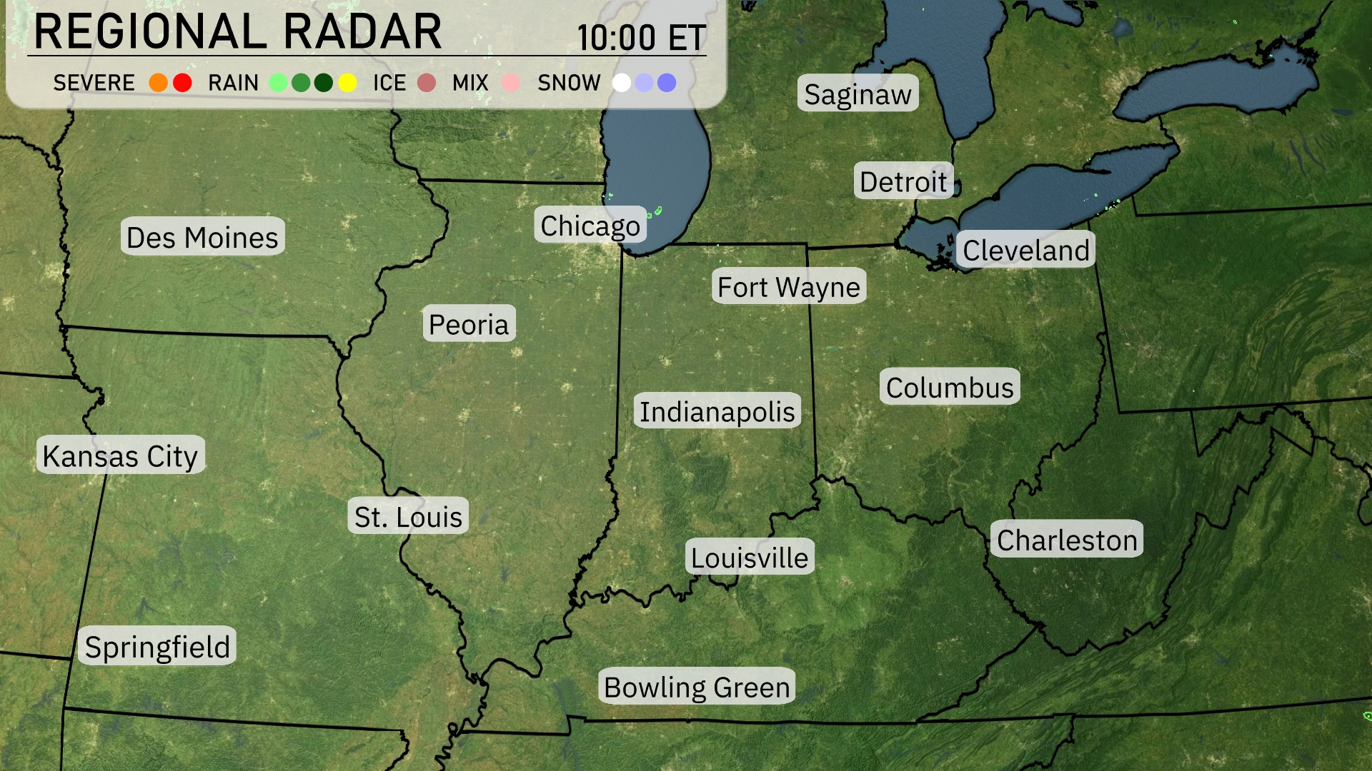
A line of severe storms is making its way across the Midwest, currently targeting Chicago with intense rainfall and potentially severe weather conditions. This storm line stretches down towards Indianapolis, prompting a watchful eye on the skies. Farther east, rain showers extend towards Columbus, keeping things damp and cloudy. St. Louis and Kansas City, meanwhile, enjoy a bit of a break under clearer skies.
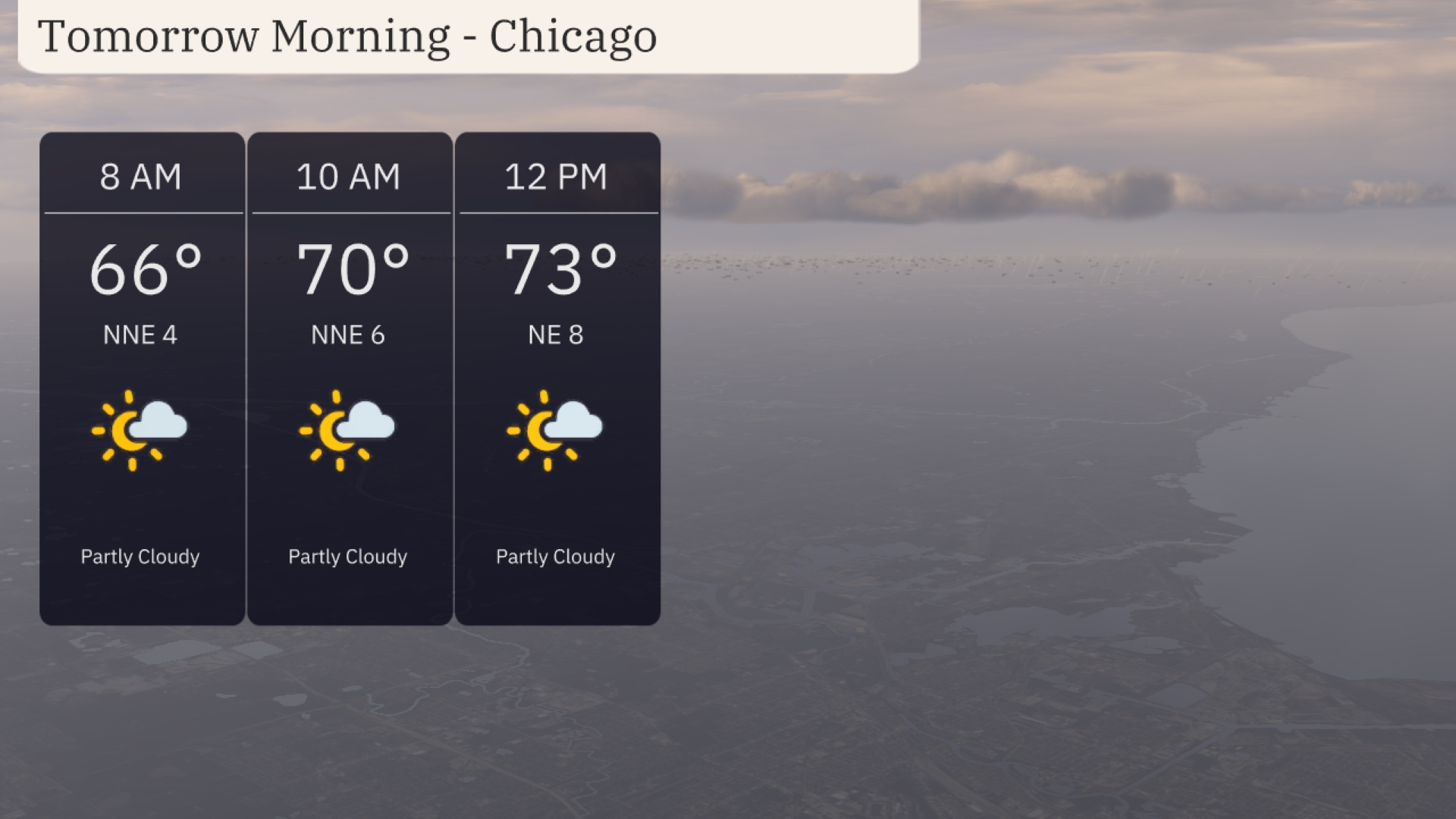
Tomorrow morning in Chicago begins with partly cloudy skies. Expect temperatures starting at 66 degrees at 8 AM, warming to 70 degrees by 10 AM. Winds will be from the north-northeast, ranging from 4 to 6 mph, providing a gentle breeze.
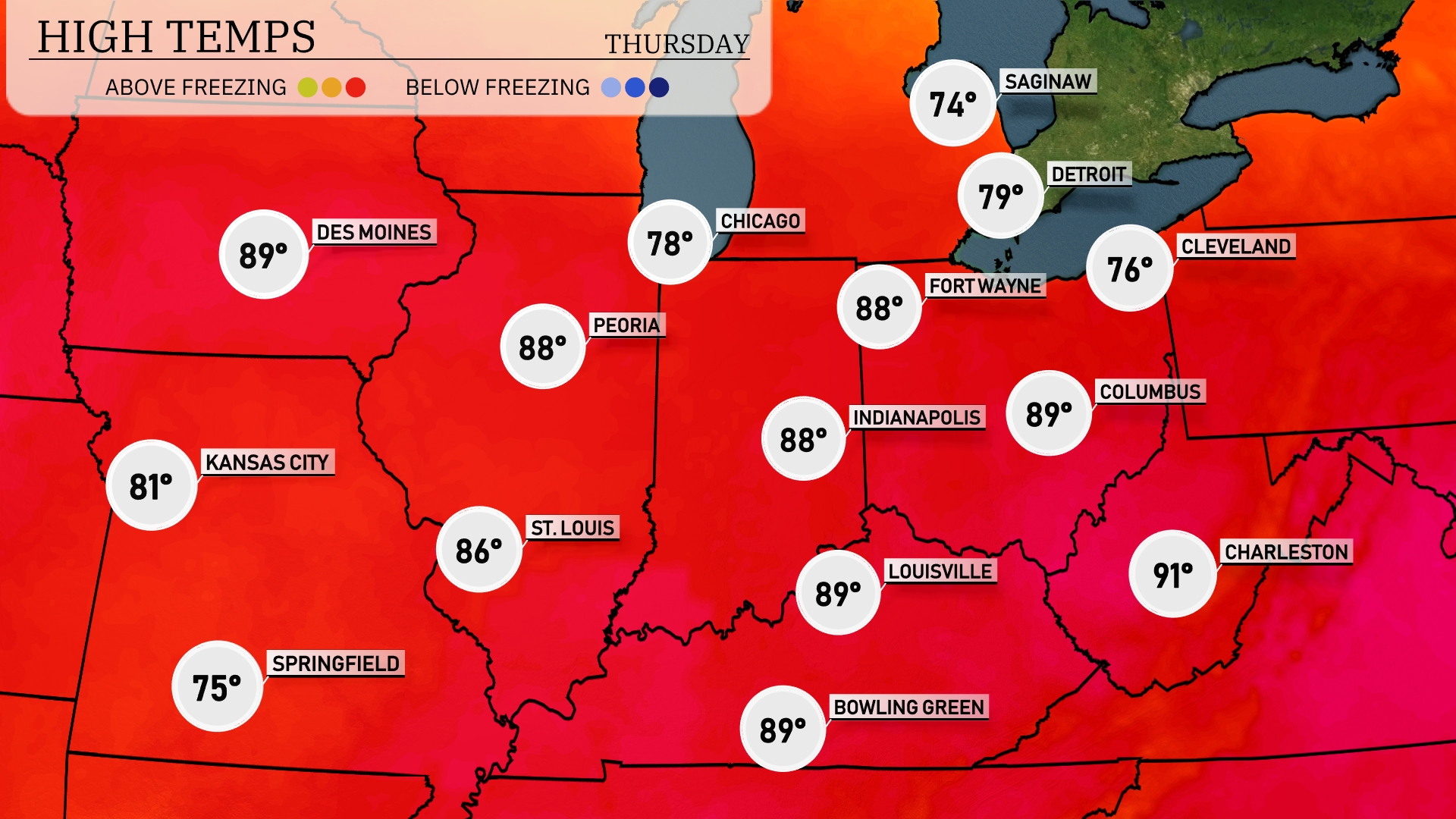
Tomorrow in the Midwest, high temperatures are poised to soar, with Indianapolis reaching 88 degrees and nearby Louisville hitting a warm 89. St. Louis will also see a high of 86 degrees, while Peoria and Bowling Green are expected to hit 88 degrees. Kansas City will enjoy a pleasant 81 degrees, and Des Moines is set for a warm 89. Overall, temperatures are significantly above average, influenced by a strong ridge of high pressure bringing warm air into the region.
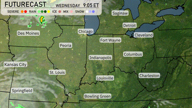
A low-pressure system is moving through the Midwest tomorrow, bringing the potential for severe thunderstorms, especially across areas from Des Moines to Chicago. Expect heavy rain, strong winds, and the possibility of isolated tornadoes mainly in the afternoon and evening hours. Temperature swings are likely, with cooler air arriving behind the front, dropping nighttime lows significantly across Fort Wayne and Indianapolis. Over 1 to 2 inches of rain could lead to localized flooding in urban areas such as St. Louis and Cleveland.
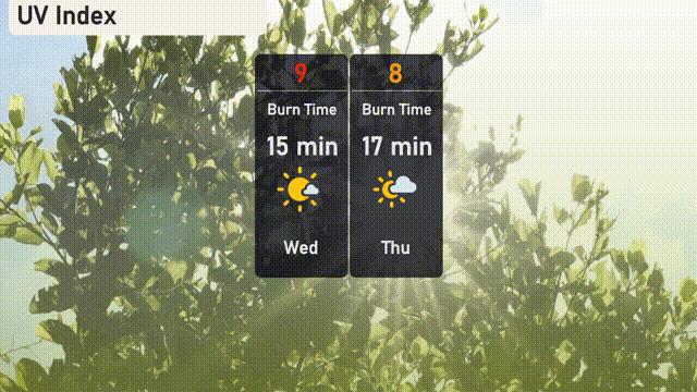
The UV index in Chicago is high today, reaching 9, with a burn time of about 15 minutes under direct sunlight. For Thursday, the UV index slightly decreases to 8, with a burn time of around 17 minutes.
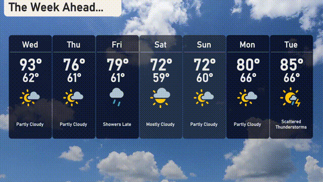
Wednesday: Partly cloudy with a high of 93 degrees and a low of 62 degrees.
Thursday: Expect partly cloudy skies and cooling temperatures, reaching a high of 76 degrees with a low of 61 degrees.
Friday: Showers expected late in the day with a high of 79 degrees and a low of 61 degrees.
Saturday: Mostly cloudy with the temperature peaking at 72 degrees during the day and dropping to 59 degrees at night.
Sunday: Skies turning partly cloudy with a high of 72 degrees and a low of 60 degrees.
Monday: Warmer, partly cloudy, with highs around 80 degrees and lows near 66 degrees.
Tuesday: Scattered thunderstorms are likely, with a high of 85 degrees and a low of 66 degrees.