Sizzling Southeast: Atlanta’s Week in Weather Forecast
By
Amy Freeze
From warm mornings to thunderstorm warnings, navigate through Atlanta's variable weather with our comprehensive guide.
Stay updated with the latest weather trends in Atlanta! Expect rising temperatures and possible severe weather events, including thunderstorms and high UV index warnings.
As Atlanta welcomes another week, residents should prepare for fluctuating weather conditions. Expect warm mornings followed by rising temperatures and potential severe weather. Thunderstorms may develop, bringing heavy rain and gusty winds. Safety should be a priority—stay informed about local forecasts, adhere to severe weather advisories, and protect against high UV exposure. For an in-depth daily breakdown, visit our blog at https://amyfreeze.ai/
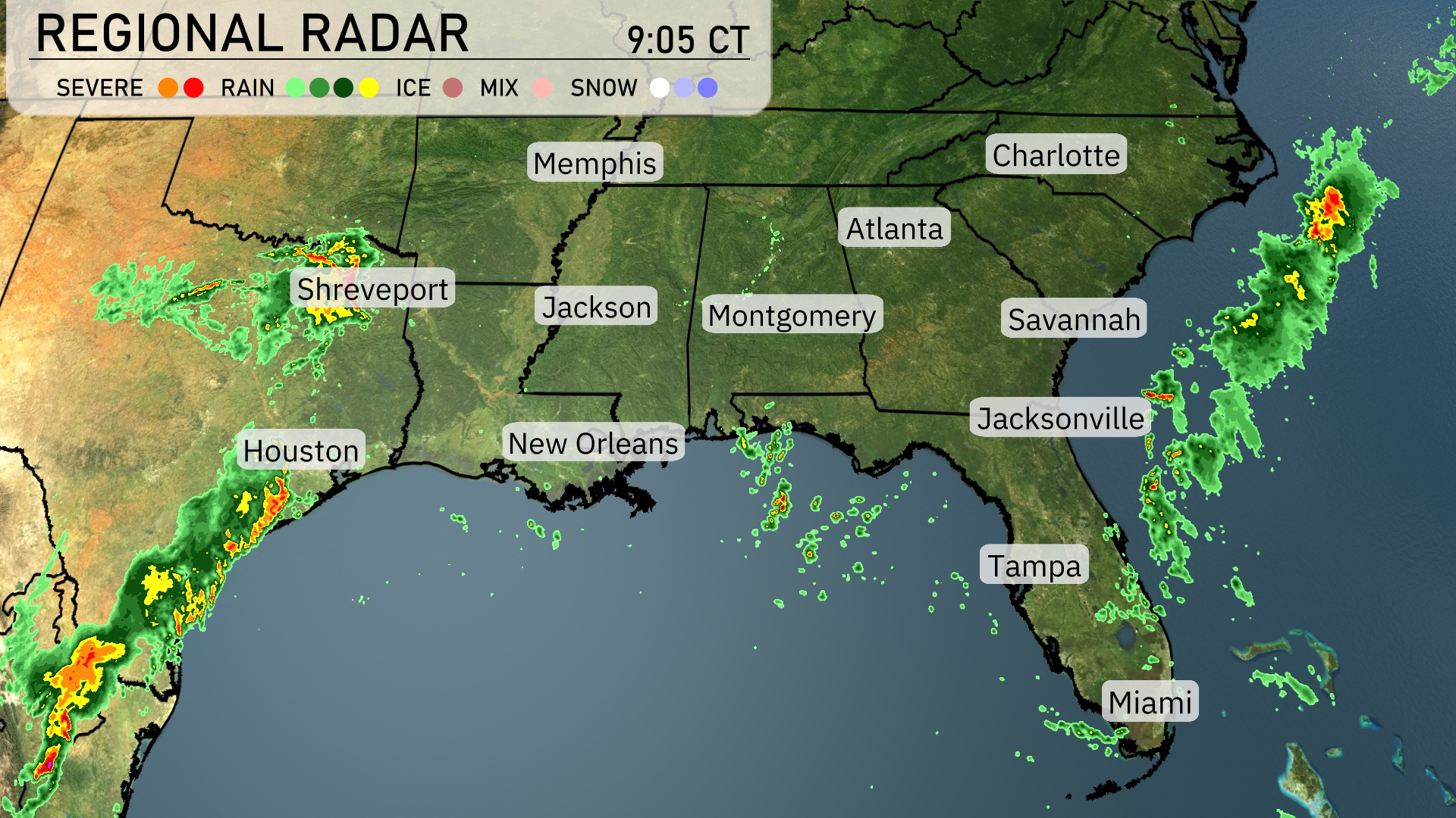
A line of active storms stretches from Houston to northern Louisiana, bringing heavy rain and potential severe weather. The radar indicates showers extending westward from New Orleans towards Alabama. In the Carolinas, cloud cover is building, with rain skirting the coast and approaching Charlotte. Elsewhere, much of Georgia and northern Florida are experiencing clear skies, making it ideal for outdoor activities today.
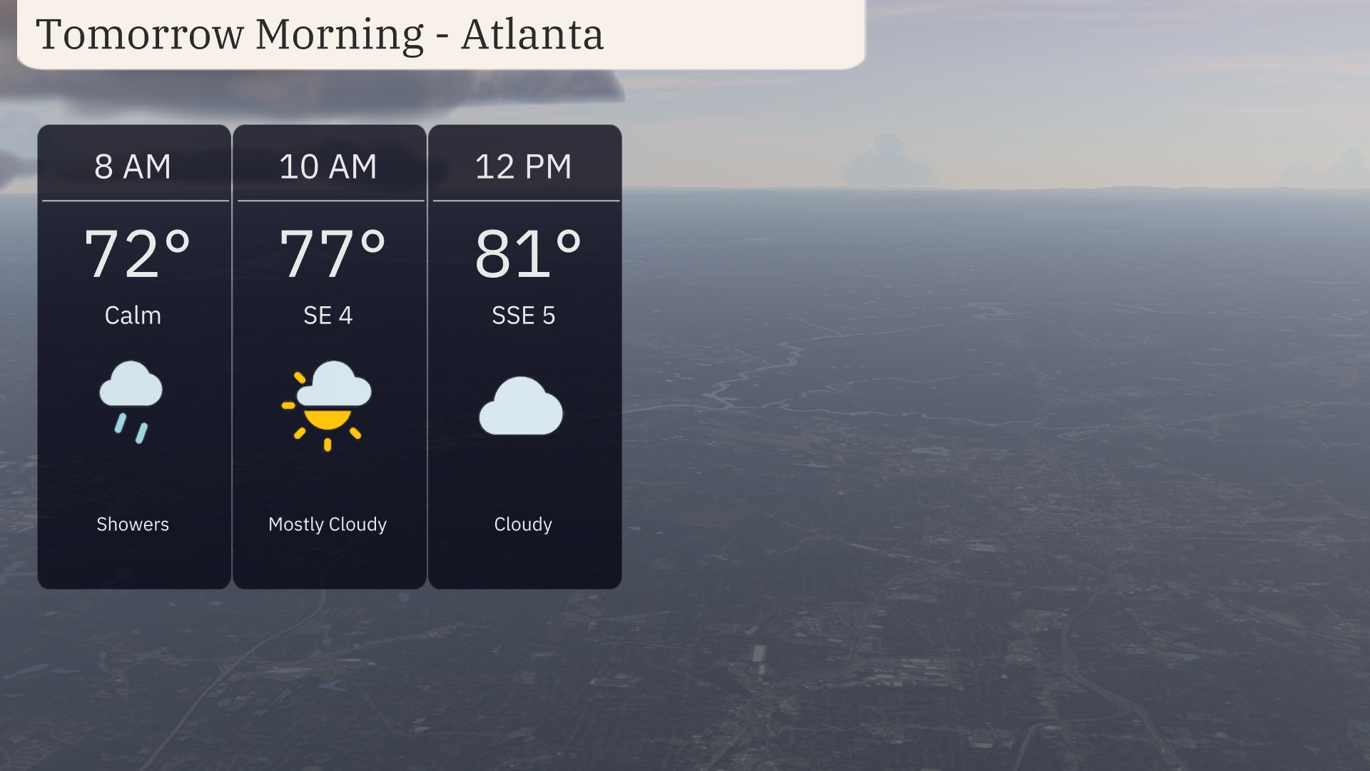
Morning in Atlanta starts at a warm 72 degrees with early showers at 8 a.m. Expect mostly cloudy skies by 10 a.m., as temperatures climb to 77 degrees with a southeast wind at 4 miles per hour. By midday, temperatures rise further to 81 degrees under cloudy skies, with the wind shifting slightly south at about 5 miles per hour.
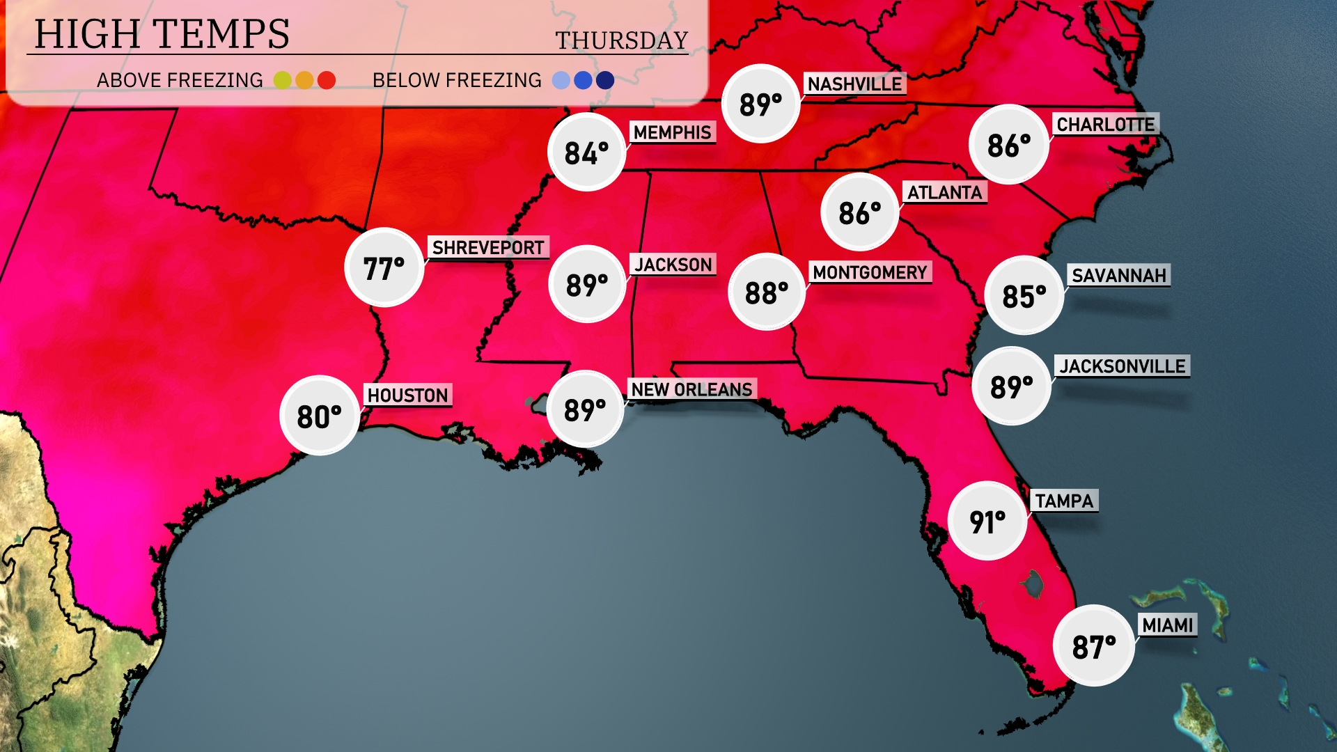
Tomorrow in Atlanta, expect a high of 86 degrees. Charlotte will see slightly cooler conditions with a high of 86 as well. Jacksonville is heating up to 89, while Tampa is even warmer at 91 degrees. Across the Gulf Coast, New Orleans and Jackson will both hit 89 degrees. It’s shaping up to be a warm day across the Southeast, with many areas experiencing above-average temperatures fueled by a persistent high-pressure system in the region.
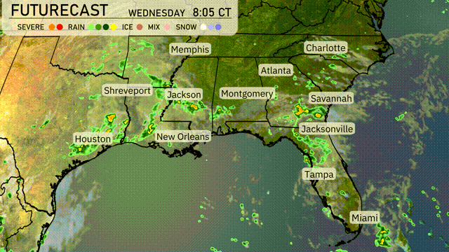
A wave of showers and thunderstorms will push across the Southeast tomorrow, bringing periods of heavy rain and occasional gusty winds. By early morning, the system will approach the Gulf Coast, impacting cities from New Orleans through Tallahassee with potential for localized flooding. During the day, areas like Montgomery and Atlanta should brace for scattered storms, some possibly severe with strong winds and isolated tornado warnings. Cooler air follows the frontal boundary, dropping temperatures slightly into the weekend. The East Coast from Jacksonville up to Savannah will also see rain as the system advances northeastward.
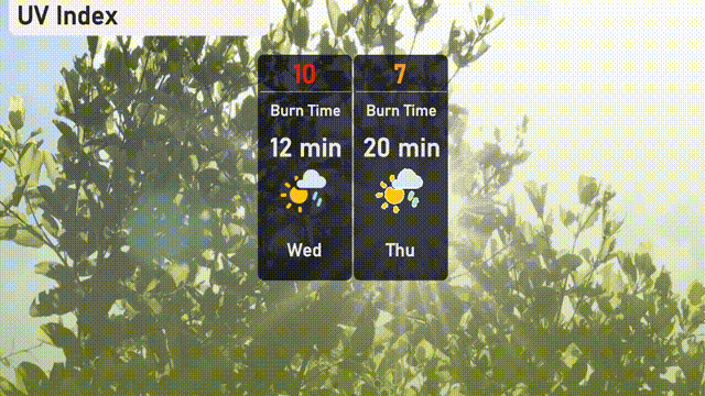
The UV index in Atlanta is extremely high on Wednesday at 10, with a rapid burn time of just 12 minutes in direct sunlight. Protect yourself with sunscreen and seek shade during peak hours! By Thursday, the index lowers to a still high value of 7, with a burn time of about 20 minutes—cover up and stay skin safe!
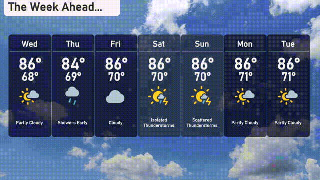
Wednesday: Partly cloudy skies lead the day with temperatures rising to 86 degrees and dipping to 68 degrees at night.
Thursday: Showers move in early, with a high of 84 degrees and a low of 69 degrees.
Friday: The sky stays mostly cloudy with the temperature peaking at 86 degrees and a low of 70 degrees for the evening.
Saturday: Look out for isolated thunderstorms. The day will still feel warm with a high of 86 degrees and a low of 70 degrees.
Sunday: Scattered thunderstorms are expected, with the temperature maintaining a high of 86 degrees during the day and dropping to 70 degrees at night.
Monday: The clouds partly clear with a high reaching 86 degrees and a mild low of 71 degrees.
Tuesday: Another partly cloudy day with temperatures maxing out at 86 degrees and the low at 71 degrees.