From sunny breaks to stormy skies, Atlanta and the Southeast are in for a weather-packed week. Get all the latest updates on temperatures, storm movements, and what to expect in your area.
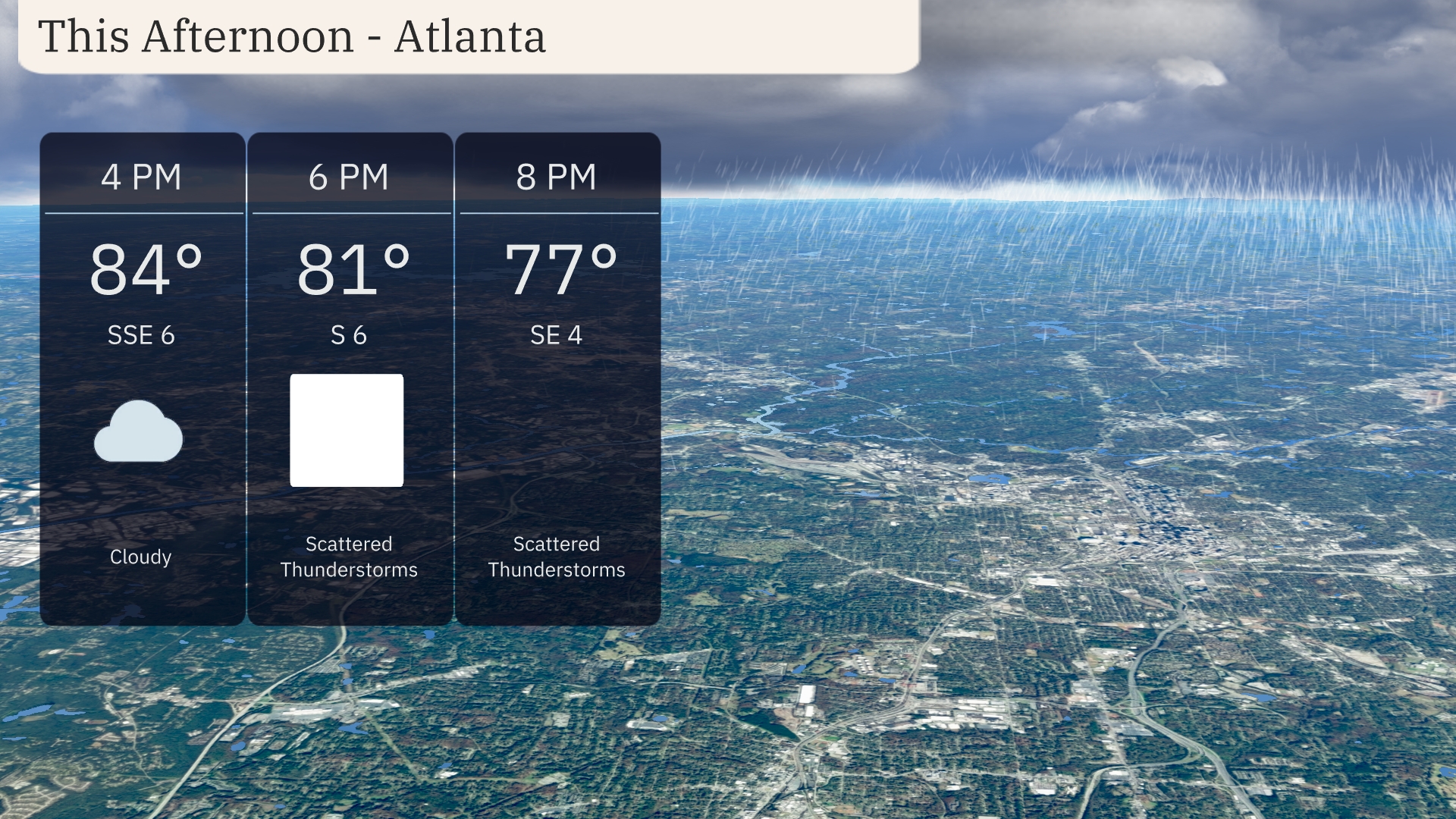
This afternoon in Atlanta, brace for a peak at 84°F, but don’t put your umbrellas away just yet! Thunderstorms are on the horizon, moving rapidly across the region.
Explore the dynamic weather pattern overtaking the Southeast, from Atlanta’s modest highs to the tumultuous showers in Houston. With thorough temperature analyses and storm tracking, this post provides everything you need to prepare for the week’s weather swings. Learn about the potential for flash flooding and how cooler, drier air will soon follow the stormy surge.
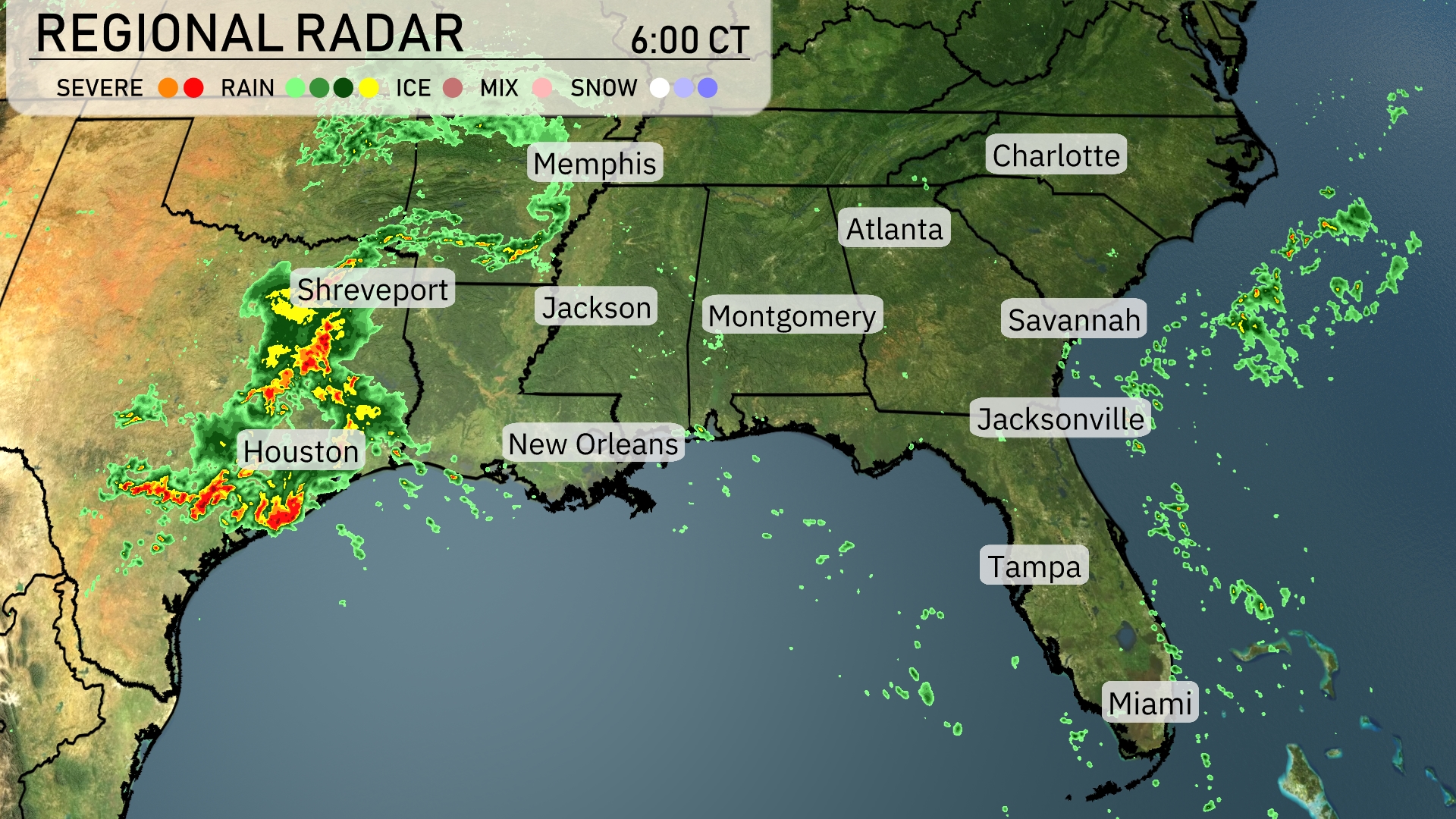
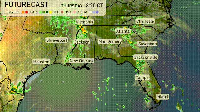
A cluster of severe thunderstorms is impacting the area around Houston, moving northeast toward Shreveport. Rain extends from New Orleans up to Jackson, Mississippi, where it’s set to intensify. Light rain showers are scattered along the Gulf Coast from Mobile to the Florida Panhandle. The rest of the Southeast, including Memphis, Atlanta, and Florida, remains mostly clear with increasing cloudiness expected later today.
This afternoon in Atlanta, temperatures will peak at 84 degrees with southeast winds at 6 mph, bringing cloudy skies. By 6 PM, anticipate a slight dip to 81 degrees accompanied by scattered thunderstorms and winds turning south at the same speed. Thunderstorms continue into the evening with temperatures reaching 77 degrees and a gentle southeast breeze at 4 mph.
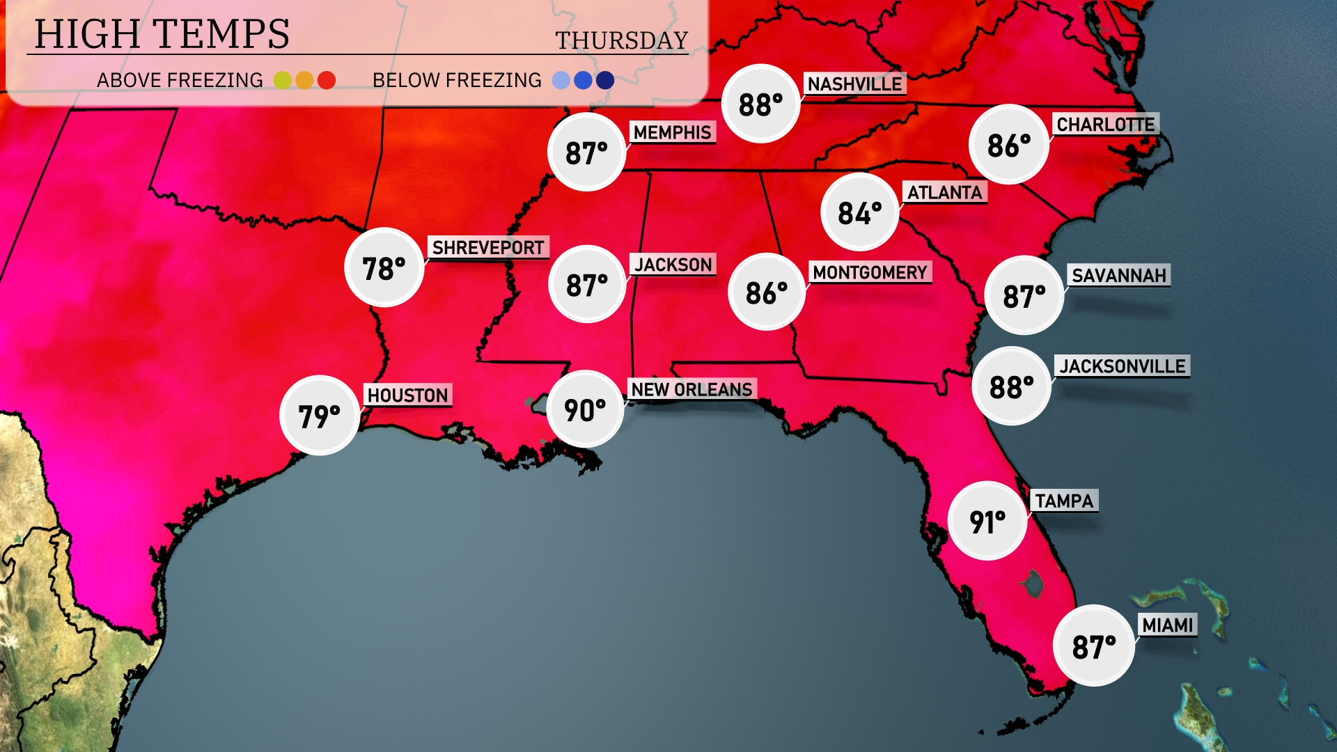
Today’s high temperatures in the Southeast show some interesting variations. In New Orleans, we’re reaching a warm 90 degrees, while nearby, Jackson will see highs around 87. Atlanta is forecasted for a pleasant 84 degrees, making for a nice day in the region. Over in Florida, Tampa is hot on the heels of New Orleans, hitting 91, while Jacksonville reports a slightly cooler 88.
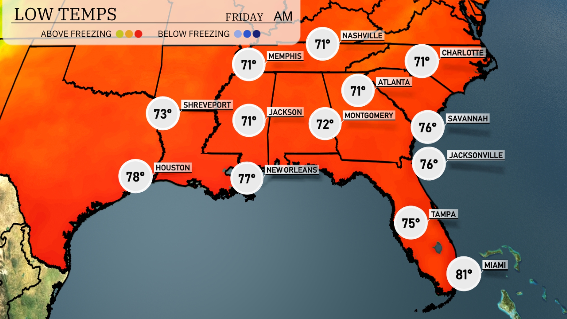
Tonight, temperatures will dip to 71 degrees in Memphis and Nashville. Jackson is expected to cool down to 71 degrees, while Montgomery will have a low of 72. Atlanta will match Nashville and Memphis at 71 degrees. New Orleans will stay a bit warmer at 77 degrees, while Tampa holds steady at 75.
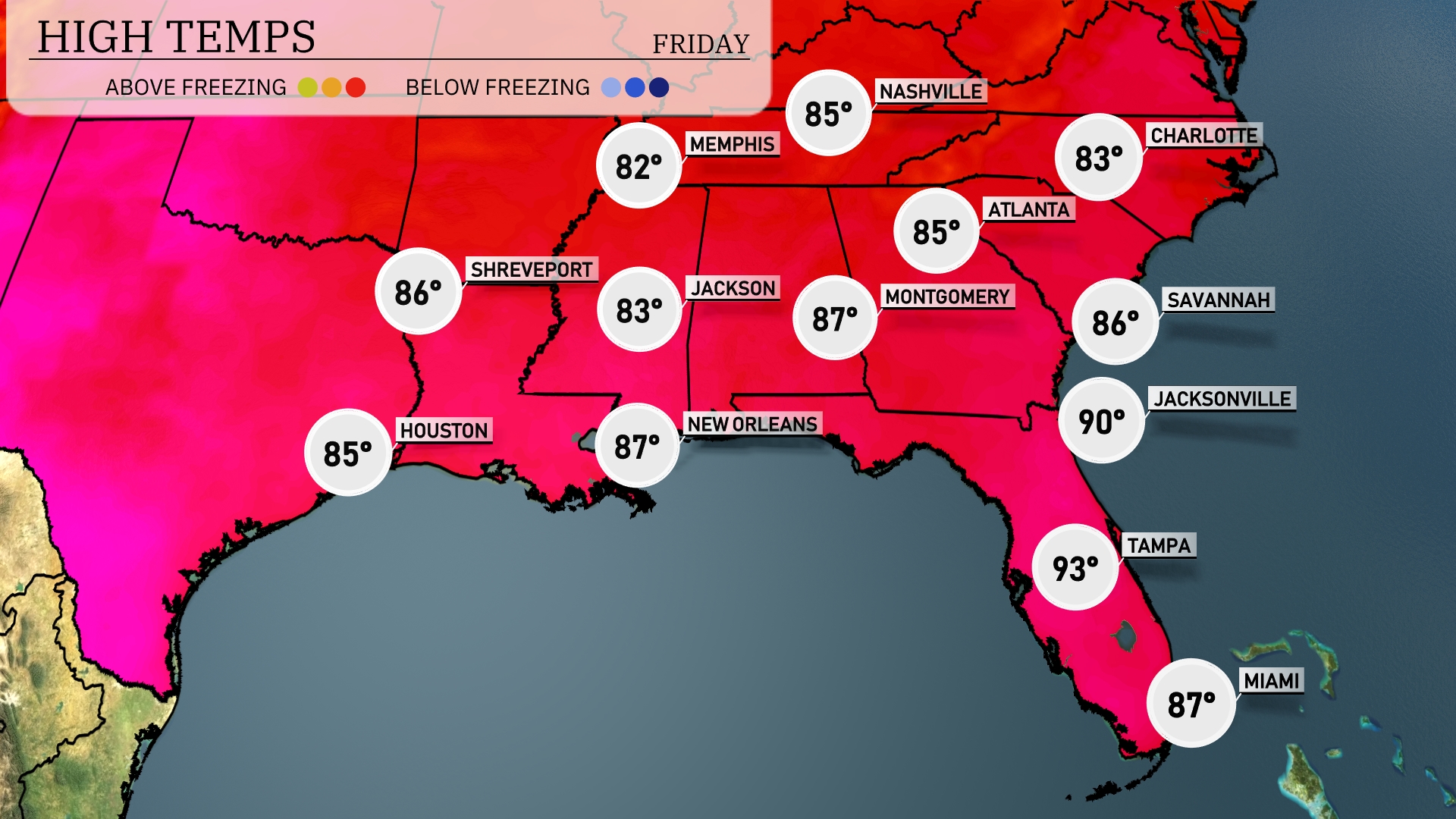
Tomorrow, Nashville will see a high of 85 degrees, while Atlanta also reaches 85. Memphis is set to warm up to 82 degrees, with Jackson hitting a high of 83. In the Florida panhandle, temperatures soar with Tampa expected to reach 93 degrees and Jacksonville close behind at 90.
A line of showers and storms is expected to advance through the Southeast, impacting areas from Shreveport to Memphis by tomorrow. The cold front will push eastward, bringing potential thunderstorms to Jackson and Montgomery during the afternoon hours. Heavy rain is forecasted from Atlanta to Jacksonville, with chances of flash flooding due to intense downpours. Behind the front, cooler and drier air will set in, calming the conditions overnight.
The UV index in Atlanta will be moderately high on Thursday, reaching a level of 6 with a burn time of about 23 minutes. On Friday, the UV index increases to 7, shortening the burn time to 20 minutes.