Navigating the Skies: Your Southeast Weather Guide for a Stormy Week Ahead
By
Amy Freeze
As Miami enjoys partly cloudy skies, areas from Houston to Jacksonville brace for stormy weather. Get all the details in your essential guide to this week's weather across the Southeast.
This week, Miami revels under partly cloudy skies while surrounding regions prepare for storms. With varying temperatures and potential severe weather alerts, stay updated with our detailed forecast.
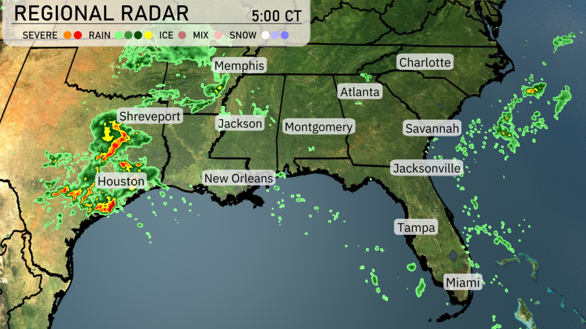
In Miami, expect partly cloudy comfort amid temperatures in the mid-80s. Meanwhile, storm conditions intensify around Houston, extending to Shreveport, with severe weather warnings. New Orleans and other parts witness lighter showers, contrasting with clear skies in places like Atlanta. With an uptick in humidity, the Southeast braces for scattered thunderstorms, hinting at gusty winds and potential flooding. Tune into our extended coverage for daily updates and safety tips, ensuring you’re well-prepared for the week.
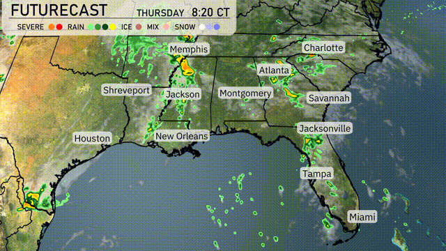
Storms accompanied by severe weather are impacting areas around Houston, with heavy rain extending towards Shreveport. In contrast, New Orleans, Jackson, and the majority of Alabama are observing lighter rain showers as the weather remains unsettled. To the east, the skies are mainly clear across Montgomery and Atlanta, while scattered showers are seen offshore of the Florida coastline, notably near Jacksonville.
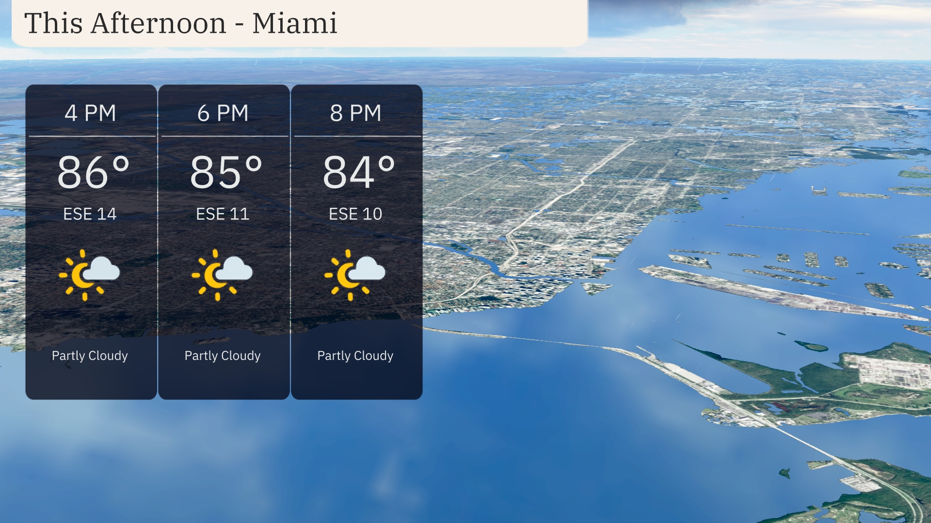
This afternoon in Miami, temperatures will hover around 86 degrees at 4 PM, gradually cooling to 84 degrees by 8 PM. Expect partly cloudy skies, providing some relief from the sun. Winds will be coming from the east-southeast at 14 miles per hour, easing to 10 miles per hour by evening.
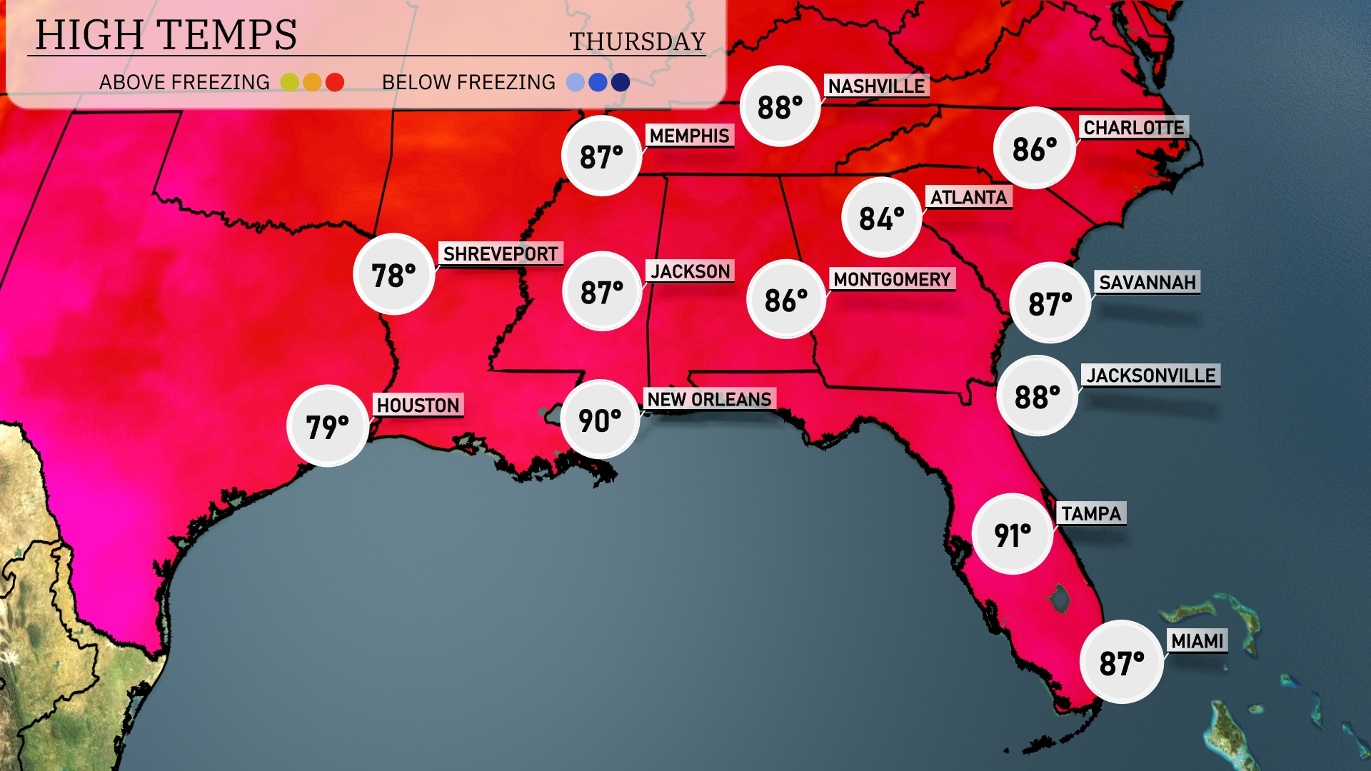
Today’s high temperatures in the Southeast are shaping up nicely. In New Orleans, expect a warm high of 90 degrees, while Houston will reach 79. Over in Atlanta, temperatures will climb to around 84 degrees. Jacksonville will be warm too, with a high of 88, and farther south in Tampa, we’re looking at a sizzling 91 degrees.
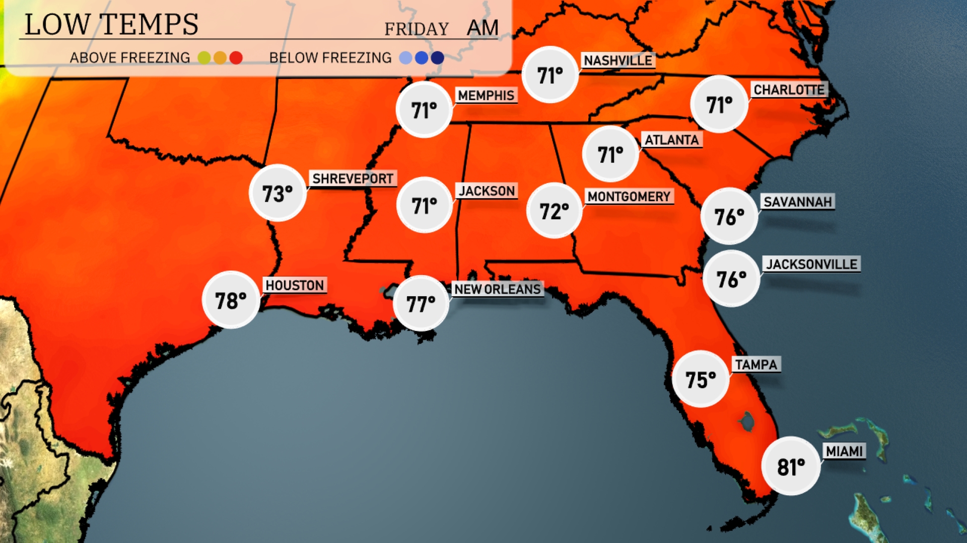
Tonight in Memphis, expect a low of 71 degrees. Nashville will cool down to 71, while Jackson also sits at 71. Montgomery is predicted to drop to 72 degrees. Atlanta will round out the night at 71, with Miami remaining comfortably warm at 81.
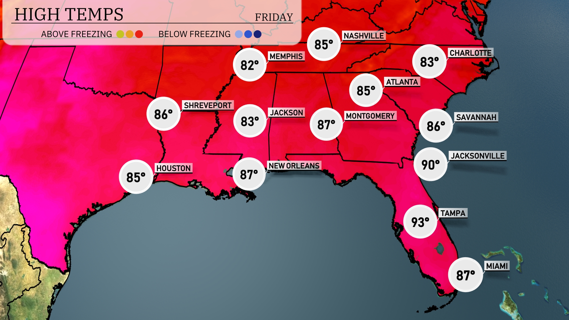
Tomorrow in the Southeast, highs will be soaring, with Tampa reaching an impressive 93 degrees. Jacksonville is also expected to feel the heat with a high of 90 degrees. Montgomery will see a warm 87, while New Orleans and Shreveport both rise to 87 degrees as well. Atlanta will hover around 85 degrees, experiencing above-average temperatures for this time of year. Cities like Houston and Memphis will see more moderate highs of 85 and 82 degrees, respectively.
An active weather pattern is set to impact the Southeast with scattered thunderstorms and showers from Jackson to Jacksonville by Thursday evening. Expect an increase in humidity accompanied by stormy weather across areas like Montgomery and Atlanta as the day progresses. Be mindful of the potential for heavy rainfall which might cause localized flooding, especially in low-lying regions. Severe weather risks include gusty winds and lightning, so keep your weather radios handy. As the system pushes eastward, skies will begin clearing, leading to drier and cooler conditions toward the weekend.
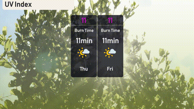
The UV index in Miami will be very high at 11 on both Thursday and Friday, with a burn time of just 11 minutes in direct sunlight.