From Sizzling Sun to Severe Showers: Your Comprehensive Southeast Weather Update
By
Amy Freeze
Explore the dynamic weather landscape of Miami and the Southeast U.S., featuring storm updates, temperature swings, and a future forecast that keeps you prepared.
This week in Miami and across the Southeast U.S., expect a mix of severe weather, soaring temperatures, and sun. Stay tuned and stay prepared.
As storm fronts collide with high temperatures across the Southeast, Miami locals and visitors alike are urged to stay weather-aware. Keep an eye on storm developments originating in Shreveport and watch out for the high UV index in Miami. Learn how it might affect your plans and how to stay safe in case of severe weather conditions. Don’t let variable skies catch you off guard!
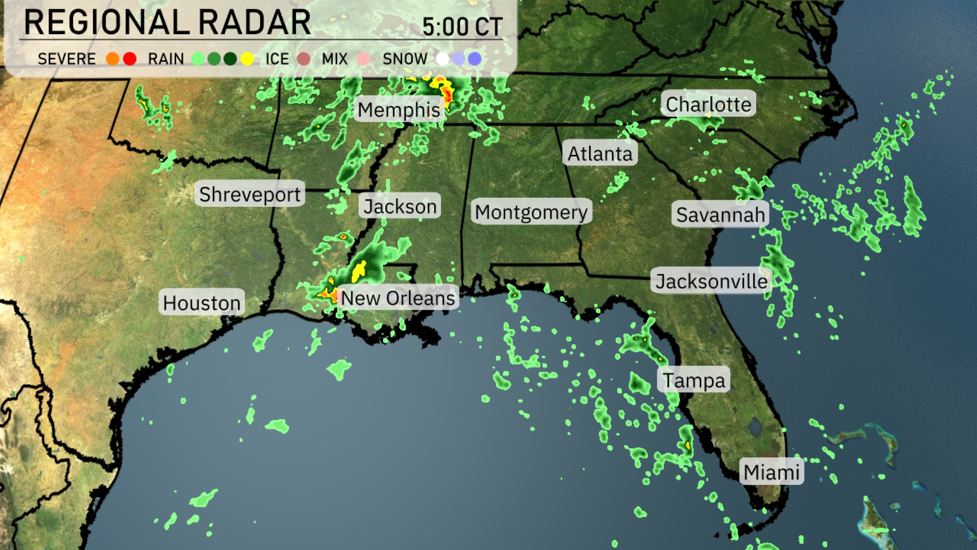
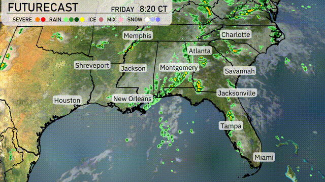
A line of storms is sweeping through the Southeast, with severe weather pressing eastward from Shreveport towards Jackson. New Orleans is experiencing heavy rain showers, while Montgomery is seeing rain build as it moves north. Savannah, Jacksonville, and parts of Miami are under cloudy skies with intermittent rain. Memphis is expecting rain as a system moves in from the west, suggesting a wet start to the day.
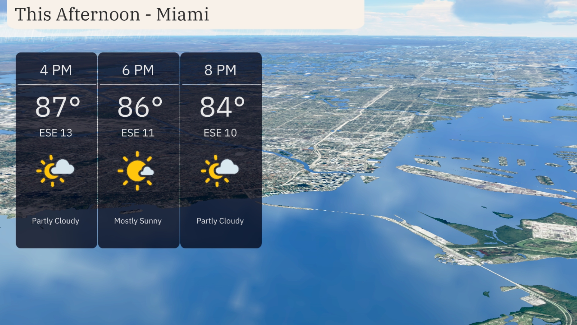
This afternoon in Miami, temperatures will be around 87 degrees at 4 PM, with gentle east-southeast winds at 13 mph. By 6 PM, expect mostly sunny skies and temperatures easing to 86 degrees, with a slight decrease in wind speed to 11 mph. The evening will bring partly cloudy conditions and a pleasant 84 degrees by 8 PM, accompanied by a gentle east-southeast breeze at 10 mph.
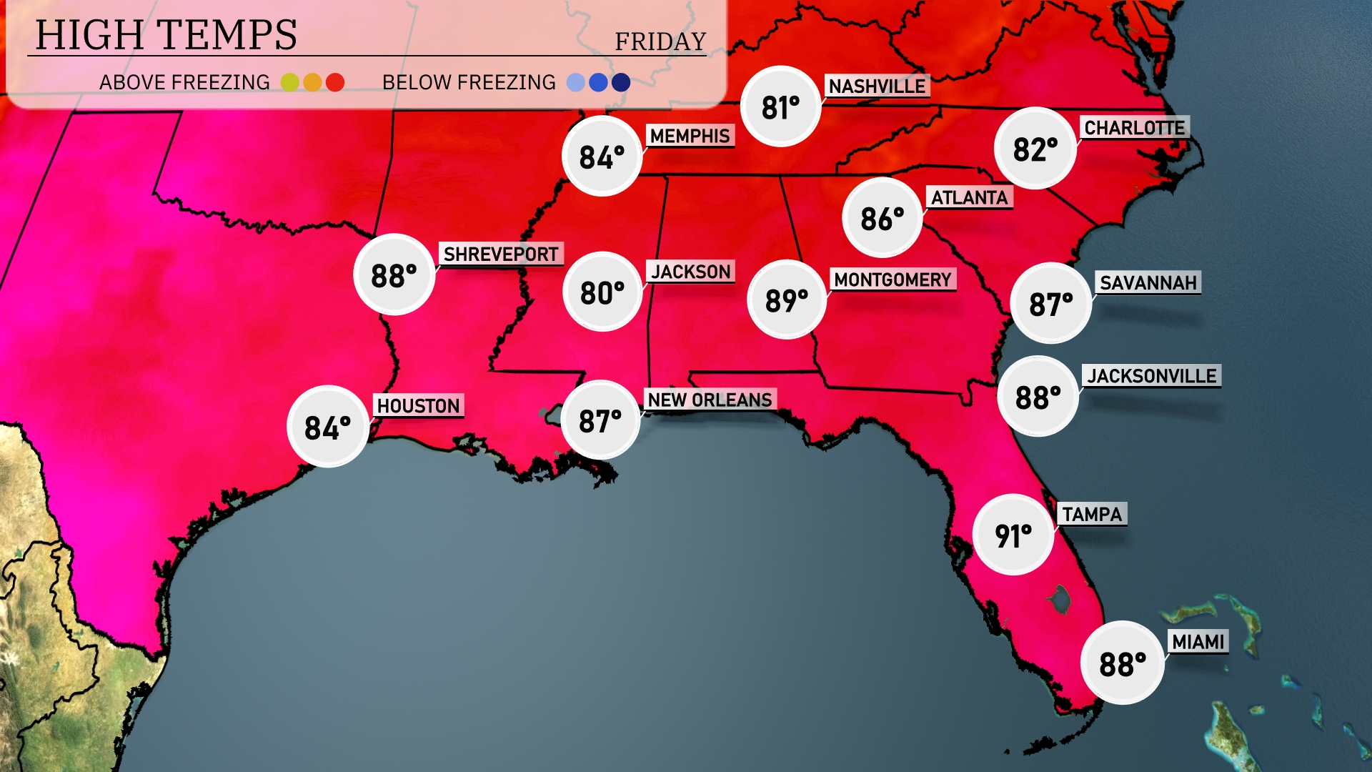
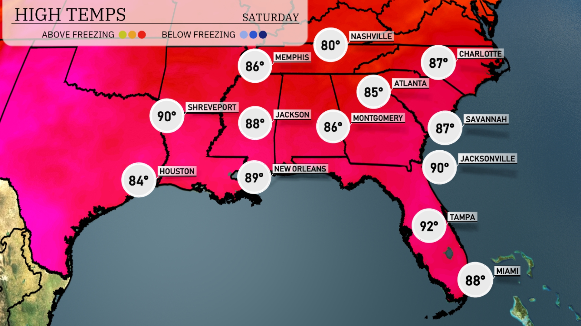
Today’s regional high temperatures reveal some warm conditions across the Southeast. In New Orleans, expect a high of 87 degrees, while Jackson will see a slightly cooler 80 degrees. Montgomery is warmer at 89 degrees, and farther east, Savannah hits 87 degrees. Jacksonville is also toasty with a high of 88 degrees, while Tampa leads the pack at 91 degrees with lots of sunshine. This warmth is contrasted by the more moderate temperatures seen in Houston at 84 degrees.
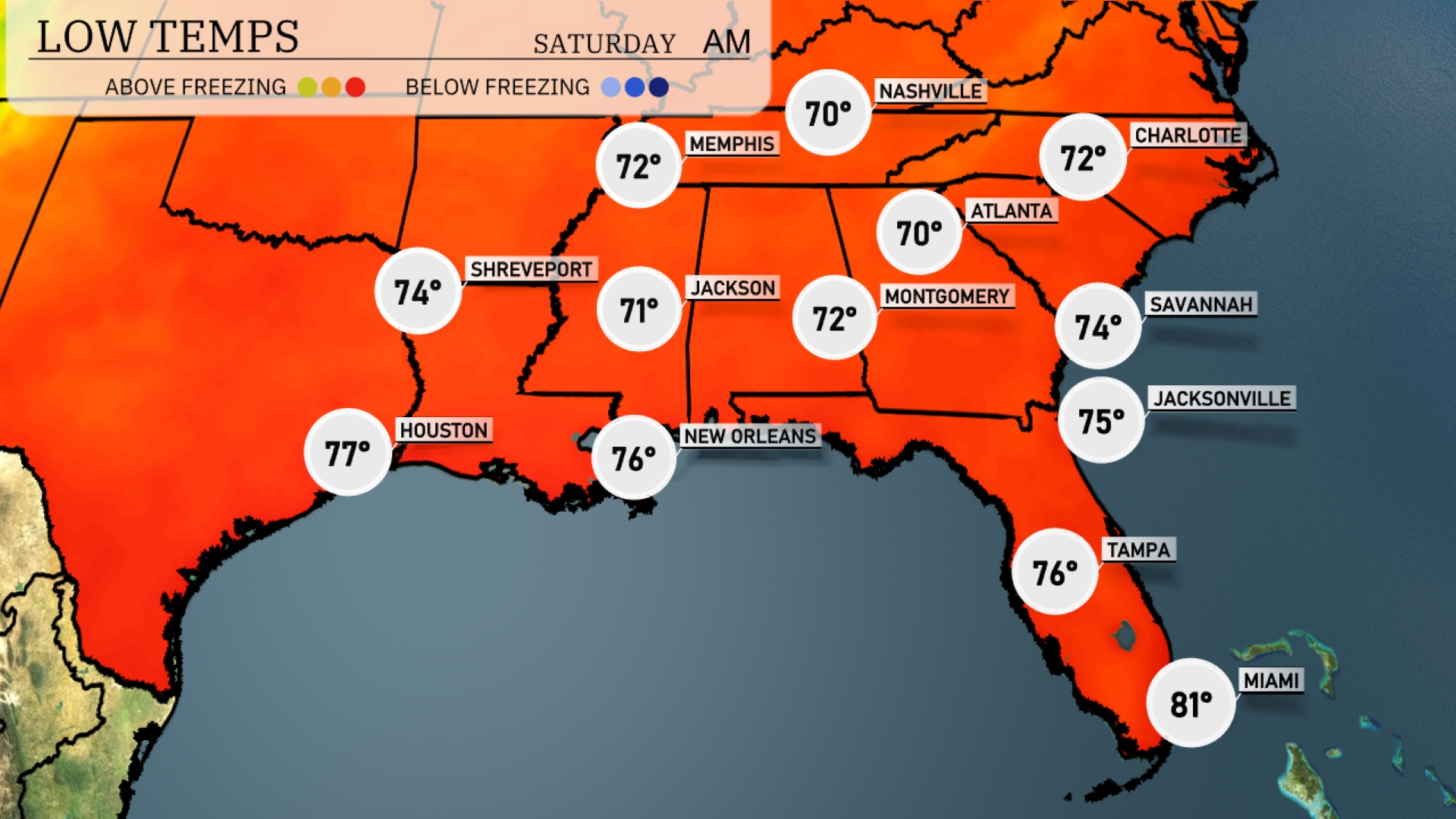
Tonight, low temperatures will dip down to 70 degrees in Memphis and Nashville. Expect 71 in Jackson and a mild 72 in Montgomery. Atlanta will see a low of 70 degrees, while temperatures remain warmer in coastal cities, with Jacksonville at 75 and Tampa at 76. Miami rounds out the Southeast with a comfy overnight low of 81 degrees.
Tomorrow in the Southeast, temperatures will soar with Jacksonville and Shreveport both reaching a high of 90 degrees. Atlanta will warm up to 85 degrees, while Montgomery expects a high of 86. Miami will enjoy a balmy 88 degrees, contrasting with cooler temperatures in Houston at 84 degrees.
A cold front is pushing through the Southeast, set to bring scattered thunderstorms from Houston to Atlanta on Friday. Expect areas like New Orleans and Montgomery to see heavy downpours and potential gusty winds, especially around midday. Jacksonville and Savannah are also in the path of persistent showers throughout the afternoon. While severe weather isn’t the primary concern, localized flooding could be an issue due to high rainfall rates. As the front moves eastward, the system exits the region by evening, leaving behind cooler, dryer air into the weekend.
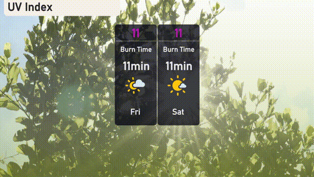
The UV index in Miami over the next two days will be very high at 11, indicating a burn time of just 11 minutes in direct sunlight.