Storm Watch: Navigating the Dynamic Weather of Austin and the Southern Plains
By
Amy Freeze
Explore today's complex weather patterns from Austin's partly cloudy skies to severe storms across Texas and the Southern Plains. Detailed insights and safety tips inside!
Catch up on today’s Southern Plains weather, including Austin’s cloudy skies and upcoming storms. Detailed forecasts and essential safety tips available!
In today’s dynamic weather forecast for Austin and the broader Southern Plains, we see a mix of partly cloudy skies and impending storms. Austin remains mostly cloudy with temperatures around 92°F, while severe weather threats loom in eastern Texas, moving towards Louisiana. Learn more about managing these conditions and staying safe, especially with a high UV index prompting quick burn times. Full details and forecasts on our blog at https://amyfreeze.ai/
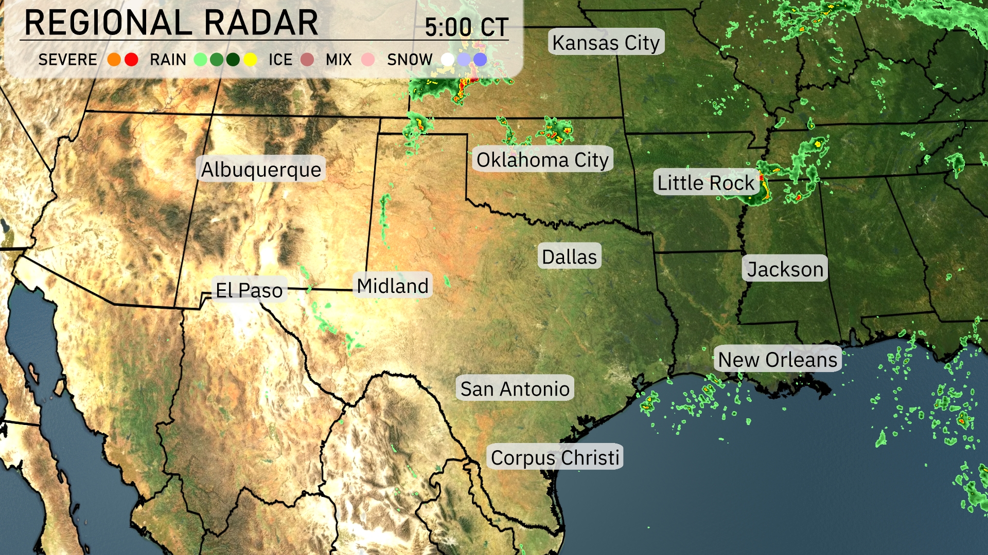
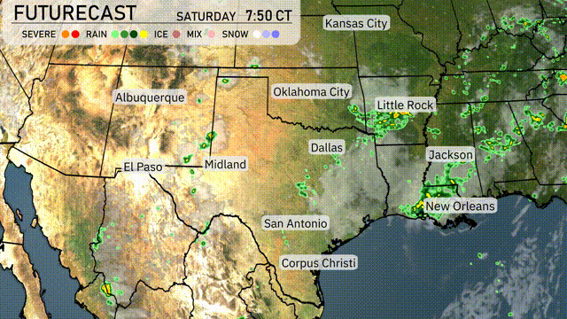
A line of strong storms is tracking through eastern Texas towards Louisiana, bringing significant rainfall around Beaumont and moving towards Shreveport. In the panhandle of Texas, near Amarillo, scattered storms are evident, with potential for severe weather. Northwest Oklahoma is also experiencing isolated showers, suggesting a mix of weather conditions. The Gulf Coast from Corpus Christi towards New Orleans is currently clear but remains under watch as cloud cover develops offshore.
Through the afternoon in Austin, look for mostly cloudy skies with temperatures steady at 92 degrees. Winds are light from the south-southeast around 7 to 6 miles per hour. Expect conditions to remain consistently warm and breezy as we head into the evening.
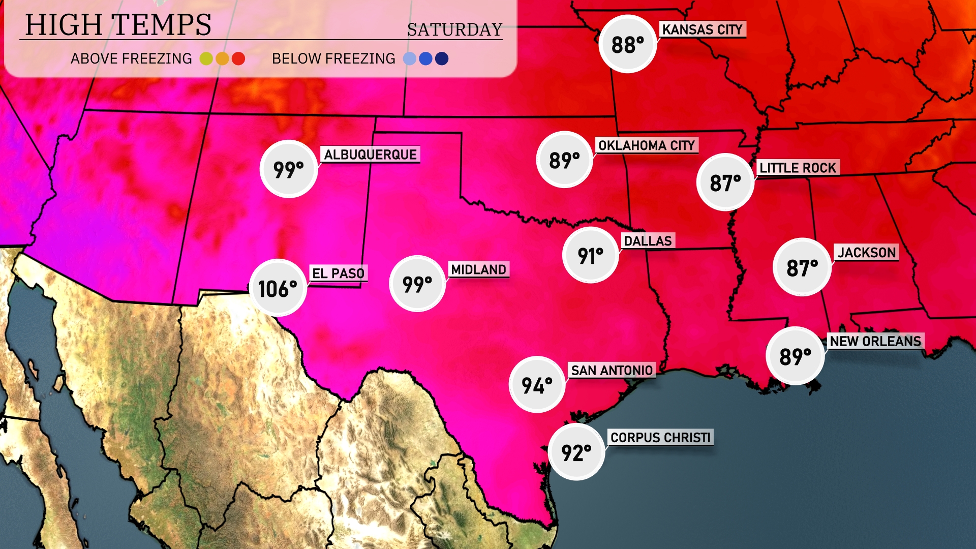
In the Southern Plains today, temperatures are heating up considerably. El Paso is leading the pack with a scorching high of 106 degrees. Midland sees a warm day with a high of 99, while Dallas isn’t far behind at 91. San Antonio will reach a pleasant 94 degrees, while farther east, New Orleans enjoys a warm 89 degrees.
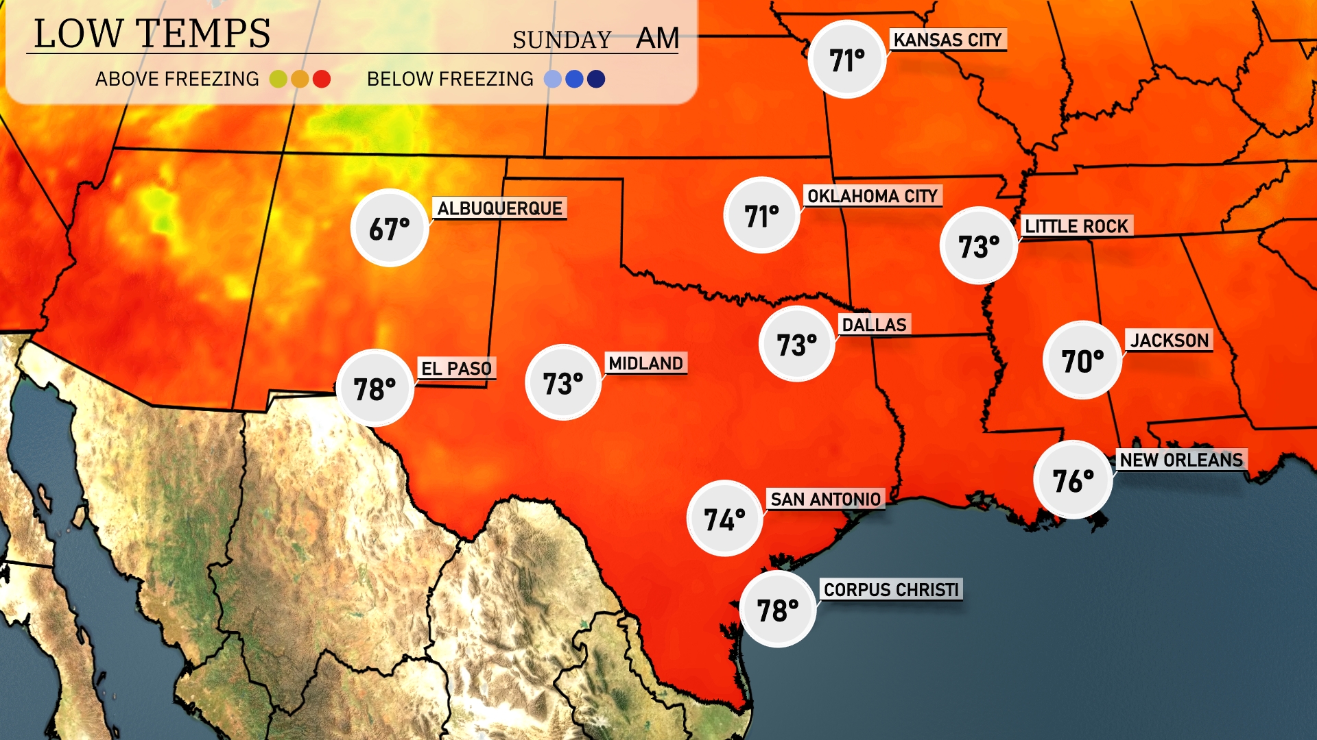
Tonight, temperatures will dip to 71 degrees in Oklahoma City and 73 degrees in Dallas. Little Rock will see a low of 73 degrees, while Jackson drops to 70. San Antonio is expected to stay warm at 74 degrees, but areas like Midland will cool down to 73.
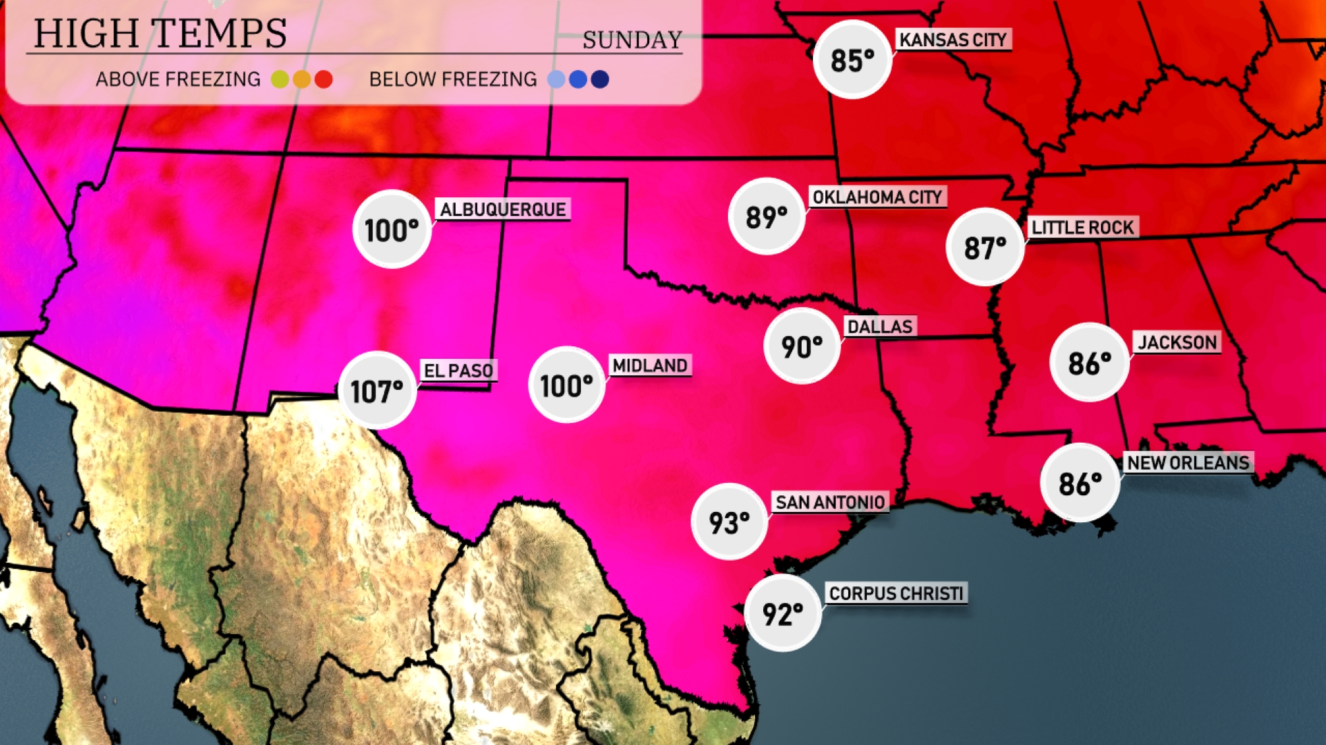
Tomorrow in El Paso, expect a scorching high of 107 degrees, while Midland also sees a warm 100 degrees. San Antonio should reach a mild 93 degrees, and Dallas is forecasted to hit 90 degrees, both above the seasonal averages. Little Rock will experience a balmy 87 degrees, aligning with typical summer trends. New Orleans remains comfortable with a high of 86 degrees, perfect for outdoor activities.
Expect a dynamic weather day in the Southern Plains tomorrow as a storm system advances. Rainfall will stretch from Dallas to Corpus Christi, bringing much-needed moisture, while Oklahoma City could experience stronger storms. An unstable air mass combined with an approaching cold front heightens the risk for severe weather, including strong winds and heavy downpours through Saturday. Areas from El Paso to Midland should prepare for isolated thunderstorms. As the front progresses southeast, be vigilant for weather alerts in regions like Little Rock and Jackson into Sunday.
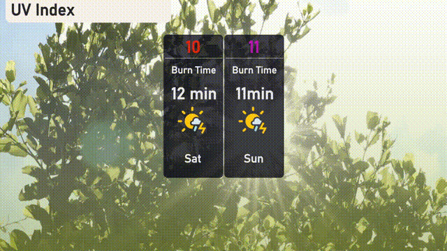
The UV index in Austin reaches a very high 10 today, with a burn time around 12 minutes, so use caution when outdoors. Tomorrow’s UV index stays extreme at 11, reducing the burn time to about 11 minutes; protective measures like sunscreen and hats are a must!