Thunderstorms on the Horizon: An Atlanta and Southeast Weather Forecast
By
Amy Freeze
Explore the dynamic weather patterns affecting Atlanta and the Southeast, from sunny highs to stormy nights. Stay prepared with our detailed forecast.
Stay ahead of the weather in Atlanta and across the Southeast with our up-to-date forecast. From scattered showers to sunny highs, find out what’s coming your way.
This week in Atlanta and throughout the Southeast, weather patterns are showing a mix of sunny days and potential stormy evenings. With temperatures ranging pleasantly in the mid-80s but looking stormy by nightfall, it’s crucial to stay prepared. For a detailed 7-day outlook and tips on how to handle the varying weather, check the full analysis on our blog.
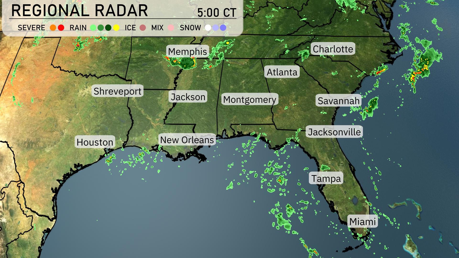
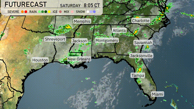
A line of storms is traveling across the Southeast region, with significant activity near Memphis. Rain showers are spotted moving eastward through Jackson towards Montgomery. In Florida, scattered showers are dotting the skies around Tampa and Jacksonville. As these systems advance, cloud cover is thickening across Georgia, setting the stage for potential rain over Atlanta and surrounding areas.
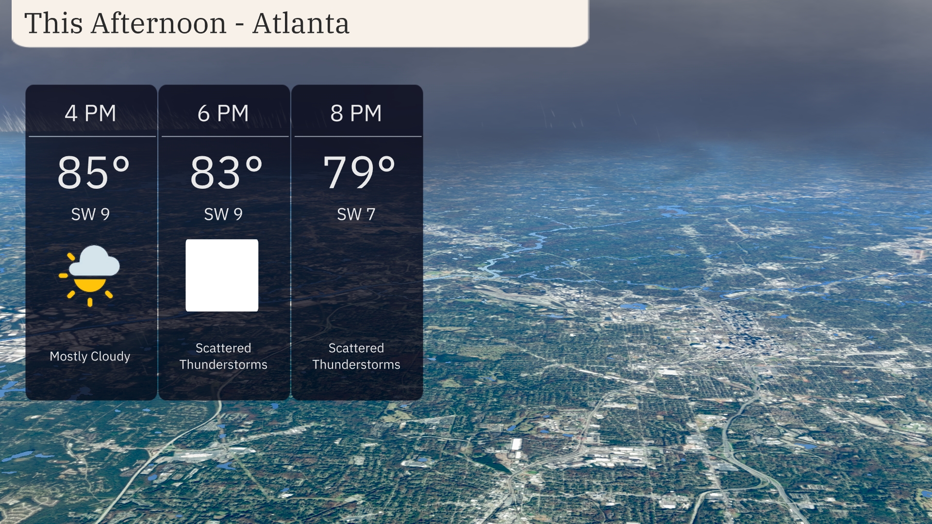
Temperatures in Atlanta this afternoon are around 85 degrees, with a southwest wind at 9 miles per hour. Clouds will increase, turning mostly cloudy by 4 PM. Scattered thunderstorms are likely beginning at 6 PM, continuing into the evening. Keep an umbrella handy as you head out, with temperatures moderating to 83 degrees by early evening.
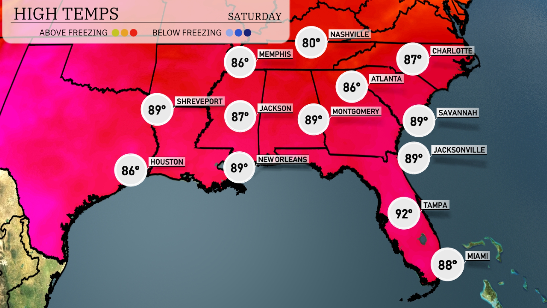
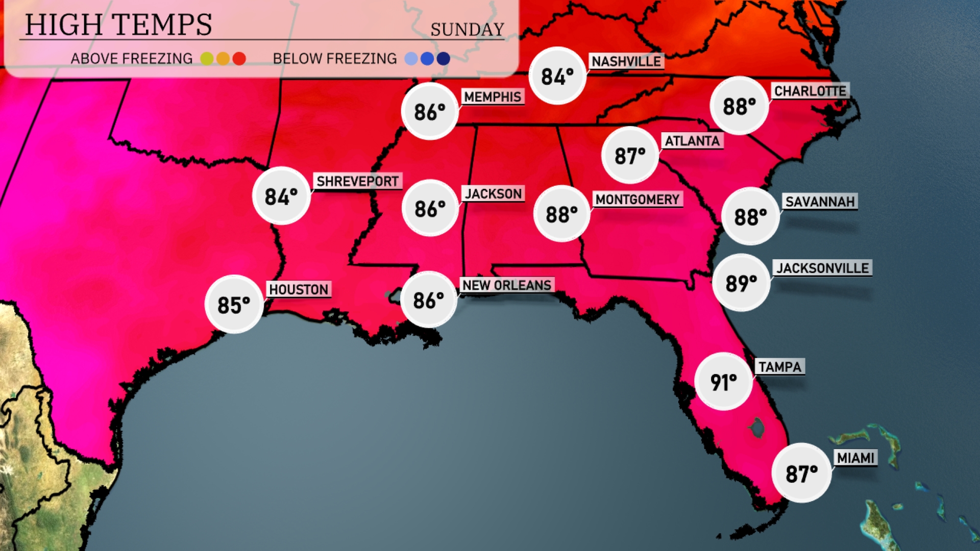
Today’s regional high temperatures in the Southeast show a warm and sunny day ahead. Atlanta is expecting a high of 87 degrees, while Savannah and Jacksonville reach a steamy 89 degrees. New Orleans will also be warm, topping out at 89 degrees. A warm front contributes to Tampa’s hot afternoon, with highs hitting 92 degrees. Miami will stay slightly cooler at 88 degrees due to an onshore flow.
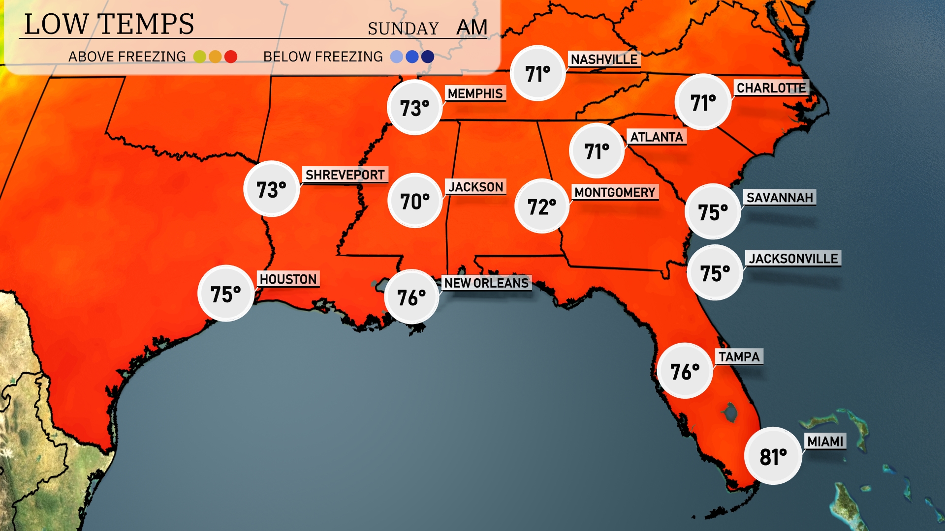
Tonight, temperatures will dip into the low 70s across much of the Southeast. Memphis will see a low of 73 degrees, while Nashville and Atlanta are expected to drop to 71. Montgomery will register 72, with Jackson cooler at 70. Coastal cities like Jacksonville and Savannah will remain warmer at 75 degrees.
Tomorrow in Atlanta, expect a high of 88 degrees, while Montgomery will warm up to 88 as well. Jacksonville hits 89 degrees, indicating a hot day ahead, typical for this time of year. New Orleans and Shreveport will experience slightly cooler temperatures, both reaching 86 degrees.
Across the Southeast, a developing low-pressure system will trigger showers and thunderstorms from New Orleans to Jacksonville tomorrow. Expect heavy rainfall in Montgomery and potential localized flooding as rainfall accumulations exceed one inch in some areas. Warm humid air will cause temperatures to rise into the 80s, with brisk southerly winds ahead of the cold front. By Saturday evening, the weather will turn more settled with cooler, drier air filtering in behind the front. Storm threats diminish by late afternoon as the system moves eastward towards the Atlantic coast.
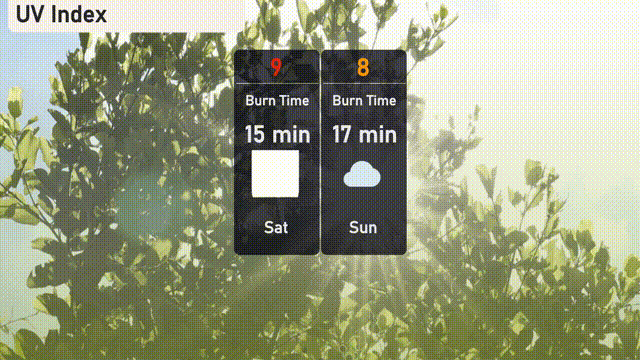
The UV index in Atlanta for Saturday is very high at 9, with a burn time of only 15 minutes, so take precautions if you’re outdoors. On Sunday, the index lowers slightly to 8, and the expected cloudy weather extends the burn time to 17 minutes.