Salt Lake Sunshine and Southwest Showers: Your Weather Outlook for 06/15/2025
By
Amy Freeze
Dive into a detailed weather outlook for Salt Lake City and read about regional weather trends across the Southwest for tomorrow. From sunny skies in Salt Lake to showers in Southern California, get all the insights.
Get ready for a sunny start in Salt Lake City tomorrow, with clear skies and mild winds. Meanwhile, Southern California prepares for showers. Find all the details in our full forecast!
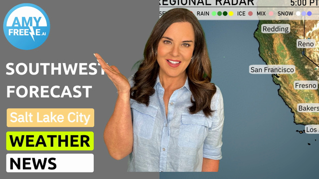
As Salt Lake City welcomes a sunny morning with mild winds and a pleasant temperature rising to 73°F, areas like Southern California prepare for an overcast day with potential showers. Dive into our comprehensive forecast as we cover temperature trends, regional weather changes, and what these conditions mean for your day in the Southwest on June 15, 2025. Stay informed and prepared for shifting weather patterns!
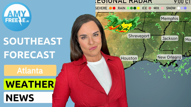
A notable line of showers is progressing from San Francisco down towards Los Angeles, indicating a wet commute for some areas. Light rain extends towards Fresno, providing welcome refreshment to Central California valleys. Reno and Salt Lake City are staying dry with clear skies. Those in Cedar City might experience light rain, while farther east around Ely, conditions remain dry and calm.
In Salt Lake City tomorrow morning, temperatures start at 67 degrees at 8 AM, warming steadily to 73 degrees by 10 AM. Skies remain clear and sunny throughout the morning. Winds are mild, initially coming from the east-southeast at 6 miles per hour, shifting to a southerly direction around 10 AM.
Tomorrow, Phoenix will be blazing hot with a high of 112 degrees. Las Vegas isn’t far behind, with temperatures soaring to 110 degrees. In Southern California, temperatures are warm, hitting 98 degrees in Bakersfield and 83 in Los Angeles. Coastal areas like San Diego will be more moderate at 80 degrees, while San Francisco remains much cooler at 62 degrees.
Expect a hot and dry start across Southern California tomorrow. However, as the day progresses, a Pacific low-pressure system will bring cooler temperatures and potential for significant precipitation, particularly along the coastal and valley regions. The rain might cause slick roads and challenging travel conditions, so be cautious. In the mountainous areas, snowfall is expected by tomorrow night, impacting travel through passes. Thunderstorms are less likely, but remain alert as conditions might quickly evolve.
The UV index in Salt Lake City is high at 9 on both Sunday and Monday, with a quick burn time of 15 minutes. It’s a great time to enjoy the outdoors, but make sure to apply sunscreen and take breaks in the shade.
Sunday: Partly cloudy with a high of 97 degrees, cooling down to 66 degrees at night.
Monday: Mostly cloudy skies as temperatures reach a high of 93 degrees and a low of 66 degrees.
Tuesday: Expect sunny skies with a high of 87 degrees and an evening low of 61 degrees.
Wednesday: Clear conditions with a warm high of 95 degrees and a nighttime low of 67 degrees.
Thursday: Sunny and bright, a peak of 103 degrees during the day, dropping to 70 degrees at night.
Friday: Another clear day with highs hitting 98 degrees and lows around 65 degrees.
Saturday: Ending the week with clear skies, a high of 84 degrees, and a cooler low of 50 degrees.