New York’s Weather Rollercoaster: From Mild Showers to Weekend Heatwave
By
Amy Freeze
Explore a comprehensive guide to New York City’s dynamic weather this week. From gentle showers to rising temperatures, see what each day holds.
This week in NYC, brace for varying weather! From cloudy skies to showers and a potential heatwave by weekend, find out how to gear up for the weather swings.
Welcome to your comprehensive update on New York City’s weather for the coming week. While today offers partly cloudy conditions and a moderate UV index, significant changes are on the horizon. Expect a band of rain moving across the Northeast affecting regions from DC to Scranton, with isolated thunderstorms likely to form and cooler air arriving by mid-week. As the skies clear, temperatures will steadily rise, culminating in a sunny and warm weekend. Get the full scoop on how these conditions could affect your daily activities and plans in our full blog post.
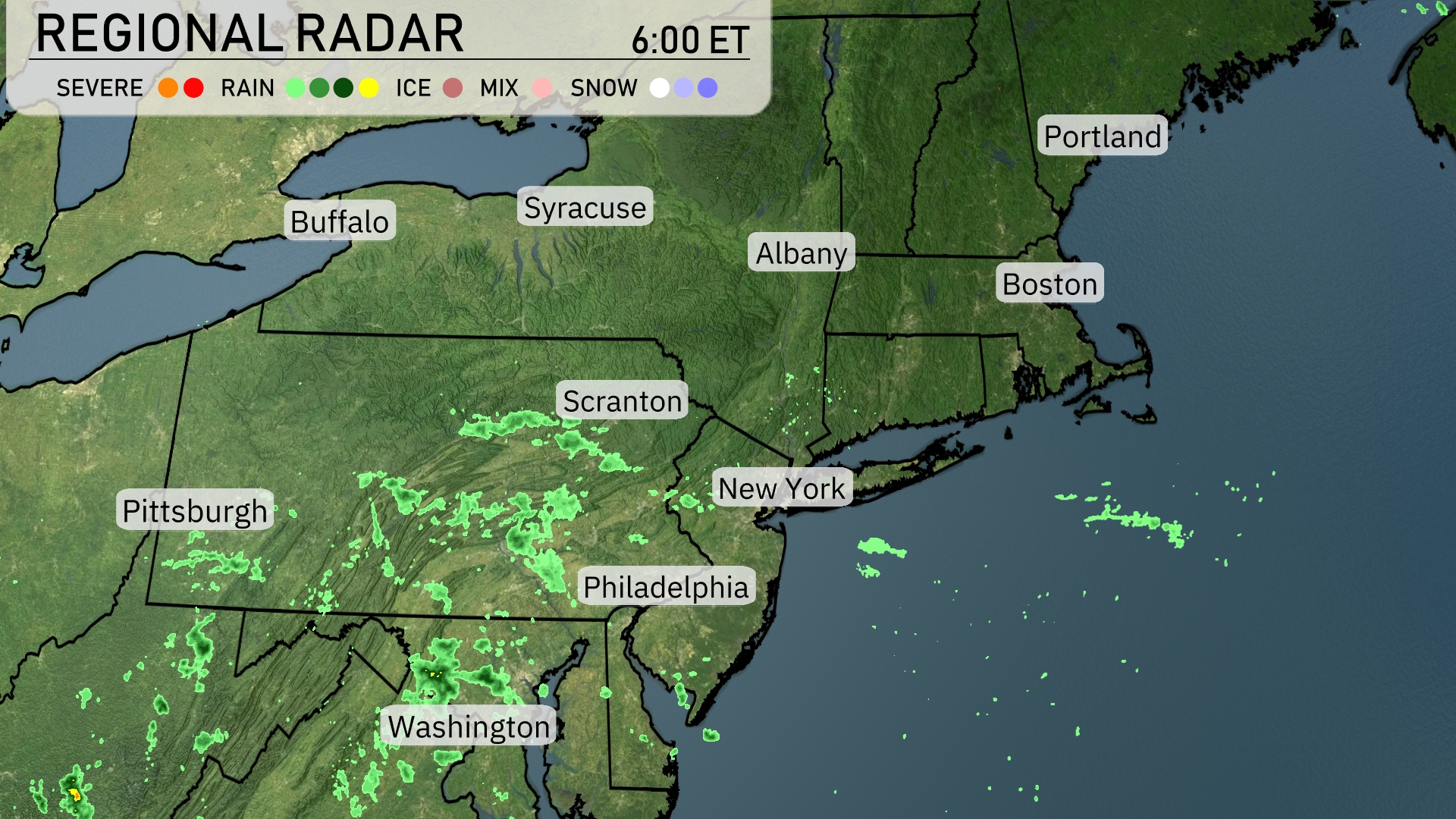
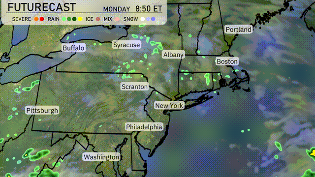
A band of rain stretches across the mid-Atlantic, with Washington, D.C., and Philadelphia experiencing light to moderate showers. Scranton is also getting some rainfall as this system moves northeastward. The rest of the Northeast, including New York and Boston, remains dry, but clouds are increasing, signaling potential changes in the weather. Farther north, cities like Syracuse and Buffalo are seeing clear skies.
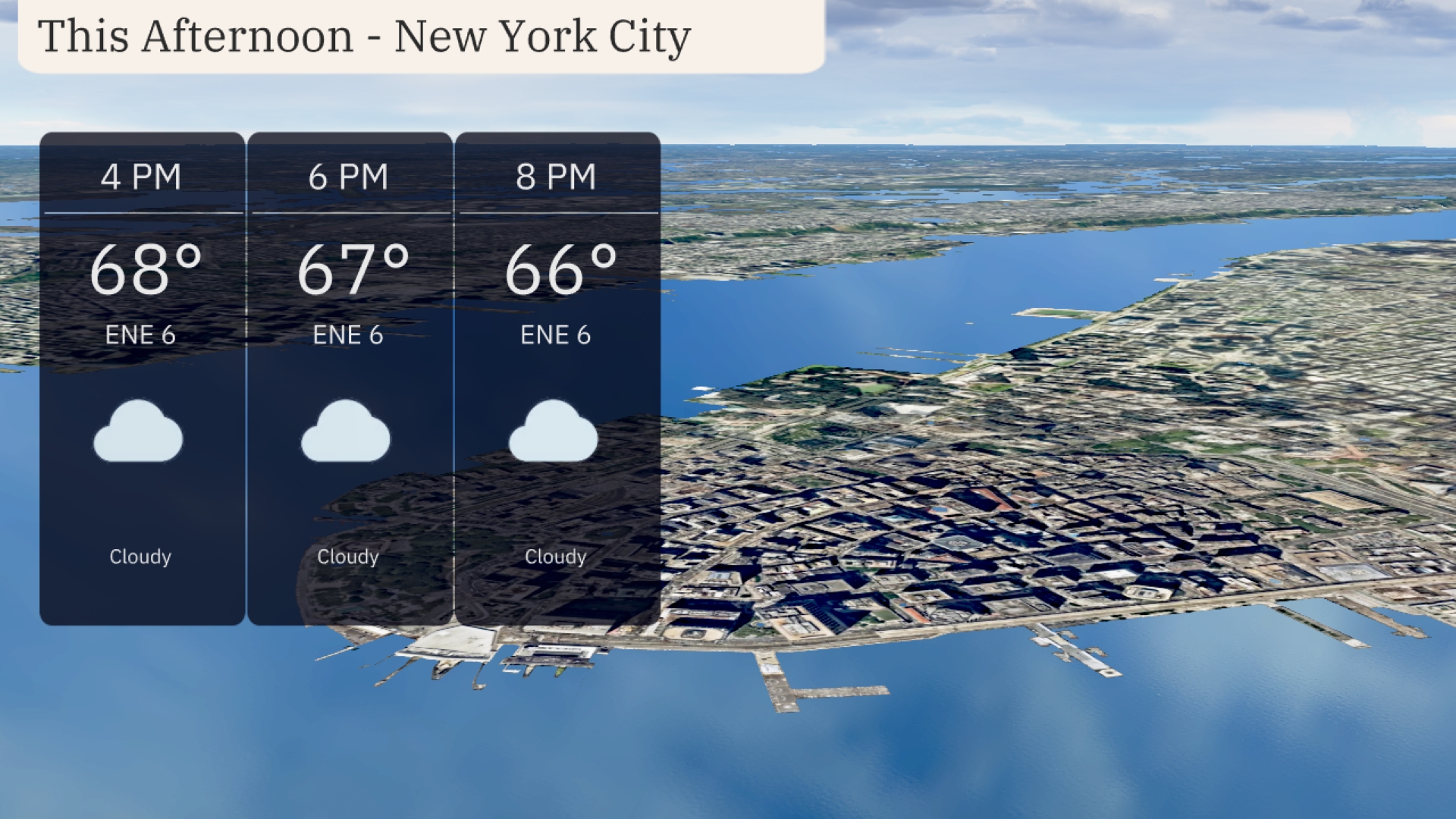
Cloudy skies dominate this afternoon in New York City, with temperatures maintaining a steady trend around 68 degrees at 4 PM, gradually easing to 66 degrees by 8 PM. Easterly winds remain gentle at 6 miles per hour, contributing to a calm and stable weather pattern.
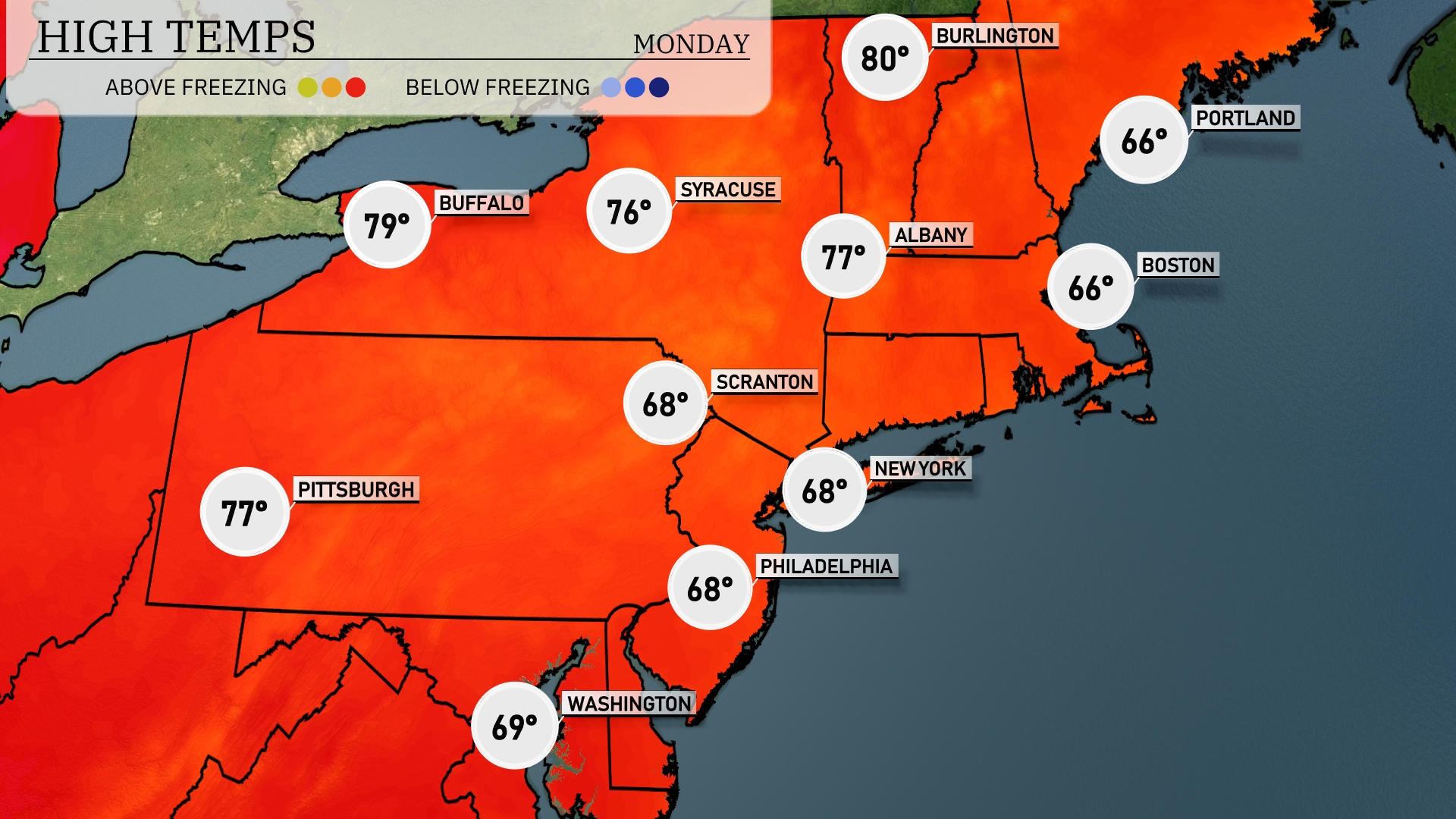
High temperatures across the Northeast today are showing some significant variation. In Buffalo, we’re expecting a warm 79 degrees, while Syracuse will see a high of 76. Down in Pittsburgh, temperatures will reach 77 degrees, providing a pleasant afternoon. Meanwhile, New York City and Philadelphia are sitting cooler with highs of 68, and Boston and Portland trailing behind at 66 degrees.
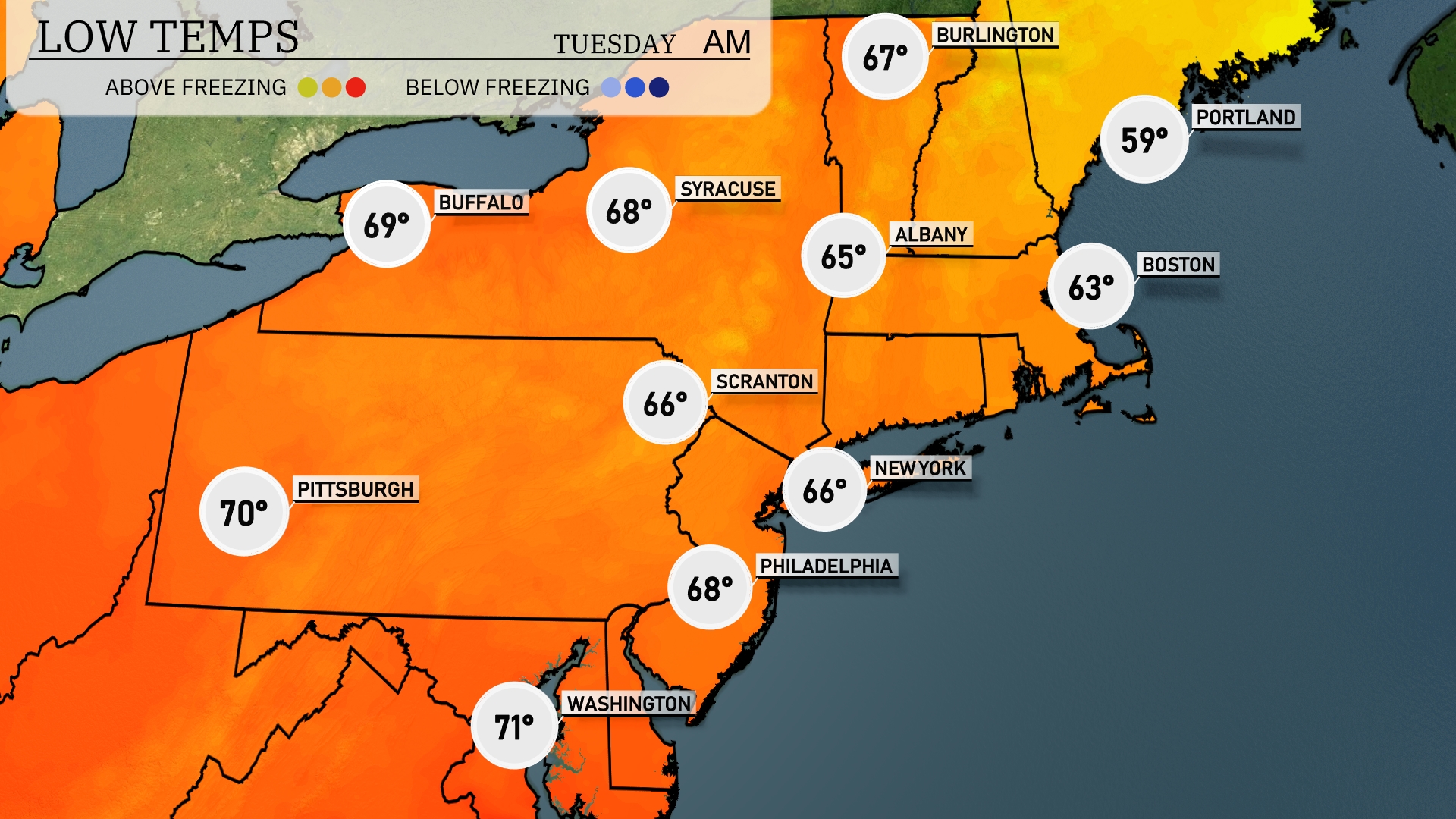
Tonight in the Northeast, Boston is expected to dip to 59 degrees, while New York City will reach a low of 66. Philadelphia isn’t far behind at 68 degrees. Scranton will see a cooler night with temperatures dropping to 66 degrees, and Syracuse will settle at 68.
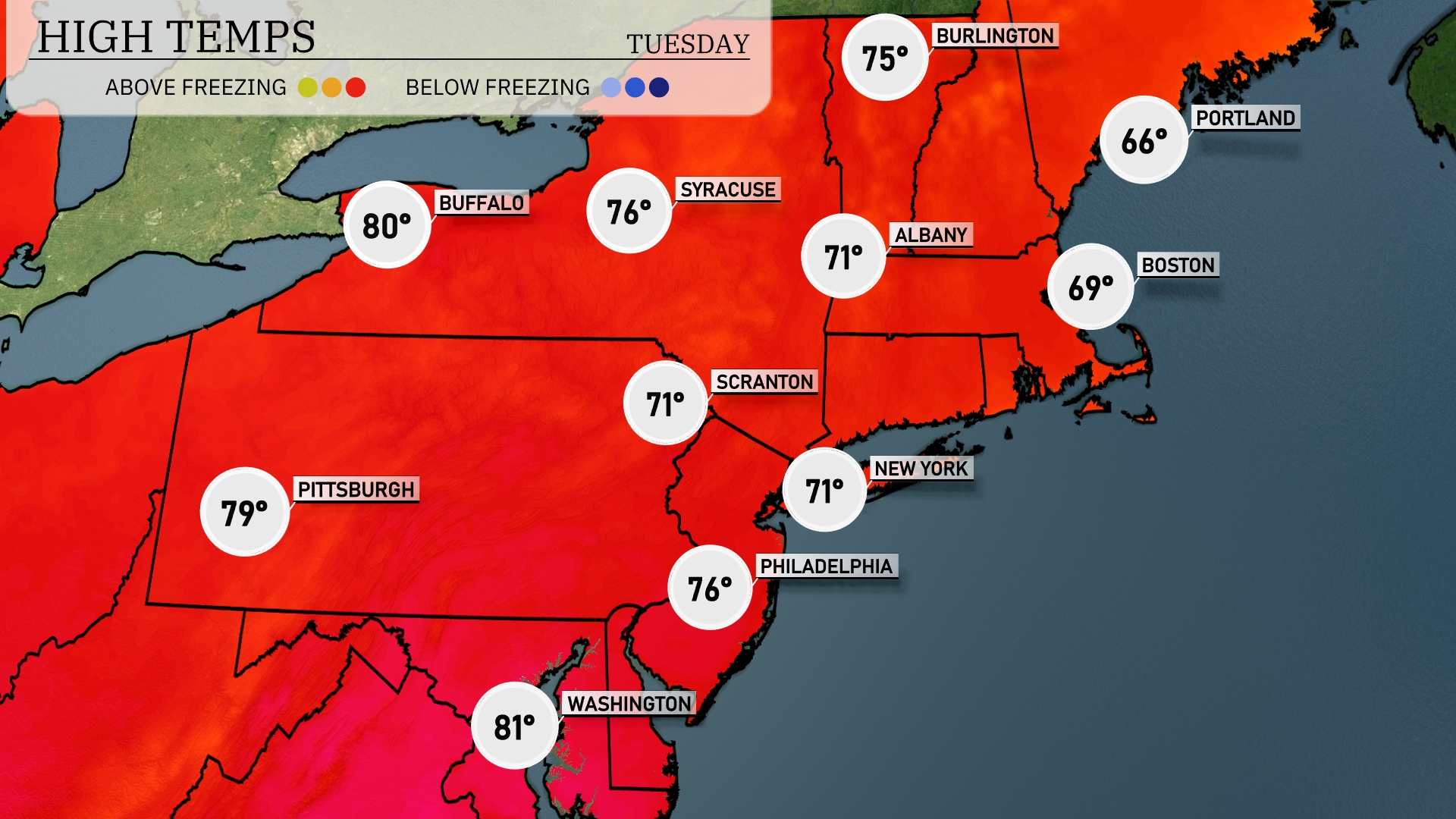
Tomorrow in the Northeast, expect warm temperatures as Buffalo reaches a high of 80 degrees. Pittsburgh is close behind at 79 degrees, while Philadelphia will see 76 degrees. New York City and Scranton both reach 71 degrees, showing a mild trend across the region. Boston will be slightly cooler at 69 degrees, while Portland tops out at 66 degrees.
A front sweeping across the Northeast brings scattered showers early in the day, with periods of heavy rain expected from Scranton to Boston tomorrow. Isolated thunderstorms may develop, with a low risk of severe weather. Cooler air arrives behind the front, bringing a drop in temperatures through Wednesday, especially noticeable in cities like Albany and Pittsburgh. Winds will gust up to 25 mph as the front clears by evening. Dry conditions return by mid-week with a mix of clouds and sun.
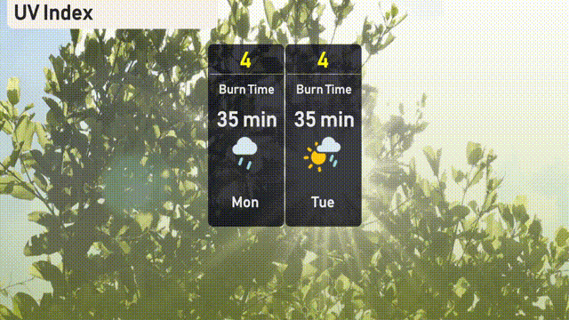
The UV index in New York City remains moderate at 4 for both Monday and Tuesday, with cloud cover potentially reducing exposure. Expect a burn time of around 35 minutes in direct sunlight if the skies clear.