Salt Lake City’s Week in Weather: Clear Skies & Sudden Showers Ahead
By
Amy Freeze
Explore how Salt Lake City’s weather is shaping up with clear skies, unexpected showers, and fluctuating temperatures, bringing unique challenges and opportunities.
Stay informed with the latest weather trends in Salt Lake City, where temperatures are climbing and thunderstorms threaten. Enjoy clear skies offset by dynamic weather shifts including potential flash floods.
The coming week in Salt Lake City features a dramatic mix of sunny skies and potential thunderstorms. With temperatures peaking in the high 90s and lows around the 60s, prepare for a week of dramatic weather shifts. From sizzling sunny days to unexpected rain, the forecast includes essentials on how to navigate these changes effectively, including safety tips for flash floods and sun exposure.
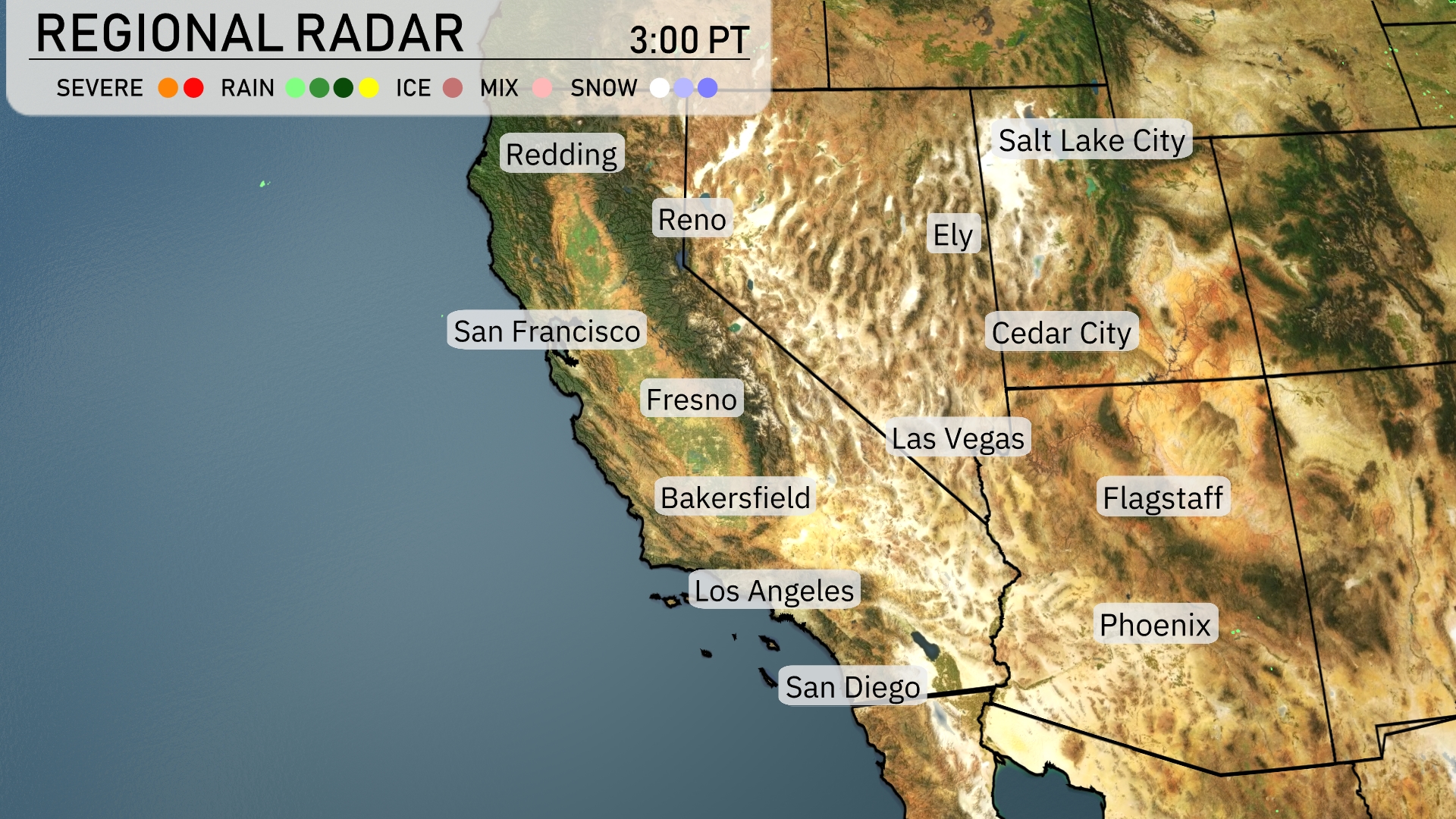
On the Regional Radar, a band of rain is extending over central California, affecting cities like Fresno and Bakersfield. In the Reno area, a mix of wintry precipitation begins to make an appearance. San Francisco and Los Angeles are staying dry, but clouds are increasing, hinting at potential changes.Flagstaff and Las Vegas are enjoying clear skies, offering a sunny day with no immediate weather concerns.
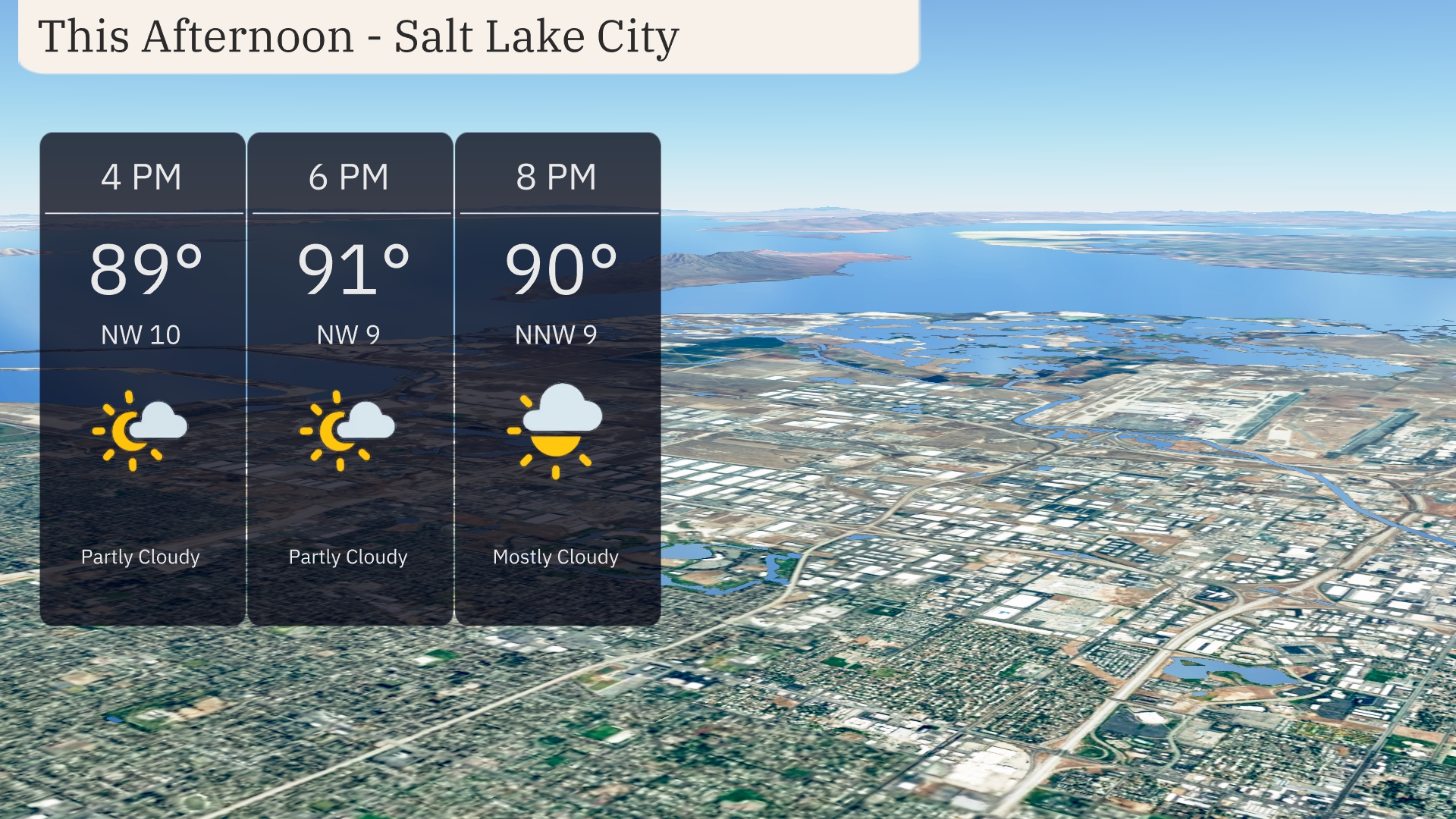
Temperatures in Salt Lake City this afternoon will climb to 91 degrees by 6 PM, with a north-northwest wind ranging from 9 to 10 miles per hour. Skies will be partly cloudy with more cloud cover moving in by 8 PM. A warm evening is ahead, with temperatures still around 90 degrees as the sky becomes mostly cloudy.
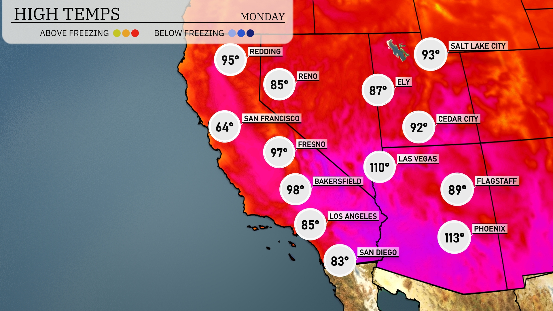
This afternoon, the Southwest is feeling the heat. Las Vegas is sizzling with a high of 110 degrees, while Phoenix is not far behind at a scorching 113 degrees. In California, Bakersfield will hit 98 degrees, and Fresno warms up to 97. Coastal areas like Los Angeles will have a milder high of 85 degrees, providing a brief respite from the intense heat inland. San Diego stays cooler at 83 degrees, making it a preferable spot for those looking to escape the heatwave.
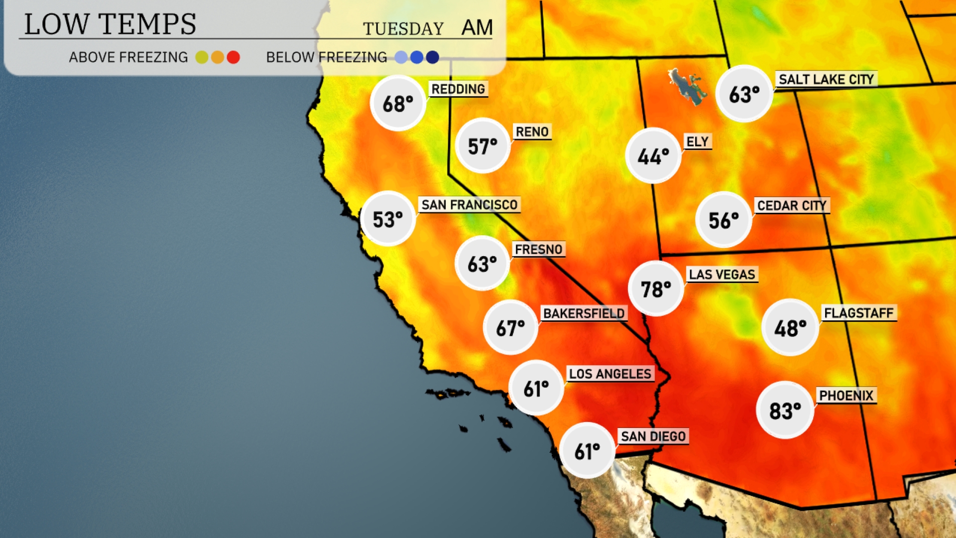
Tonight, low temperatures will drop to 48 degrees in Flagstaff, marking a significant cool down for the region. Las Vegas will see milder conditions with a low of 78 degrees. In Southern California, temperatures will remain more moderate, with Los Angeles expected to cool to 61 degrees. Bakersfield will see a low of 67, while Fresno registers at 63 degrees overnight.
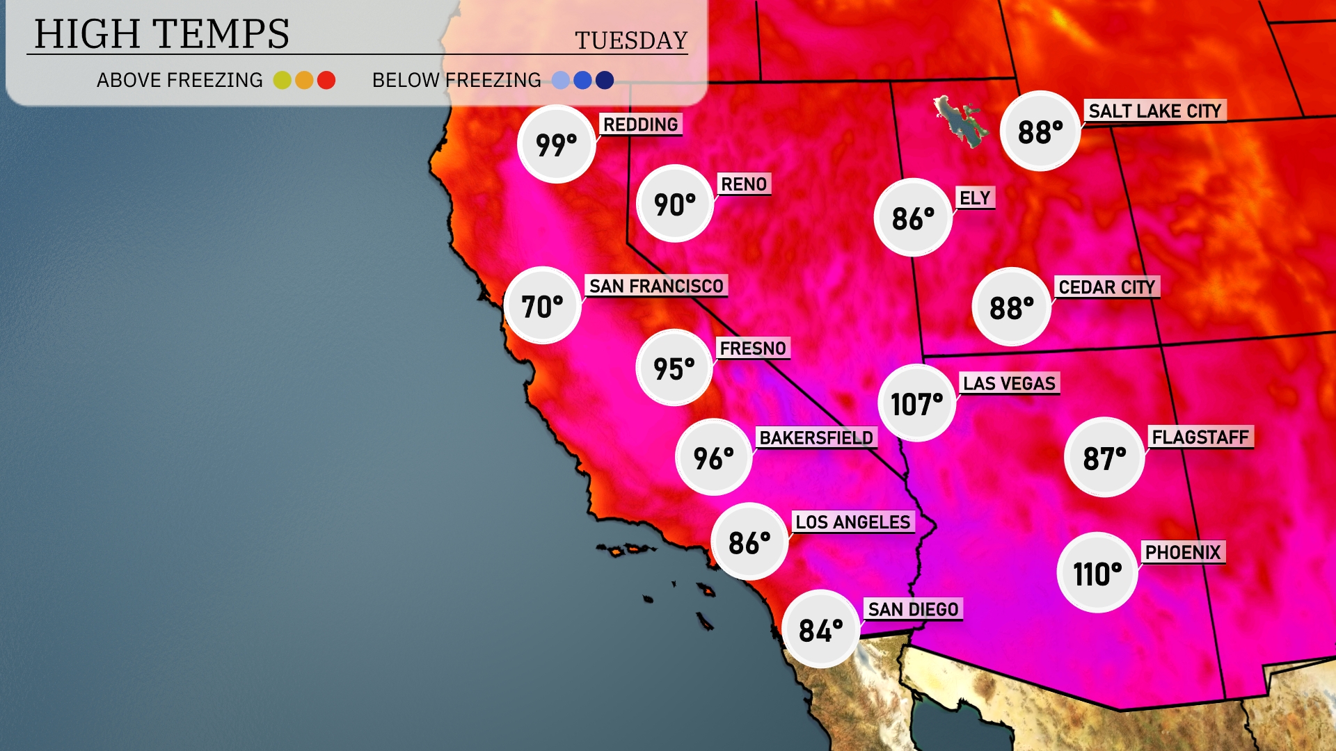
Tomorrow in the Southwest, temperatures are set to soar with Phoenix reaching a blistering 110 degrees, well above average for this time of year. Las Vegas isn’t far behind, expecting a high of 107 degrees, indicating a continuation of the heatwave. In California, Fresno will see a warm 95 degrees and Bakersfield is forecasted to hit 96 degrees. Coastal cities will experience milder temperatures, with San Diego peaking at 84 degrees and Los Angeles around 86 degrees. San Francisco will be significantly cooler at 70 degrees, showing the coastal influence on temperature trends.
A low-pressure system will impact the Four Corners region tomorrow, bringing scattered thunderstorms and potential heavy rain. Areas from Flagstaff to Albuquerque are likely to experience flash flooding due to intense downpours. Daytime temperatures will remain warm, reaching the mid to high 80s but expect cooler conditions post-rainfall. A weak cold front may move through late Tuesday, bringing breezy conditions across parts of Arizona.
For Salt Lake City, the UV index on Monday reaches 8, posing a very high exposure risk with a burn time of about 17 minutes. Tuesday sees an increase to an index of 9, where sunburn can occur in just 15 minutes!