Austin’s Weather Rollercoaster: From Sizzling Suns to Stormy Skies
By
Amy Freeze
Explore Austin's dynamic weather from serene sunny days to storm alerts, with expert tips on staying protected and comfortable.
Austin rides a weather wave from clear, sunny skies to possible storm threats. Read on to understand what’s brewing in the sky and how to enjoy or prepare for it.
In the heart of the Southern Plains, Austin’s weather paints a picture of contrast and diversity. From the serene, sun-drenched afternoons to storm-laden evenings, this comprehensive guide covers the essentials of local weather patterns. Delve into a detailed forecast and explore proactive measures to take during fluctuating conditions, ensuring your plans remain uninterrupted by nature’s moods.
On the Regional Radar, storms are currently concentrated in eastern Arkansas, particularly around Little Rock, making their way towards the Mississippi border. These systems are generating significant rainfall and are heading eastward. Showers are also developing in southeastern Louisiana, positioning themselves near New Orleans. Clear conditions dominate the rest of the Southern Plains, notably around Oklahoma City and Dallas, with minimal cloud cover evident.
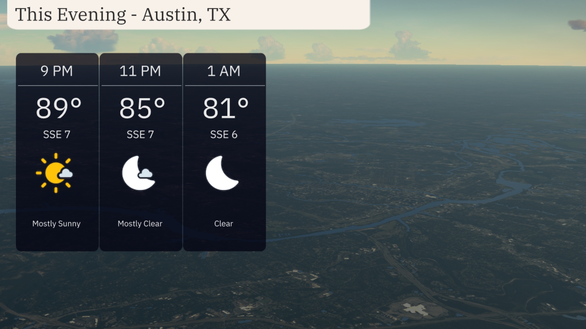
Evening conditions in Austin bring mostly sunny skies by 9 PM, with temperatures at 89 degrees. A gentle south-southeast breeze at 7 mph continues as temperatures drop to 85 degrees by 11 PM, with skies turning mostly clear. By 1 AM, expect clear skies and temperatures at 81 degrees, with winds calming slightly to 6 mph from the south-southeast.
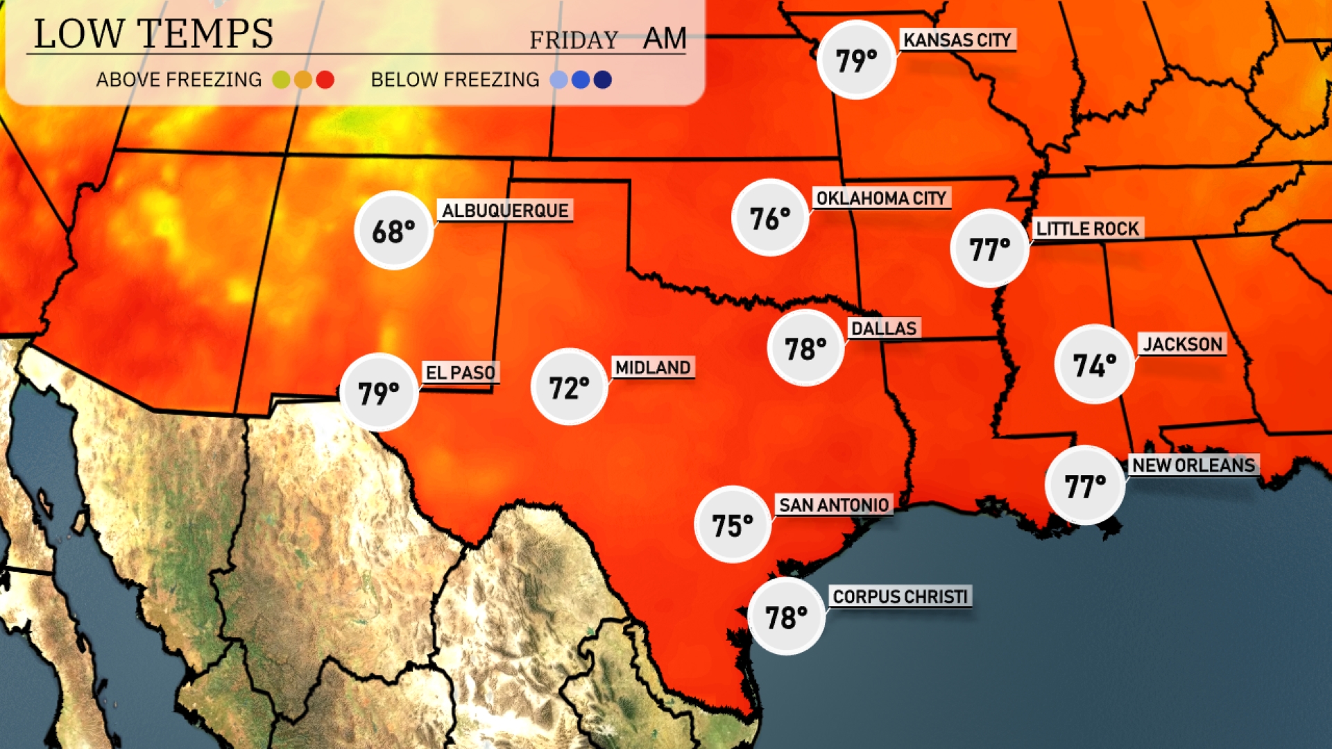
Tonight, Oklahoma City will drop to a low of 76 degrees. Dallas is expected to reach 78, while San Antonio cools down to 75. Little Rock will see temperatures dip to 77, and Jackson will settle at 74 degrees.
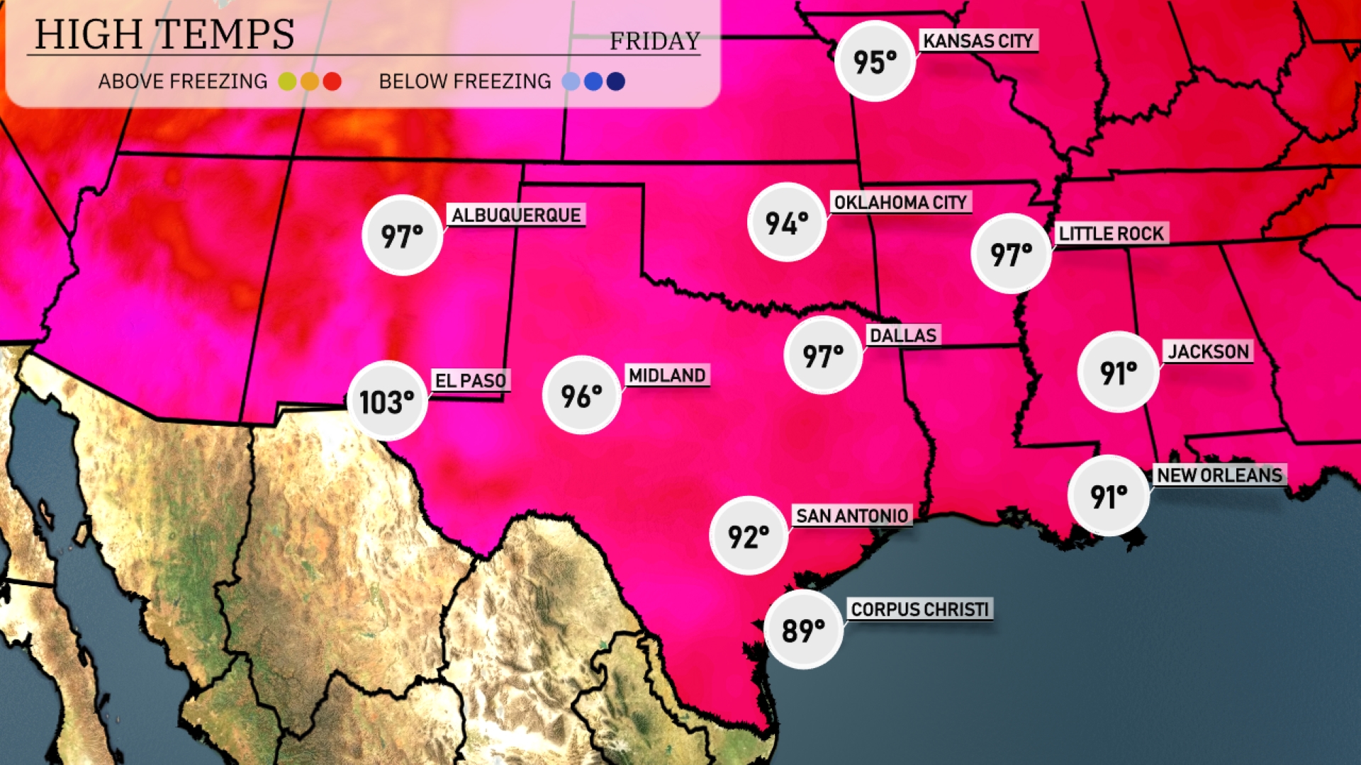
Tomorrow in the Southern Plains, El Paso will sizzle with a high of 103 degrees, marking significantly above-average temperatures. Midland is slated for a warm 96 degrees, while Dallas will reach 97. San Antonio is expected to warm up to 92 degrees, and farther south, Corpus Christi will be slightly cooler at 89 degrees.
A robust weather system will impact the Southern Plains tomorrow, bringing a mix of rain and storms. In the early hours, expect widespread rain from Dallas to Corpus Christi, offering beneficial moisture. By afternoon, Oklahoma City is poised for potentially stronger thunderstorms as a cold front advances. The unstable atmosphere could spark severe weather into Wednesday night, therefore, it’s crucial to remain alert for any severe thunderstorm warnings.
The UV index in Austin will be extremely high at 11 on both Thursday and Friday, resulting in a quick burn time of just 11 minutes in direct sunlight.
For the 7-day outlook in Austin:
Thursday: It’s a mostly clear day with a high of 94 degrees and a low of 75 degrees.
Friday: Very similar to Thursday, mostly clear with highs again reaching 94 degrees and lows at 75.
Saturday: Comes with partly cloudy skies with temperatures peaking at 93 degrees and dipping to 75 at night.
Sunday: Anticipate mostly clear conditions, highs around 94 degrees, cooler at night with a low of 74 degrees.
Monday: The clear skies persist, with daytime temperatures reaching 94 degrees and nighttime dropping to 73.
Tuesday: Another mostly clear day on the horizon, high temperatures are 94 degrees and lows are 73.
Wednesday: Partly cloudy conditions expected with a high of 93 degrees and a low of 73.