Storm Watch: Amy Freeze Reports on Midwest Weather Conditions
By
Amy Freeze
Stay ahead of the weather with Amy Freeze's expert analysis on looming storms and temperature trends across the Midwest. Essential reading for planning your week.
Catch up on the Midwest’s latest weather forecasts with Amy Freeze. From storm systems to sunny days, know what to expect in your area!
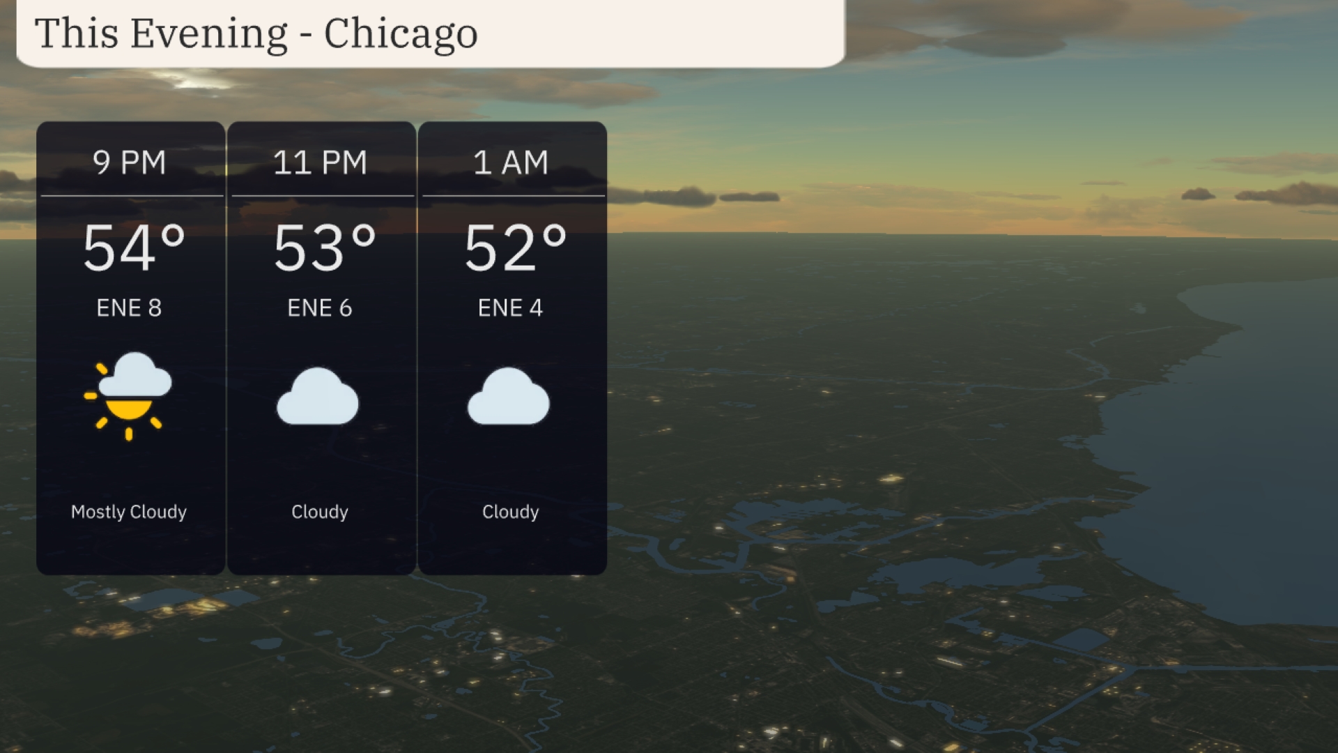
In-depth weather analysis by renowned meteorologist Amy Freeze capturing the dynamic changes in weather across the Midwest. Coverage includes forecast details on storms, temperature variations, and UV index insights. Prepare for your week with critical weather information and safety tips. Across the Midwest, the radar shows a substantial storm system developing over southern Missouri and western Illinois, with Springfield experiencing intense rainfall and thunderstorms. This system is headed northeast toward the St. Louis area, which can expect heavy rain and possibly stormy conditions. Clouds are spreading over Chicago, but the area remains dry for now. Detroit and the surrounding regions, including Cleveland, are under a swath of light rain moving from the east. Fort Wayne and Indianapolis are enjoying clear skies before potential weather changes later in the day. For this evening in Chicago, look for mostly cloudy skies with temperatures gently descending from 54 degrees at 9 PM to 52 degrees by 1 AM. Winds will be coming from the east-northeast at 8 miles per hour around 9 PM, calming to 4 miles per hour by midnight. Cloud cover will increase, with cloudy conditions prevailing through the late evening hours. Tonight in the Midwest, Chicago will see a low of 47 degrees, while Indianapolis is forecasted to chill down to 50. Look for Peoria at 49 degrees and Fort Wayne slightly cooler at 46. Saginaw is expected to drop to 44, marking one of the colder spots in the region. Expect a mild night in Cleveland with a low of 51 degrees. Tomorrow Chicago is forecast to hit 61 degrees, while Indianapolis reaches a pleasant 66. St. Louis and Louisville will see similar highs of 69 degrees, and in Bowling Green, temperatures could soar to 70. Kansas City will be cooler at 65 degrees, with Fort Wayne expecting a high of 67. Charleston is poised for the warmest day in the region, with a high of 72 degrees. A strong storm system approaches the Midwest with showers moving into Des Moines and Peoria by late morning. Expect thunderstorms to develop, with potential for severe weather including hail and gusty winds, especially near St. Louis. Keep an eye on possible delays and hazardous travel as rain could reduce visibility. Temperature trends show a cooling pattern post-front, with highs dropping by 10 to 15 degrees across the region. Indianapolis and surrounding areas should anticipate precipitation tapering off by evening. The UV index in Chicago for Saturday and Sunday is high, with a level of 8 each day. This indicates a burn time of just 17 minutes in direct sunlight, so be sure to apply sunscreen frequently and wear protective clothing. Here’s the 7-day forecast for Chicago:
Saturday: Cloudy conditions with a high of 60 degrees and a low of 51.
Sunday: Skies clear up for a mostly clear day with temperatures reaching 63 degrees and dropping to 46 at night.
Monday: Expect a cloudy day, with a high of 64 degrees and a low of 51.
Tuesday: Showers are likely, bringing a high of 64 degrees and a low of 55.
Wednesday: Partly cloudy skies with a mix of sun and clouds, reaching 65 degrees for the high, and cooling off to 53 at night.
Thursday: Partly cloudy with a mild high of 67 degrees and a nighttime low of 55.
Friday: Wrap up the week with partly cloudy skies, as the temperature climbs to 70 degrees.