Atlanta’s Morning Mix: Storms, Sun, and Surprises in the Southeast
By
Amy Freeze
Explore the dynamic weather pattern hitting Atlanta and the Southeast from thunderstorms in the Gulf to sunshine in Savannah.
Tomorrow’s weather in Atlanta begins with thunderstorms in the morning before transitioning to a partly cloudy but warm afternoon. Detailed insights on what these changes mean for you!
Expect a whirlwind of weather activity as Atlanta faces a spectrum from thunderstorms to sunshine. Early morning thunder might disrupt your commute but will clear up, giving way to a warm and partly cloudy afternoon. With temperatures peaking at 89°F and a diverse weather scenario unfolding across the Southeast, our detailed breakdown helps you plan your days effectively while staying safe under the high UV index. Visit our full blog post at https://amyfreeze.ai/ for more details and safety tips.
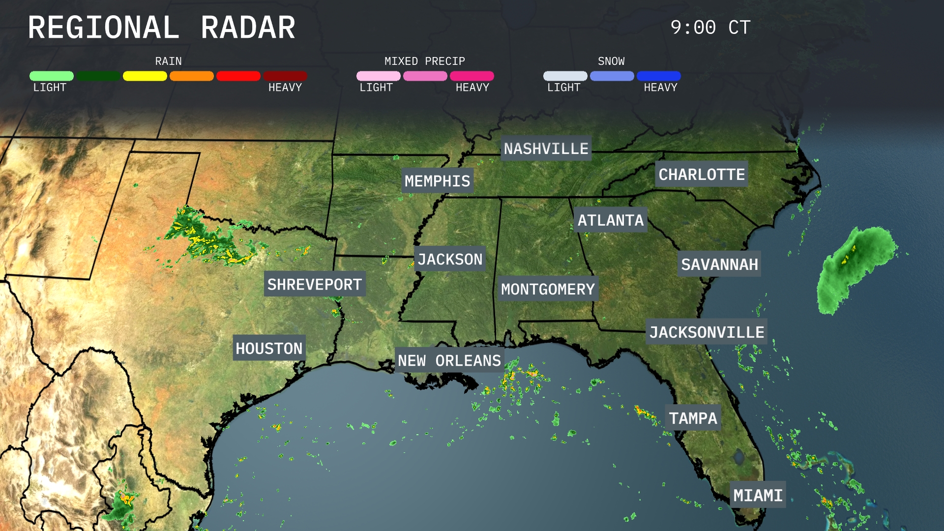
A small cluster of thunderstorms is developing just off the Gulf Coast near New Orleans, with scattered showers extending into the area. Savannah and Jacksonville can expect light showers while an area of heavier rain moves off the Atlantic coast near Miami. Central Georgia and South Carolina remain under cloudy conditions, potentially bringing rain later. Texas is seeing thunderstorms west of Houston while much of Mississippi and Alabama are enjoying clearer skies.
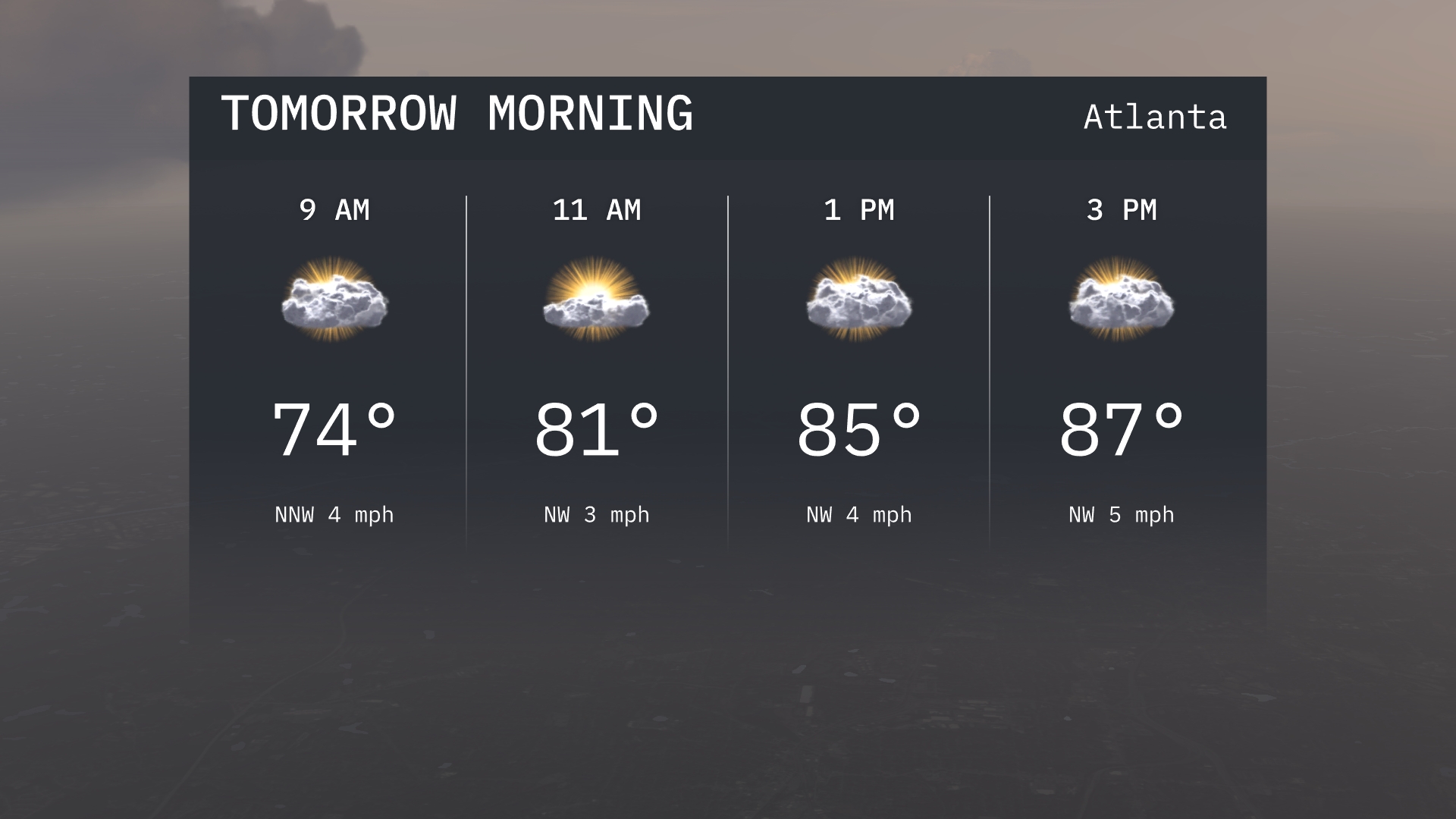
Atlanta will begin its morning with temperatures at 74 degrees by 9 AM, rising to 81 degrees by 11 AM. The forecast shows a partly cloudy sky with winds coming from the northwest at 3 to 4 miles per hour. Expect a gradual warming trend as the morning progresses, setting the stage for a warm afternoon.
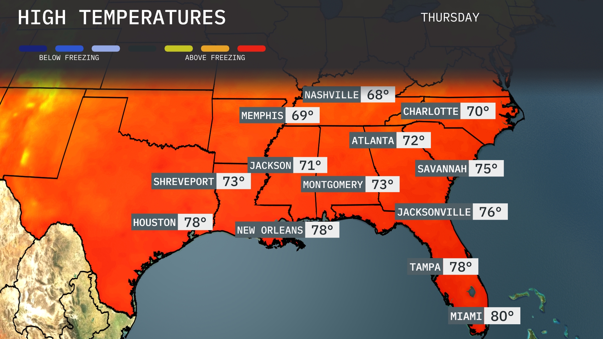
Tomorrow, Atlanta will reach a high of 72 degrees, while Nashville will be slightly cooler at 68 degrees. In the Gulf region, New Orleans and Houston are warming up to 78 degrees, creating a pleasant afternoon. Jacksonville and Tampa are also looking at highs of 76 and 78 degrees respectively, indicating a consistent trend across the coast. Miami will enjoy the warmest temperatures in the Southeast, hitting 80 degrees as summer heat lingers.
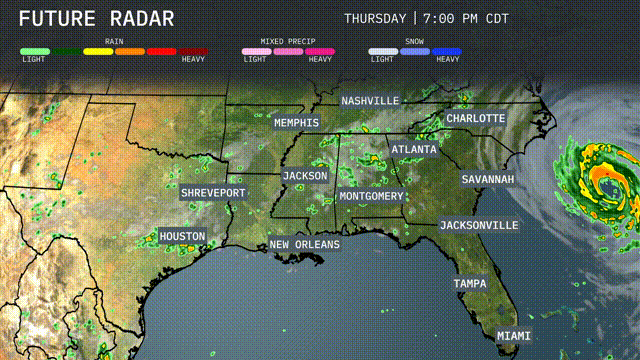
A dynamic weather pattern is setting up across the Southeast as a cold front approaches from Texas, bringing embedded thunderstorms into Arkansas, Louisiana, Mississippi, and Alabama. Expect thunderstorms early tomorrow morning in Atlanta during the commute. New Orleans to Montgomery is under the storm path with potential heavy rainfall. Jacksonville to Savannah anticipates thunderstorms by tomorrow afternoon. Stay alert for localized flooding and potential severe weather as more than an inch of rain is expected over the next 48 hours.
The UV index in Atlanta will be high today, with a burn time of just 15 minutes in direct sunlight. Tomorrow, expect similar conditions with the same high UV index, so take proper sun protection measures. Keep sunscreen handy and consider protective clothing for both days!
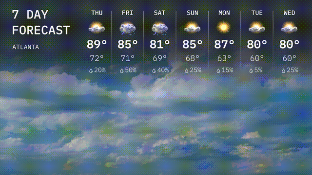
For the 7 Day Outlook in Atlanta:
Thursday: Partly cloudy with a high of 89 degrees and a low of 72 degrees.
Friday: Showers move in with a high of 85 degrees, cooling to 71 at night. Rain chance is 50 percent.
Saturday: Expect thunderstorms with a high of 81 degrees and a low around 69 degrees. Rain chance is 40 percent.
Sunday: Partly cloudy, warming up to 85 degrees, with an overnight low of 68 degrees
Monday: Enjoy more sunshine with a high of 87 degrees, cooling to 63 in the evening.
Tuesday: Expect drier conditions with a high of 80 degrees and a low of 60 degrees.
Wednesday: Mostly cloudy with temperatures peaking at 80 degrees and dipping to 60 overnight.