Soaring Temperatures and Sudden Showers: Your Comprehensive Southeast Weather Guide
By
Amy Freeze
Experience the heat and humidity across Atlanta and the Southeast as temperatures soar and storms loom. Stay ahead with your go-to weather forecast!
This week in Atlanta: Sizzling temps and potential storms. Read more about your local forecast and how to prepare for the weather ahead!
As Atlanta basks in high temperatures in the low 90s and prepares for a potential cooldown, residents should stay alert. With the southeast facing a blend of heatwaves and sudden thunderstorms, understanding this dynamic weather landscape is crucial for planning your days. From UV precautions to managing through sudden rainfalls, our extensive guide offers all insights.
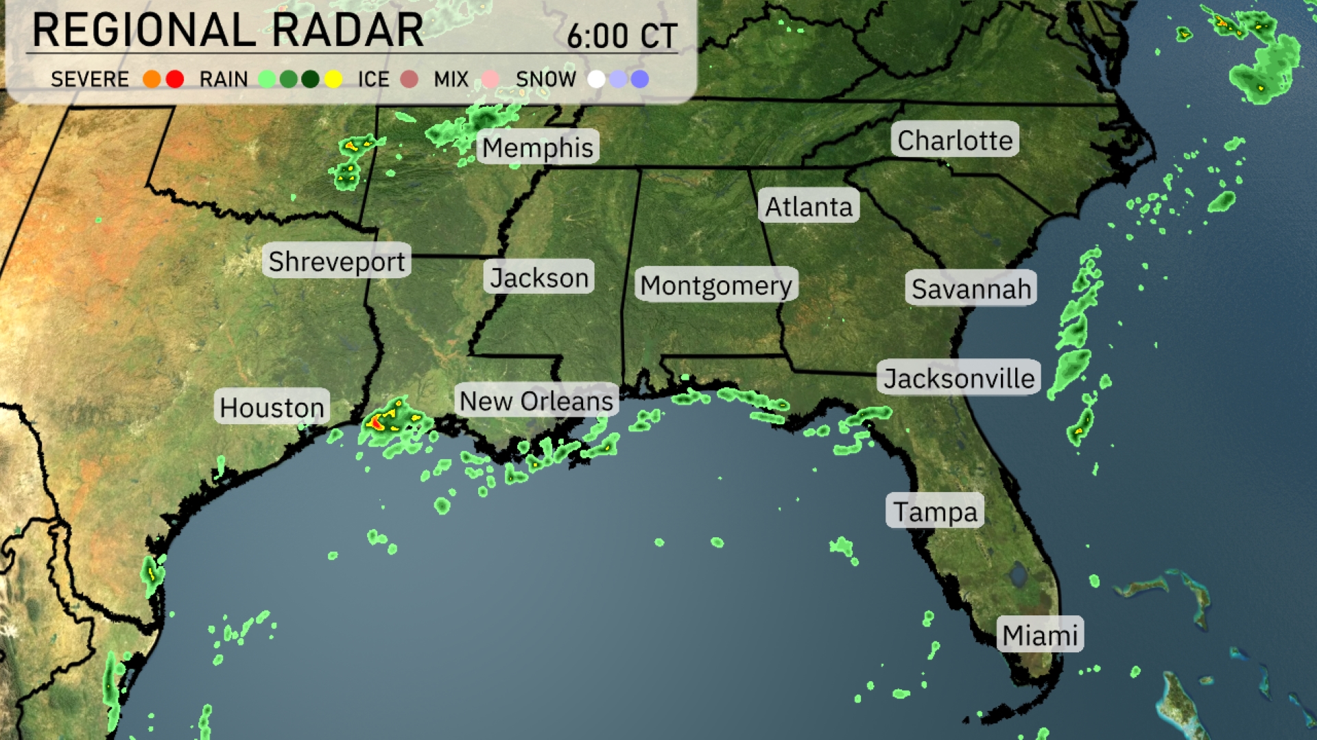
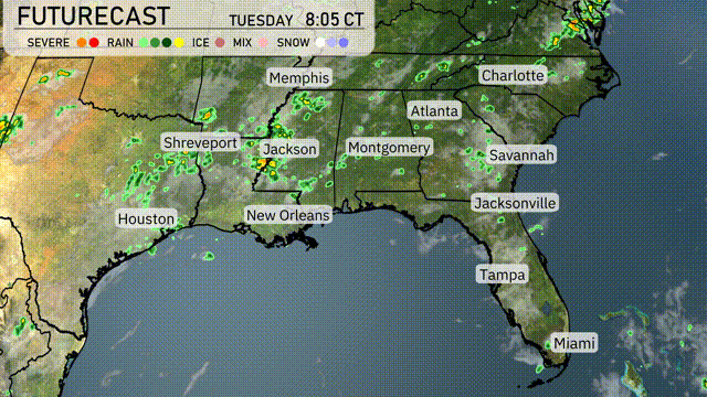
A band of showers is moving across the Gulf Coast, bringing rain to areas including New Orleans and Houston. Light rain is starting to drift into Montgomery and stretching towards Jacksonville. The Southeast’s inland regions, including Memphis and Atlanta, are experiencing clear conditions for now. Along Florida’s Atlantic coast, scattered showers are creating a damp start from Jacksonville down to Miami.
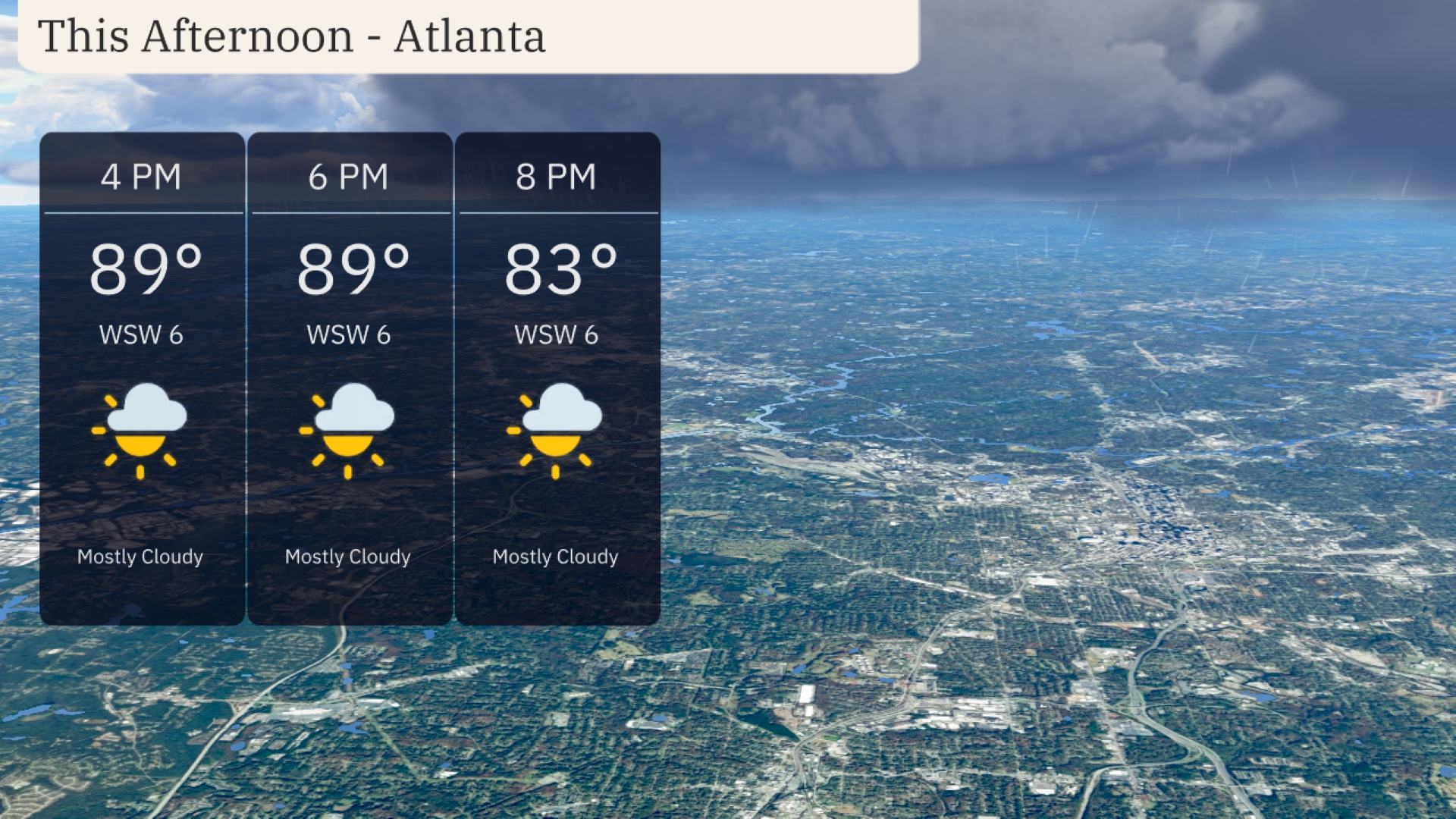
This afternoon in Atlanta, you’ll find temperatures steady at 89 degrees with mostly cloudy skies. Winds are coming from the west-southwest at about 6 miles per hour, providing a gentle breeze. As the afternoon progresses, clouds persist, but any rain is likely to stay away, keeping conditions dry.
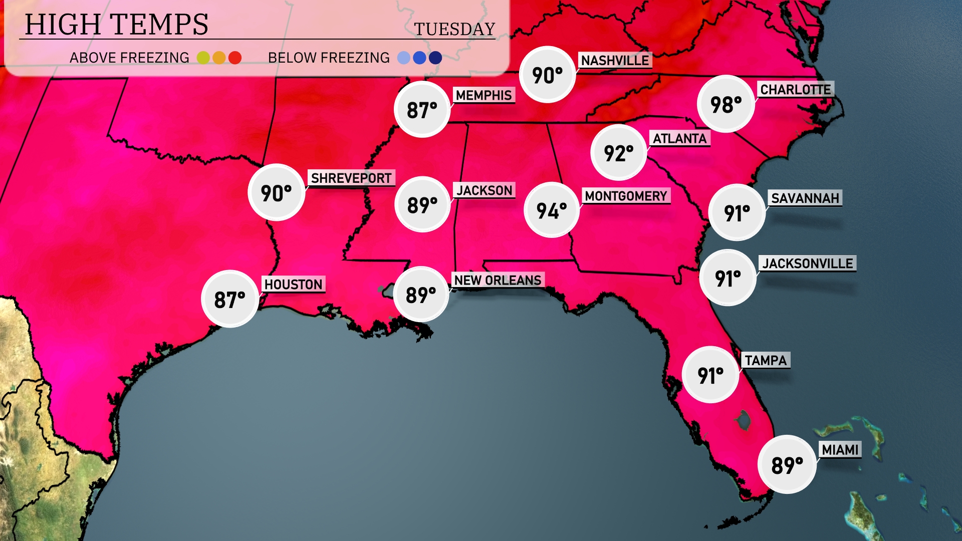
Today’s high temperatures in the Southeast are heating things up. Charlotte reaches a scorching 98 degrees, making it the hottest spot in the region. Atlanta isn’t far behind, with a high of 94 degrees, while Montgomery sizzles at 92. New Orleans and Jackson both hit 89 degrees, providing some relief in comparison. Over in Florida, Tampa and Jacksonville are tied at 91 degrees, offering steamy afternoons with a chance of scattered storms later on.
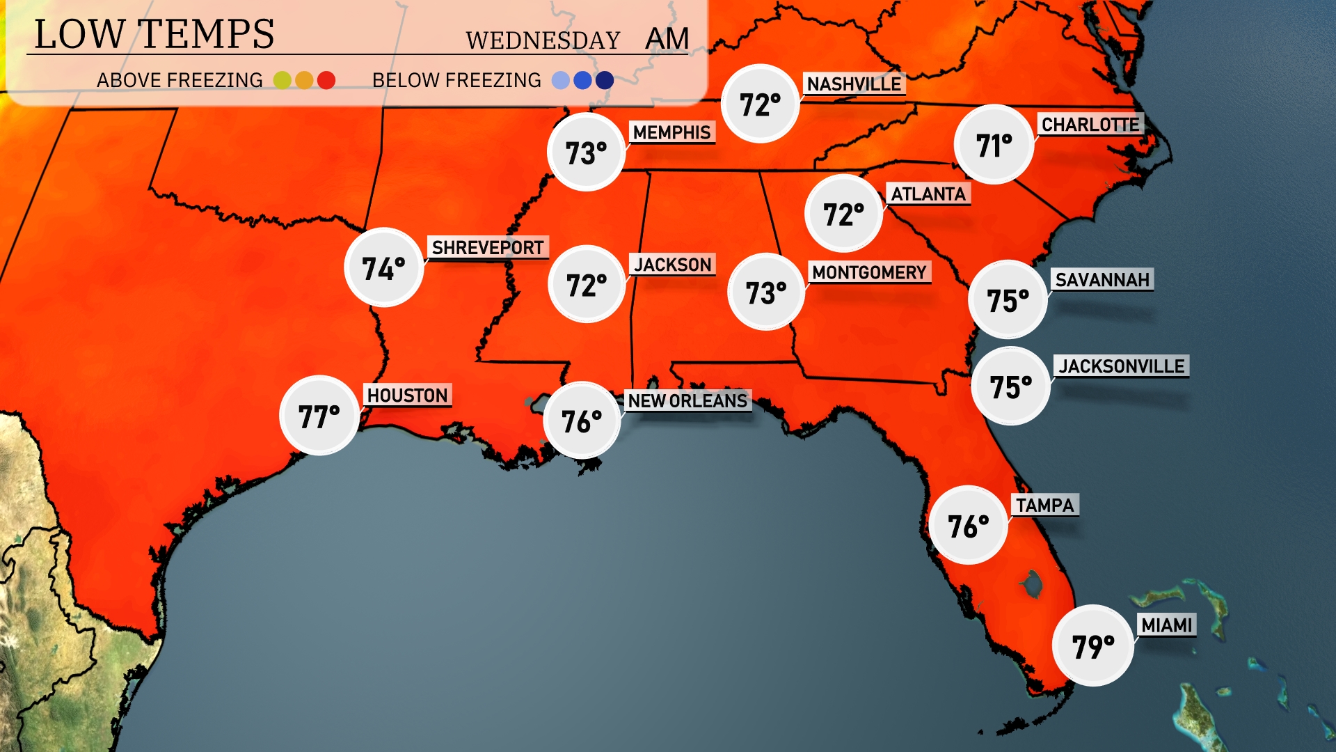
Tonight, low temperatures will be mild across the Southeast. Memphis will see a low of 72 degrees, with Nashville just a touch cooler at 71. Atlanta will drop to 72 as well, while Montgomery stays steady at 73. Jacksonville and Savannah will both hover around 75 degrees, keeping the warmth consistent throughout the region.
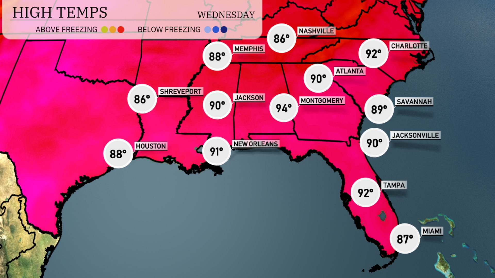
Tomorrow, Atlanta will experience a high of 90 degrees, while Montgomery reaches a sizzling 94. In Jackson, expect temperatures to peak at 90 degrees. New Orleans will be very warm at 91 degrees, and farther east, Tampa is set to hit 92.
A dynamic weather shift is heading to the Southeast with a cold front bringing embedded thunderstorms expected to move from Texas and Oklahoma into Arkansas, Louisiana, Mississippi, and Alabama. Severe storms with possible torrential rain and local flooding risks in areas like New Orleans and Shreveport are anticipated by late Tuesday. Jackson will experience storms leading into a wet Wednesday for cities like Montgomery and Atlanta as the front progresses east. Central regions from Jacksonville to Savannah should brace for showers and storms by Wednesday. Despite the stormy start, the skies will clear up by Thursday, bringing cooler but pleasant temperatures.
The UV index in Atlanta is extremely high at 11 on Tuesday, with a burn time of only 11 minutes. On Wednesday, it slightly decreases to 10, but the sun remains intense, with a burn time of 12 minutes.