Atlanta and Southeast Weather Alert: From Sunny Spells to Thunderstorms
By
Amy Freeze
Explore the dynamic weather changes impacting Atlanta and the Southeast, from pleasant sunny spells to severe thunderstorm alerts.
On June 11, 2025, experience a mix of sun and clouds in Atlanta while preparing for potential storms in the Southeast. Keep an eye on the skies!
Atlanta Afternoon News – June 11, 2025: Today in the Southeast, the weather swings from partly cloudy skies in Atlanta to storm threats looming over Houston. With temperatures peaking across various cities and potential severe weather including flash floods, this comprehensive weather update keeps you prepared. Follow our daily and weekly insights to stay ahead of the weather changes impacting your plans.
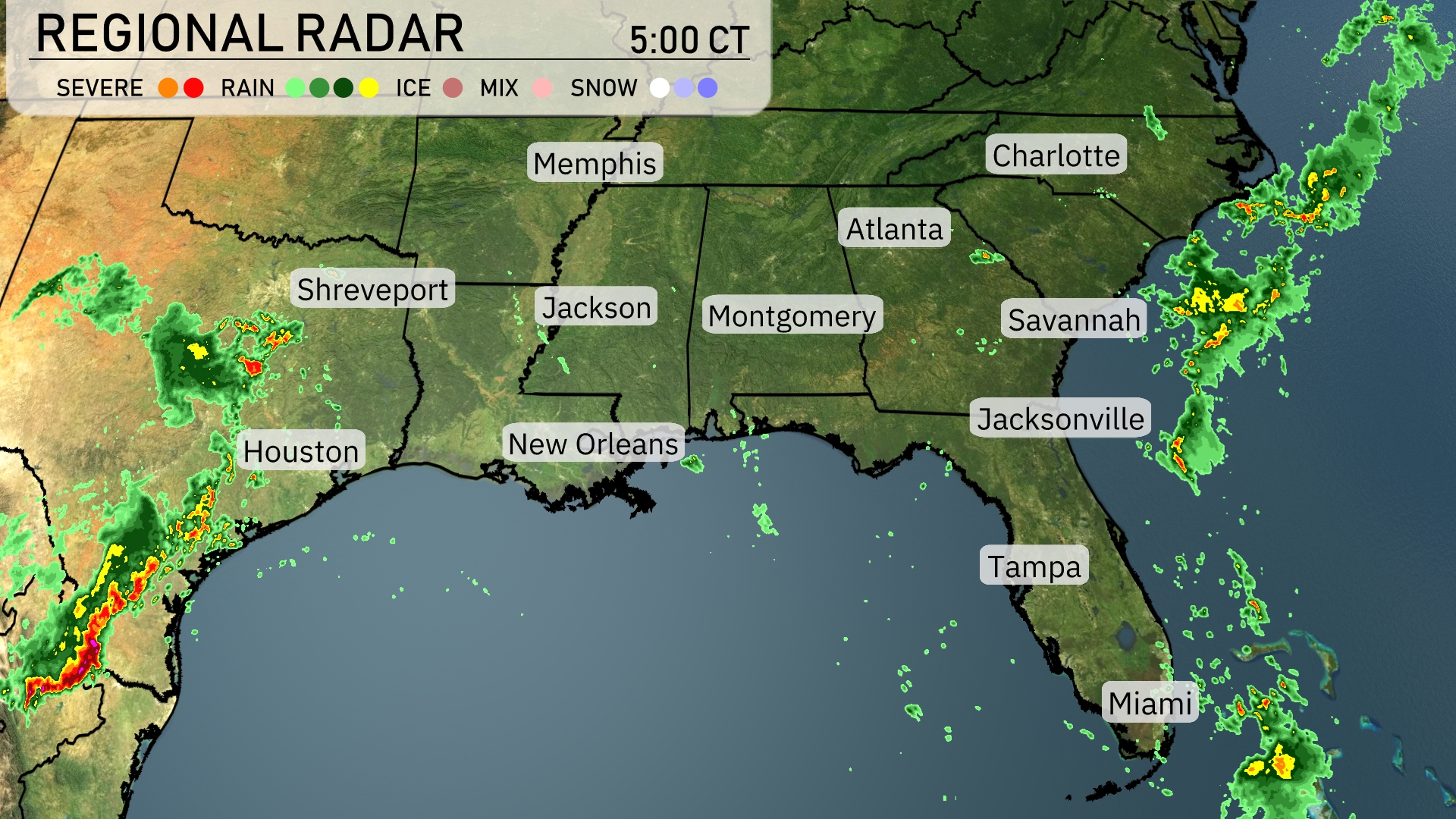
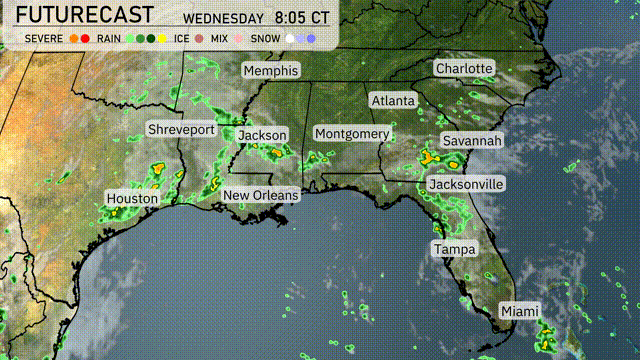
A storm system is approaching Houston from the west, bringing intense rainfall and the potential for severe weather. Showers and thunderstorms are extending eastward from Shreveport to Jackson, suggesting a wet commute for these areas. The Georgia coast, including Savannah, is seeing some scattered showers moving offshore, impacting Charleston and the surrounding Low Country. Areas like Miami are enjoying clear skies today.
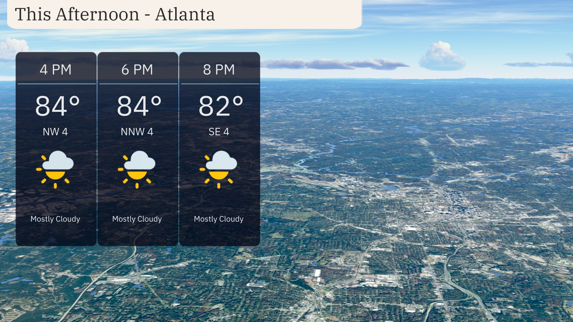
Afternoon temperatures in Atlanta are expected to hold at 84 degrees with mostly cloudy skies. Winds will shift from northwest at 4 mph to north-northwest by evening. Heading into the evening, winds will gently turn southeast at 4 mph.
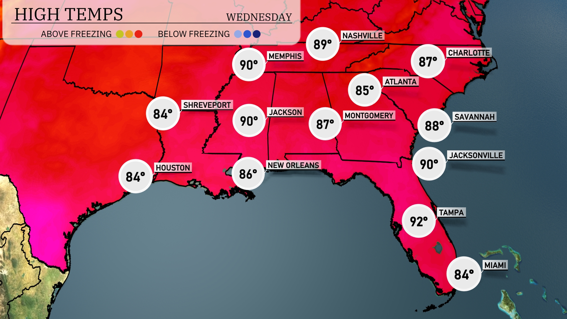
Today’s high temperatures in the Southeast are making for a warm afternoon. Atlanta will peak at 85 degrees, while Jackson sizzles with a high of 90. Over in Florida, Tampa will be a bit toastier at 92 degrees, while Jacksonville also sees a high of 90. Savannah is not far behind with a high of 88 degrees. New Orleans stays slightly cooler at 86 degrees.
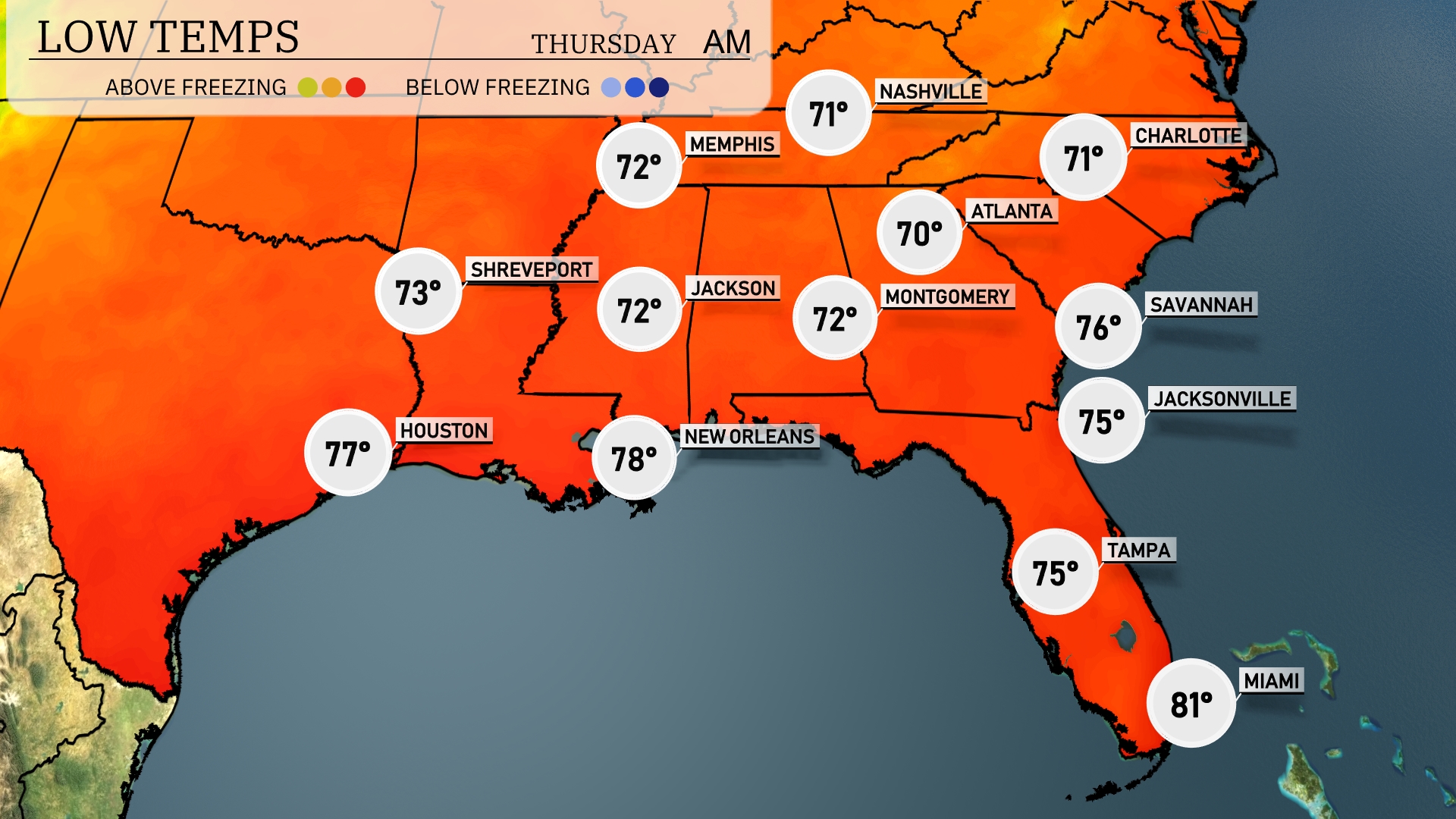
Tonight, expect Memphis to drop to 73 degrees, while Nashville will cool down to a pleasant 71. Jackson is forecasted at 72, with Montgomery also hitting the same low. In coastal cities, Jacksonville will see a low of 75, and further south, Tampa remains mild at 75 degrees.
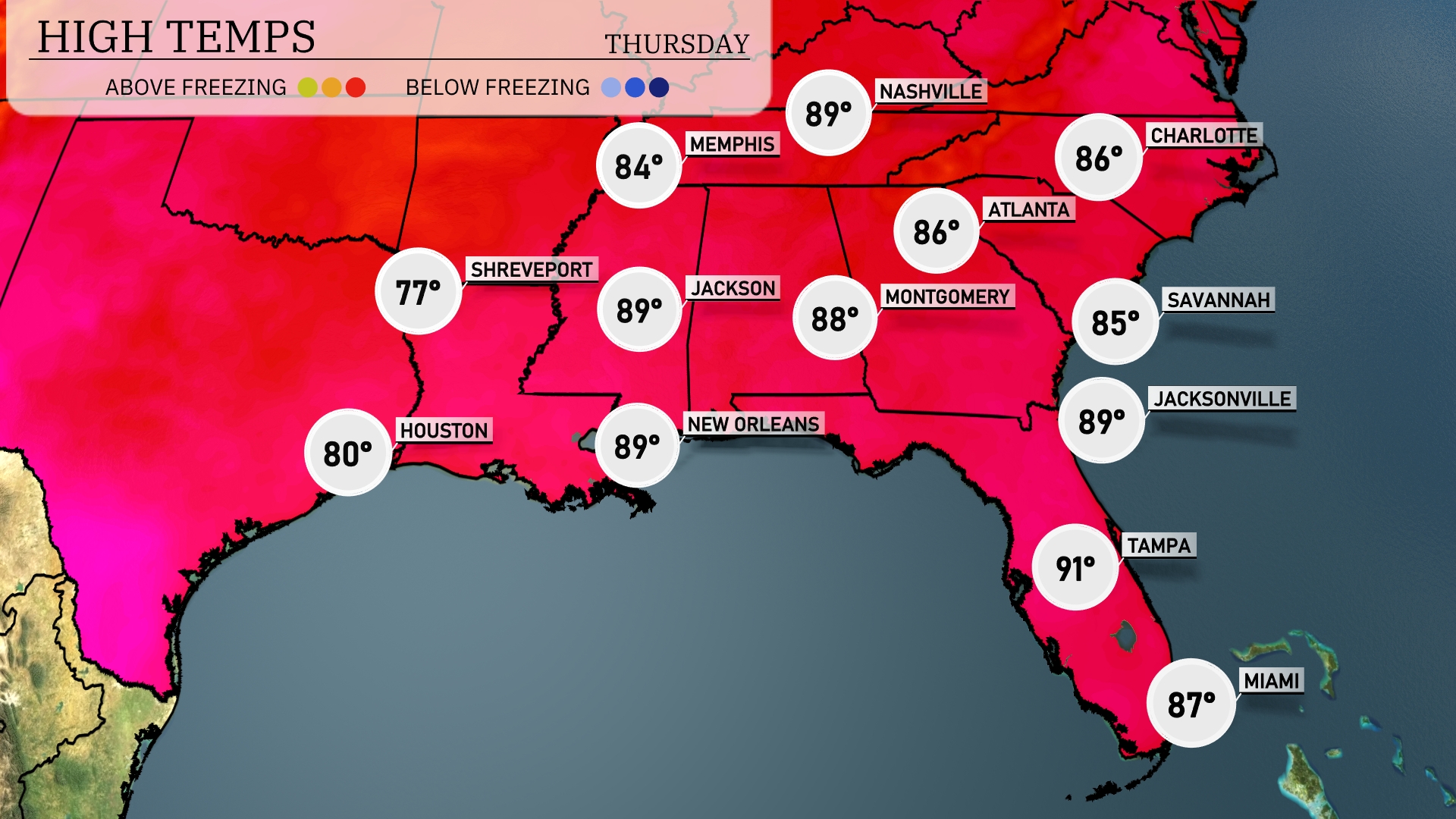
Tomorrow in the Southeast, expect warm temperatures with highs reaching 89 degrees in Jackson and New Orleans. Atlanta will have a high of 86 degrees, while Montgomery warms to 88. In Florida, Tampa leads the way with a scorching high of 91 degrees, and Jacksonville follows closely at 89 degrees.
A cold front is moving through the Southeast, triggering widespread thunderstorms from Houston to Atlanta. The heaviest rain is expected in areas from New Orleans to Montgomery, with a possibility of flash flooding due to repeated downpours. By early Wednesday, the front spreads intense thunderstorms across coastal Georgia from Savannah to Jacksonville. Up to two inches of rain may accumulate, necessitating caution for low-lying regions. Post-storm, expect temperatures to drop by roughly 5 to 10 degrees while clearing skies develop later in the day.
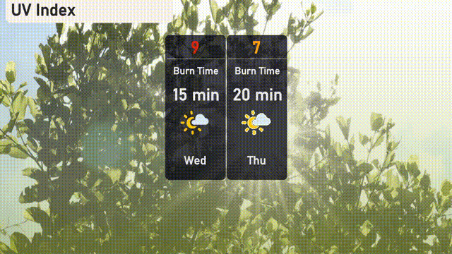
The UV index in Atlanta will reach a high of 9 on Wednesday, indicating a burn time of just 15 minutes in direct sunlight. Thursday sees a slight decrease to 7, with a burn time of 20 minutes.