Thunderstorms and Temperatures: A Detailed Weather Outlook for Atlanta and the Southeast
By
Amy Freeze
Explore the intricate dance of thunderstorms and soaring temperatures across Atlanta and the Southeast. Get insight into expected weather patterns, potential severe weather, and how it affects your week ahead.
Today’s forecast in Atlanta features thunderstorms and high temperatures affecting various cities across the Southeast. Dive into our full analysis for what to expect this week.
In today’s dynamic weather scenario, Atlanta and surrounding Southeast regions are experiencing a mix of thunderstorms and high temperatures. This detailed look explores how these patterns will influence daily activities and offers safety tips amid potential severe weather. With temperatures peaking and storms intensifying, understanding the forecast could be crucial for your week’s planning.
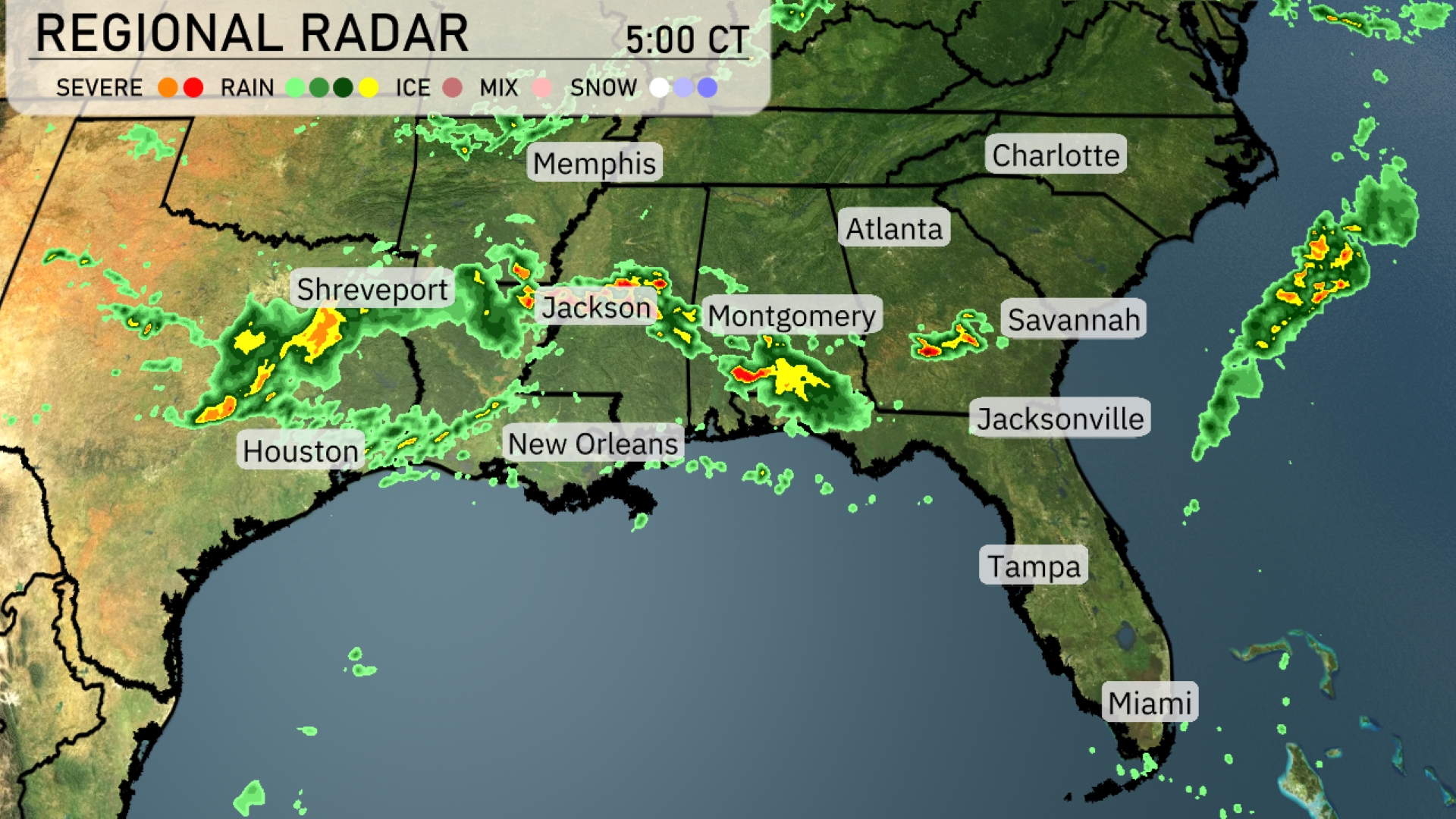
A line of strong thunderstorms is sweeping eastward across the Southeast, with heavy precipitation impacting areas from Jackson to Montgomery. Shreveport is drenched with intense rain, while Jackson and Montgomery are directly under the storm’s path. Rain is extending into Georgia, approaching Savannah and Jacksonville, bringing cloud cover and showers to these areas. Houston and New Orleans see light to moderate rain as the weather system advances.
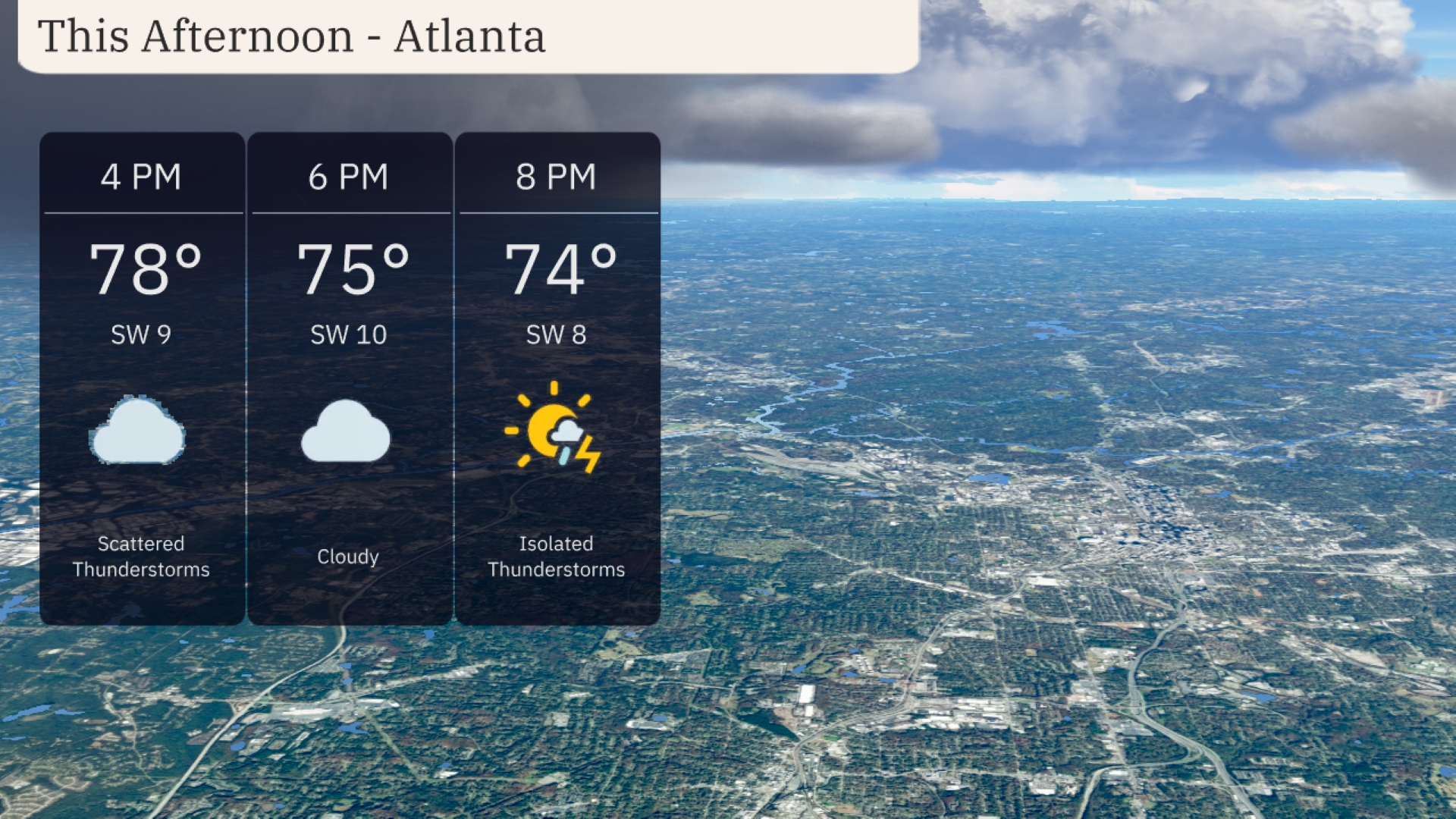
Atlanta’s afternoon forecast shows temperatures reaching up to 78 degrees with scattered thunderstorms. Winds will be from the southwest at 9 miles per hour, gradually shifting to 10 miles per hour by 6 PM, as skies turn cloudy with a temperature of 75 degrees. By 8 PM, isolated thunderstorms are expected, with temperatures slightly cooling to 74 degrees.
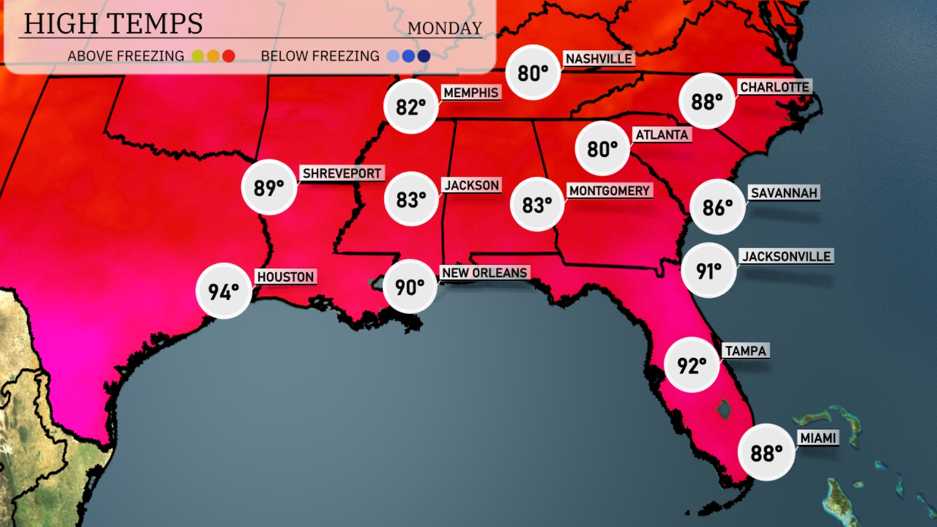
Look at those high temperatures today across the Southeast! In New Orleans, we’re seeing a warm high of 90 degrees, while Jackson also warms up to 83. Jacksonville is reaching up to 91 degrees, making it one of the hottest spots in the region. Atlanta will hit 88 degrees, and farther north, temperatures in Montgomery are a comfortable 83.
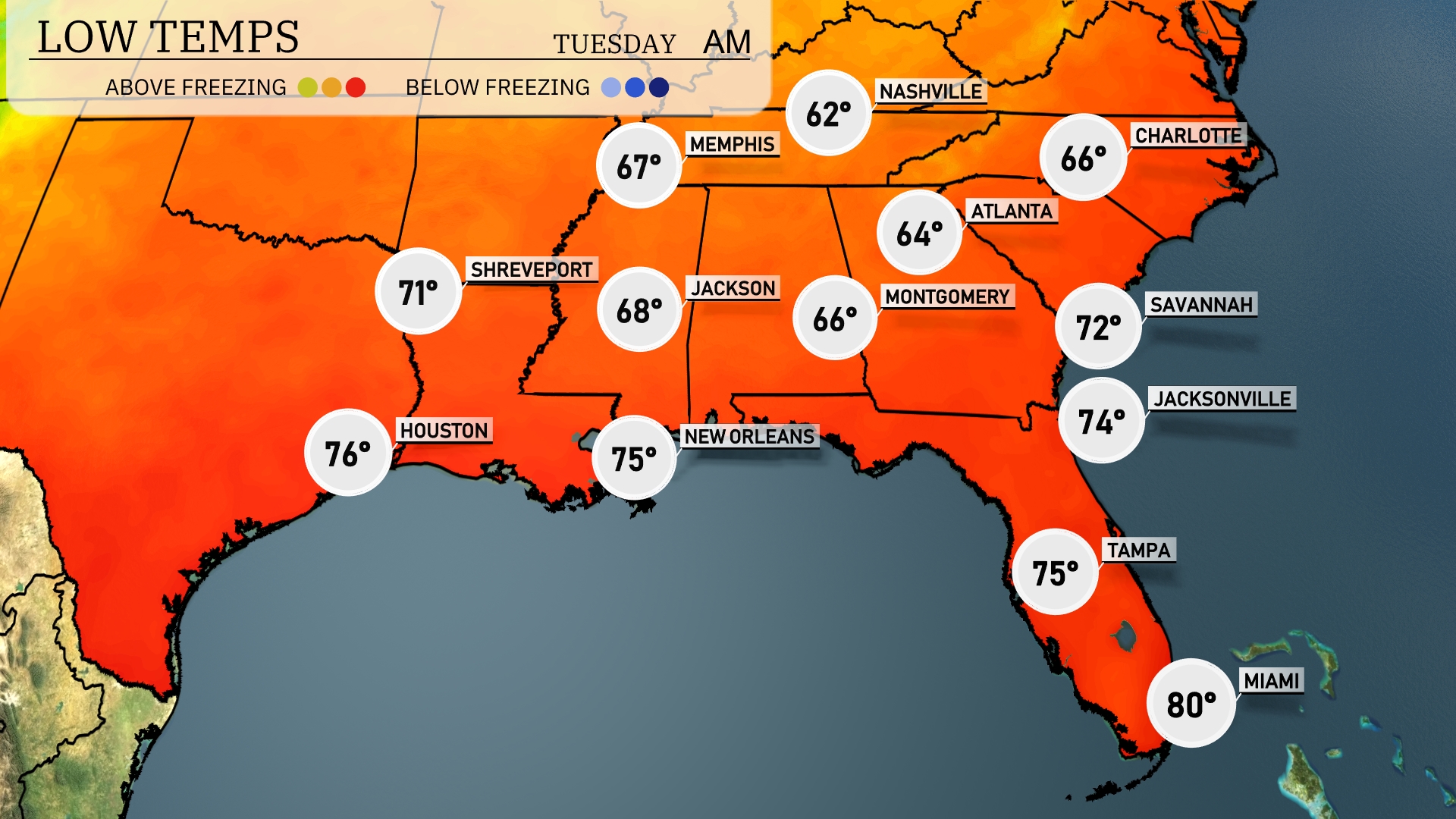
Tonight, low temperatures will be quite mild across the Southeast. Memphis will cool down to 62 degrees, while Nashville drops to 64. Montgomery is expected to see a low of 66 degrees, and Jackson will settle at 68. In contrast, Miami remains warmer with a low of 80 degrees.
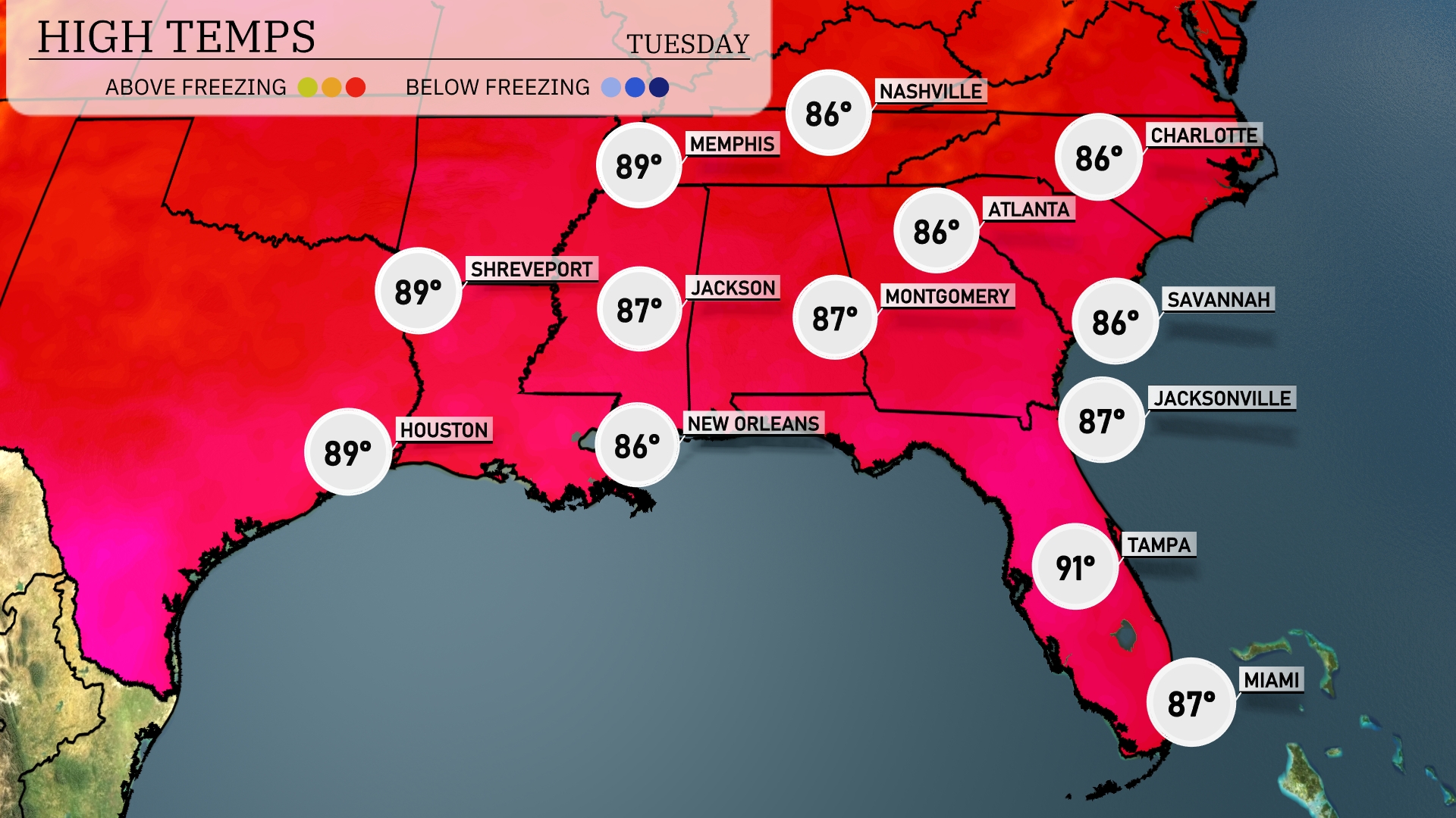
Tomorrow in the Southeast, Memphis will reach a high of 89 degrees, while Nashville warms up to 86. Jackson is expected to enjoy a high of 87, coupled with New Orleans at 86 degrees. Atlanta and Montgomery are also set for similar readings, both at 86 degrees. In Florida, Tampa is heating up significantly with a high forecasted at 91 degrees.
A cold front with embedded thunderstorms is expected to move through the Southeast tomorrow, affecting areas from Jacksonville to Montgomery. Anticipate heavy downpours and possible severe weather as the system progresses, with strong winds posing a risk. Rainfall amounts could surpass an inch in some locales, which may alleviate drought concerns but also raise the risk of localized flooding. Temperatures are likely to drop by several degrees behind the front, bringing cooler, drier conditions.
Today in Atlanta, the UV index reaches a high of 7, with potential sunburn in about 20 minutes when directly exposed. Tomorrow, anticipate a very high UV index of 10, significantly reducing the burn time to just 12 minutes.