Atlanta’s Weather Wonders: A Look at This Week’s Fiery Forecast and Beyond!
By
Amy Freeze
Explore the dynamic weather patterns affecting Atlanta and the Southeast, with a detailed analysis of temperatures, storms, and a 7-day outlook.
Stay updated with Atlanta’s weekly weather forecast: From sunny afternoons to severe storm warnings, we’ve got your weather needs covered!
Welcome to our deep dive into Atlanta’s intricate weather patterns. This post covers everything from today’s conditions to a detailed 7-day outlook with insights into potential storms and temperature changes. Follow along as we explore the impacts of a high-pressure ridge and an advancing cold front across the Southeast.
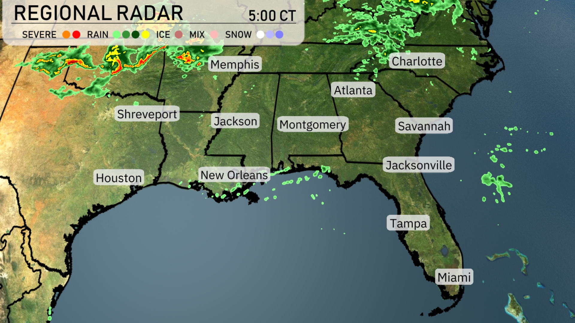
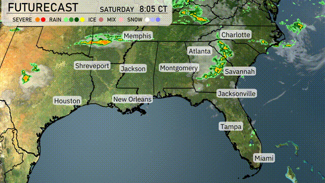
On the Regional Radar, we see a band of severe storms stretching across northern Louisiana and southern Arkansas, moving towards Memphis. These intense conditions are expected to bring heavy rain and potentially damaging winds. In addition, scattered light rain is visible near Savannah, while Charlotte is experiencing heavier showers moving in. The remainder of the Southeast, including Miami and Tampa, appears relatively clear with only sparse cloud cover.
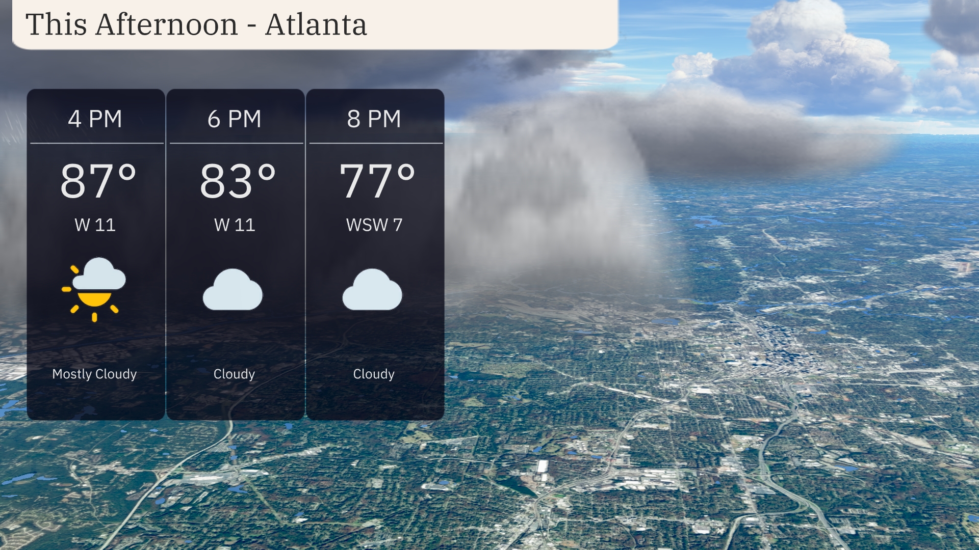
Atlanta temperatures for this afternoon are steady in the upper 80s, starting at 87 degrees by 4 PM and cooling to 83 degrees by 6 PM with a strong west wind at 11 mph. As cloud cover increases, expect mostly cloudy conditions throughout. By 8 PM, temperatures drop further to 77 degrees with the wind easing slightly to 7 mph from the west-southwest.
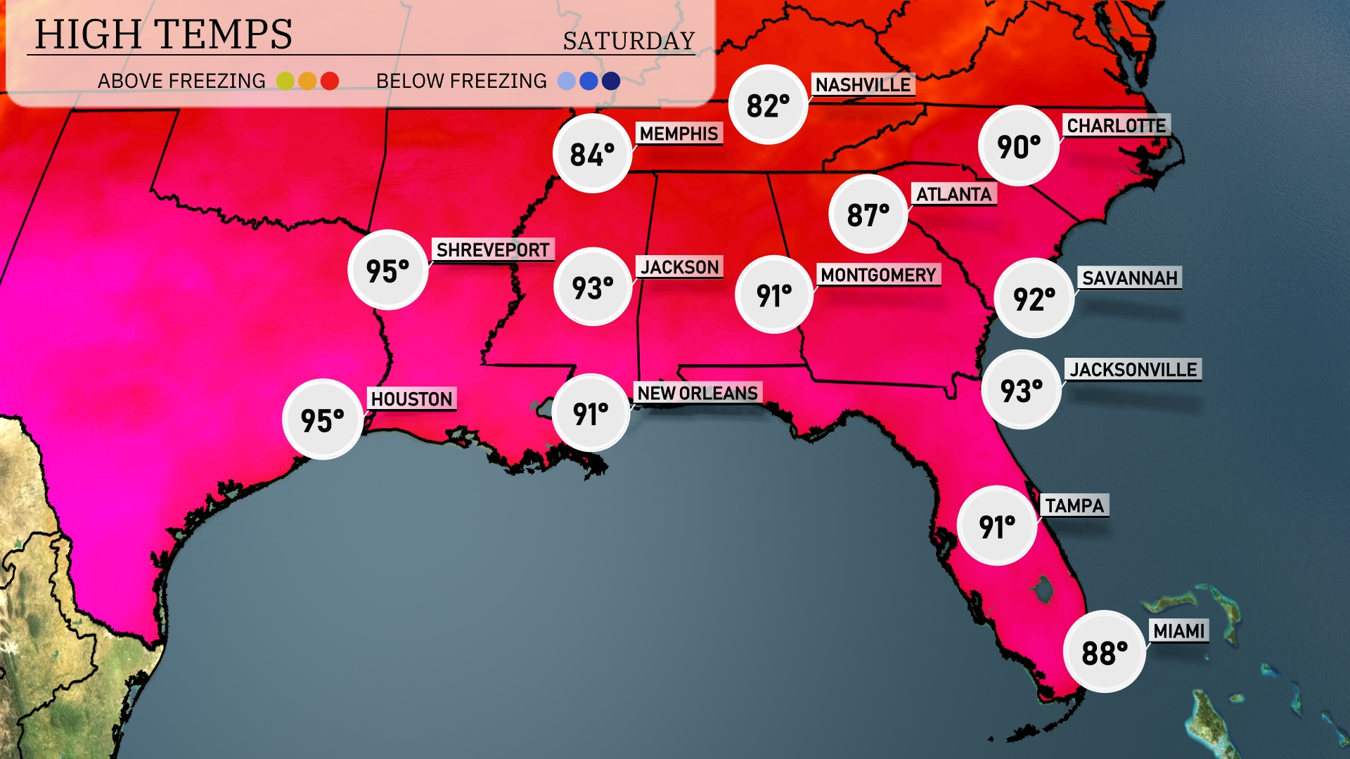
Today’s high temperatures in the Southeast are climbing significantly. Shreveport and Houston are both sweltering at 95 degrees. Jackson reaches a warm 93 degrees, while New Orleans checks in at a comfortable 91 degrees. Over in Atlanta, temperatures are slightly lower at 90 degrees, but still warm. In Florida, Jacksonville hits 93, with Tampa a bit cooler at 91 and Miami at 88 degrees, indicating some coastal moderation.
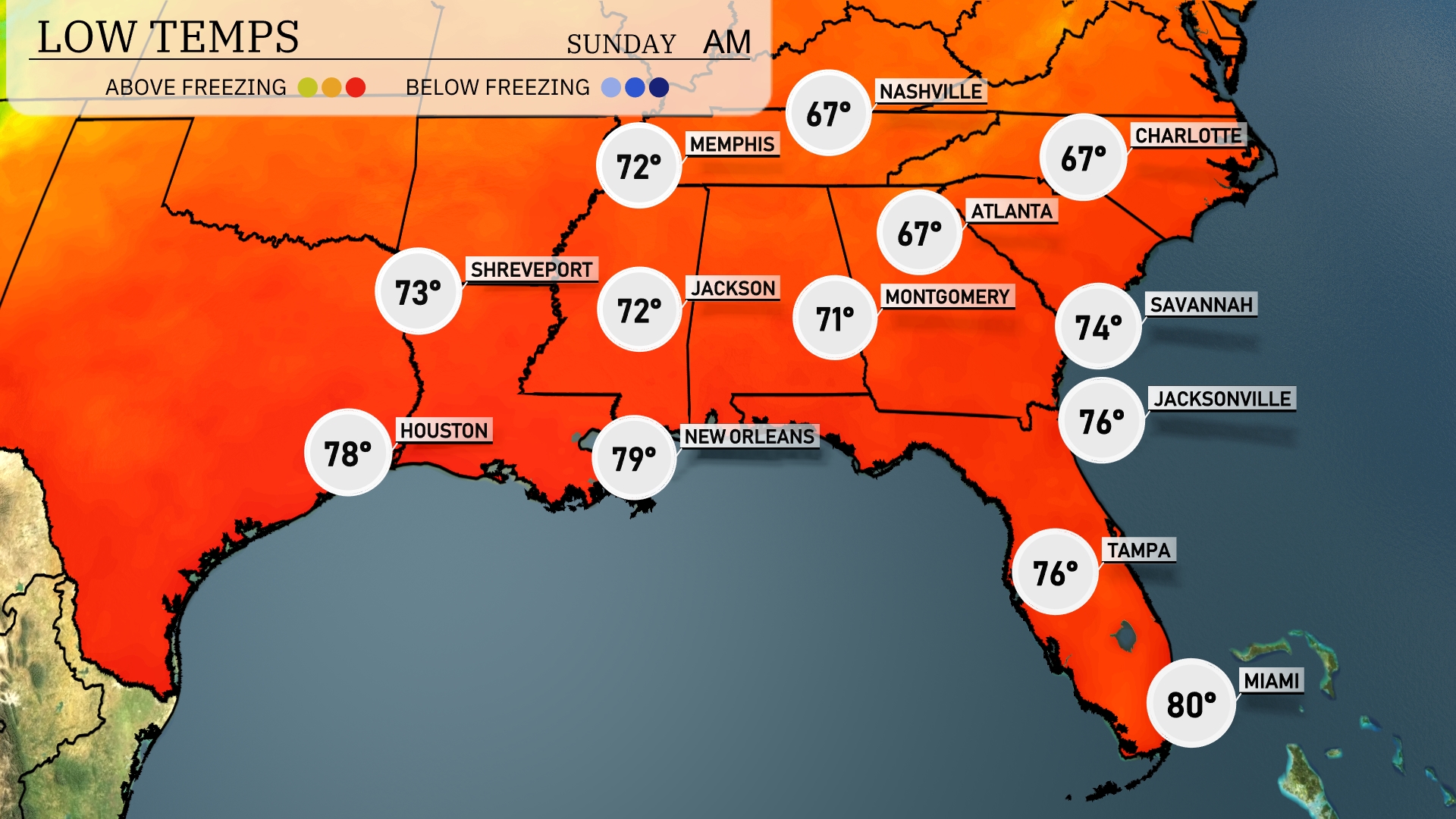
Tonight, Memphis will drop to a mild 72 degrees. Expect lows of 71 in Montgomery and 73 in Shreveport, while Jackson is forecasted to cool down to 72. Atlanta and Nashville will see similar temperatures, hitting 67 degrees. Savannah and Jacksonville will hold a bit warmer at 74 and 76 degrees, respectively.
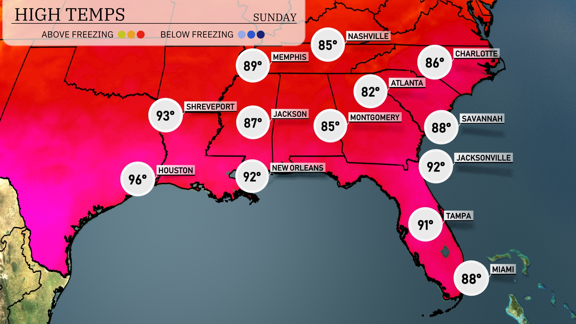
Tomorrow in Houston, expect a scorching high of 96 degrees. Jackson will warm up to 87 degrees, while New Orleans sees a high of 92. In Atlanta, temperatures will reach 82 degrees, and Charlotte can look forward to a high of 86 degrees. Coastal cities like Jacksonville and Tampa will also experience warm temperatures, topping out at 92 and 91 degrees, respectively. Many locations are trending above average due to a persistent ridge of high pressure influencing the region.
A cold front moving through the Southeast will spark thunderstorms from Memphis to Montgomery tomorrow. Expect scattered storms, with potential for heavy rainfall and gusty winds during the afternoon and evening hours. In Atlanta, temperatures will dip slightly following the frontal passage, bringing cooler conditions by late Wednesday. Showers and thunderstorms will extend across the region, reaching Jacksonville by evening.
The UV index in Atlanta will be very high on Saturday, peaking at 9 with a burn time of just 15 minutes in direct sunlight. On Sunday, it decreases to a high of 7, with a burn time of 20 minutes.