Atlanta’s Spring Symphony: Sun, Breezes, and Storm Alerts
By
Amy Freeze
Meteorologist Amy Freeze guides you through a week of fluctuating weather patterns in Atlanta from delightful sunny afternoons to impending stormy evenings. Stay prepared with our detailed forecast.
From gentle breezes and clear skies to storm warnings and cool nights, Atlanta’s weather is in for a rollercoaster ride this week. Tune into our forecast with Amy Freeze for all the details you need to know.
Welcome to Atlanta’s Spring Weather Report with Meteorologist Amy Freeze. This week, Atlanta offers a melodious mix of weather, from serenely sunny afternoons to sudden stormy evenings. With sunshine dominating the landscape amidst gentle western breezes, the city promises ideal conditions for outdoor enthusiasts. However, as the week progresses, a looming cold front threatens with heavy showers and severe weather, including potential tornadoes. We break down the day-by-day expectations, discuss the UV index for safe outdoor activities, and provide pivotal tips for weathering the upcoming storms. Prepare for every weather scenario with us and ensure your week is both safe and enjoyable.
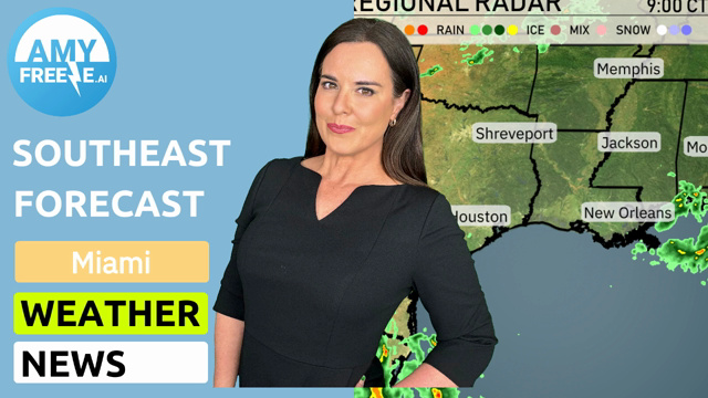
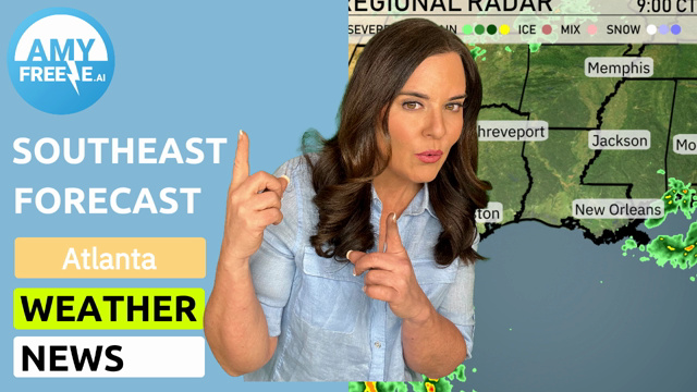
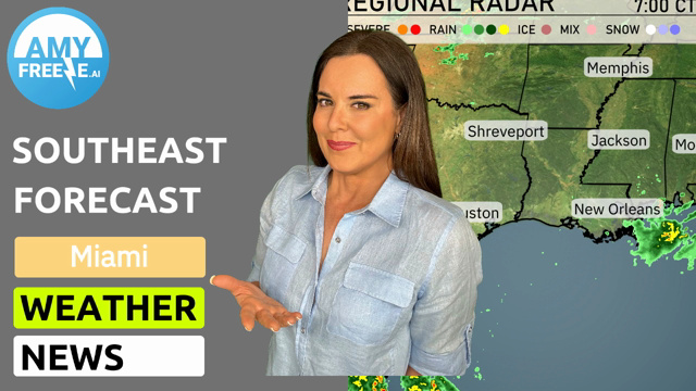
The Southeast region is displaying quite calm weather on the regional radar, except for some isolated rain showers dotted near Jacksonville and with a hit or miss shower for areas farther south in Florida. A weak weather system is developing, bringing a few scattered showers near these locations. Meanwhile, most other cities, including Atlanta, Montgomery, and New Orleans, are enjoying dry conditions with clear skies. North of Charlotte, some light shower activity is visible. The rest of the region, including Savannah and Houston, are enjoying a break from any significant weather events.
In Atlanta this afternoon, temperatures hold steady at 71 degrees by 3 PM and 5 PM, with a gentle breeze from the west-northwest at 13 to 12 miles per hour. Expect sunny skies throughout the late afternoon, gradually transitioning into clear conditions by 7 PM when temperatures dip to 65 degrees.
Let’s take a look at those high temperatures across the region today. In Shreveport, we’re seeing a warm high of 81 degrees, making it one of the hottest spots. Over in Houston, temperatures are slightly cooler at 83 degrees.
Moving east, Jackson reaches a high of 79, while New Orleans enjoys a pleasant 76 degrees. On the coast in Florida, Tampa sees a high of 73 degrees, with Miami matching that at 75.
Farther north, temperatures dip as we hit Atlanta at 72 and Jacksonville at 75, while Savannah is just a bit cooler at 74 degrees. It’s a delightful spring day across the Southeast with plenty of sunshine to enjoy!
The Southeast is in for a chilly night. Memphis will cool down to 44 degrees, while Nashville expects a low of 49. Shreveport will see 46 degrees, and Jackson will drop to around 48. Montgomery and Atlanta will both experience lows in the 50s. In the coastal areas, Savannah will be slightly cooler at 64, Jacksonville at 48, and Tampa will settle at 66 degrees. Miami will remain warm, with a low of 73 degrees. Overall, expect a notable drop across the region, particularly in the Tennessee Valley.
High temperatures for the Southeast tomorrow are looking quite warm, with many areas experiencing above-average readings. In Houston, we’re expecting a high of 82 degrees. Shreveport will feel the heat with a high of 84 degrees. Jackson also reaches 80 degrees, while New Orleans is on track for a pleasant 78 degrees.
Farther north, Memphis will see a high of 73 degrees, which is slightly cooler, yet still mild for this time of year. Nashville is forecasted for a high of 78 degrees, while Atlanta will warm up to 78 degrees. In Florida, both Tampa and Jacksonville are set to reach 82 and 78 degrees, respectively, showcasing a nice day in the Sunshine State.
“Looking ahead on the futurecast for the Southeast, expect active weather as a cold front pushes in from the west. Strong thunderstorms are anticipated across states like Mississippi, Alabama, and Georgia, with some areas seeing severe weather risks, including damaging winds and isolated tornadoes. Rain will be heavy at times, particularly from Jackson to Montgomery, potentially causing localized flooding. As the front moves toward the East Coast by early Sunday, cities like Savannah and Jacksonville should brace for stormy conditions. In the wake of the system, drier and cooler air will filter in, leading to more mild weather into early next week.”
The UV index in Atlanta will be a high level of 7 this weekend. Be cautious if you plan to be outdoors, as burn time is approximately 20 minutes. Remember to wear sunscreen and protective clothing to minimize sun exposure.