Weathering Atlanta: Evening Update and a Look at the Week Ahead
By
Amy Freeze
Get the latest updates on Atlanta’s weather conditions for tonight and what to expect in the coming week as temperatures sway and storms approach.
Tonight in Atlanta: Skies remain partly cloudy with mild temps. Check our full weekly forecast for more on the heating trends and upcoming storms in the Southeast.
This evening in Atlanta, expect partly cloudy skies and mild conditions, perfect for an evening stroll but keep that umbrella handy. Our special coverage includes a night-by-night breakdown and a detailed analysis of the Southeast’s temperature highs and storm probabilities. With a cold front approaching, learn what these changes mean for your daily plans and discover tips for staying safe during severe weather. Don’t miss our UV index guide for effective sun protection!
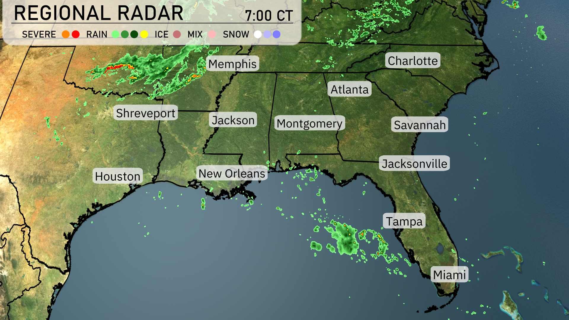
On the Regional Radar, scattered showers are moving across parts of Mississippi and Alabama, with considerable precipitation around Memphis extending towards Jackson. Shreveport and New Orleans are experiencing light rain, as a line of moisture continues to push east. In Georgia, Atlanta remains dry for now, but increasing cloud cover suggests forthcoming rain. The Florida Panhandle and areas near Jacksonville are seeing isolated showers.
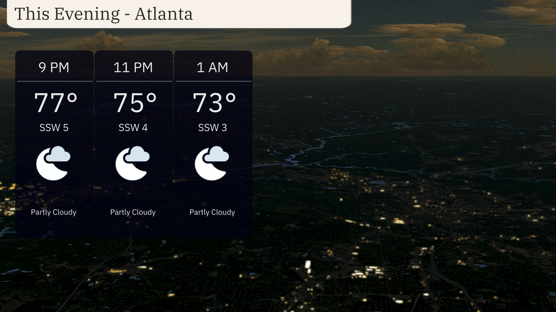
For this evening in Atlanta, expect partly cloudy skies and mild conditions. Temperatures will gradually decrease from 77 degrees at 9 PM to 73 degrees by 1 AM. Winds will be gentle from the south-southwest, ranging from 5 to 3 miles per hour throughout the evening.
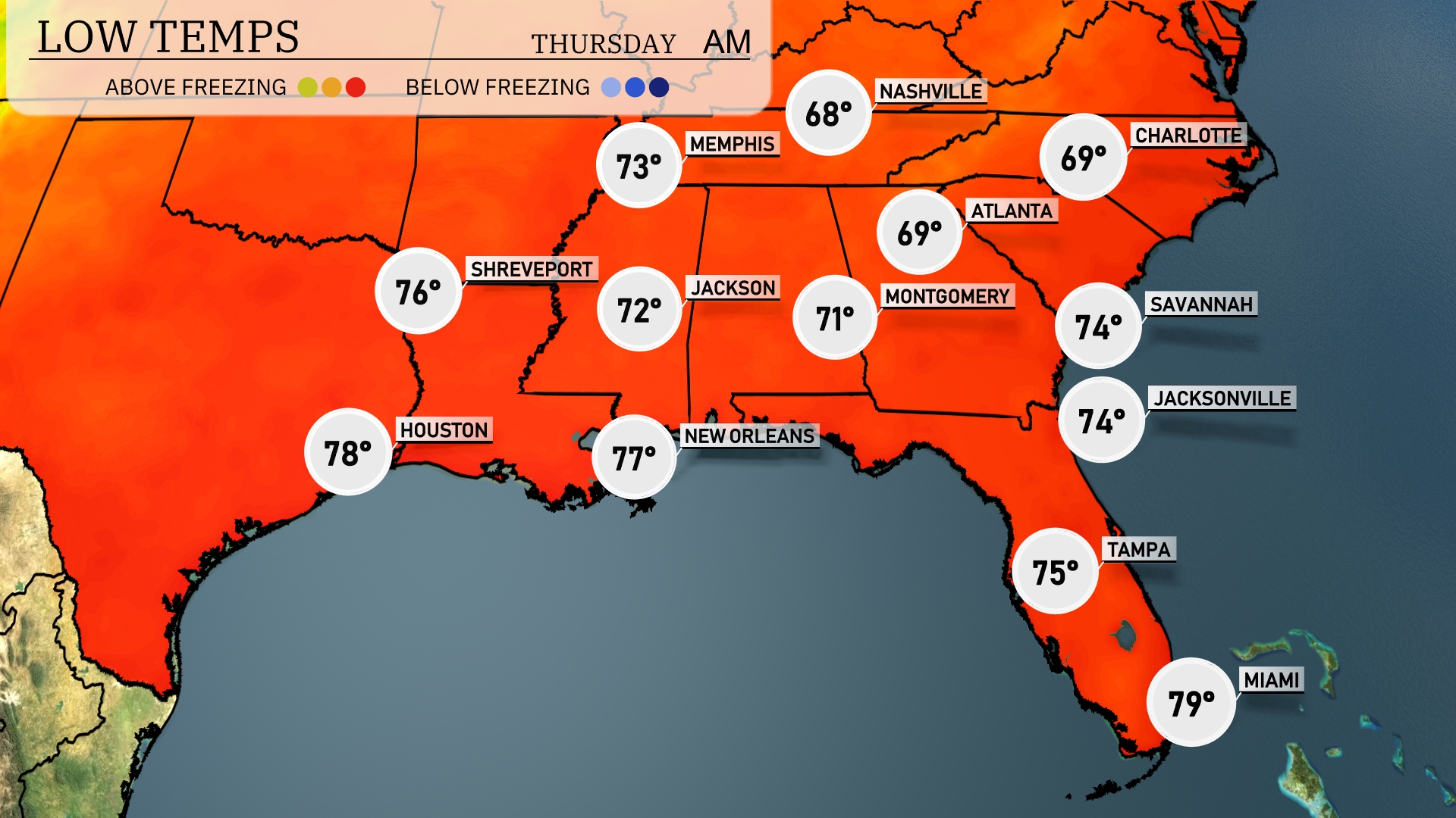
Tonight, Nashville will see a low of 68 degrees, while Memphis cools down to 73. In Jackson, expect temperatures to drop to 72 degrees, with Montgomery slightly cooler at 71. Over in Atlanta, it will be a mild evening with a low of 69 degrees.
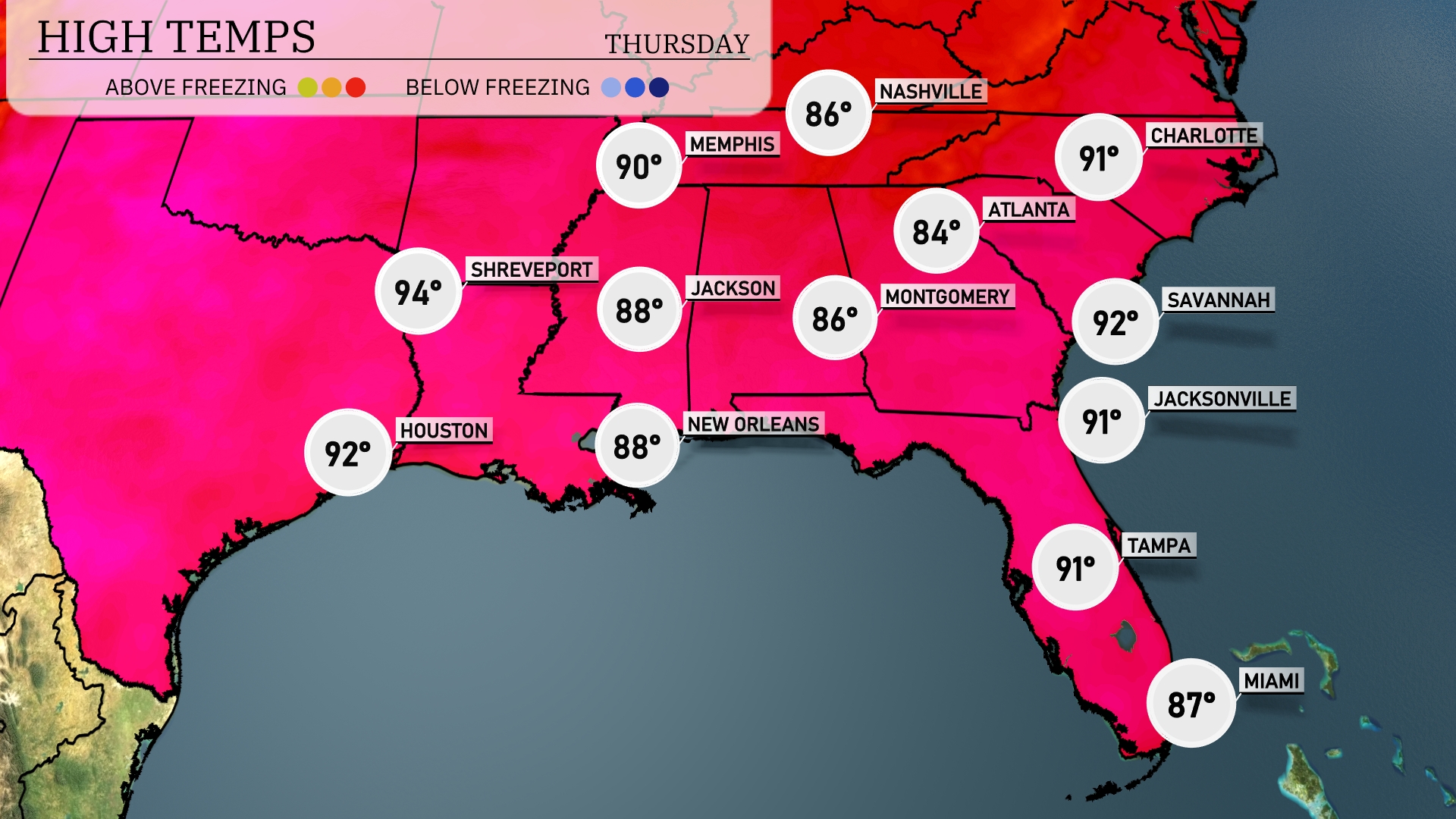
Tomorrow, high temperatures in the Southeast will soar, with Houston reaching 92 degrees and Shreveport hitting 94. New Orleans will see a warm 88 degrees, while Jackson is expected to peak at 88 as well. Atlanta’s high is forecasted at 84 degrees, with Jacksonville and Savannah both rising to 91.
A cold front approaches the Southeast, with increasing chances of thunderstorms from Houston to Tallahassee. By mid-morning Wednesday, expect rain showers stretching from Memphis through Atlanta with potential heavy downpours and isolated severe storms. Keep an eye on localized flooding, especially in urban areas along the Gulf Coast. Temperatures remain warm ahead of the front but will drop slightly post-frontal passage. Prepare for gusty winds and be alert for any severe weather watches or warnings issued by the N-W-S.
The UV index in Atlanta for Wednesday is high at 7, with a burn time of around 20 minutes in direct sunlight. On Thursday, the UV index increases to 8, meaning exposure can lead to sunburn in just 17 minutes!
For the 7 day outlook in Atlanta:
Wednesday: Expect partly cloudy skies with a warm high of 87 degrees and a low of 70 degrees.
Thursday: Slightly cooler with partly cloudy conditions; high of 84 degrees and a low of 68 degrees.
Friday: Clear skies will bring a sunny day with temperatures reaching a high of 90 degrees and a low of 70 degrees.
Saturday: Temperatures rise under partly cloudy skies, with a high hitting 93 degrees and a low of 73 degrees.
Sunday: Expect partly cloudy skies with a high of 92 degrees and a comfortable low of 73 degrees.
Monday: It’ll be a warm start to the week with partly cloudy conditions, reaching a high of 94 degrees and a low of 74 degrees.
Tuesday: Temperatures climb once more under partly cloudy skies, with a high of 95 degrees and a low of 73 degrees.