Atlanta’s Morning Forecast: Sun, Clouds, and UV Index Warnings
By
Amy Freeze
Start your day informed with our detailed weather forecast for Atlanta and the broader Southeast region, covering UV exposure, temperatures, and potential rain development.
Discover how Atlanta’s weather will shape up tomorrow with our comprehensive forecast. Expect a mix of sun and clouds with an increasing UV index, providing key insights to plan your day.
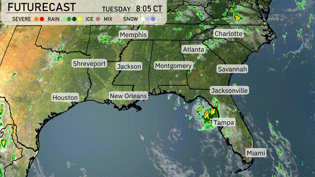
In Atlanta on Tuesday, the morning will greet you with partly cloudy skies followed by increasingly sunny conditions as temperatures rise to a comfortable 93 degrees. However, be mindful of the UV index reaching a high level; sun protection is crucial. The area around the Southeast will vary, from scattered showers near the Florida coast to clear skies in Montgomery. As we move through the week, similar patterns are expected with high temperatures and partly cloudy skies dominating the region’s weather narrative.
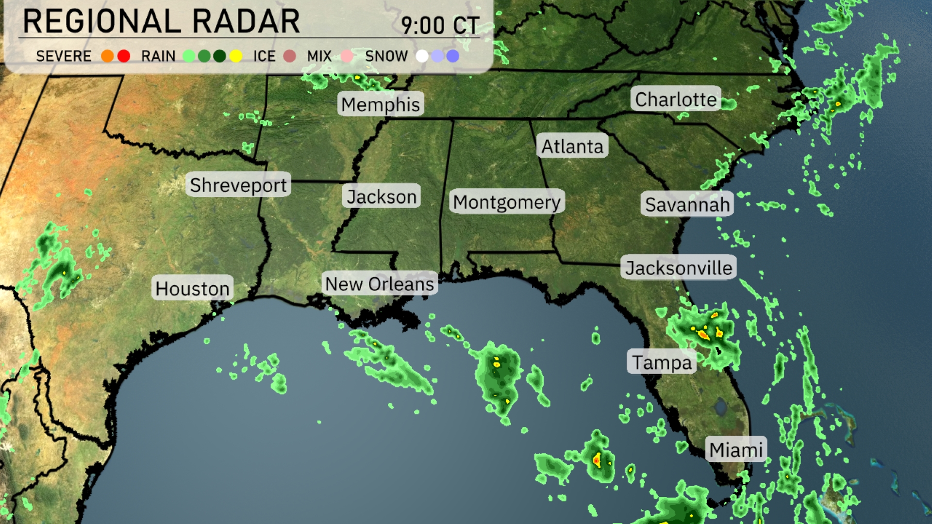
The Southeast is seeing scattered showers primarily along the Florida coast, with heavier precipitation around Jacksonville and moving towards Tampa. Miami is also experiencing significant rain and cloud cover. Atlanta, Charlotte, and Montgomery remain clear with no immediate precipitation detected. The radar shows light rain development in the Gulf of Mexico, indicating possible future activity along the coastal areas.
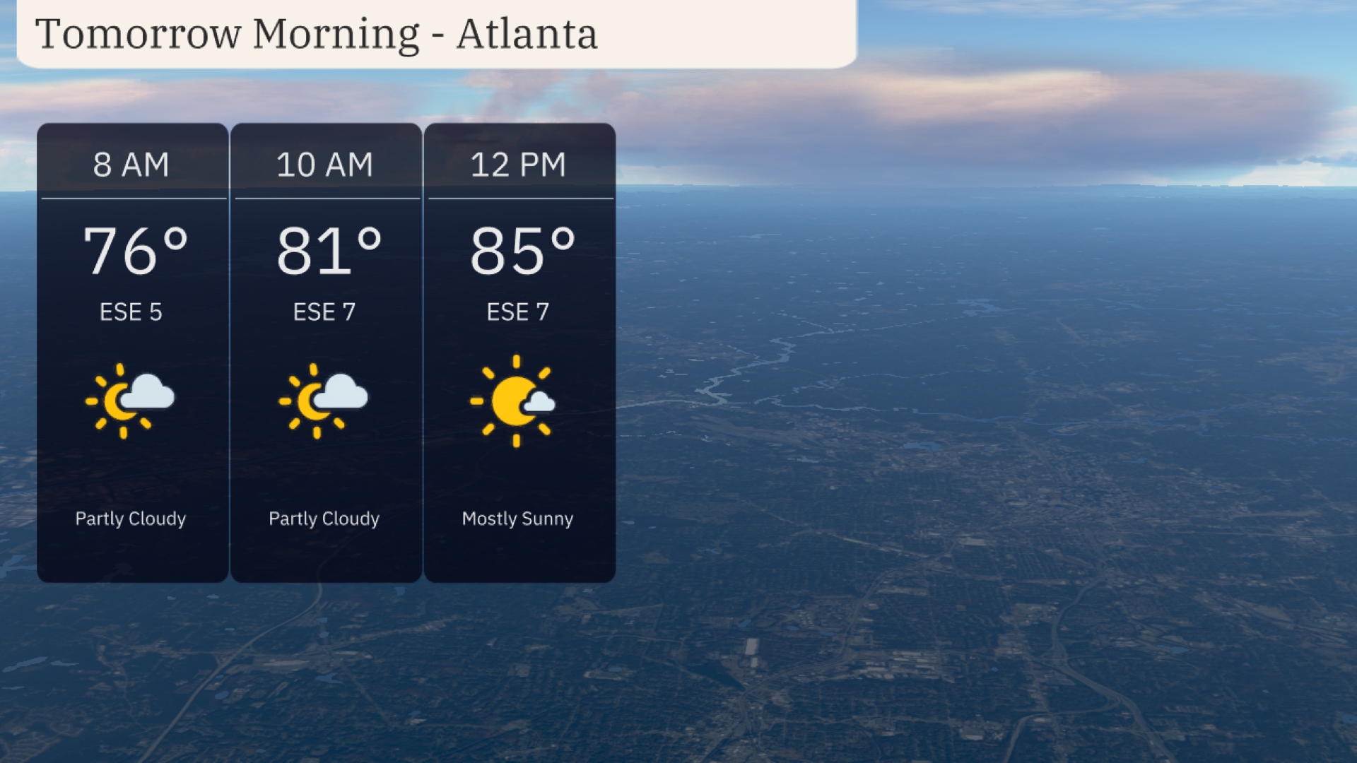
Morning temperatures in Atlanta start at 76 degrees at 8 AM, with southeast winds at 5 mph. By 10 AM, temperatures rise to 81 degrees with winds increasing to 7 mph. Skies remain partly cloudy until noon, when they clear up, and temperatures reach 85 degrees under mostly sunny conditions.
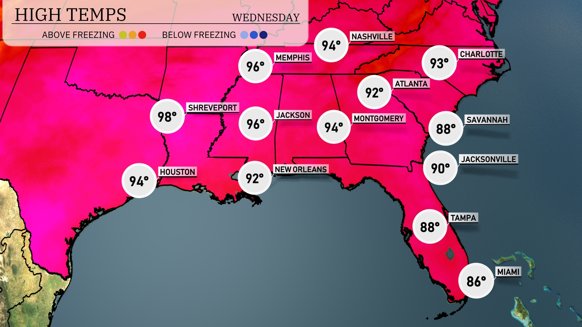
Tomorrow, expect a hot day across the Southeast. Shreveport is looking at a high of 98 degrees, while Houston will reach 94. Memphis and Jackson are both forecasted to hit 96 degrees, indicating near-record warmth for this time of year. In the east, Montgomery will see 92 degrees, and further south, New Orleans will be slightly cooler at 92 degrees as well. The coastal areas of Florida will experience high temperatures of 90 in Jacksonville and 88 in Tampa, remaining slightly below average.
A developing weather system over the Southeast will bring scattered thunderstorms from Miami to Charlotte on Wednesday. Expect periods of heavy rainfall particularly in the morning hours. By afternoon, strong wind gusts are possible along with localized flooding due to intense downpours. Temperatures will remain in the low 80s, with cooler air filtering in behind the storms.
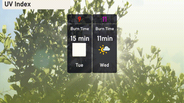
In Atlanta, the UV index is at a very high level of 9 today, so be cautious of sun exposure with a burn time of just 15 minutes. Tomorrow, it climbs to an extreme level of 11, with a swift burn time of 11 minutes.
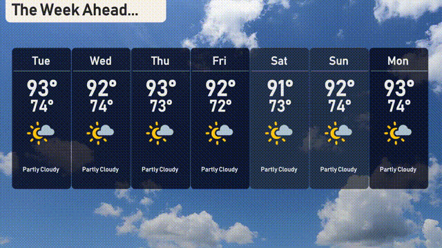
For the 7 Day Forecast in Atlanta:
Tuesday: Partly cloudy with a high of 93 degrees and a low of 74 degrees.
Wednesday: Expect partly cloudy skies with highs reaching 92 degrees and lows at 74 degrees.
Thursday: Partly cloudy again with temperatures peaking at 93 degrees and dipping to 73.
Friday: Look for partly cloudy conditions, a high of 92 degrees, and a low about 72.
Saturday: Continuing with the trend, it’s partly cloudy at 91 degrees for the high and a low of 73.
Sunday: The partly cloudy stretch continues with a high of 92 degrees and a low of 74.
Monday: Wrapping up the week, partly cloudy skies with a high reaching 93 degrees and a low of 74.