What’s Brewing in the Skies? Your Detailed Atlanta Weather Forecast
By
Amy Freeze
Explore our detailed forecast for Atlanta, including moderate UV levels and upcoming thunderstorms that could bring localized flooding. Stay prepared with the latest insights.
This week in Atlanta, expect a mix of sun and clouds with potential thunderstorms. Keep your sunscreen handy with a moderate UV index!
Experience all dimensions of Atlanta’s changing weather. From mild mornings at 70°F to afternoon thunderstorms, we cover your week ahead. Expect highs reaching the mid-80s and lows at a cool 54°F. Stay tuned for updates on potential rainfall and daily UV index readings.
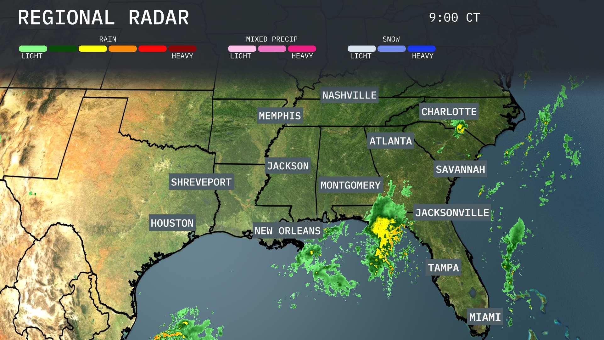
A mix of light to moderate rain is moving across Northern Florida, with Jacksonville experiencing the heaviest rain showers, while a band of precipitation extends from there into the Gulf. This rain pattern continues up through Southeast Georgia, nearing Savannah. Clear skies linger over the broader region, including Alabama and Mississippi, with no precipitation detected. However, clouds are amassing ahead of the rain system, suggesting impending weather changes for parts of the Southeast.
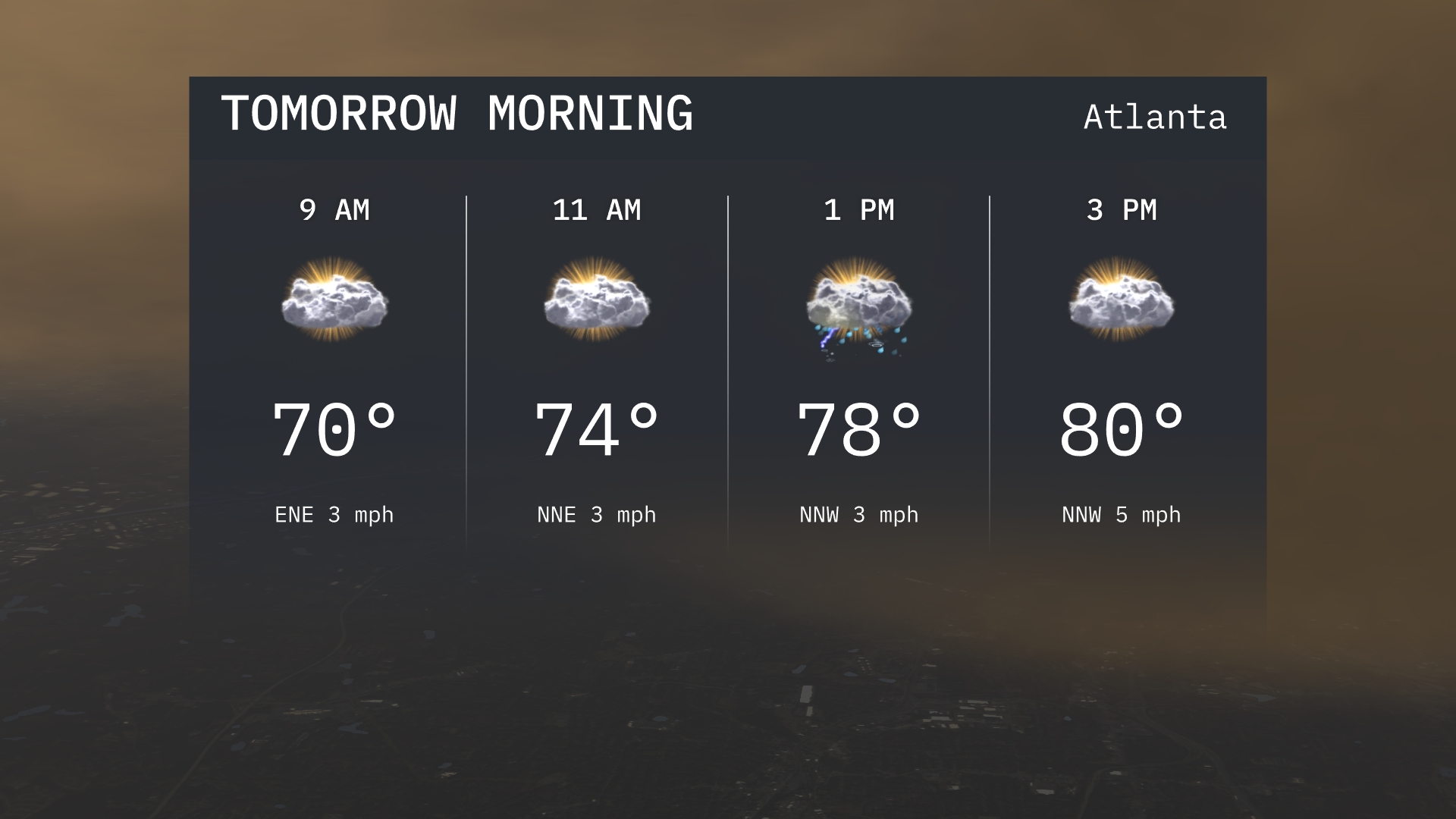
Tomorrow morning in Atlanta starts off with temperatures at 70 degrees at 9 AM, accompanied by calm east-northeast winds. By 11 AM, the temperature rises to 74 degrees with winds shifting to north-northwest. Expect partly cloudy skies throughout the morning, providing a pleasant atmospheric feel.
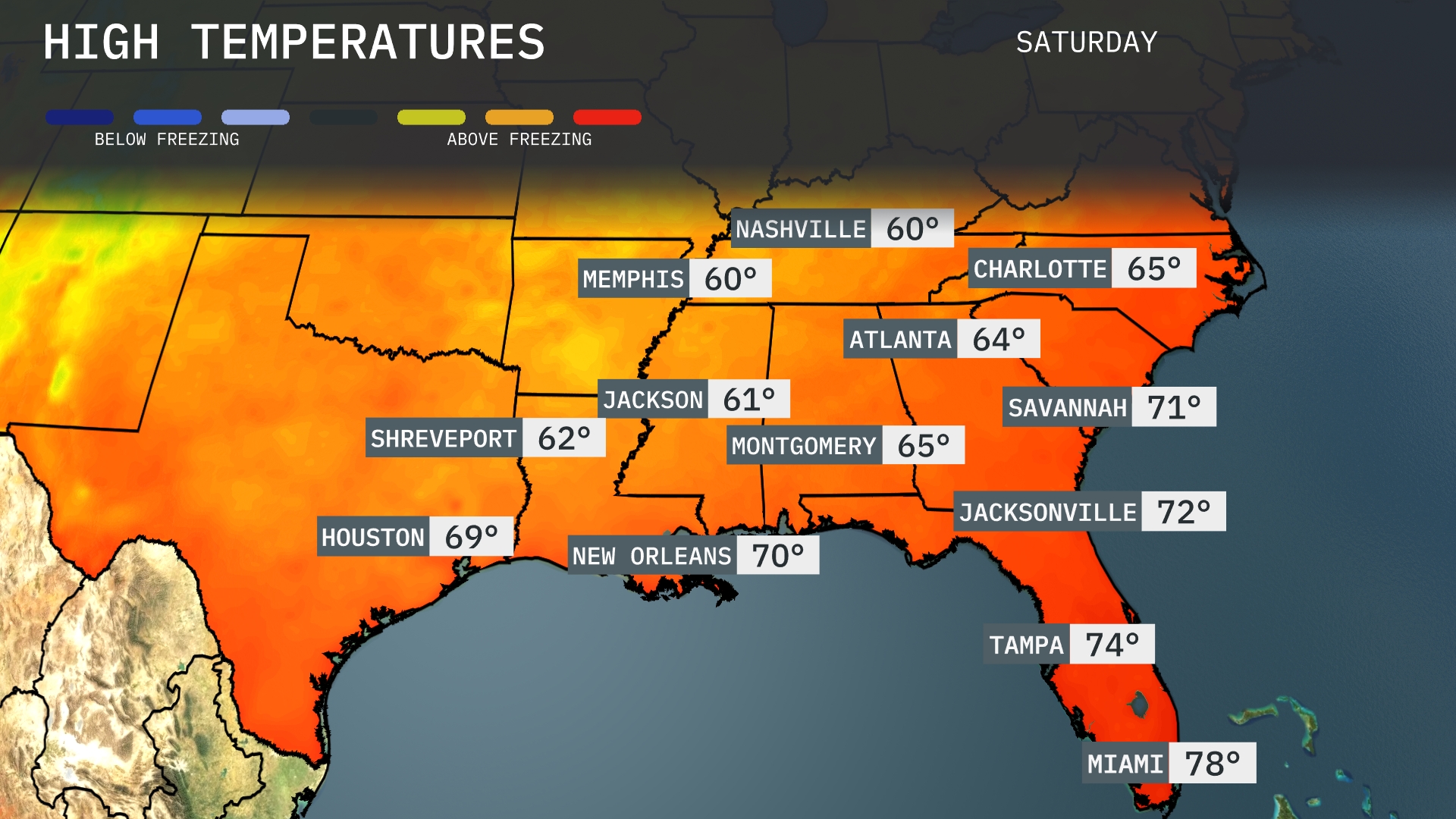
Tomorrow in the Southeast, Atlanta will see a high of 64 degrees, while Nashville is set at 60. Montgomery, Alabama, will warm up to 65 degrees. Temperatures will reach 70 degrees in New Orleans, with Jacksonville hitting 72. Miami is expected to feel pleasant with a high of 78 degrees, maintaining above-average readings across the region.
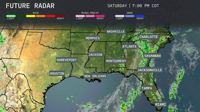
A line of scattered thunderstorms is expected to move through the Southeast tomorrow, affecting areas from Jackson to Charlotte. As this front progresses, brief periods of heavy rainfall and gusty winds are possible, particularly in the afternoon. Temperatures will remain warm ahead of the front, but cooler air follows, bringing refreshing conditions into Thursday. Be prepared for potential localized flooding due to the intense rain in some areas. Monitor updates as conditions could evolve rapidly.
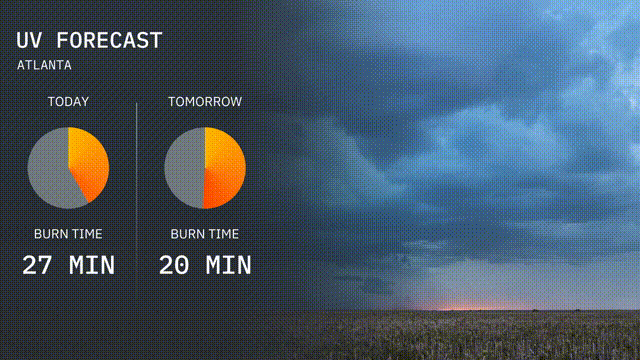
The UV index in Atlanta will be moderate today, with a value allowing for a burn time of about 27 minutes in direct sunlight. Tomorrow, the UV index remains moderate with burn time decreasing to 20 minutes, so be prepared with sunscreen and protective gear. Enjoy your outdoor activities while keeping sun exposure risks in mind!
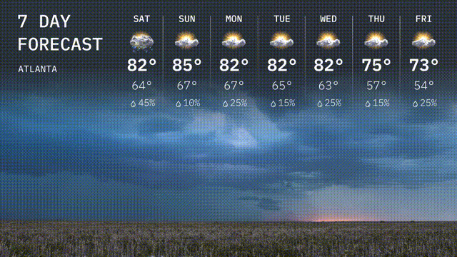
For the 7-day outlook in Atlanta:
Saturday: A thunderstorm or two is expected with temperatures reaching a high of 82 degrees and a low of 64 degrees.
Sunday: Mostly sunny and quite warm with a high of 85 degrees and a low of 67 degrees.
Monday: Sunshine continues, high temperatures around 82 degrees, cooling to 67 at night.
Tuesday: Partly sunny with a high of 82 degrees and a low of 65 degrees.
Wednesday: The sun sticks around with a high of 82 degrees, dipping to a low of 63 degrees.
Thursday: Cloudy with the chance of a storm, temperatures will reach 75 degrees with a low of 57 degrees.
Friday: Showers are possible with a cooler high of 73 degrees and a low of 54 degrees.